Upgrade to Pro
— share decks privately, control downloads, hide ads and more …
Speaker Deck
Features
Speaker Deck
PRO
Sign in
Sign up for free
Search
Search
Geospatial applications on Rails
Search
Sergey Nartimov
June 01, 2013
Programming
440
8
Share
Embed
Copy iframe code
Copy JS code
Copy link
Start on current slide
Geospatial applications on Rails
Sergey Nartimov
June 01, 2013
More Decks by Sergey Nartimov
See All by Sergey Nartimov
PubSub at Rails
lest
0
140
Rails in production - RubyConfBY 22 Mar 2015
lest
1
160
Sequel - BRUG 21 Feb 2015
lest
0
100
Elixir – Belarus Ruby User Group 25 Jan 2014
lest
3
670
Authentication Security – RUBYSPB
lest
2
200
Design patterns – Belarus Ruby on Rails User Group 23 Feb 2013
lest
8
670
Ruby Stdlib – Minsk.rb October 2012
lest
10
420
Background jobs with realtime results – RailsClub'Moscow 2012
lest
5
230
Other Decks in Programming
See All in Programming
【やさしく解説 設計編・中級 #1】一つの車に、運転手は一人 ~ある倉庫システムの事例から~
panda728
PRO
0
120
AI駆動開発を妨げる技術的負債の解消アプローチ / ai-refactoring-approach
minodriven
17
8.7k
スマートグラスで並列バイブコーディング
hyshu
0
280
自作OSでスライド発表する
uyuki234
1
3.7k
act1-costs.pdf
sumedhbala
0
180
どこまでゆるくて許されるのか
tk3fftk
0
430
ECSアプリログをFireLensでコスト削減しようとしたけど諦めた話 in Fargate×Node.js
akihisaikeda
2
4.2k
Language Server 使ってる? 〜VSCode と Zed の場合〜 / Are you using a Language Server? ~For VS Code and Zed~
handlename
0
830
Skillsは効率化、Agentsは"自分の拡張"——Builder時代のエージェント編成(CC Night 2026)
wemra
1
200
AI がコードを書く時代における新卒エンジニアの仕事風景 (2026) / New Graduate Engineers in the Era of AI Coding (2026)
sushichan044
0
200
なぜ型を書くのか? TSKaigi2026で改めて考える #tskaigi_smarthr
kajitack
0
210
Performance Engineering for Everyone
elenatanasoiu
0
260
Featured
See All Featured
Exploring anti-patterns in Rails
aemeredith
3
440
Writing Fast Ruby
sferik
630
63k
Discover your Explorer Soul
emna__ayadi
2
1.2k
Stewardship and Sustainability of Urban and Community Forests
pwiseman
0
250
Creating an realtime collaboration tool: Agile Flush - .NET Oxford
marcduiker
35
2.5k
Designing Experiences People Love
moore
143
24k
Facilitating Awesome Meetings
lara
57
7k
State of Search Keynote: SEO is Dead Long Live SEO
ryanjones
0
220
A Modern Web Designer's Workflow
chriscoyier
698
190k
Become a Pro
speakerdeck
PRO
31
6k
Leadership Guide Workshop - DevTernity 2021
reverentgeek
1
320
Java REST API Framework Comparison - PWX 2021
mraible
34
9.4k
Transcript
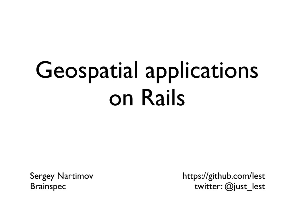
Geospatial applications on Rails Sergey Nartimov Brainspec https://github.com/lest twitter: @just_lest
About • Rails, Rubinius, Elixir contributor • Software engineer at
Brainspec Sergey Nartimov Brainspec https://github.com/lest twitter: @just_lest
Geospatial data
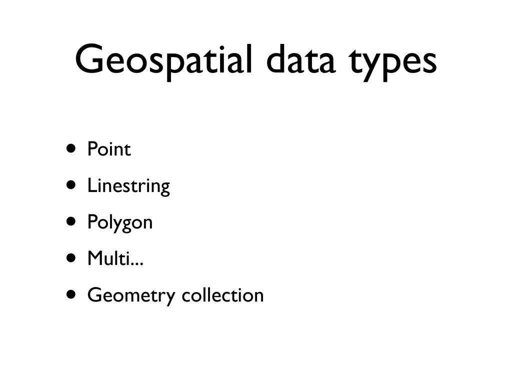
Geospatial data types • Point • Linestring • Polygon •
Multi... • Geometry collection
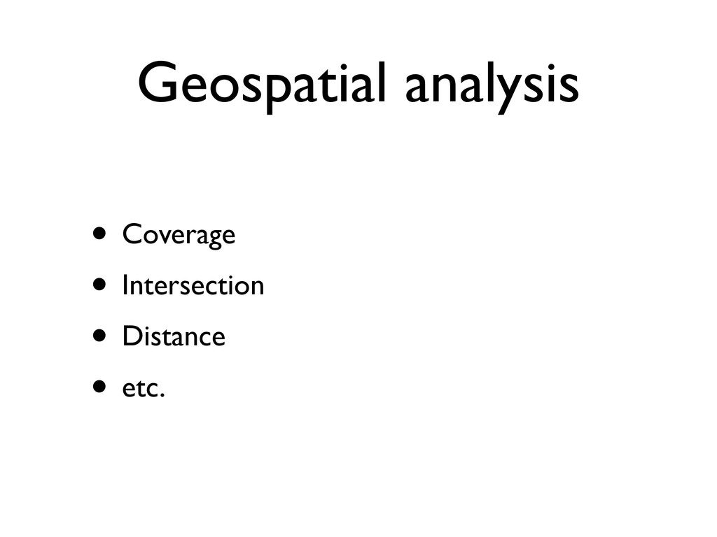
Geospatial analysis • Coverage • Intersection • Distance • etc.
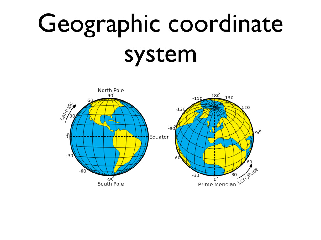
Geographic coordinate system
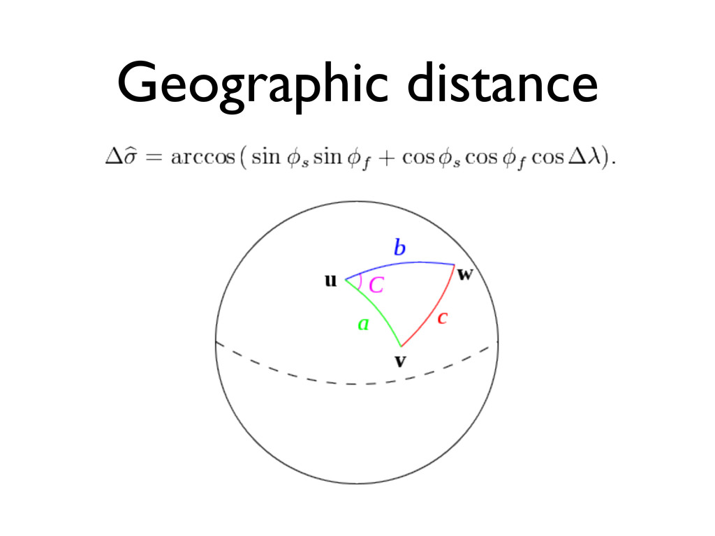
Geographic distance
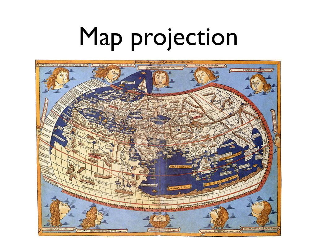
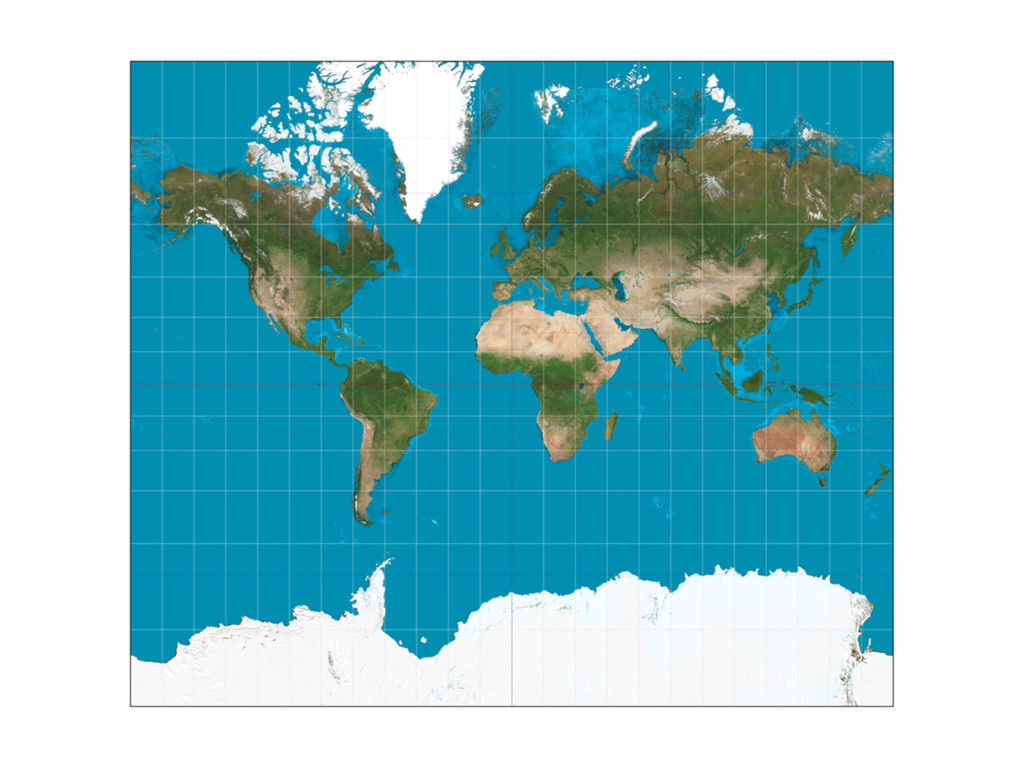
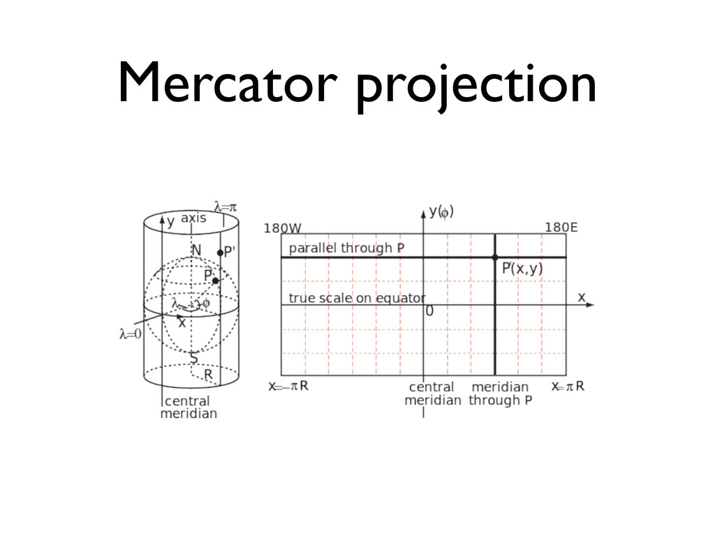
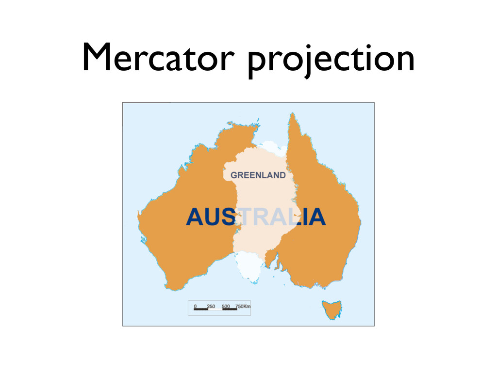
Map projection
Mercator projection
None
Mercator projection
Mercator projection
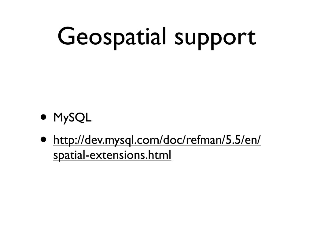
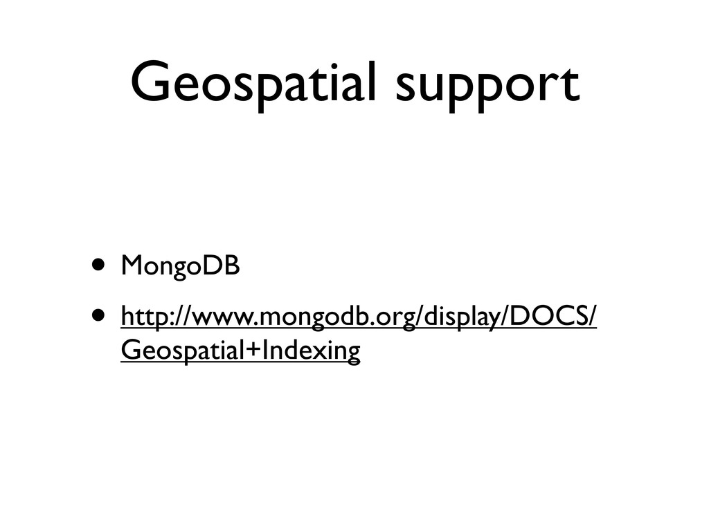
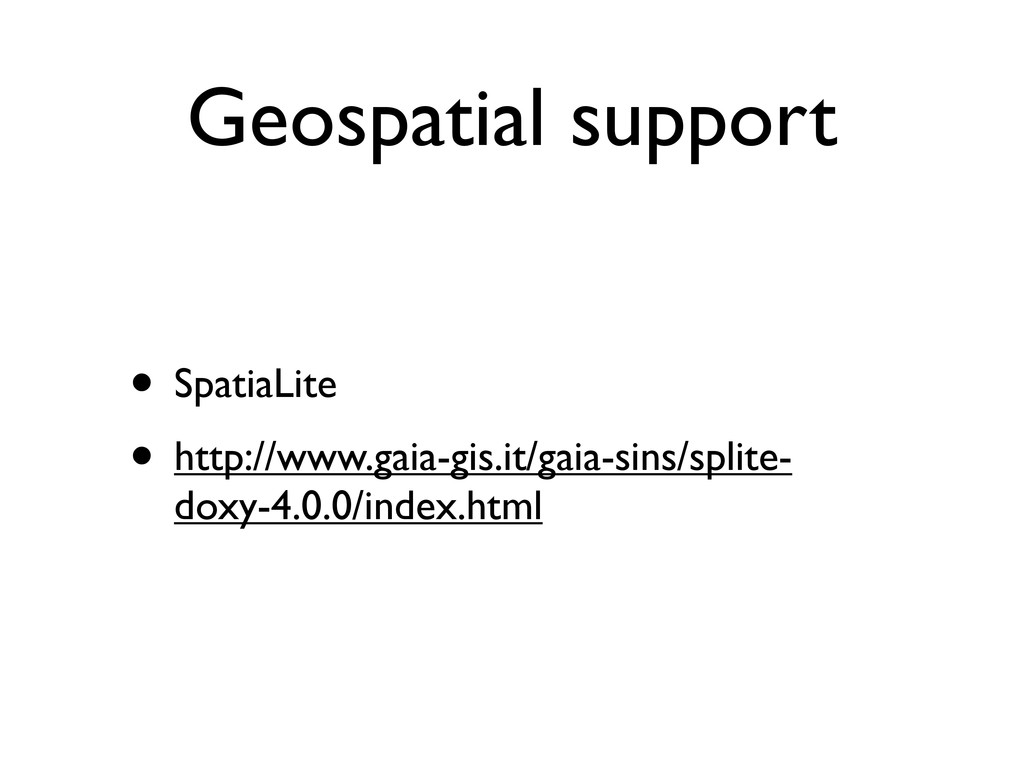
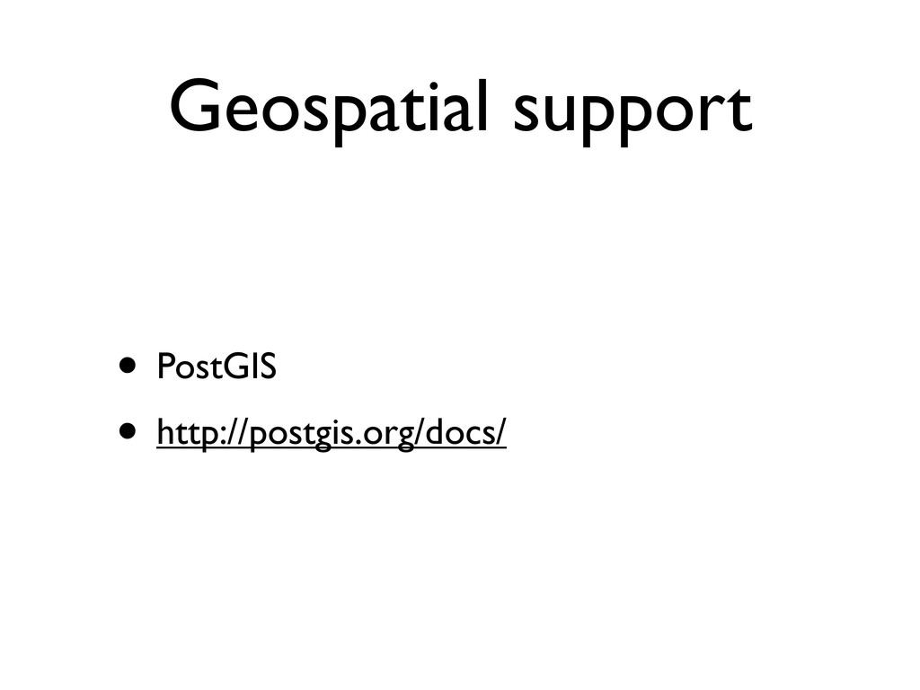
Geospatial support
Geospatial support • MySQL • http://dev.mysql.com/doc/refman/5.5/en/ spatial-extensions.html
Geospatial support • MongoDB • http://www.mongodb.org/display/DOCS/ Geospatial+Indexing
Geospatial support • SpatiaLite • http://www.gaia-gis.it/gaia-sins/splite- doxy-4.0.0/index.html
Geospatial support • PostGIS • http://postgis.org/docs/
Rails & PostGIS
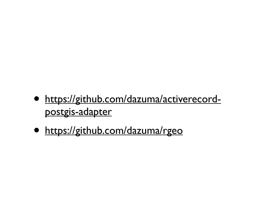
• https://github.com/dazuma/activerecord- postgis-adapter • https://github.com/dazuma/rgeo
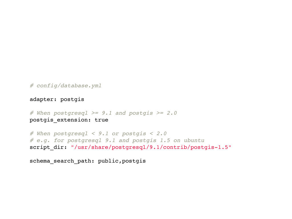
# config/database.yml adapter: postgis # When postgresql >= 9.1 and
postgis >= 2.0 postgis_extension: true # When postgresql < 9.1 or postgis < 2.0 # e.g. for postgresql 9.1 and postgis 1.5 on ubuntu script_dir: "/usr/share/postgresql/9.1/contrib/postgis-1.5" schema_search_path: public,postgis
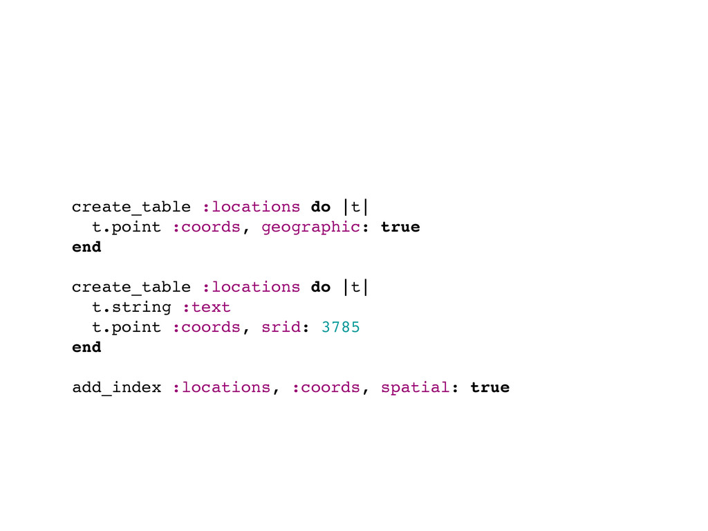
create_table :locations do |t| t.point :coords, geographic: true end create_table
:locations do |t| t.string :text t.point :coords, srid: 3785 end add_index :locations, :coords, spatial: true
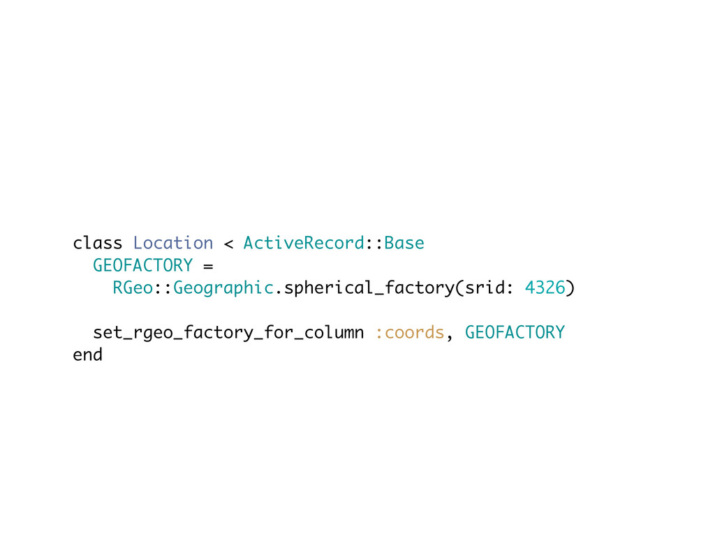
class Location < ActiveRecord::Base GEOFACTORY = RGeo::Geographic.spherical_factory(srid: 4326) set_rgeo_factory_for_column :coords,
GEOFACTORY end
Points in radius
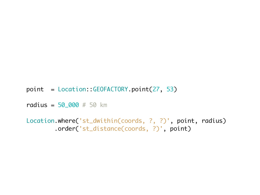
point = Location::GEOFACTORY.point(27, 53) radius = 50_000 # 50 km
Location.where('st_dwithin(coords, ?, ?)', point, radius) .order('st_distance(coords, ?)', point)
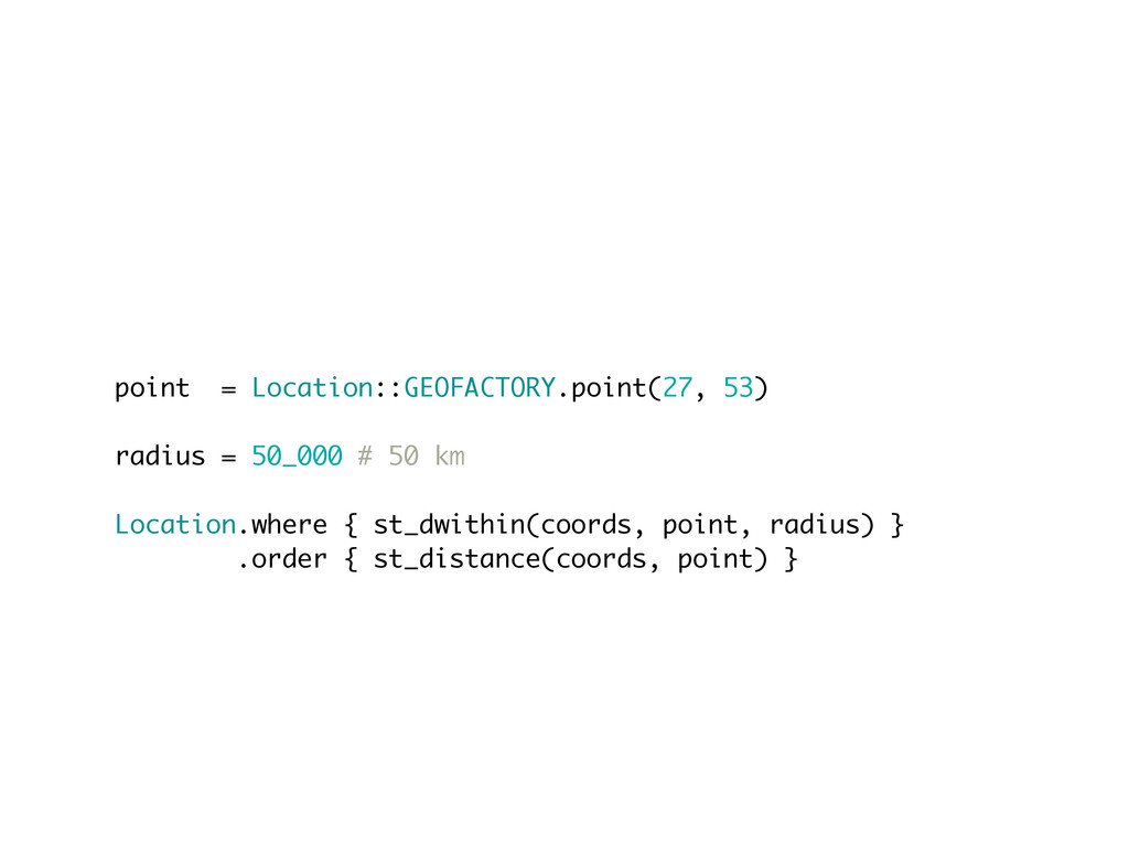
Squeel • https://github.com/ernie/squeel
point = Location::GEOFACTORY.point(27, 53) radius = 50_000 # 50 km
Location.where { st_dwithin(coords, point, radius) } .order { st_distance(coords, point) }
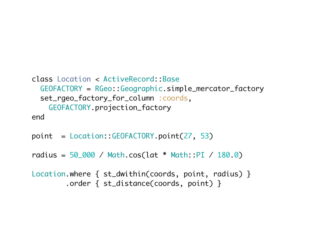
class Location < ActiveRecord::Base GEOFACTORY = RGeo::Geographic.simple_mercator_factory set_rgeo_factory_for_column :coords, GEOFACTORY.projection_factory
end point = Location::GEOFACTORY.point(27, 53) radius = 50_000 / Math.cos(lat * Math::PI / 180.0) Location.where { st_dwithin(coords, point, radius) } .order { st_distance(coords, point) }
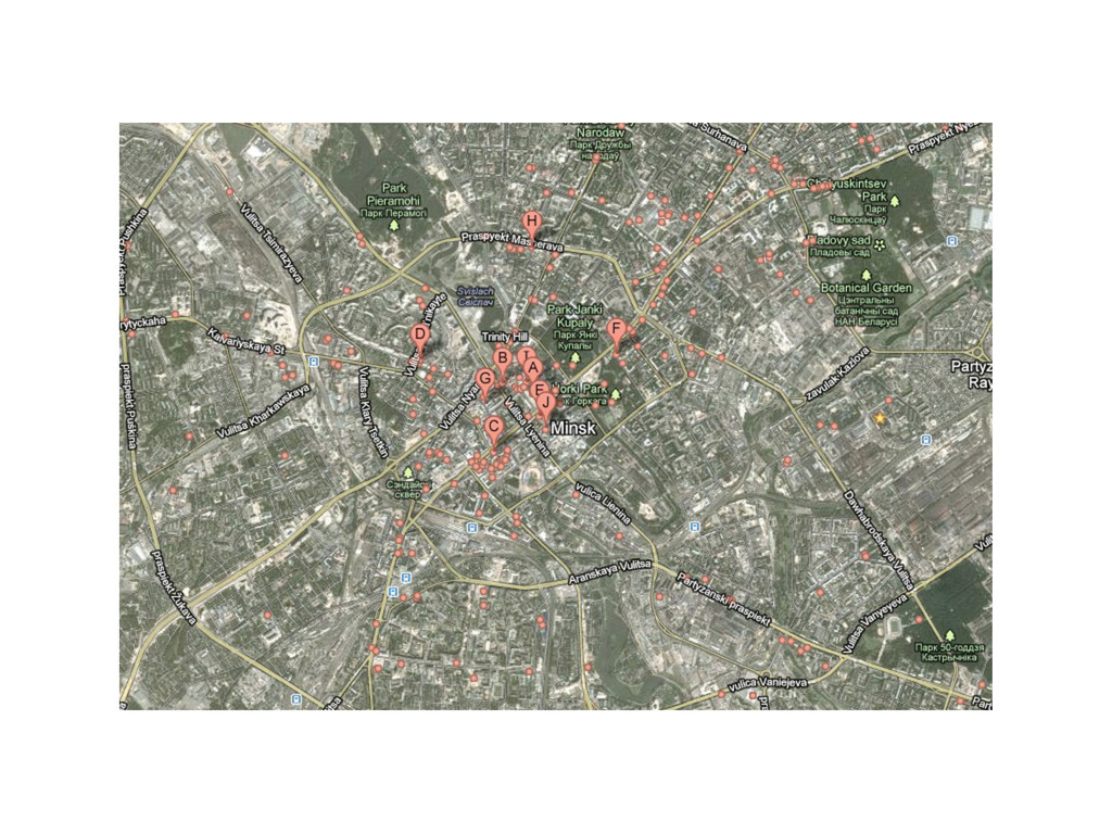
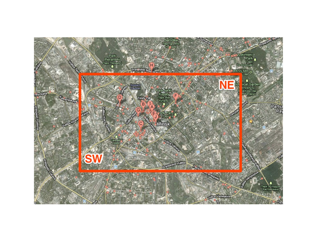
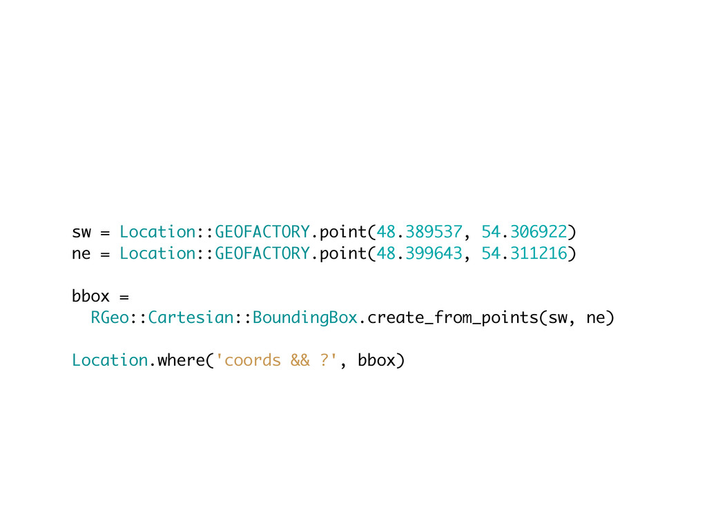
Points in bounding box
None
None
sw = Location::GEOFACTORY.point(48.389537, 54.306922) ne = Location::GEOFACTORY.point(48.399643, 54.311216) bbox =
RGeo::Cartesian::BoundingBox.create_from_points(sw, ne) Location.where('coords && ?', bbox)
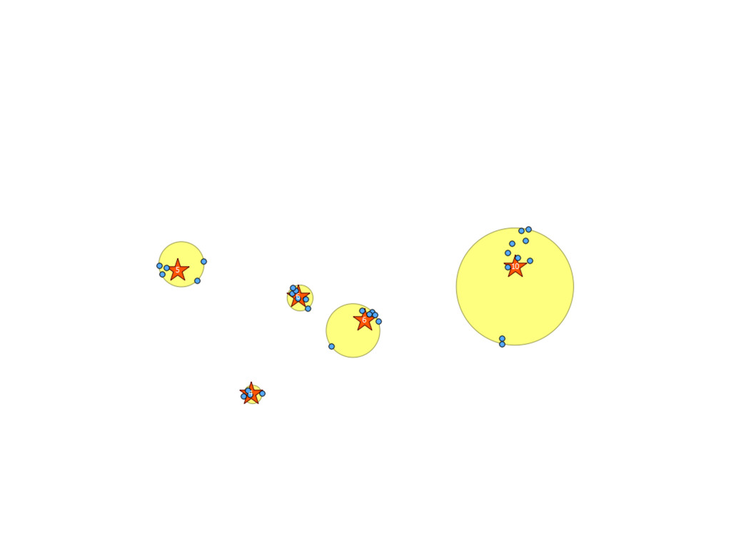
Clustering • http://pgxn.org/dist/kmeans/ • http://postgis.refractions.net/docs/ ST_SnapToGrid.html
None
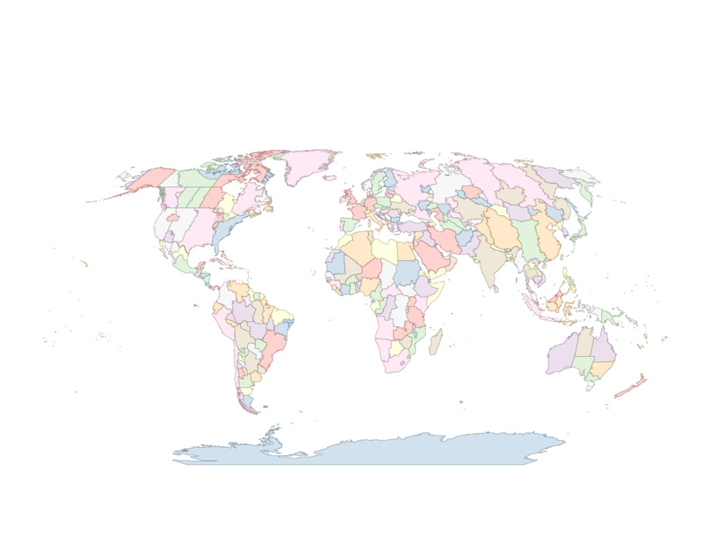
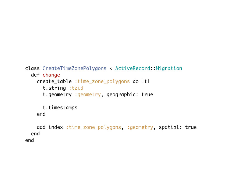
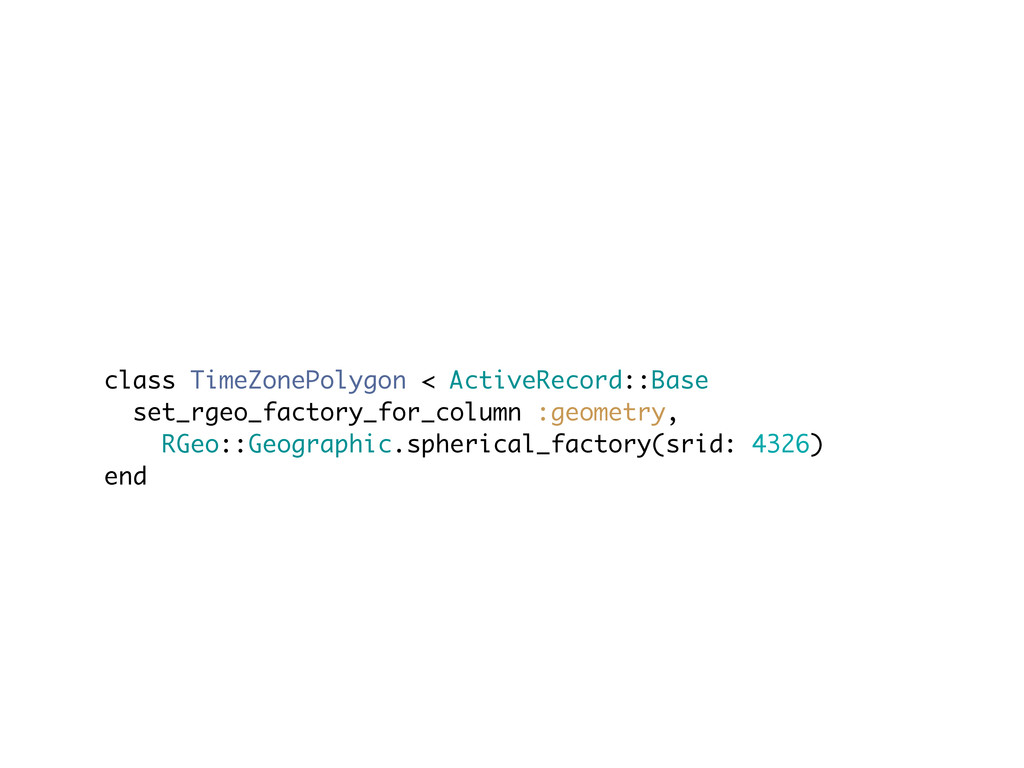
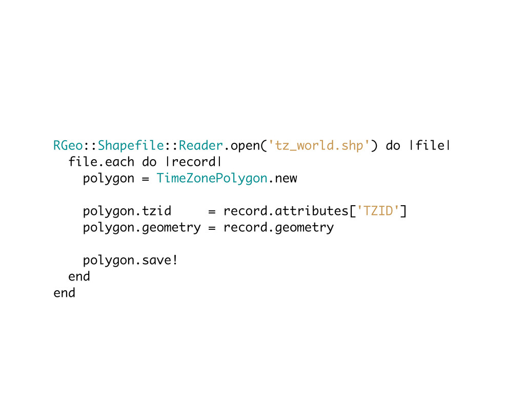
Time zones example
• http://efele.net/maps/tz/world/
None
• https://github.com/dazuma/rgeo-shapefile
class CreateTimeZonePolygons < ActiveRecord::Migration def change create_table :time_zone_polygons do |t|
t.string :tzid t.geometry :geometry, geographic: true t.timestamps end add_index :time_zone_polygons, :geometry, spatial: true end end
class TimeZonePolygon < ActiveRecord::Base set_rgeo_factory_for_column :geometry, RGeo::Geographic.spherical_factory(srid: 4326) end
RGeo::Shapefile::Reader.open('tz_world.shp') do |file| file.each do |record| polygon = TimeZonePolygon.new polygon.tzid
= record.attributes['TZID'] polygon.geometry = record.geometry polygon.save! end end
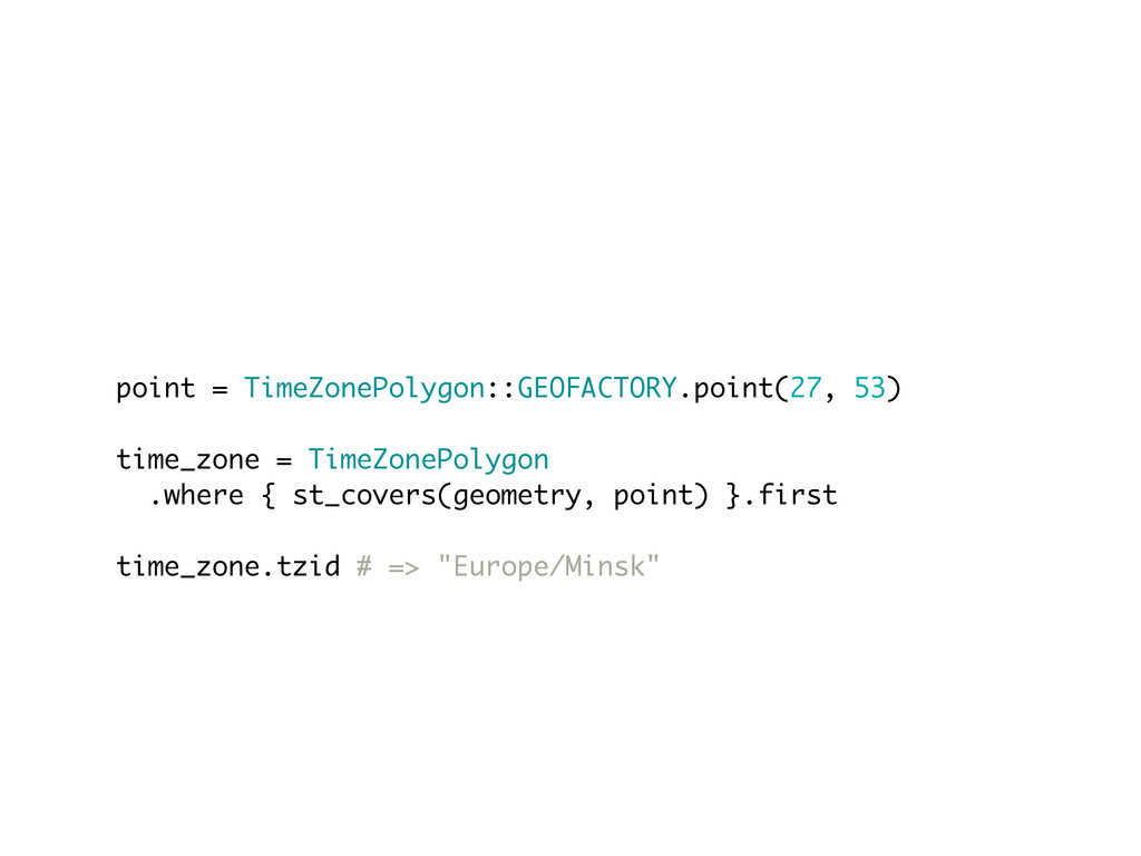
point = TimeZonePolygon::GEOFACTORY.point(27, 53) time_zone = TimeZonePolygon .where { st_covers(geometry,
point) }.first time_zone.tzid # => "Europe/Minsk"
• Further improvements
Thanks <3 Sergey Nartimov Brainspec https://github.com/lest twitter: @just_lest