Upgrade to Pro
— share decks privately, control downloads, hide ads and more …
Speaker Deck
Features
Speaker Deck
PRO
Sign in
Sign up for free
Search
Search
(NACIS2015) A New Atlas of American History
Search
Sponsored
·
SiteGround - Reliable hosting with speed, security, and support you can count on.
→
Alan McConchie
October 15, 2015
Technology
390
4
Share
Embed
Copy iframe code
Copy JS code
Copy link
Start on current slide
(NACIS2015) A New Atlas of American History
Notes and links to animations: sta.mn/6gk
Alan McConchie
October 15, 2015
More Decks by Alan McConchie
See All by Alan McConchie
NACIS 2024: Mapping History Using Digital Tools
almccon
0
76
NACIS 2024: The Past, Present, and Future of Stamen Maps
almccon
0
150
Rebuilding Stamen’s iconic map styles with Stadia Maps
almccon
0
460
2022 Hunter College Seminar in Geoinformatics
almccon
0
67
NACIS 2020: Mapping COVID-19 Coast to Coast, and Around the World
almccon
0
74
NACIS 2019: Cartography and Community in OpenStreetMap: Getting Native Reservations on the Map
almccon
1
480
(GISDay 2018) Open Source Cartography: Blending Data and Design for the Next Generation of Online Maps
almccon
0
250
Stamen Design: recent work
almccon
0
220
Open Source Cartography: Blending Data and Design for the Next Generation of Online Maps
almccon
1
740
Other Decks in Technology
See All in Technology
フルカイテン株式会社 エンジニア向け採用資料
fullkaiten
0
11k
初めてのDatabricks勉強会
taka_aki
2
190
脱SaaS!FDEを支えるプロビジョニングと分離設計
knih
0
300
Deep Data Security 機能解説
oracle4engineer
PRO
2
230
When Platform Engineering Meets GenAI
sucitw
0
200
AWS Summit 2026で見えたSIerにとっての Amazon Quickの位置づけ
maf_0521
0
110
#エンジニアBooks 30分でわかる 「技術記事を書く技術」 / engineer-books 2026-06-30
jnchito
1
130
OTel × Datadog で 「AI活用」を計測し、改善に繋げる
shihochan
2
1.1k
AI時代のコスト管理を考えよう〜明日から使える実践AWSノウハウ~
yoshimi0227
0
950
WebGIS AI Agentの紹介
_shimizu
0
590
AWS Summit の片隅で、体育座りしながらコミュニティがにぎわう理由を考えた
k_adachi_01
2
210
Amazon Redshift zero-ETL 統合を活用した軽量なマルチプロダクトデータ可視化基盤 / Lightweight Multi-Product Data Visualization with Amazon Redshift Zero-ETL
kaminashi
0
110
Featured
See All Featured
Stop Working from a Prison Cell
hatefulcrawdad
274
21k
16th Malabo Montpellier Forum Presentation
akademiya2063
PRO
0
150
Navigating Algorithm Shifts & AI Overviews - #SMXNext
aleyda
1
1.3k
svc-hook: hooking system calls on ARM64 by binary rewriting
retrage
2
310
The Anti-SEO Checklist Checklist. Pubcon Cyber Week
ryanjones
0
170
Learning to Love Humans: Emotional Interface Design
aarron
275
41k
Leadership Guide Workshop - DevTernity 2021
reverentgeek
1
310
How To Stay Up To Date on Web Technology
chriscoyier
790
250k
Ruling the World: When Life Gets Gamed
codingconduct
0
260
Speed Design
sergeychernyshev
33
1.9k
Leveraging Curiosity to Care for An Aging Population
cassininazir
1
280
Why Your Marketing Sucks and What You Can Do About It - Sophie Logan
marketingsoph
0
170
Transcript
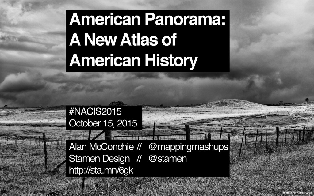
photo © Nathaniel Ayers American Panorama: A New Atlas of
American History #NACIS2015 October 15, 2015 Alan McConchie // @mappingmashups Stamen Design // @stamen http://sta.mn/6gk
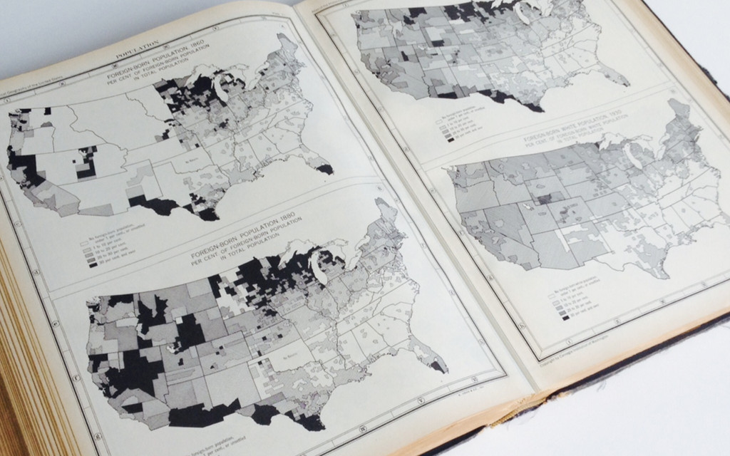
Charles O. Paullin John K. Wright Published 1932
None
None
“The ideal historical atlas might well be a collection of
motion-picture maps, if these could be displayed on the pages of a book without the paraphernalia of projector, reel and screen.” – John K. Wright
None
None
None
None
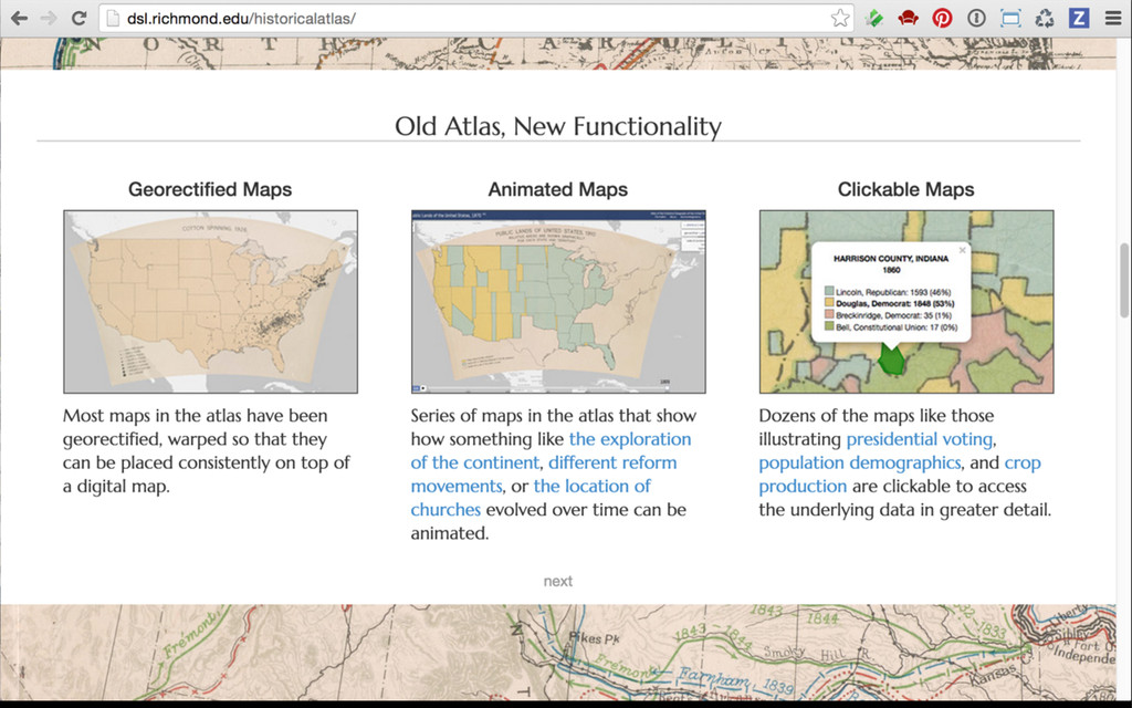
photo © Nathaniel Ayers An Atlas of United States History
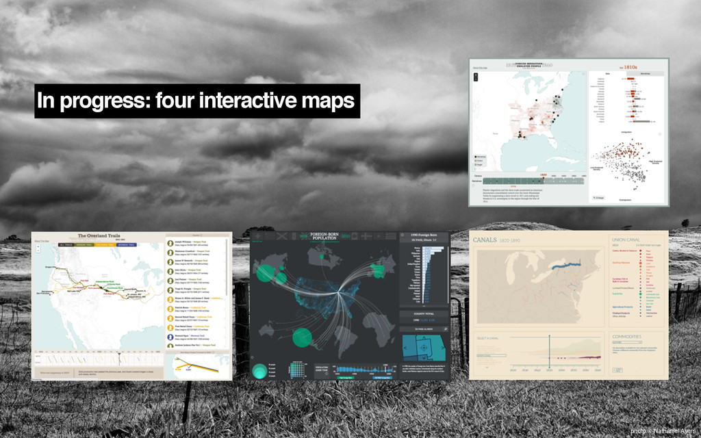
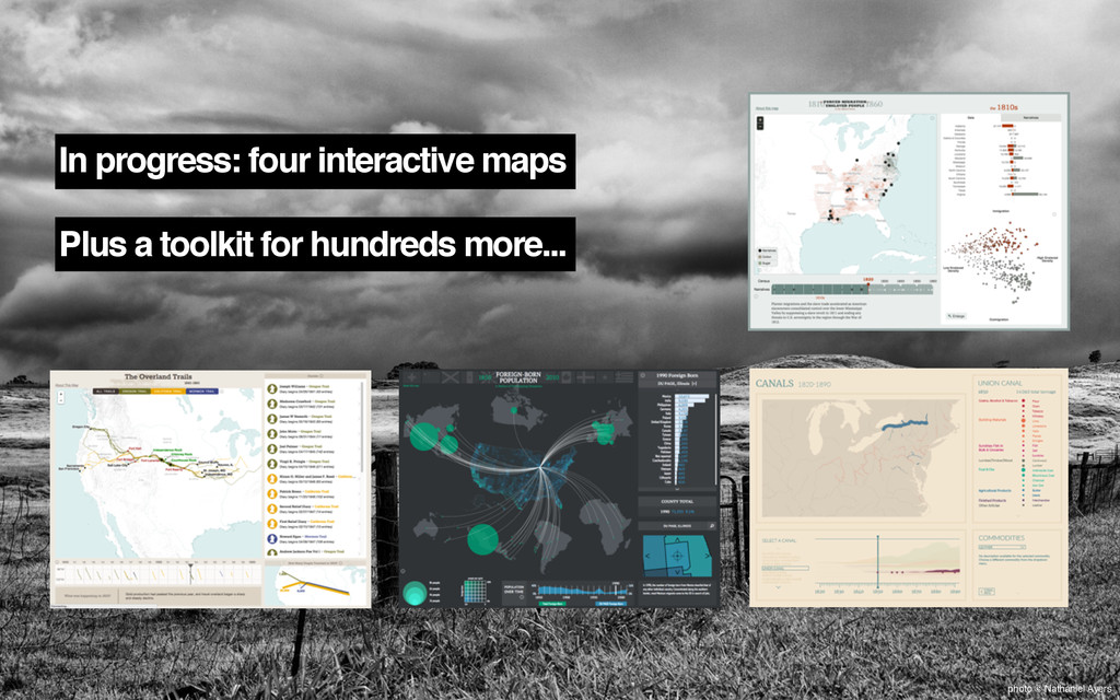
In progress: four interactive maps photo © Nathaniel Ayers
In progress: four interactive maps Plus a toolkit for hundreds
more... photo © Nathaniel Ayers
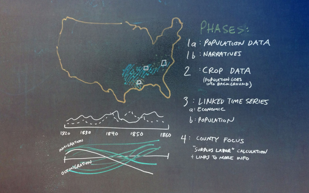
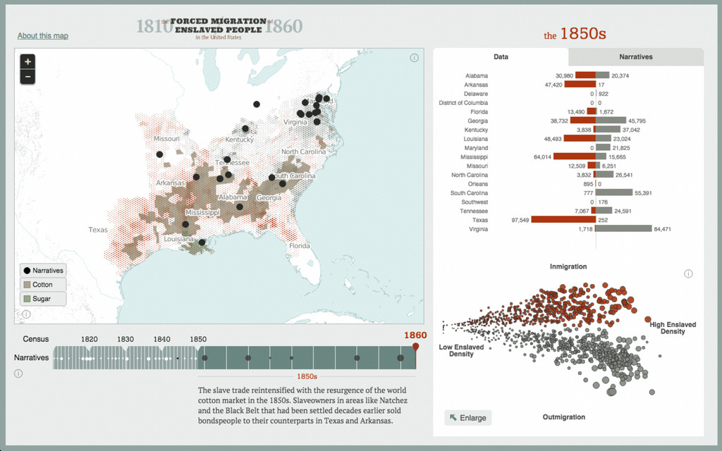
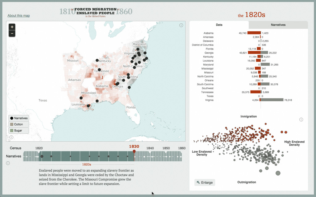
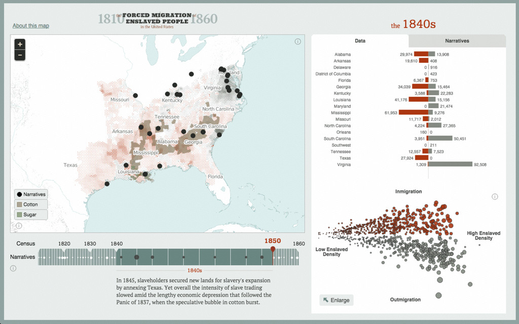
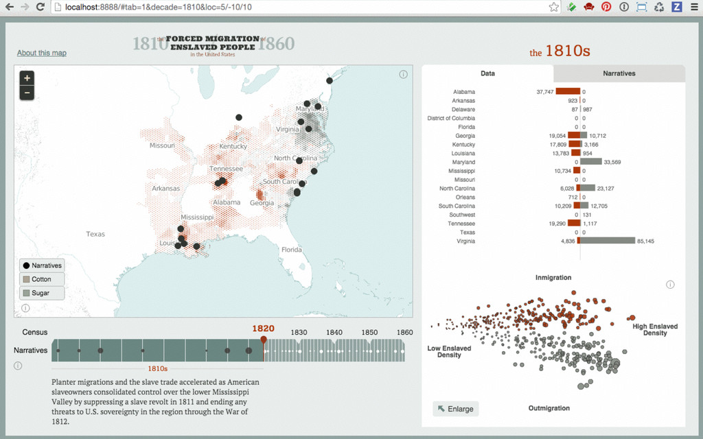
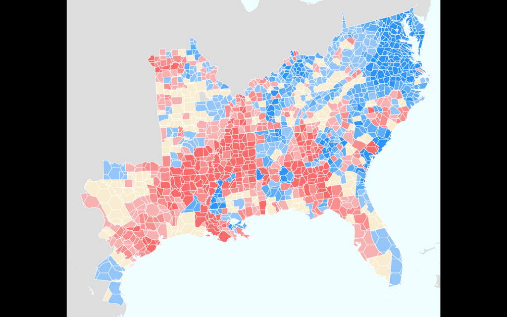
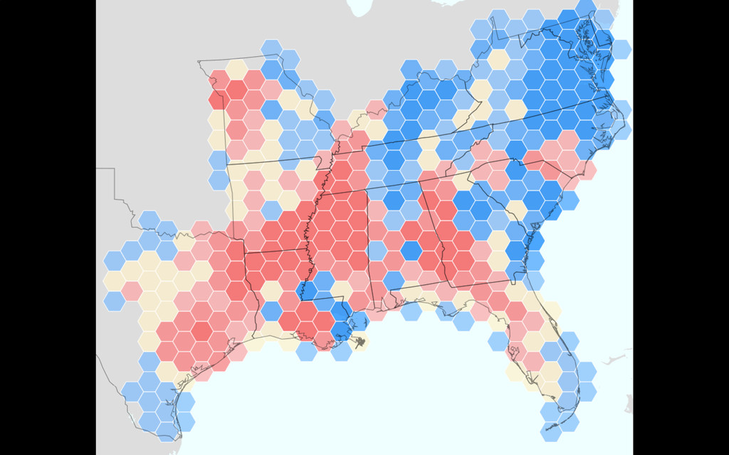
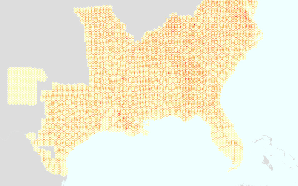
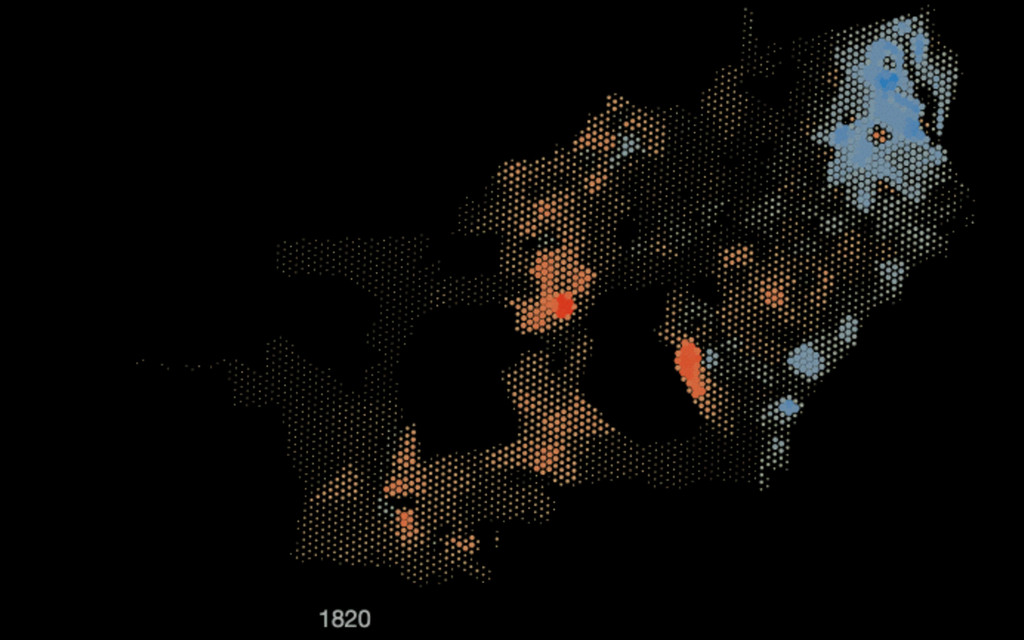
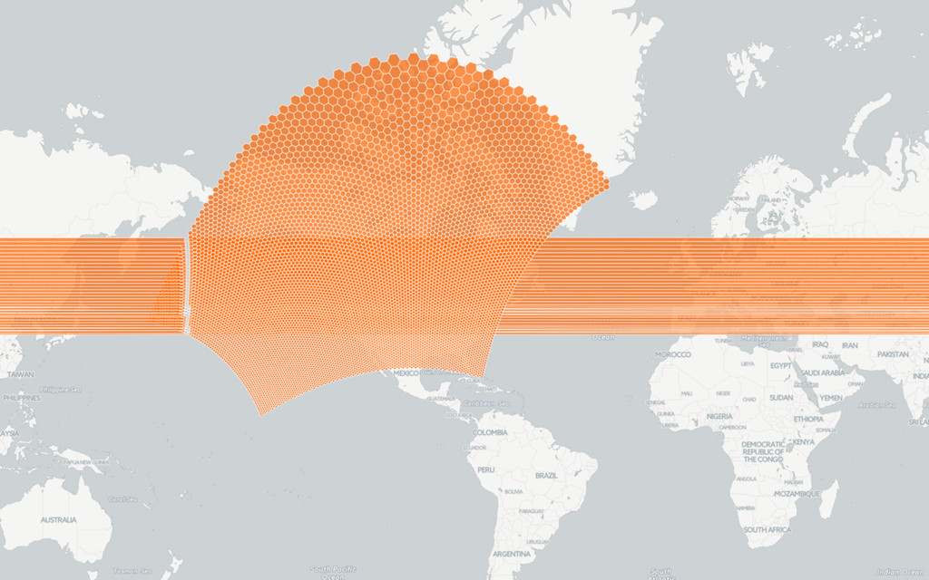
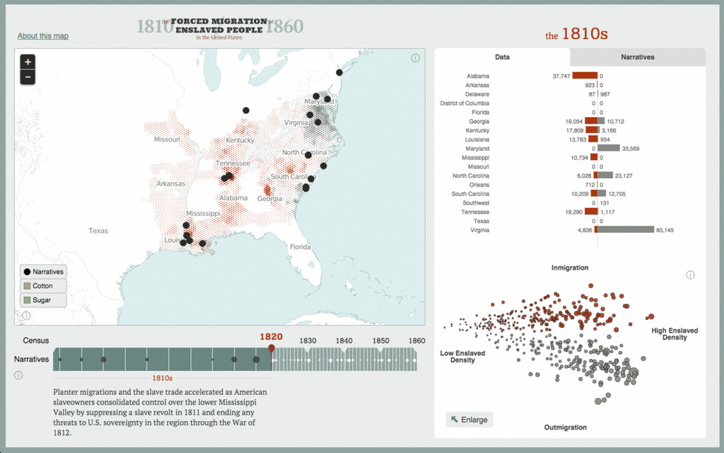
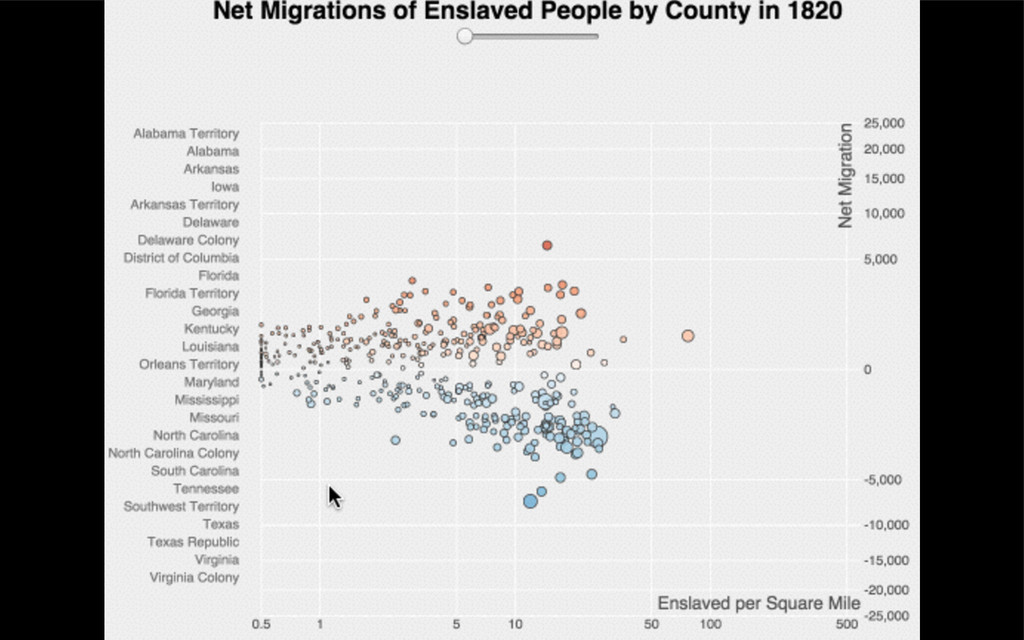
photo © Nathaniel Ayers Forced Migration of Enslaved People in
the United States 1810-1860
None
None
None
None
None
None
None
synced tables from Google Sheets CartoDB GeoJSON D3 charts map
tiles Leaflet markers, D3 overlays (svg + canvas) user interaction: react.js
None
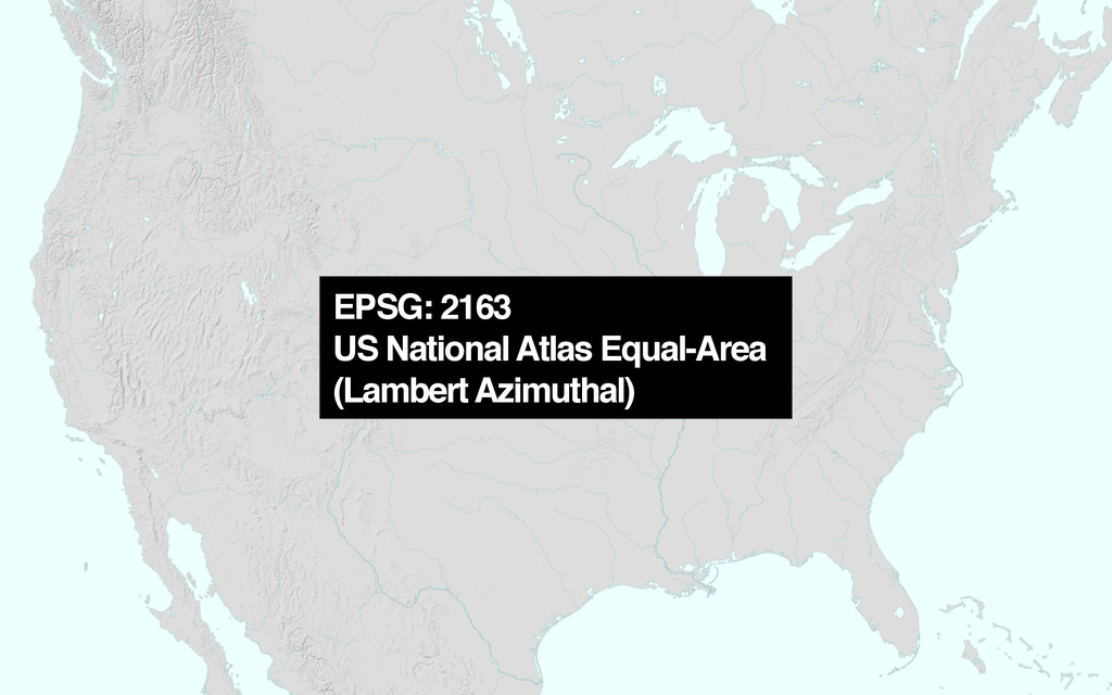
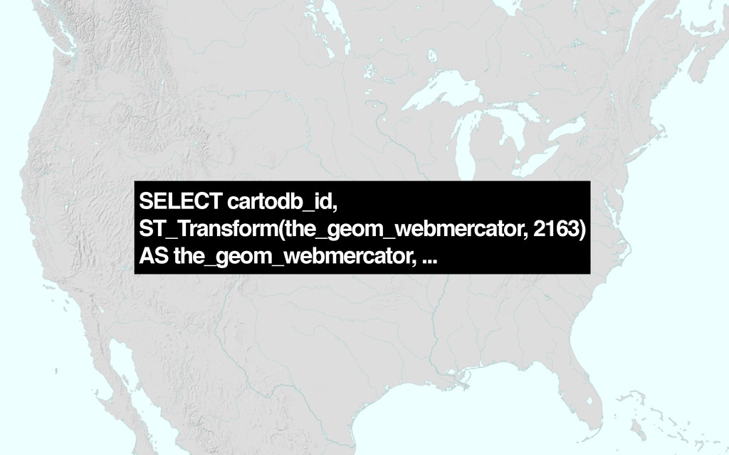
EPSG: 2163 US National Atlas Equal-Area (Lambert Azimuthal)
SELECT cartodb_id, ST_Transform(the_geom_webmercator, 2163) AS the_geom_webmercator, ...
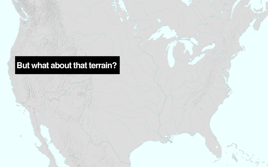
But what about that terrain?
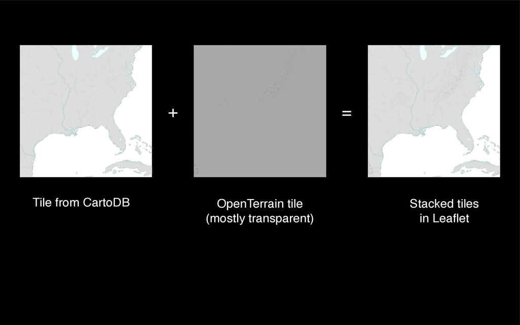
+ Tile from CartoDB OpenTerrain tile (mostly transparent) = Stacked
tiles in Leaflet
None
None
None
None
None
None
None
None
Hans Rosling: gapminder.org
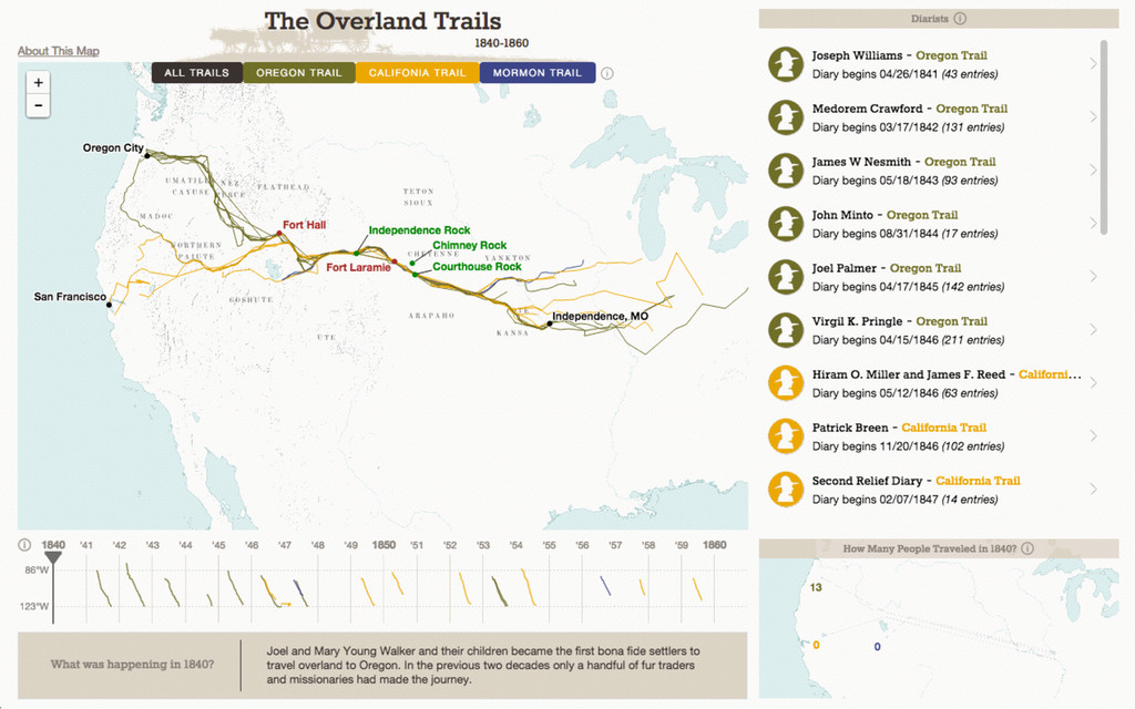
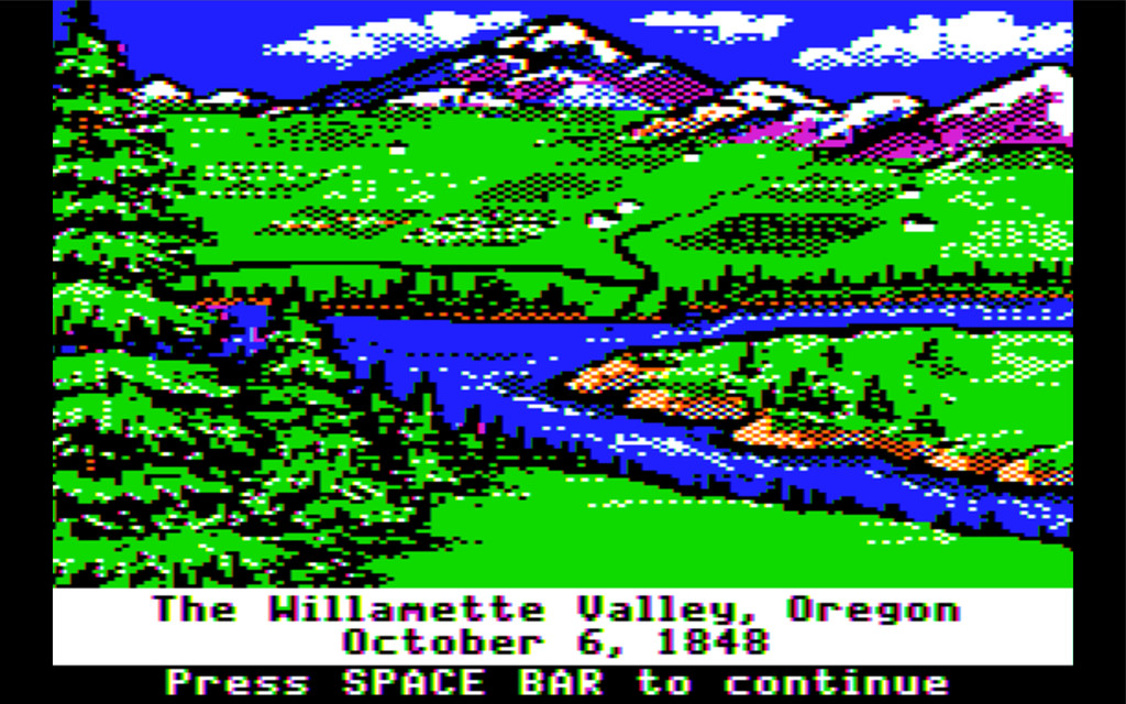
photo © Nathaniel Ayers Overland Trails 1840-1860
None
None
None
None
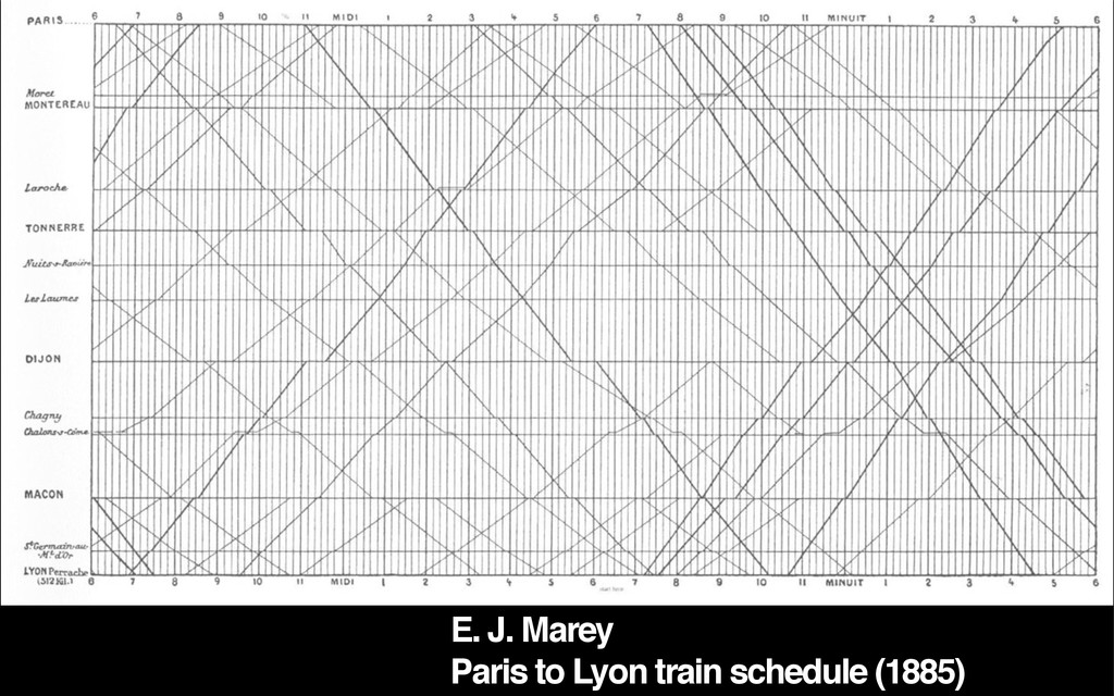
E. J. Marey Paris to Lyon train schedule (1885)
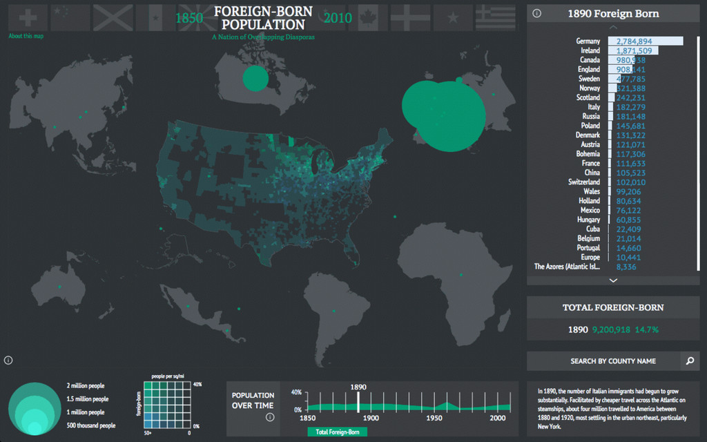
photo © Nathaniel Ayers Foreign-born Population 1850-2010
None
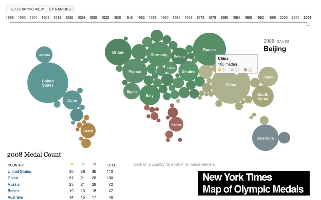
New York Times Map of Olympic Medals
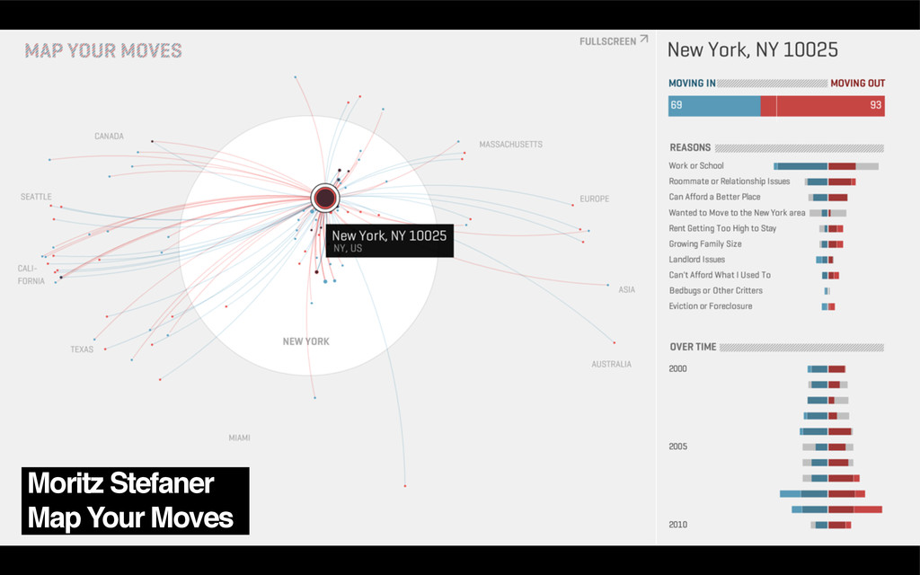
Moritz Stefaner Map Your Moves
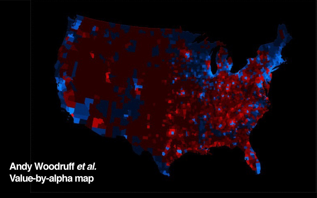
Andy Woodruff et al. Value-by-alpha map
None
None
None
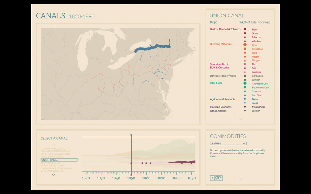
photo © Nathaniel Ayers Canals 1820-1890
None
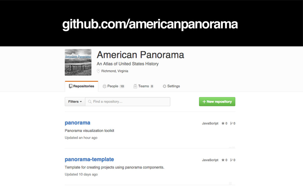
github.com/americanpanorama
Thank you! Alan McConchie // @mappingmashups Stamen Design // @stamen
Digital Scholarship Lab // dsl.richmond.edu Slides, notes, & links // sta.mn/6gk
None