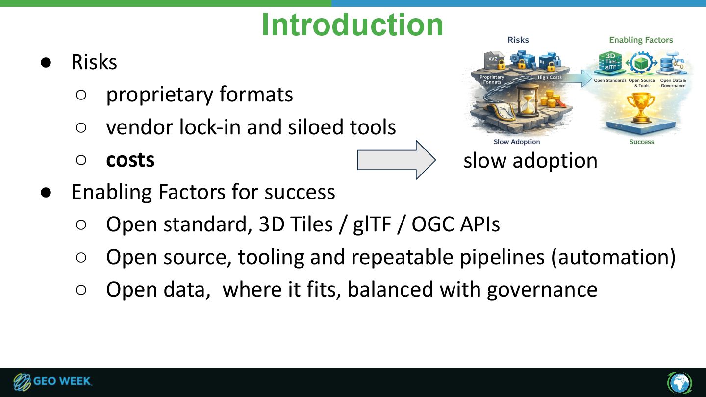
siloed tools ◦ costs • Enabling Factors for success ◦ Open standard, 3D Tiles / glTF / OGC APIs ◦ Open source, tooling and repeatable pipelines (automation) ◦ Open data, where it fits, balanced with governance slow adoption
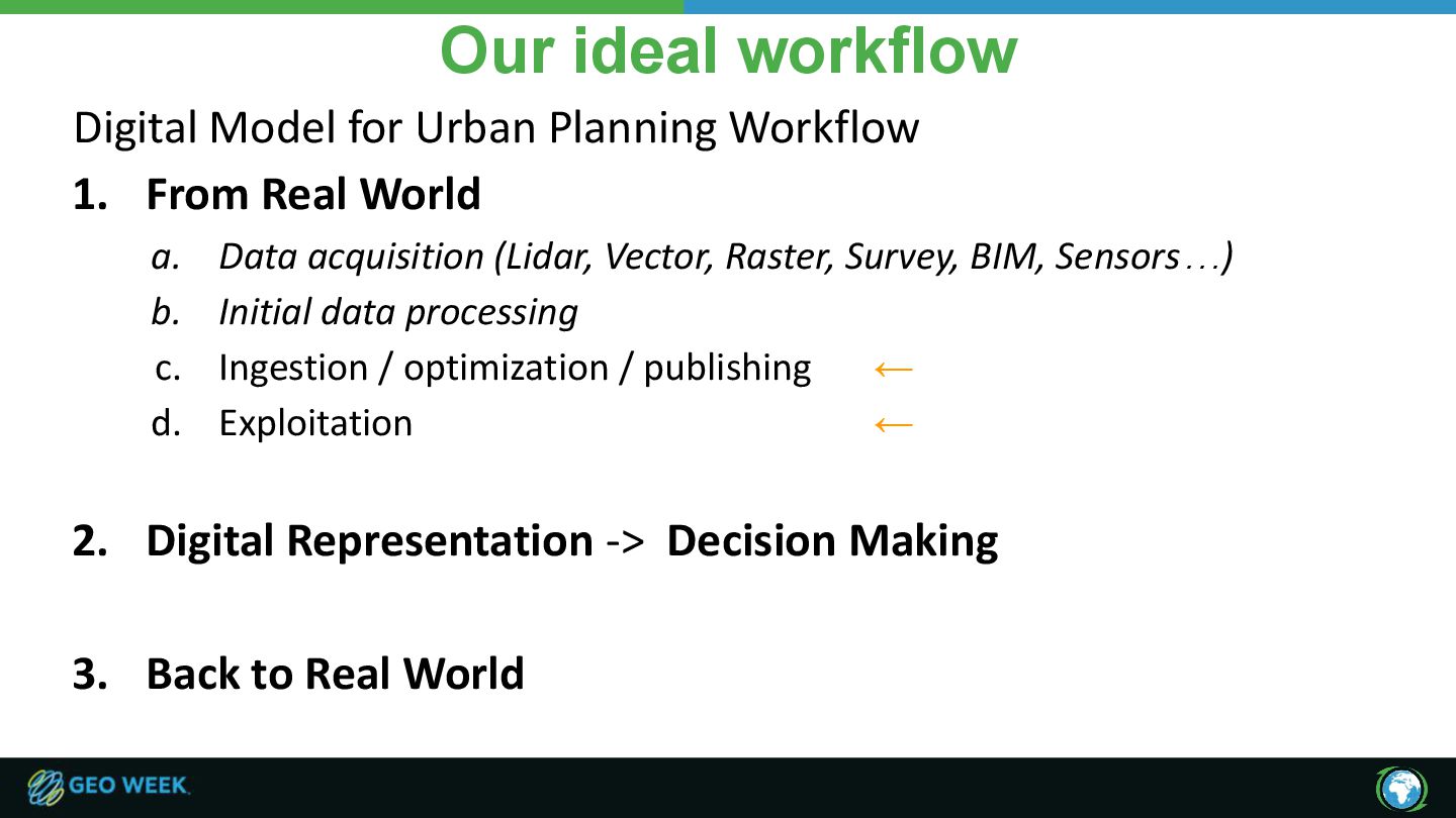
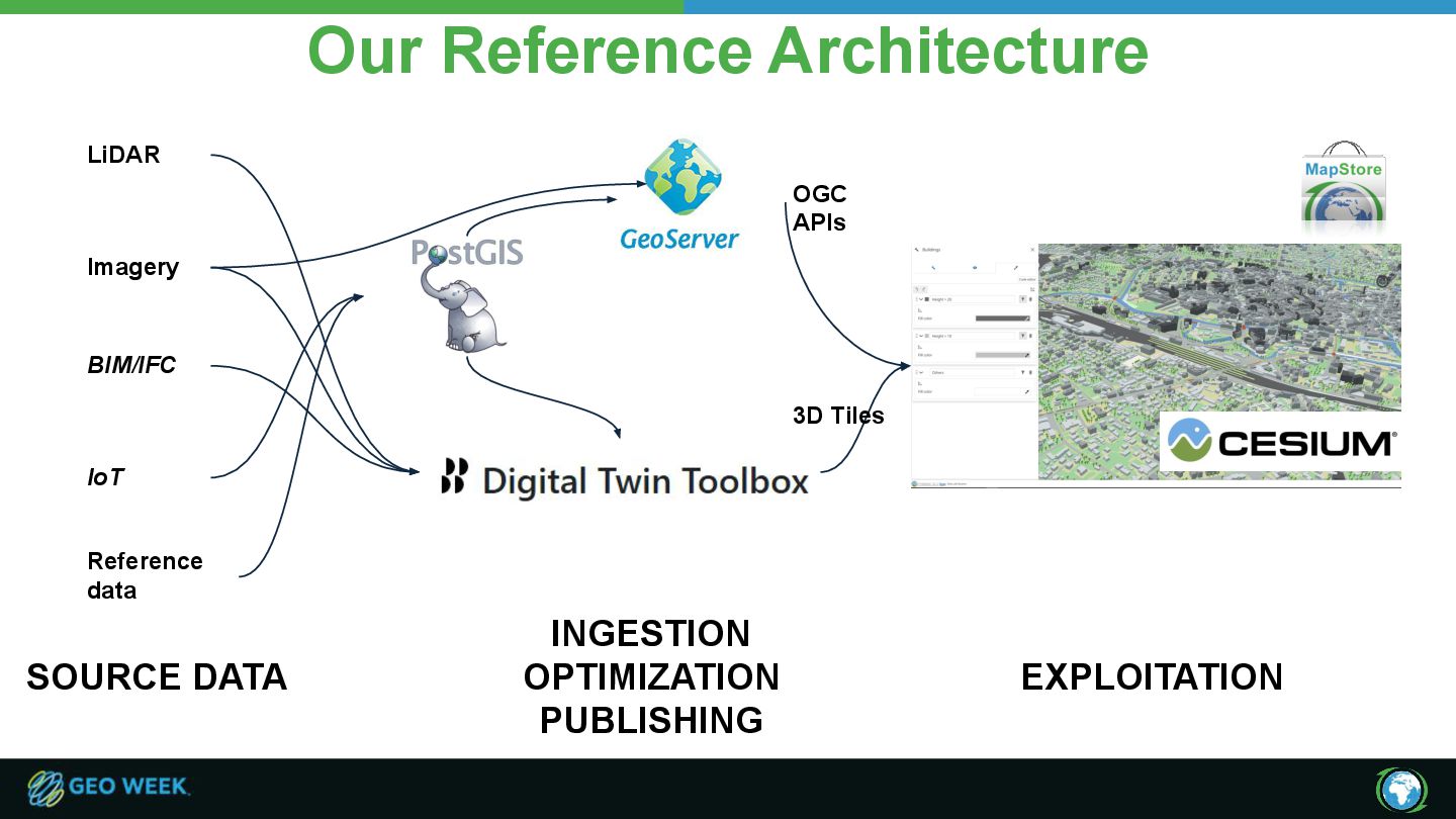
From Real World a. Data acquisition (Lidar, Vector, Raster, Survey, BIM, Sensors…) b. Initial data processing c. Ingestion / optimization / publishing ← d. Exploitation ← 2. Digital Representation -> Decision Making 3. Back to Real World
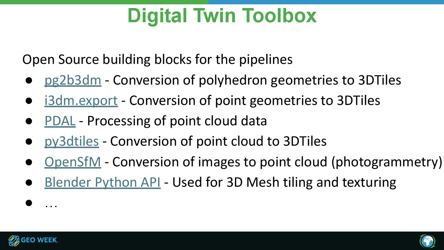
• pg2b3dm - Conversion of polyhedron geometries to 3DTiles • i3dm.export - Conversion of point geometries to 3DTiles • PDAL - Processing of point cloud data • py3dtiles - Conversion of point cloud to 3DTiles • OpenSfM - Conversion of images to point cloud (photogrammetry) • Blender Python API - Used for 3D Mesh tiling and texturing • …
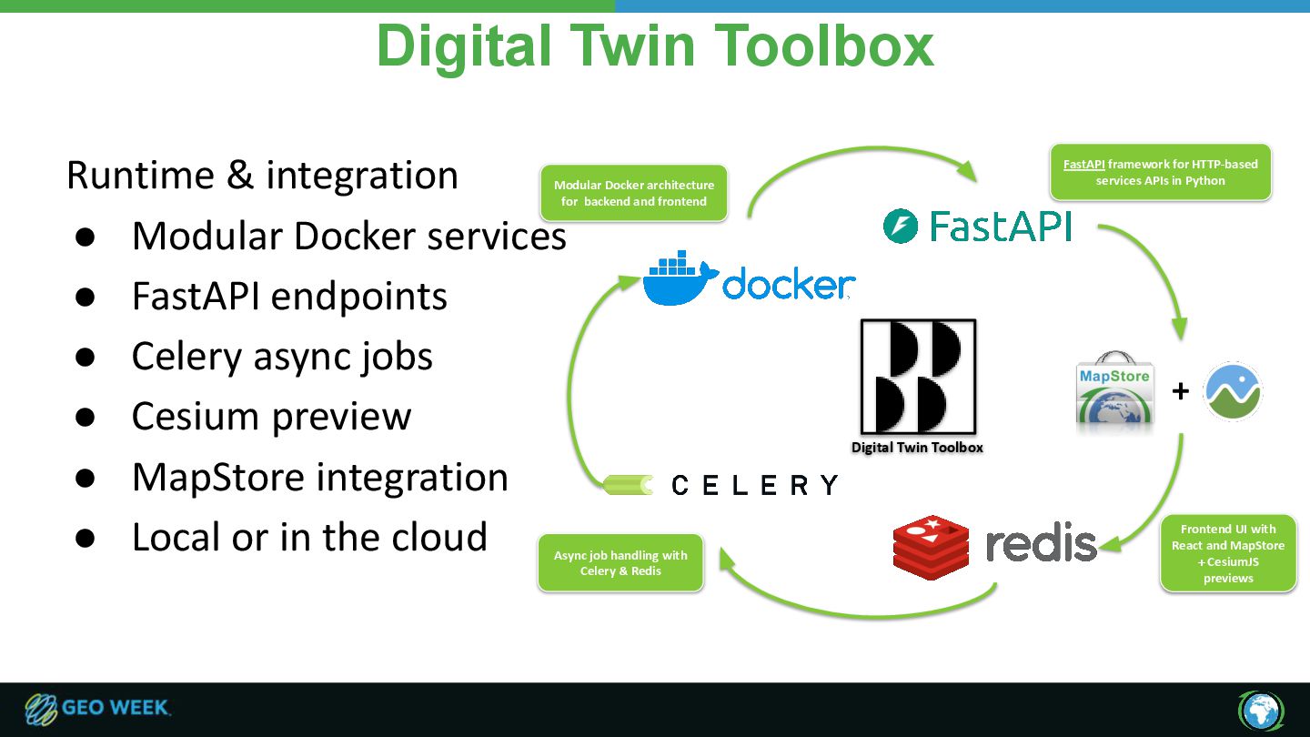
• FastAPI endpoints • Celery async jobs • Cesium preview • MapStore integration • Local or in the cloud Modular Docker architecture for backend and frontend FastAPI framework for HTTP-based services APIs in Python Digital Twin Toolbox Async job handling with Celery & Redis Frontend UI with React and MapStore + CesiumJS previews +
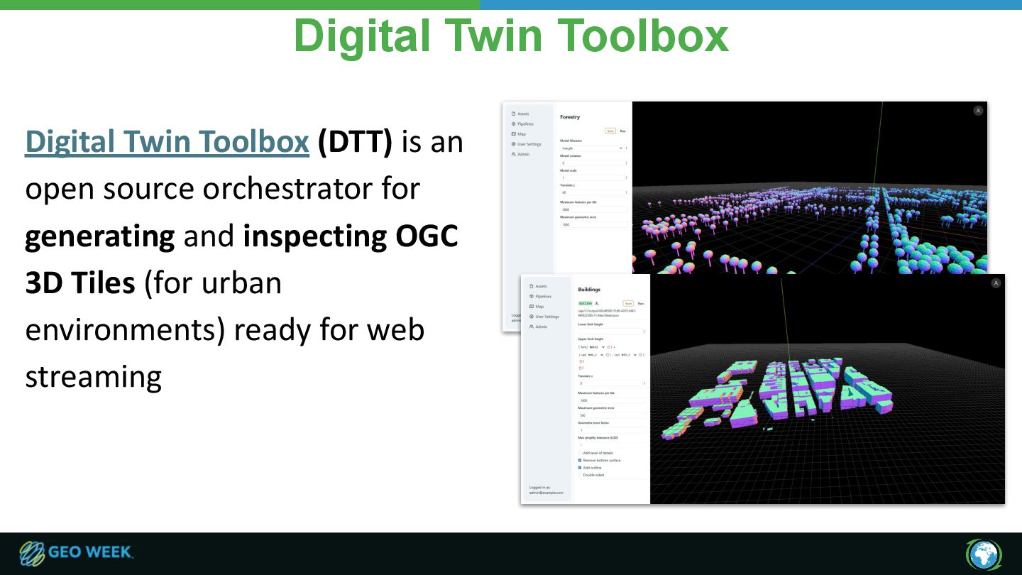
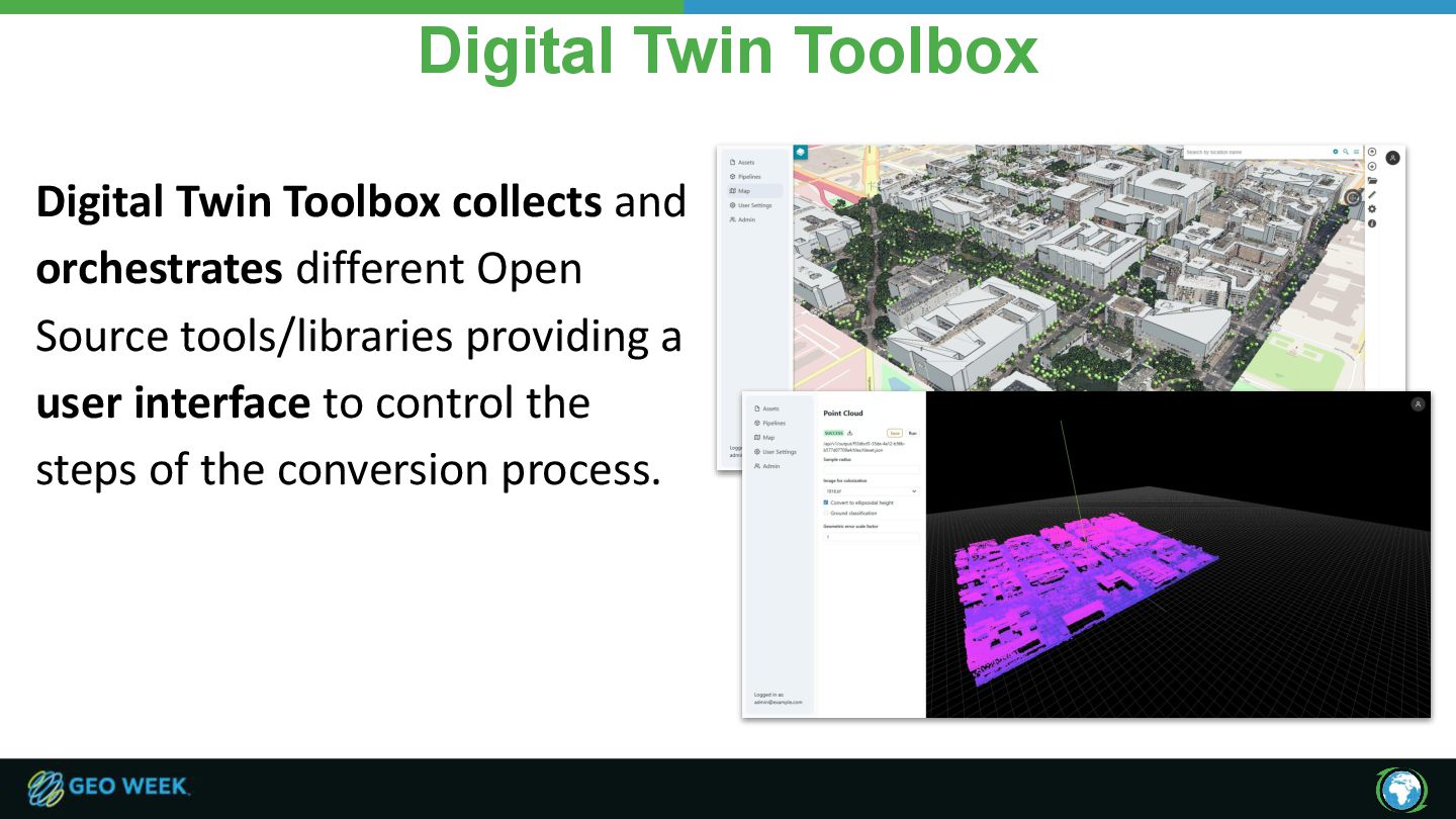
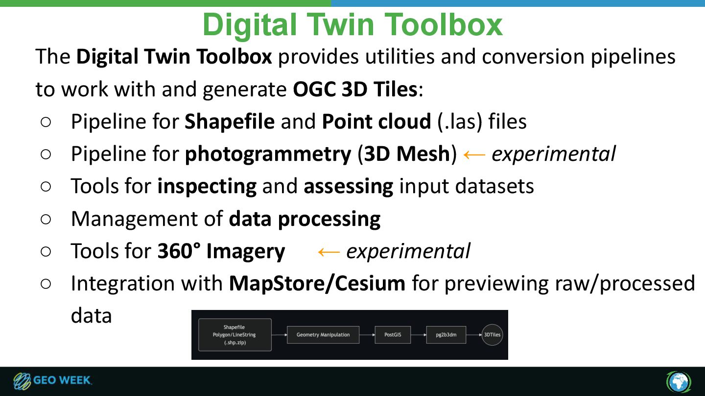
conversion pipelines to work with and generate OGC 3D Tiles: ◦ Pipeline for Shapefile and Point cloud (.las) files ◦ Pipeline for photogrammetry (3D Mesh) ← experimental ◦ Tools for inspecting and assessing input datasets ◦ Management of data processing ◦ Tools for 360° Imagery ← experimental ◦ Integration with MapStore/Cesium for previewing raw/processed data
• Pre-Release at: https://github.com/geosolutions-it/digital-twin-toolbox/releases/tag/v1.0.0-rc3 • Online documentation: https://github.com/geosolutions-it/digital-twin-toolbox/wiki • Tutorials are also available in the WIKI: https://github.com/geosolutions-it/digital-twin-toolbox/wiki/Tutorials • Check out the webinar on Youtube: https://youtu.be/owQW-AUjk0U?si=yc1j_KTiJHsXwUCL
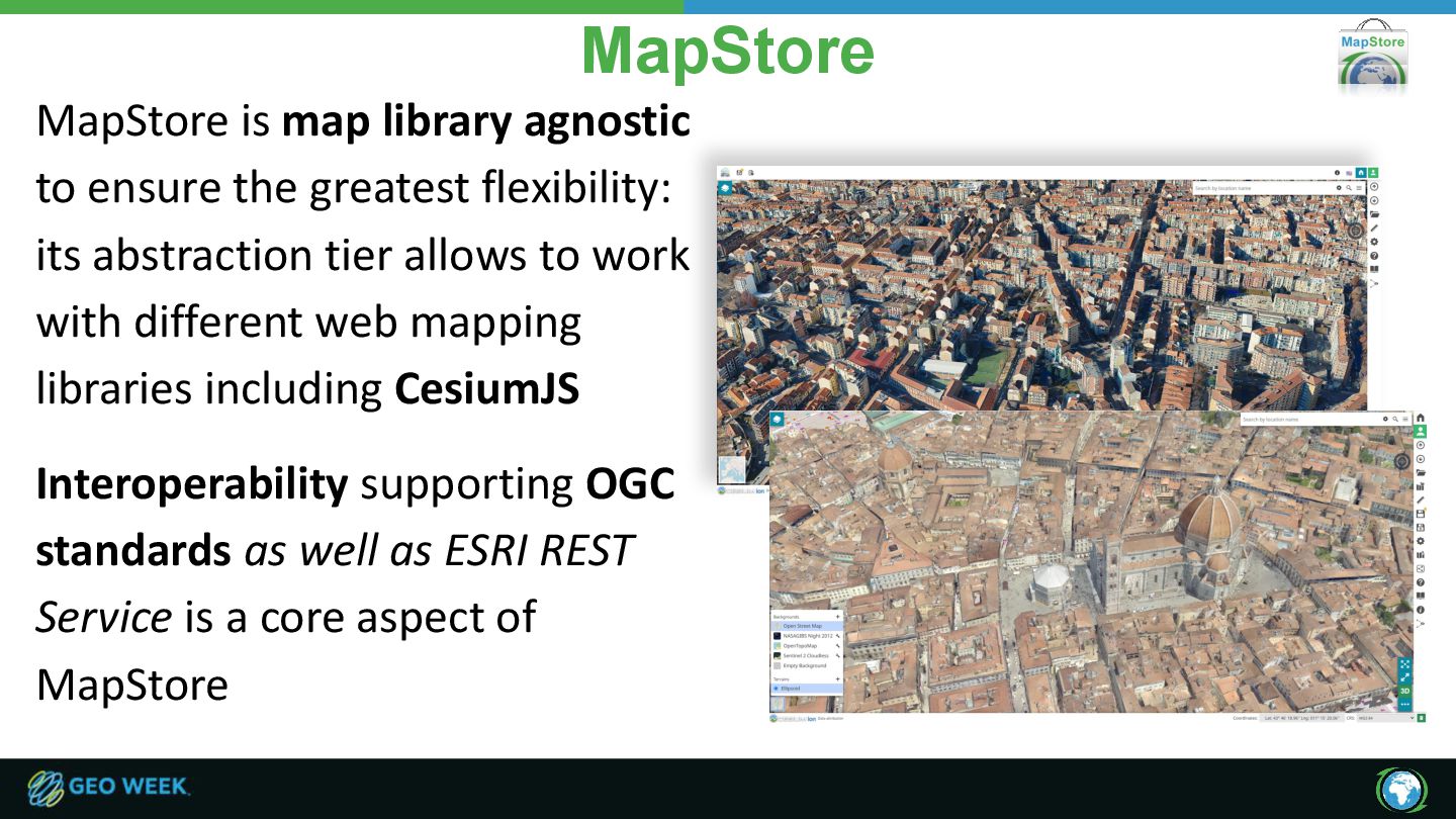
flexibility: its abstraction tier allows to work with different web mapping libraries including CesiumJS Interoperability supporting OGC standards as well as ESRI REST Service is a core aspect of MapStore
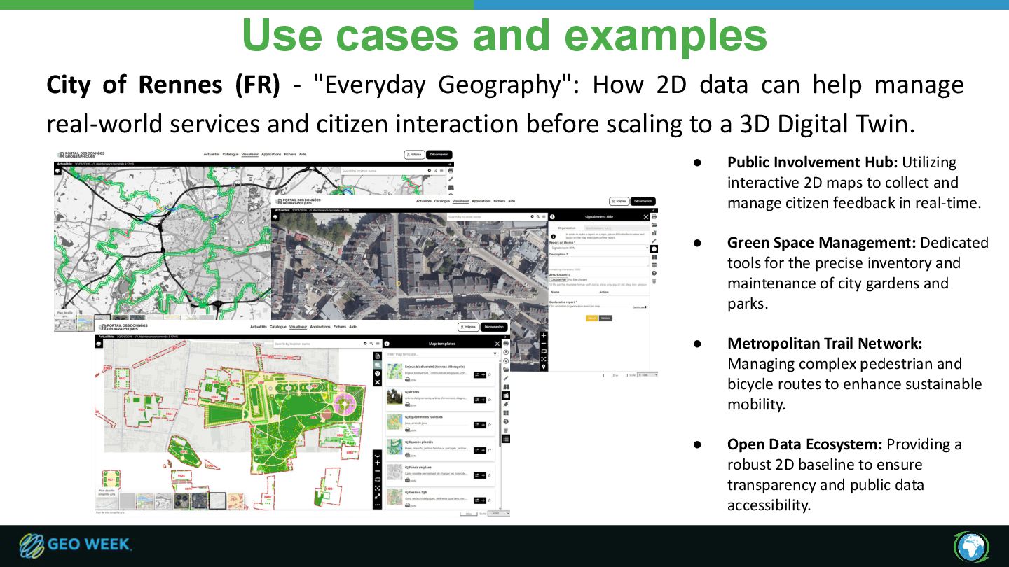
Geography": How 2D data can help manage real-world services and citizen interaction before scaling to a 3D Digital Twin. • Public Involvement Hub: Utilizing interactive 2D maps to collect and manage citizen feedback in real-time. • Green Space Management: Dedicated tools for the precise inventory and maintenance of city gardens and parks. • Metropolitan Trail Network: Managing complex pedestrian and bicycle routes to enhance sustainable mobility. • Open Data Ecosystem: Providing a robust 2D baseline to ensure transparency and public data accessibility.
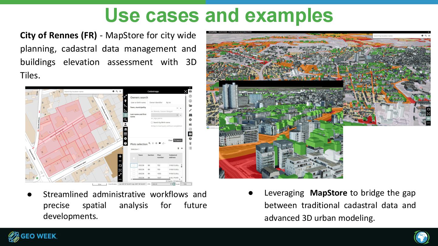
for city wide planning, cadastral data management and buildings elevation assessment with 3D Tiles. • Streamlined administrative workflows and precise spatial analysis for future developments. • Leveraging MapStore to bridge the gap between traditional cadastral data and advanced 3D urban modeling.
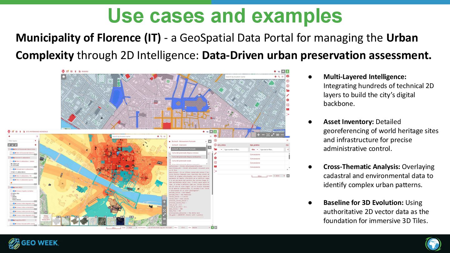
GeoSpatial Data Portal for managing the Urban Complexity through 2D Intelligence: Data-Driven urban preservation assessment. • Multi-Layered Intelligence: Integrating hundreds of technical 2D layers to build the city’s digital backbone. • Asset Inventory: Detailed georeferencing of world heritage sites and infrastructure for precise administrative control. • Cross-Thematic Analysis: Overlaying cadastral and environmental data to identify complex urban patterns. • Baseline for 3D Evolution: Using authoritative 2D vector data as the foundation for immersive 3D Tiles.
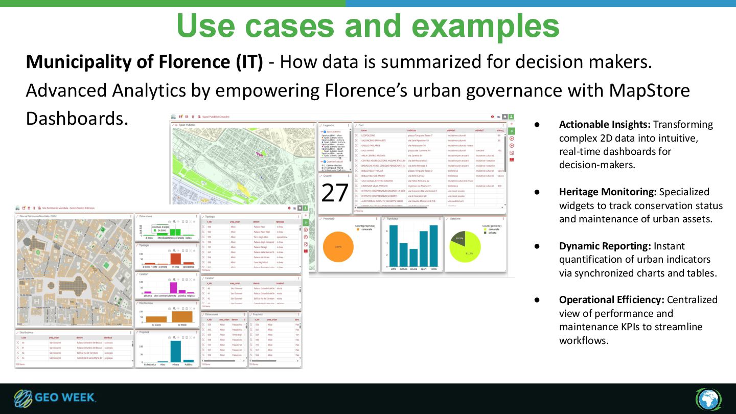
data is summarized for decision makers. Advanced Analytics by empowering Florence’s urban governance with MapStore Dashboards. • Actionable Insights: Transforming complex 2D data into intuitive, real-time dashboards for decision-makers. • Heritage Monitoring: Specialized widgets to track conservation status and maintenance of urban assets. • Dynamic Reporting: Instant quantification of urban indicators via synchronized charts and tables. • Operational Efficiency: Centralized view of performance and maintenance KPIs to streamline workflows.
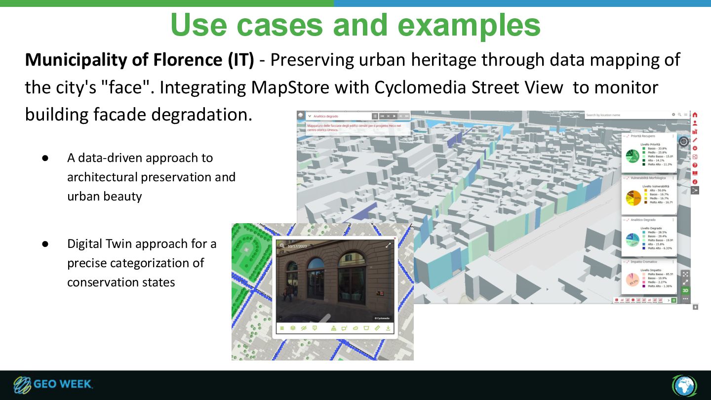
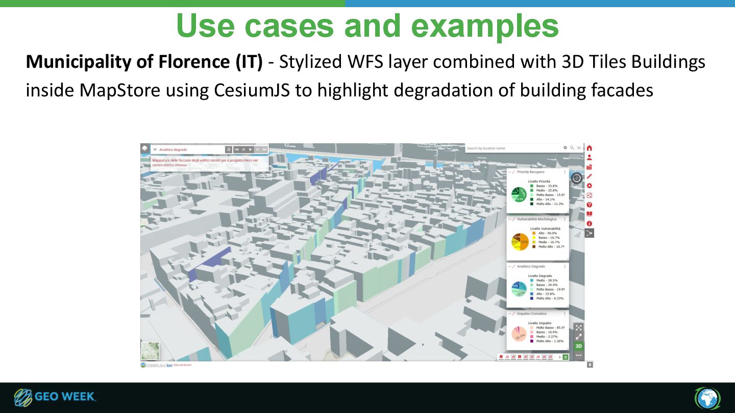
urban heritage through data mapping of the city's "face". Integrating MapStore with Cyclomedia Street View to monitor building facade degradation. • Digital Twin approach for a precise categorization of conservation states • A data-driven approach to architectural preservation and urban beauty
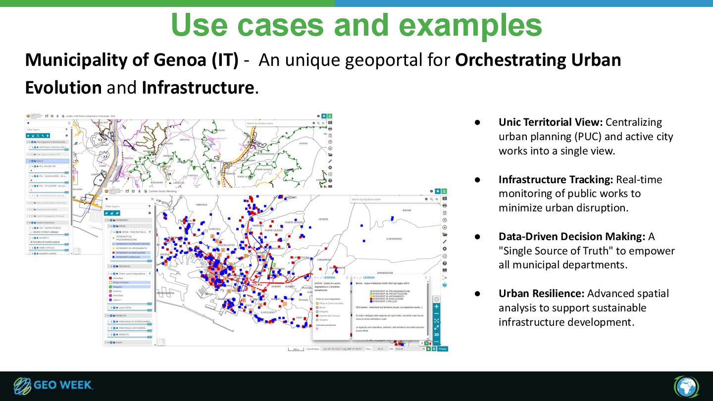
unique geoportal for Orchestrating Urban Evolution and Infrastructure. • Unic Territorial View: Centralizing urban planning (PUC) and active city works into a single view. • Infrastructure Tracking: Real-time monitoring of public works to minimize urban disruption. • Data-Driven Decision Making: A "Single Source of Truth" to empower all municipal departments. • Urban Resilience: Advanced spatial analysis to support sustainable infrastructure development.
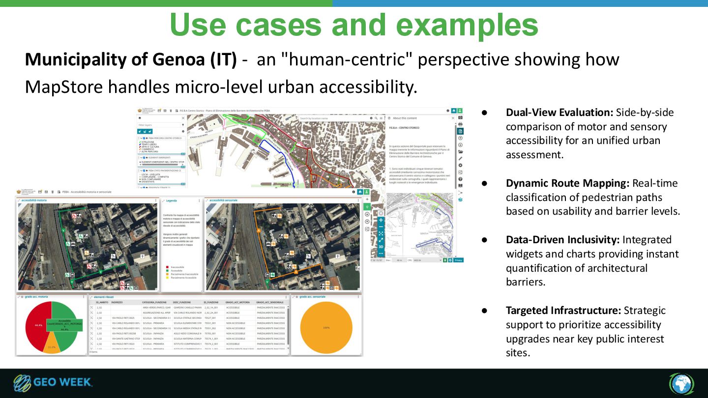
"human-centric" perspective showing how MapStore handles micro-level urban accessibility. • Dual-View Evaluation: Side-by-side comparison of motor and sensory accessibility for an unified urban assessment. • Dynamic Route Mapping: Real-time classification of pedestrian paths based on usability and barrier levels. • Data-Driven Inclusivity: Integrated widgets and charts providing instant quantification of architectural barriers. • Targeted Infrastructure: Strategic support to prioritize accessibility upgrades near key public interest sites.
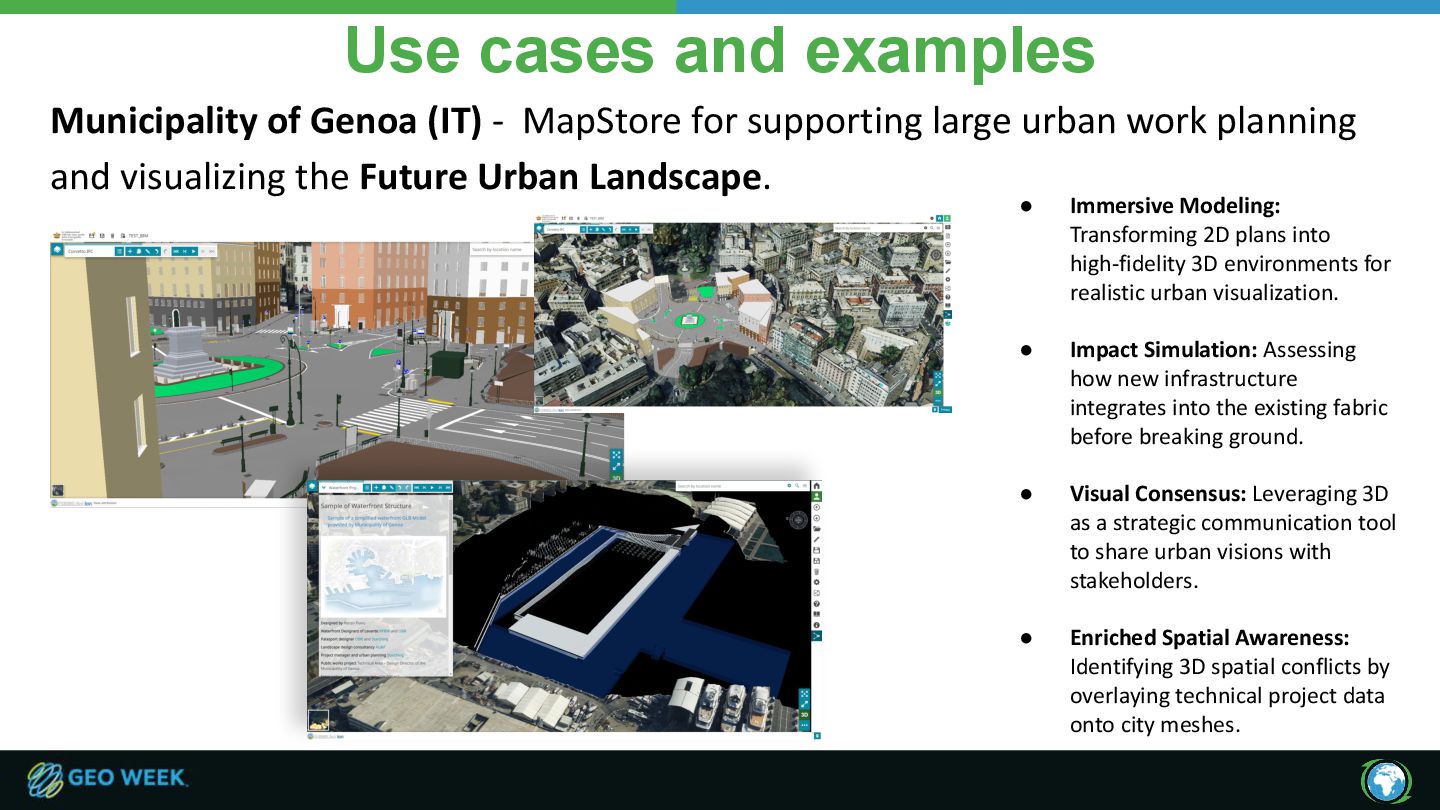
for supporting large urban work planning and visualizing the Future Urban Landscape. • Immersive Modeling: Transforming 2D plans into high-fidelity 3D environments for realistic urban visualization. • Impact Simulation: Assessing how new infrastructure integrates into the existing fabric before breaking ground. • Visual Consensus: Leveraging 3D as a strategic communication tool to share urban visions with stakeholders. • Enriched Spatial Awareness: Identifying 3D spatial conflicts by overlaying technical project data onto city meshes.
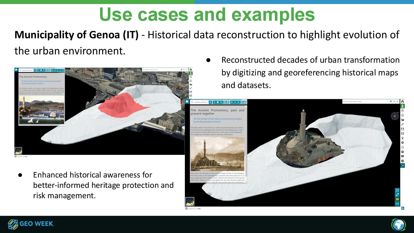
data reconstruction to highlight evolution of the urban environment. • Reconstructed decades of urban transformation by digitizing and georeferencing historical maps and datasets. • Enhanced historical awareness for better-informed heritage protection and risk management.
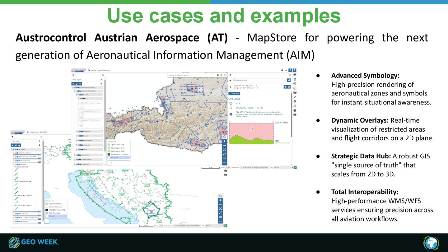
for powering the next generation of Aeronautical Information Management (AIM) • Advanced Symbology: High-precision rendering of aeronautical zones and symbols for instant situational awareness. • Dynamic Overlays: Real-time visualization of restricted areas and flight corridors on a 2D plane. • Strategic Data Hub: A robust GIS "single source of truth" that scales from 2D to 3D. • Total Interoperability: High-performance WMS/WFS services ensuring precision across all aviation workflows.
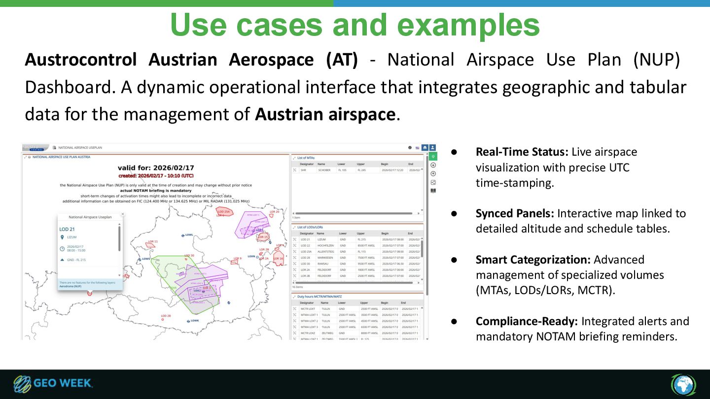
Airspace Use Plan (NUP) Dashboard. A dynamic operational interface that integrates geographic and tabular data for the management of Austrian airspace. • Real-Time Status: Live airspace visualization with precise UTC time-stamping. • Synced Panels: Interactive map linked to detailed altitude and schedule tables. • Smart Categorization: Advanced management of specialized volumes (MTAs, LODs/LORs, MCTR). • Compliance-Ready: Integrated alerts and mandatory NOTAM briefing reminders.
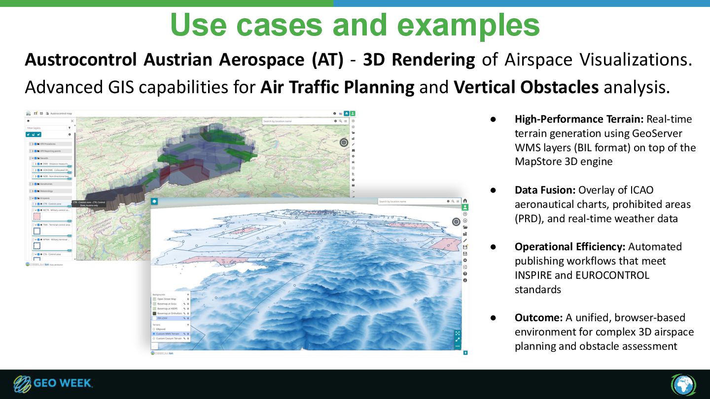
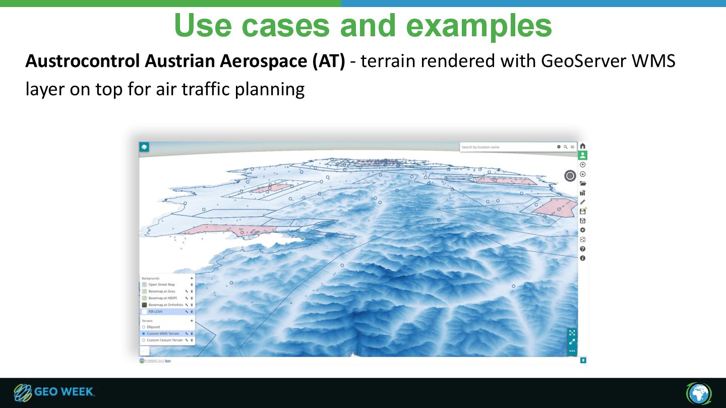
Rendering of Airspace Visualizations. Advanced GIS capabilities for Air Traffic Planning and Vertical Obstacles analysis. • High-Performance Terrain: Real-time terrain generation using GeoServer WMS layers (BIL format) on top of the MapStore 3D engine • Data Fusion: Overlay of ICAO aeronautical charts, prohibited areas (PRD), and real-time weather data • Operational Efficiency: Automated publishing workflows that meet INSPIRE and EUROCONTROL standards • Outcome: A unified, browser-based environment for complex 3D airspace planning and obstacle assessment
let clients interoperate. • Use 3D Tiles / glTF as for 3D and OGC APIs for raster/vector 2D serving. Check also COG and STAC. • Automate conversion and provenance • Build repeatable pipelines. • Produce provenance metadata and previews so outputs are auditable and retryable • Design & implement for real users • Deliver filtered, styled, LOD-aware views, measurement and annotation. • Client-side styling + attribute overlays beats republishing tiles for every view • Plan operations & data governance early • Implement CDN + cache invalidation, tile versioning, monitoring and rollback procedures. • Decide where open data applies and formalize access/governance for restricted datasets. Standards, Automation, UX, Operations & governance, the ingredients that make urban twins operational
to enrich the DTT capabilities: • Finalizations of photogrammetry process to 3D Tiles mesh • Support of Obj files to 3D Tiles conversion pipeline • Support of IFC and CityGML files to 3D Tiles conversion pipeline As far as MapStore more work is ongoing: • Improved filtering for 3D Tiles • Support for OGC GeoVolumes • Better overlay support for OGC Services in 3D • Integration with sensor data & simulation models!
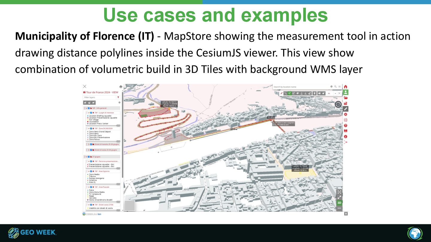
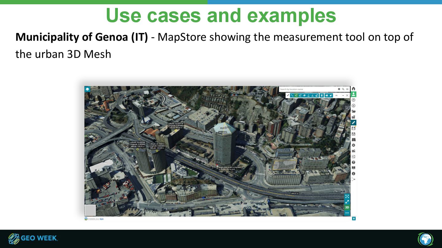
showing the measurement tool in action drawing distance polylines inside the CesiumJS viewer. This view show combination of volumetric build in 3D Tiles with background WMS layer
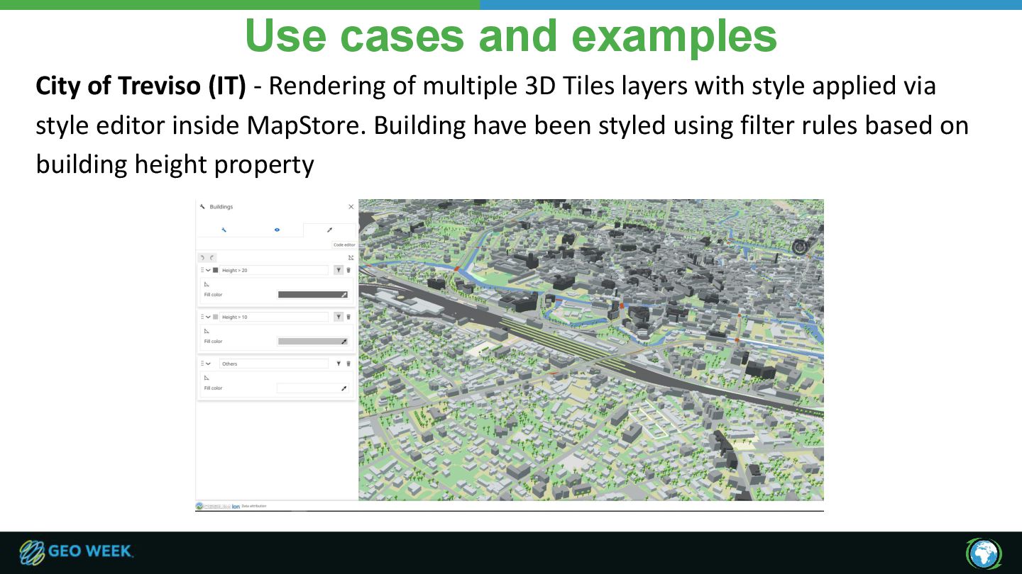
of multiple 3D Tiles layers with style applied via style editor inside MapStore. Building have been styled using filter rules based on building height property
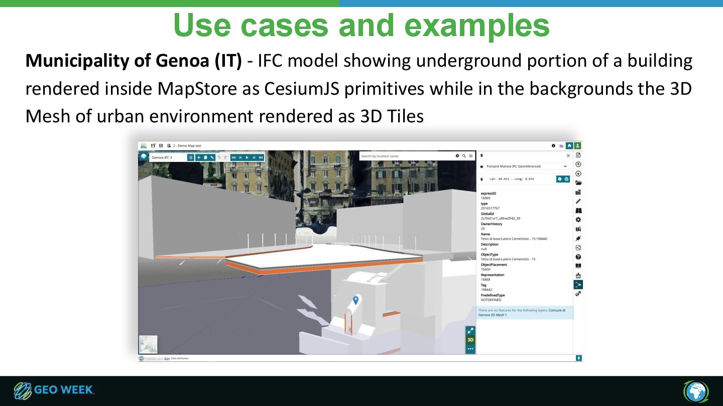
model showing underground portion of a building rendered inside MapStore as CesiumJS primitives while in the backgrounds the 3D Mesh of urban environment rendered as 3D Tiles
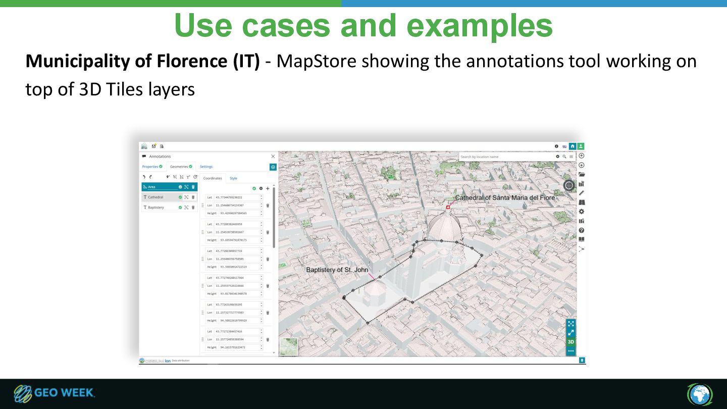
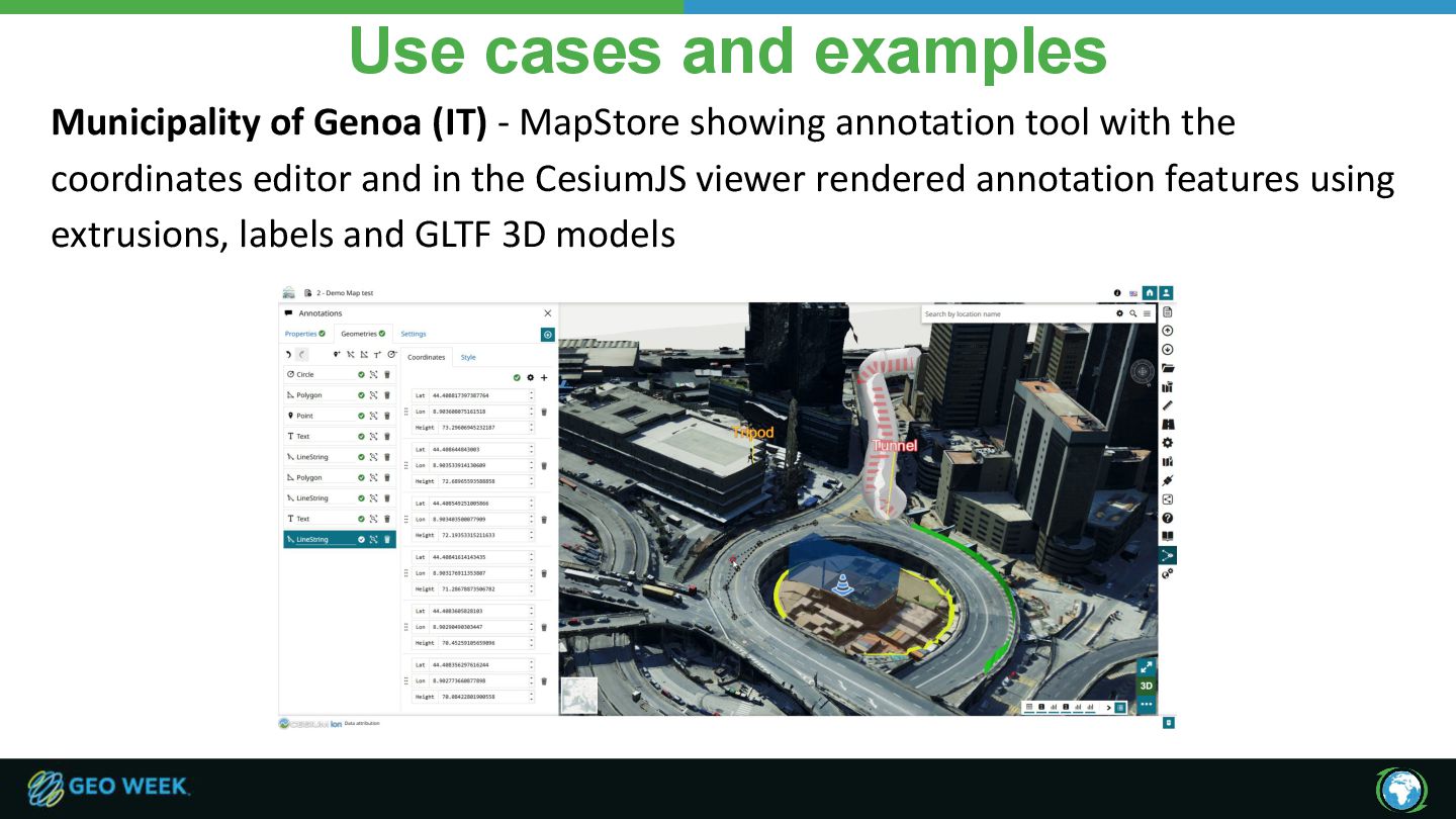
showing annotation tool with the coordinates editor and in the CesiumJS viewer rendered annotation features using extrusions, labels and GLTF 3D models
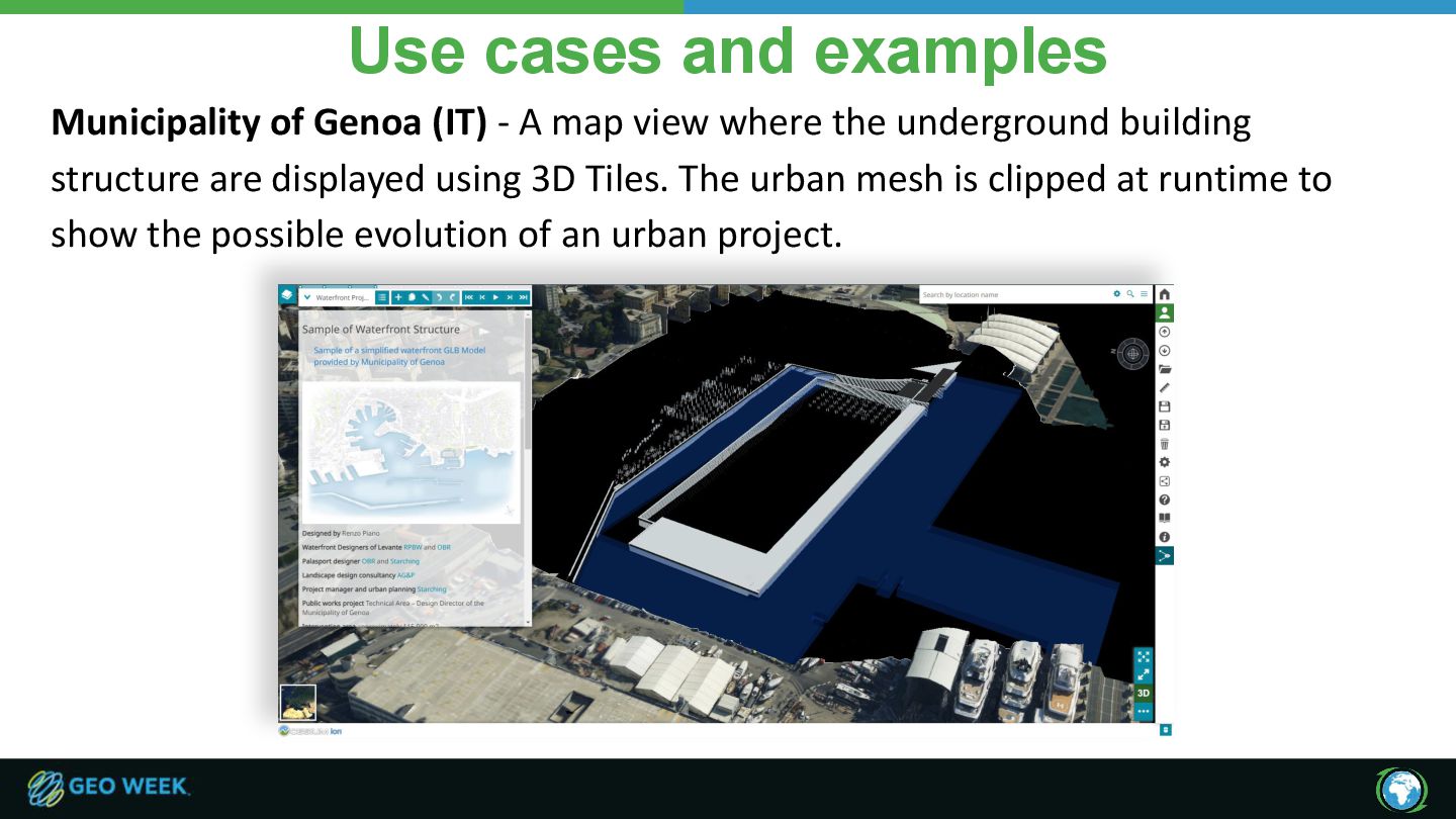
map view where the underground building structure are displayed using 3D Tiles. The urban mesh is clipped at runtime to show the possible evolution of an urban project.
![Ready to scale your geospatial platform? [email protected]](https://files.speakerdeck.com/presentations/f900515bbf12493281220056b2235203/slide_33.jpg)