Upgrade to Pro
— share decks privately, control downloads, hide ads and more …
Speaker Deck
Sign up for free
Menu
Search
Features
All features
Private URLs
Password Protection
Custom URLS
Scheduled publishing
Remove Branding
Restrict embedding
Deck Collections
Notes
Features
All features
Private URLs
Password Protection
Custom URLS
Scheduled publishing
Remove Branding
Restrict embedding
Deck Collections
Notes
Explore
Featured decks
Featured speakers
Programming
Technology
Storyboards
Explore
Featured decks
Featured speakers
Programming
Technology
Storyboards
Pricing
Search
Sign in
Sign up for free
Barry Kronenfeld Cartograms
Search
NACIS
October 15, 2015
230
0
Share
Embed
Copy iframe code
Copy JS code
Copy link
Start on current slide
Barry Kronenfeld Cartograms
NACIS
October 15, 2015
Transcript
46 slides
Where the People Are Barry J Kronenfeld Eastern Illinois University
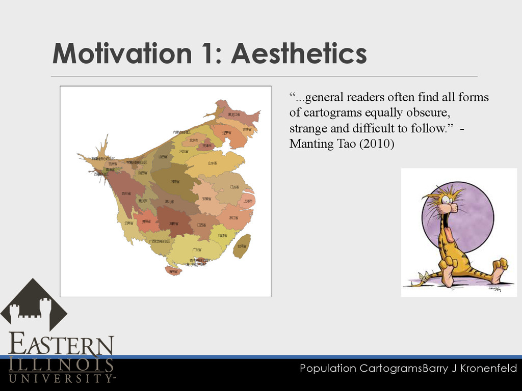
Population Cartograms Barry J Kronenfeld Motivation 1: Aesthetics “...general readers
often find all forms of cartograms equally obscure, strange and difficult to follow.” - Manting Tao (2010)
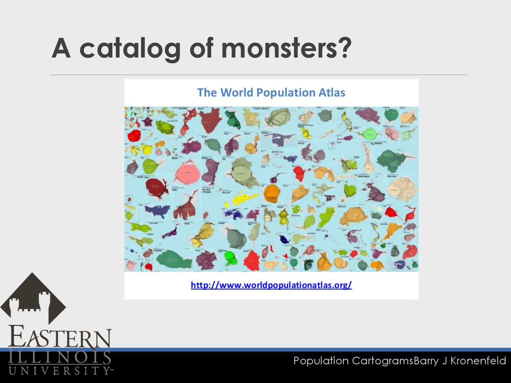
Population Cartograms Barry J Kronenfeld A catalog of monsters?
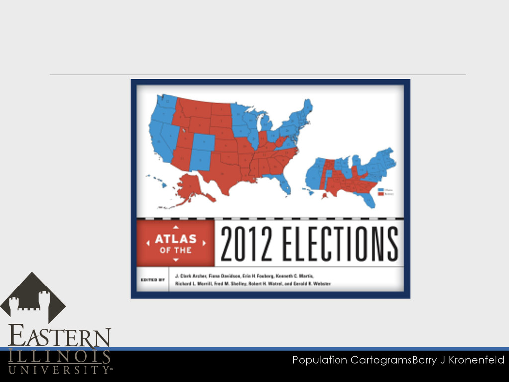
Population Cartograms Barry J Kronenfeld Cartograms of a different era
Population Cartograms Barry J Kronenfeld
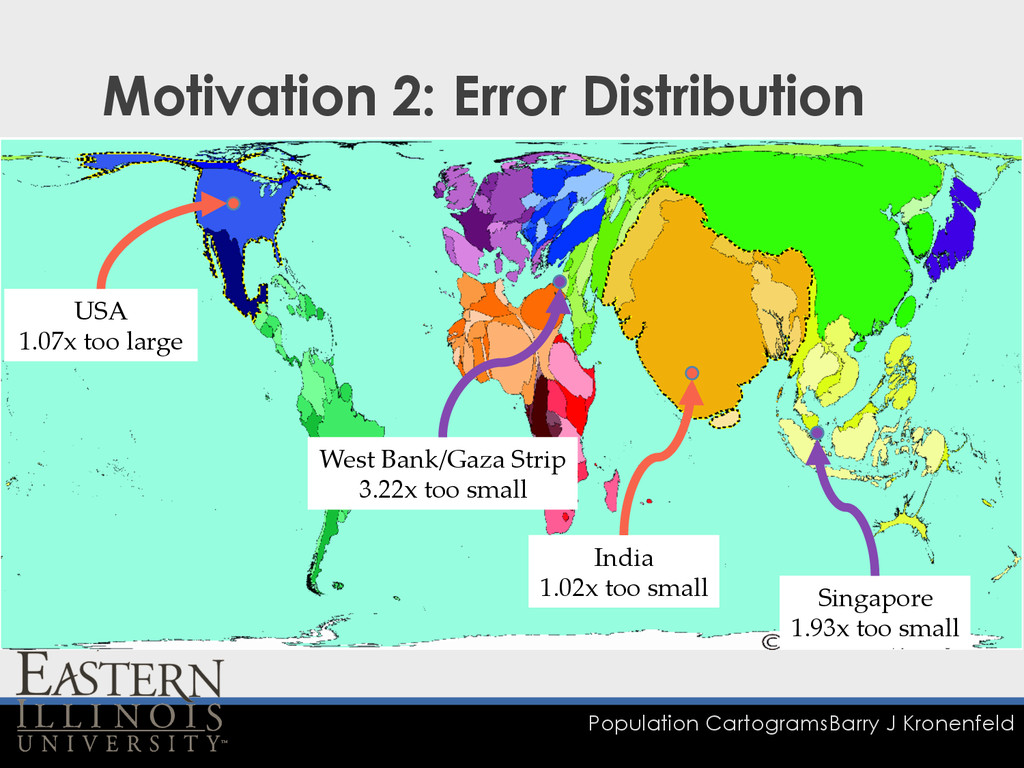
Population Cartograms Barry J Kronenfeld Motivation 2: Error Distribution USA
1.07x too large West Bank/Gaza Strip 3.22x too small Singapore 1.93x too small India 1.02x too small
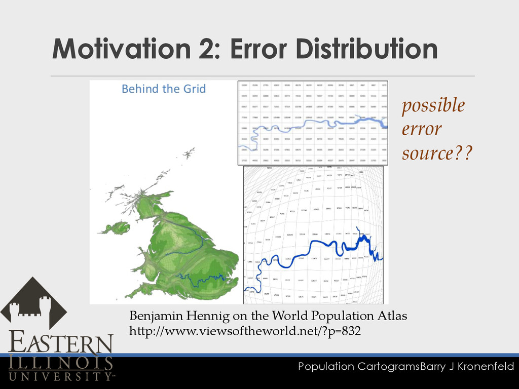
Population Cartograms Barry J Kronenfeld Motivation 2: Error Distribution Benjamin
Hennig on the World Population Atlas hGp://www.viewsoftheworld.net/?p=832 possible error source??
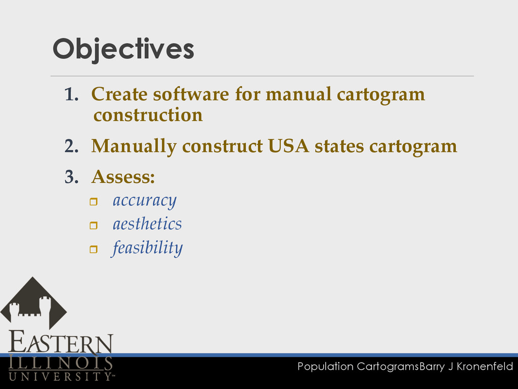
Population Cartograms Barry J Kronenfeld Objectives 1. Create software for
manual cartogram construction 2. Manually construct USA states cartogram 3. Assess: r accuracy r aesthetics r feasibility
1. Software Environment for Manual Cartogram Construction
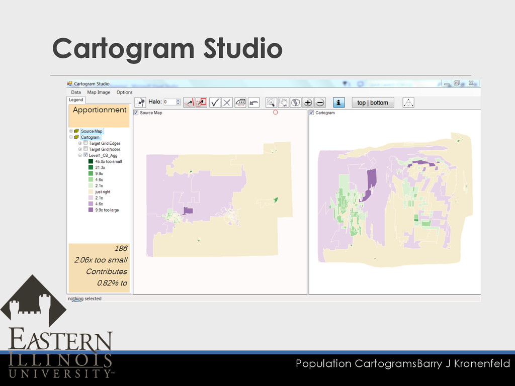
Population Cartograms Barry J Kronenfeld Cartogram Studio
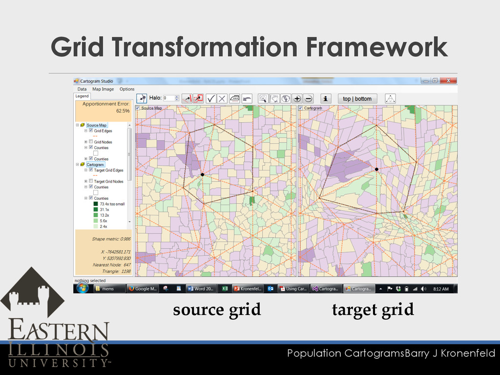
Population Cartograms Barry J Kronenfeld Grid Transformation Framework source grid
target grid
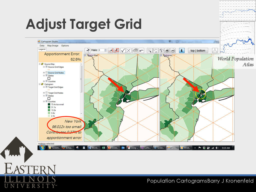
Population Cartograms Barry J Kronenfeld Adjust Target Grid World Population
Atlas
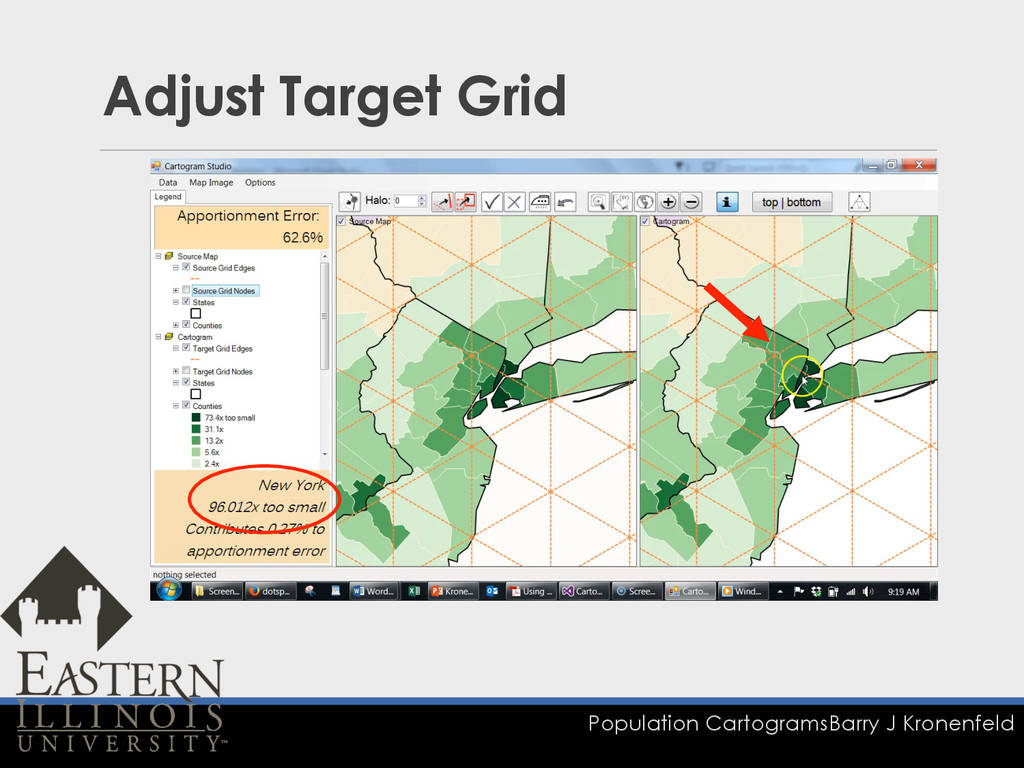
Population Cartograms Barry J Kronenfeld Adjust Target Grid
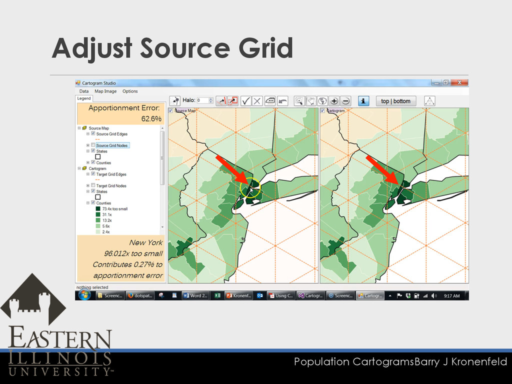
Population Cartograms Barry J Kronenfeld Adjust Source Grid
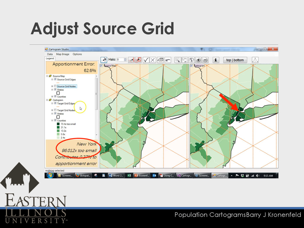
Population Cartograms Barry J Kronenfeld Adjust Source Grid
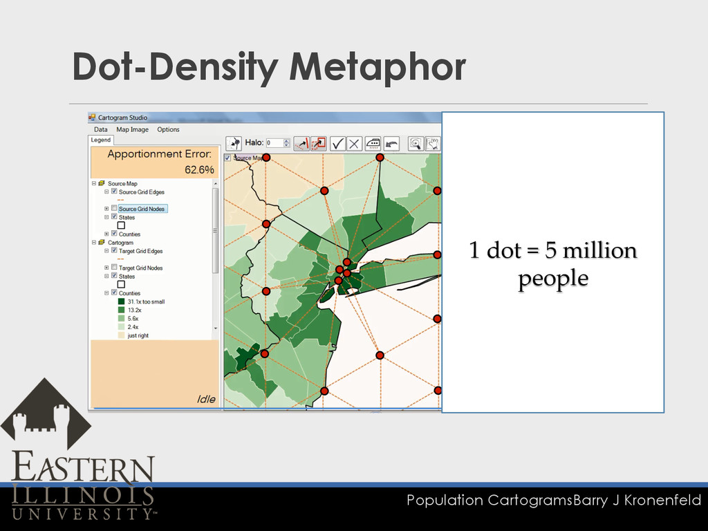
Population Cartograms Barry J Kronenfeld Dot-Density Metaphor 1 dot =
5 million people
Population Cartograms Barry J Kronenfeld Adjustment Tools q Rectangle Transform
Tool q Line Transform Tool q Smudge Tool
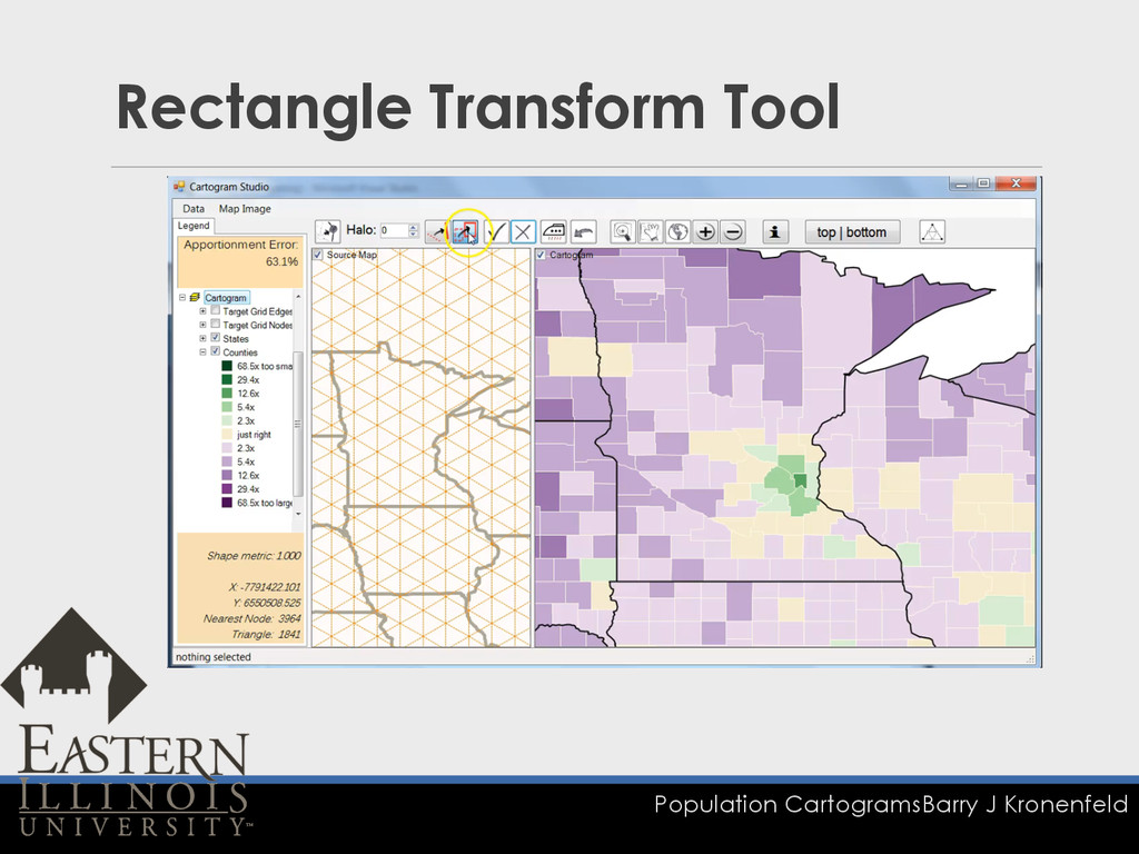
Population Cartograms Barry J Kronenfeld Rectangle Transform Tool
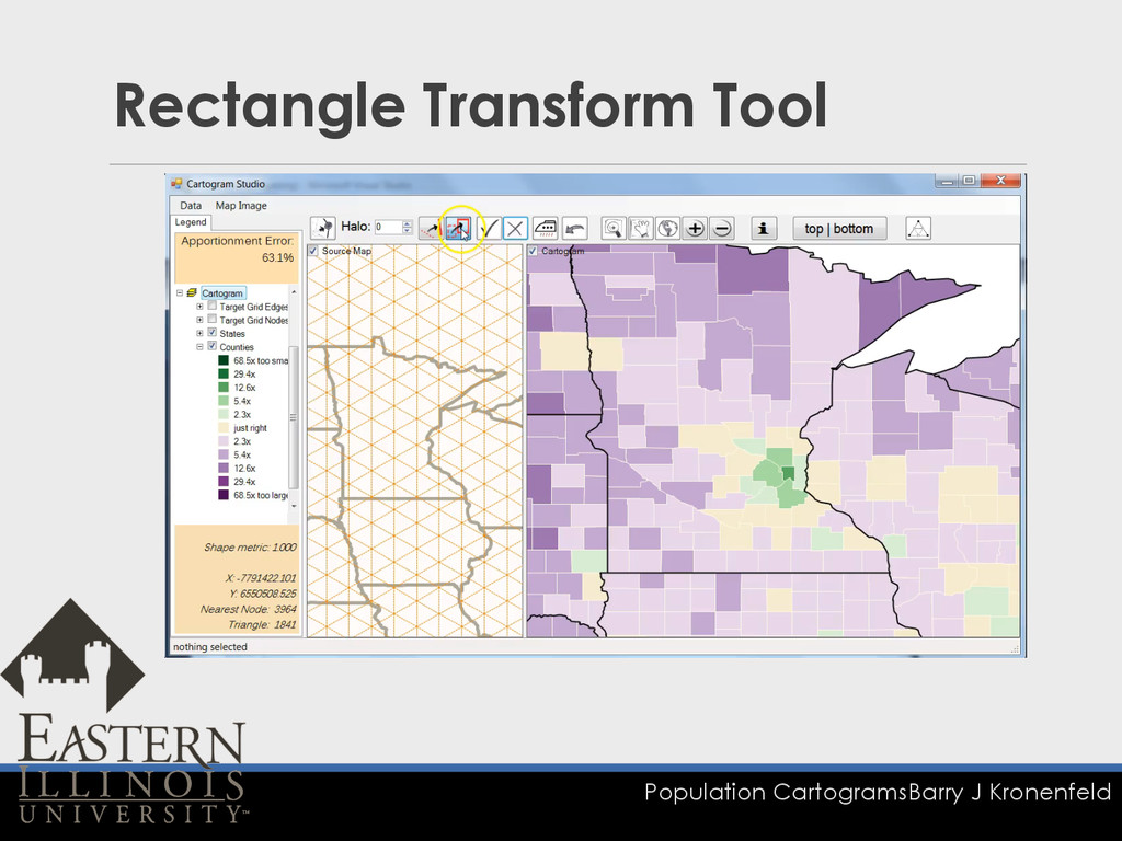
Population Cartograms Barry J Kronenfeld Rectangle Transform Tool
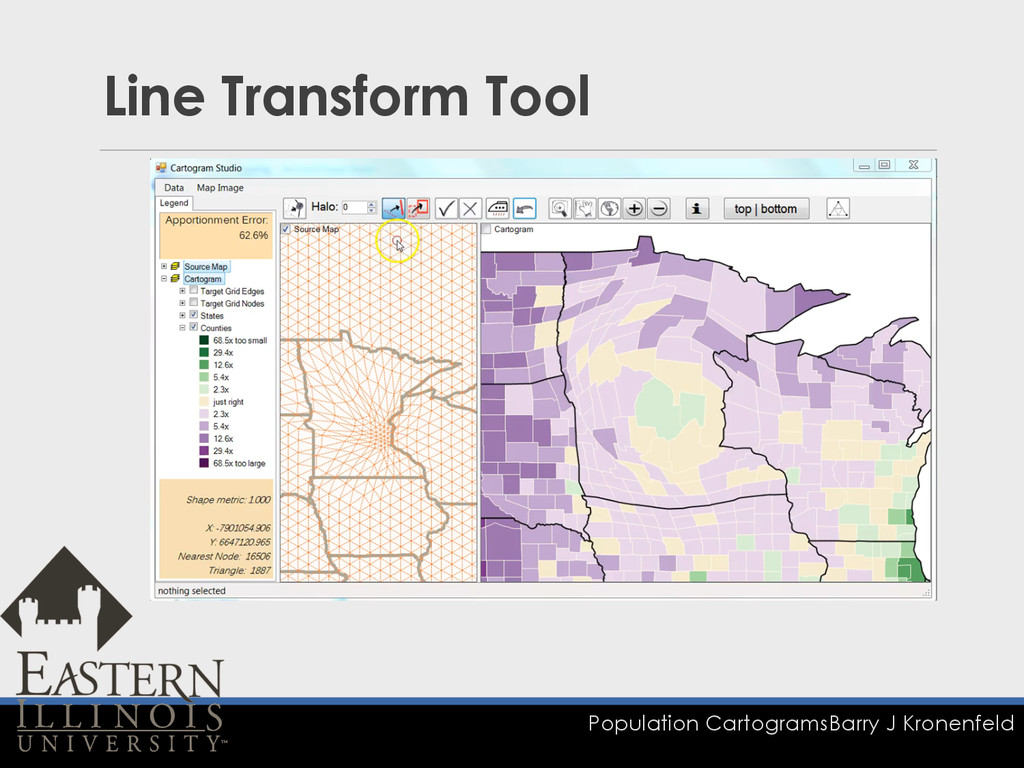
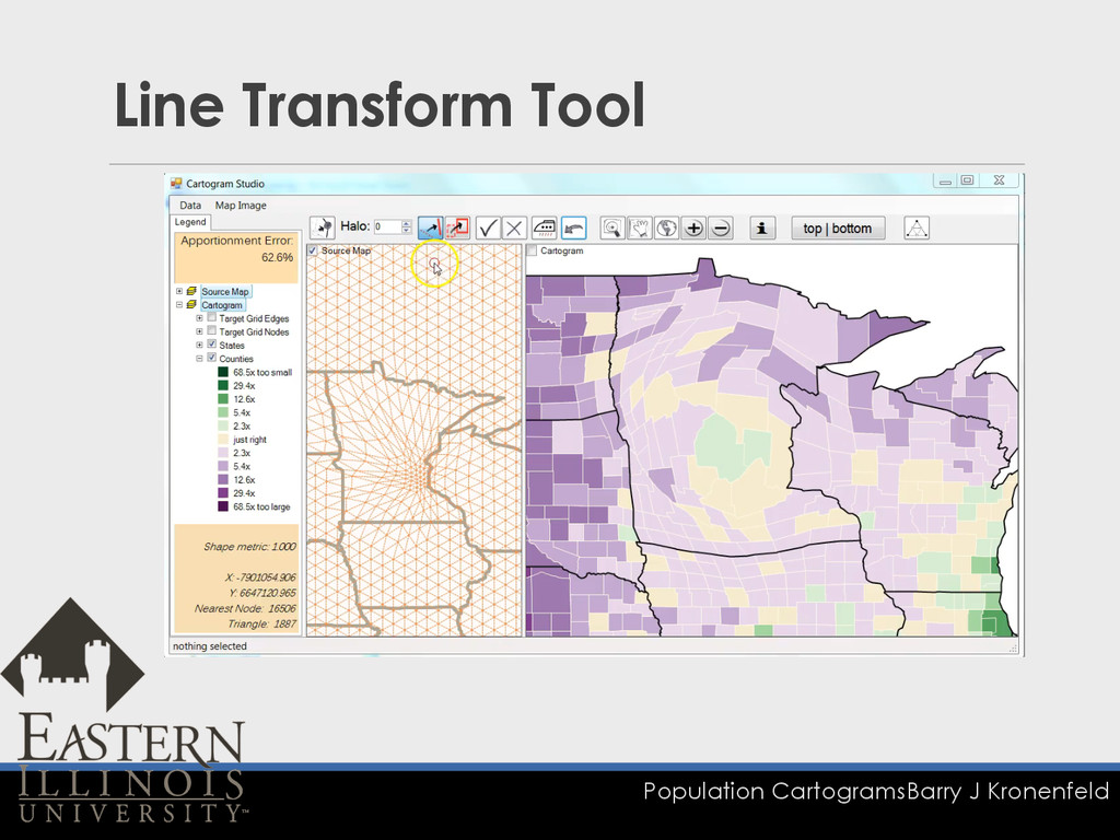
Population Cartograms Barry J Kronenfeld Line Transform Tool
Population Cartograms Barry J Kronenfeld Line Transform Tool
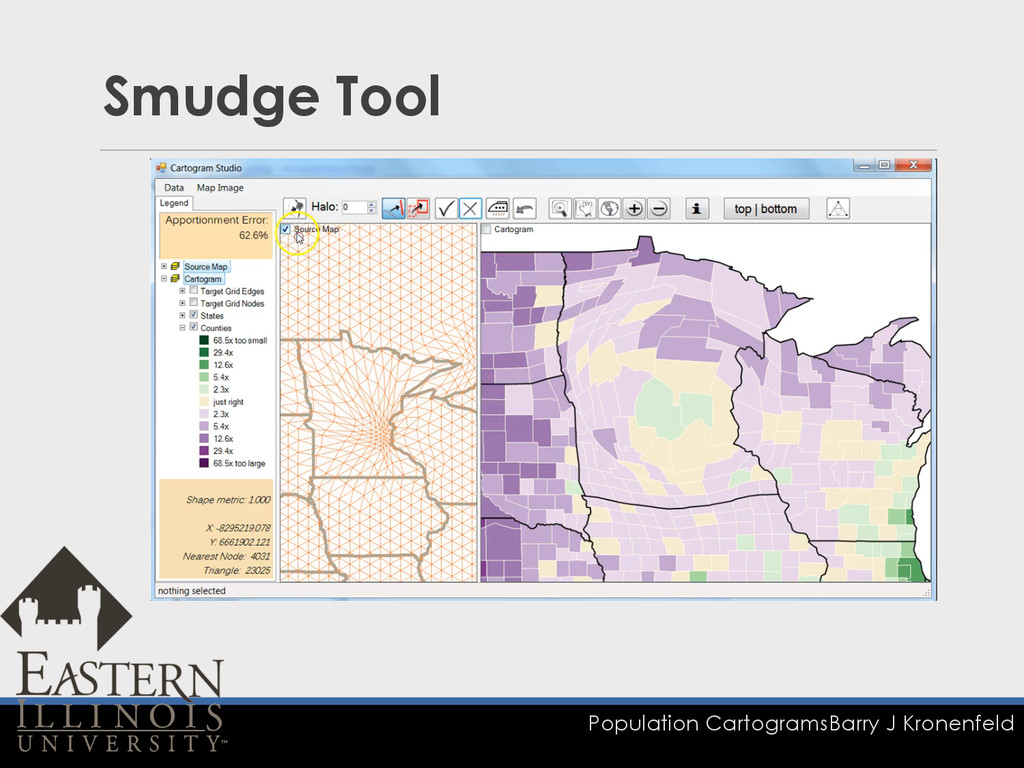
Population Cartograms Barry J Kronenfeld Smudge Tool
Population Cartograms Barry J Kronenfeld Smudge Tool
2. USA States Population Cartogram
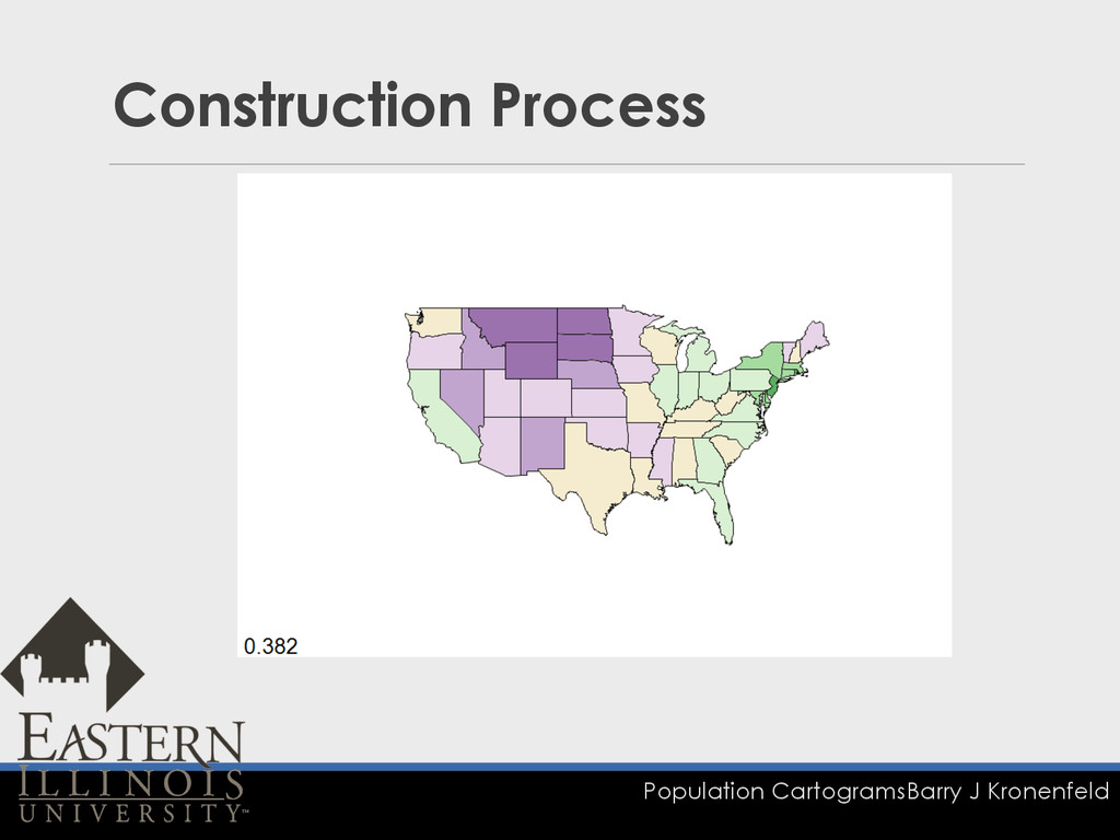
Population Cartograms Barry J Kronenfeld Construction Process
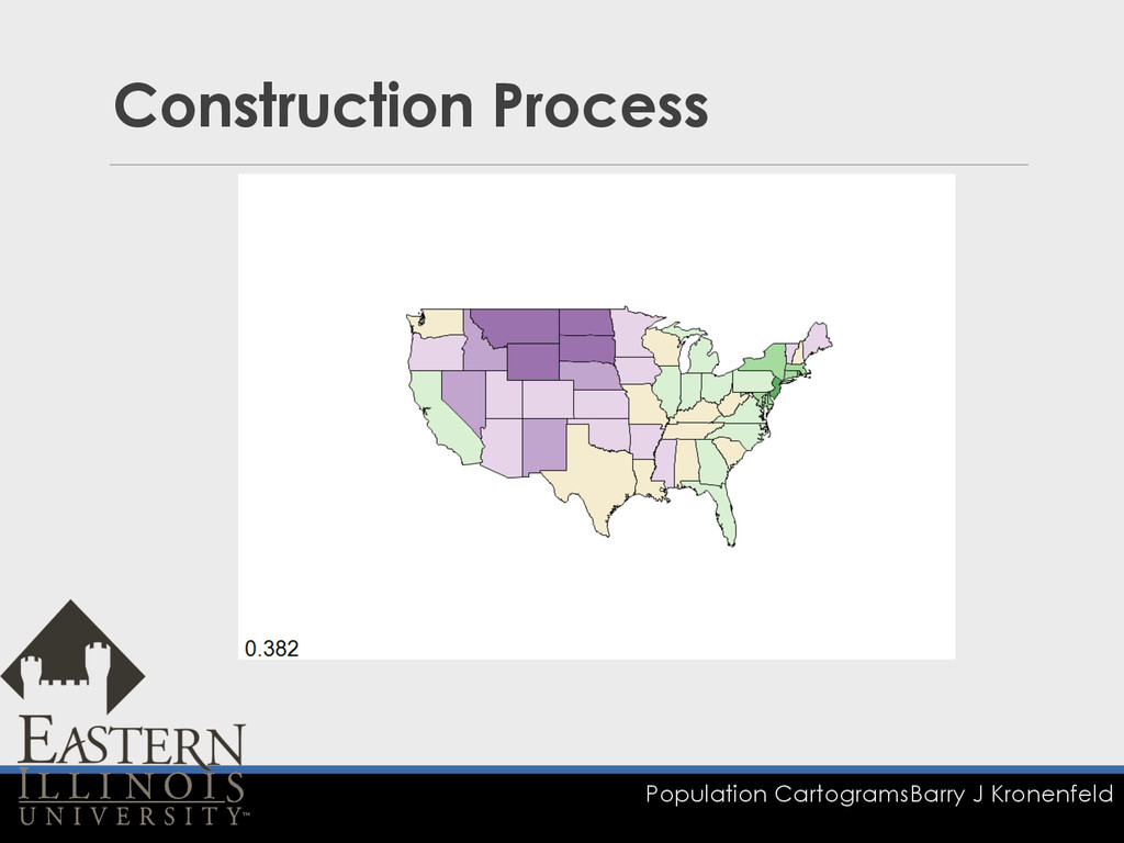
Population Cartograms Barry J Kronenfeld Construction Process
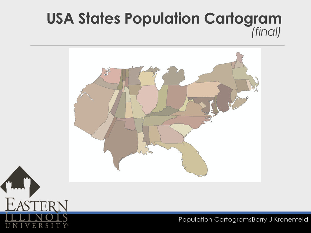
Population Cartograms Barry J Kronenfeld USA States Population Cartogram (final)
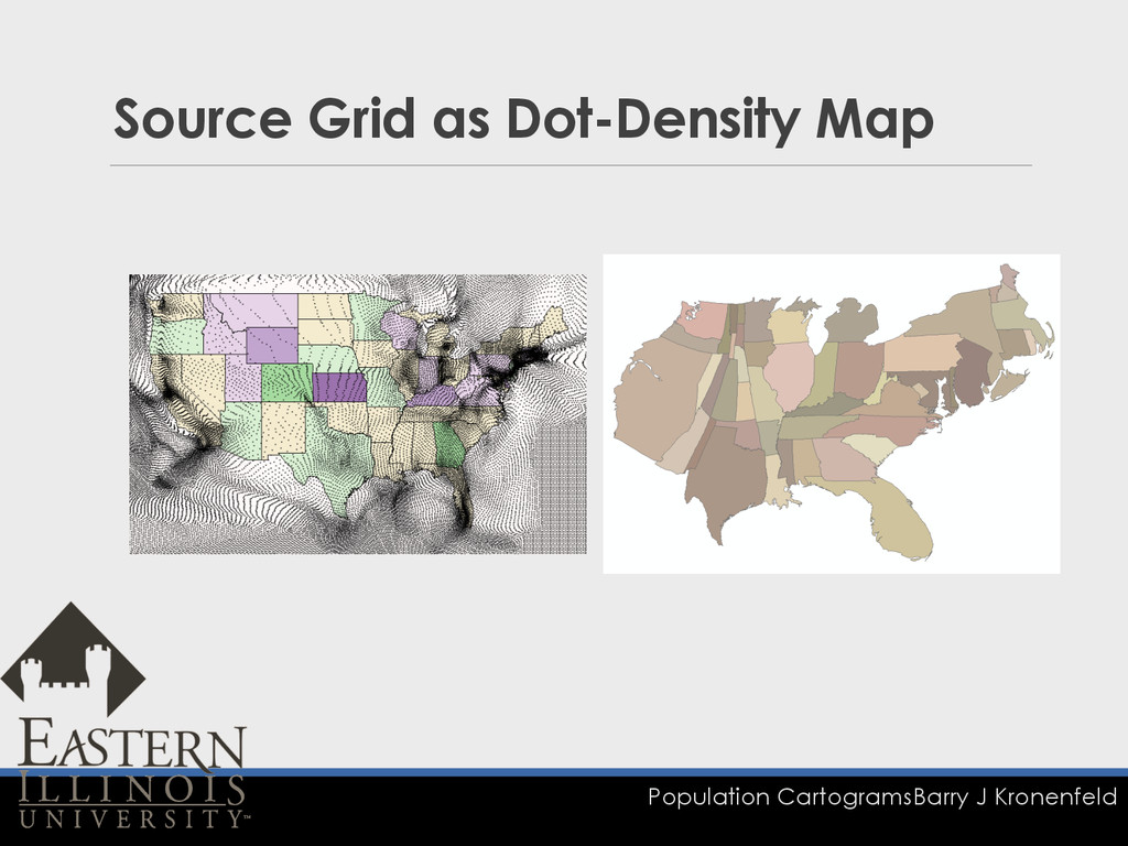
Population Cartograms Barry J Kronenfeld Source Grid as Dot-Density Map
3. Assessment
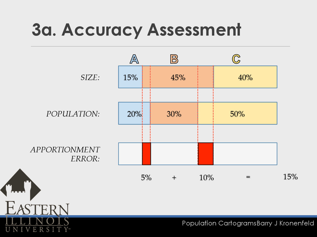
Population Cartograms Barry J Kronenfeld 3a. Accuracy Assessment 20% 30%
50% 15% 45% 40% POPULATION: SIZE: APPORTIONMENT ERROR: 5% 10% + = 15%
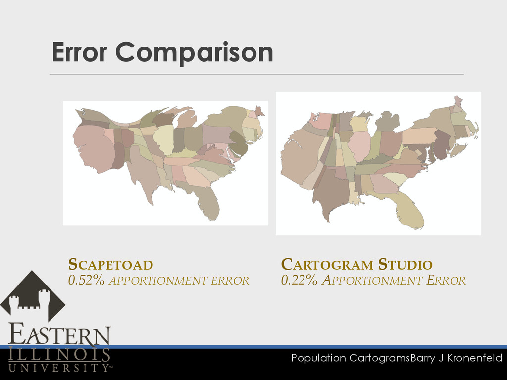
Population Cartograms Barry J Kronenfeld Error Comparison SCAPETOAD 0.52%
APPORTIONMENT ERROR CARTOGRAM STUDIO 0.22% APPORTIONMENT ERROR
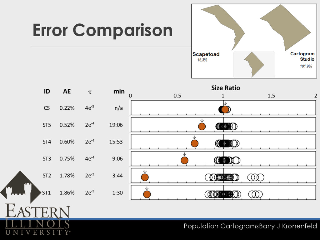
Population Cartograms Barry J Kronenfeld Error Comparison
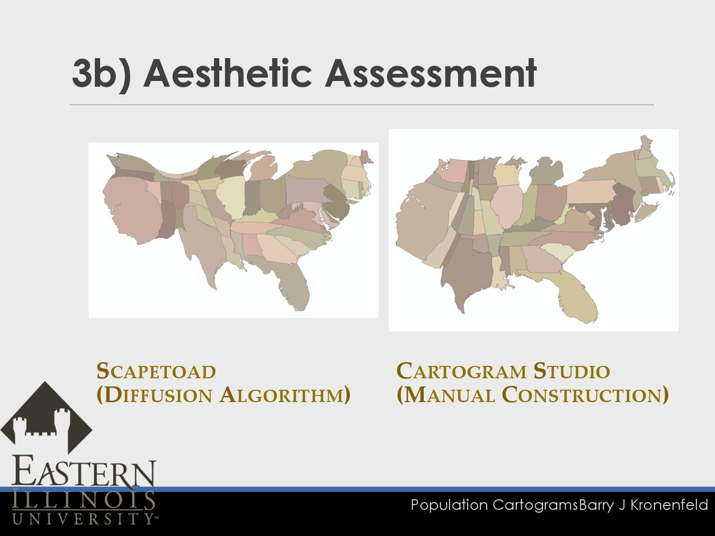
Population Cartograms Barry J Kronenfeld 3b) Aesthetic Assessment SCAPETOAD
(DIFFUSION ALGORITHM) CARTOGRAM STUDIO (MANUAL CONSTRUCTION)
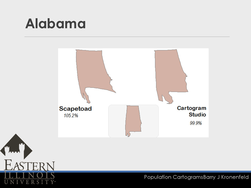
Population Cartograms Barry J Kronenfeld Alabama
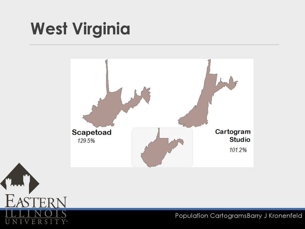
Population Cartograms Barry J Kronenfeld West Virginia
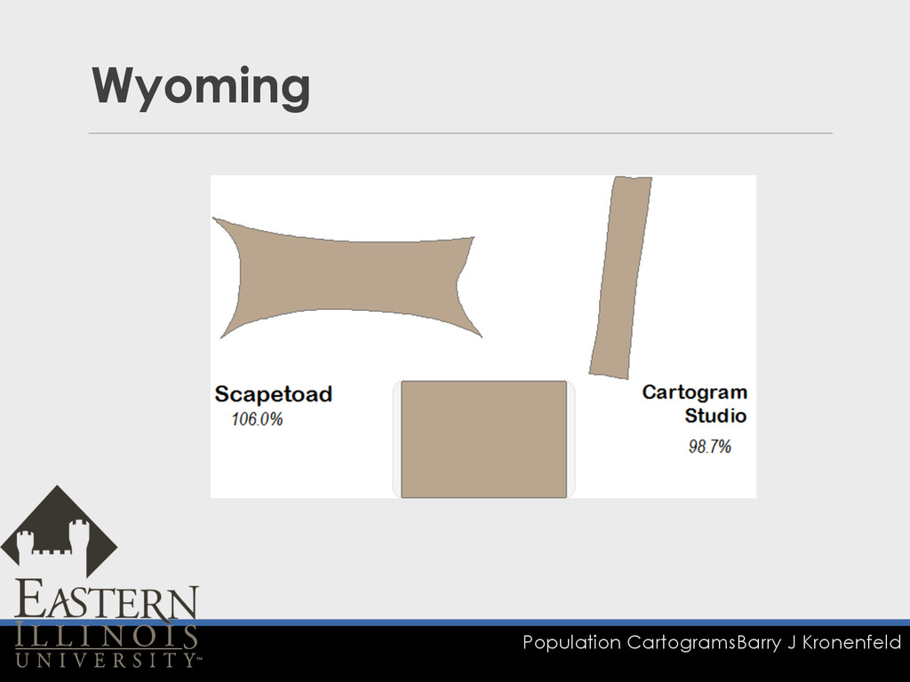
Population Cartograms Barry J Kronenfeld Wyoming
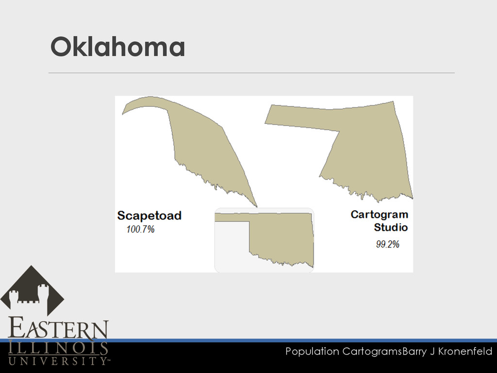
Population Cartograms Barry J Kronenfeld Oklahoma
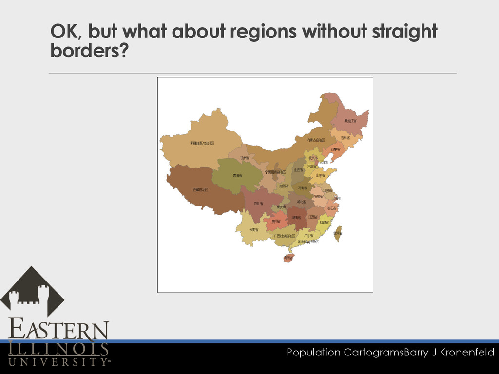
Population Cartograms Barry J Kronenfeld OK, but what about regions
without straight borders?
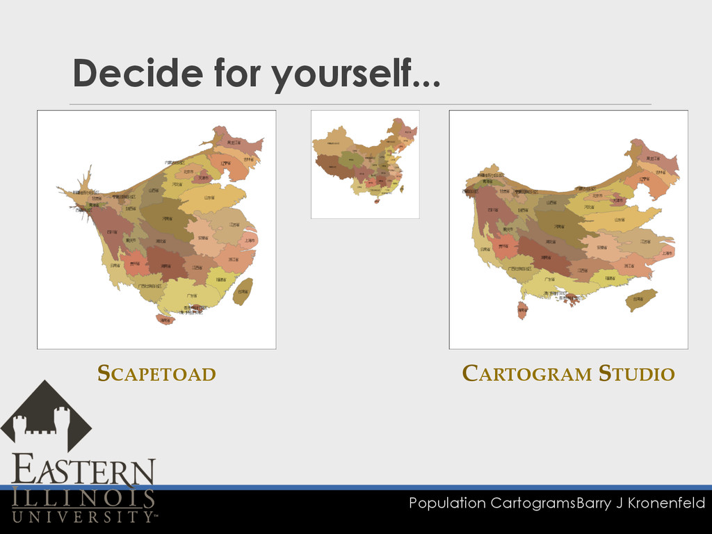
Population Cartograms Barry J Kronenfeld Decide for yourself... SCAPETOAD CARTOGRAM
STUDIO
Population Cartograms Barry J Kronenfeld 3c. Feasibility q Work in
Progress r personal results r classroom experience
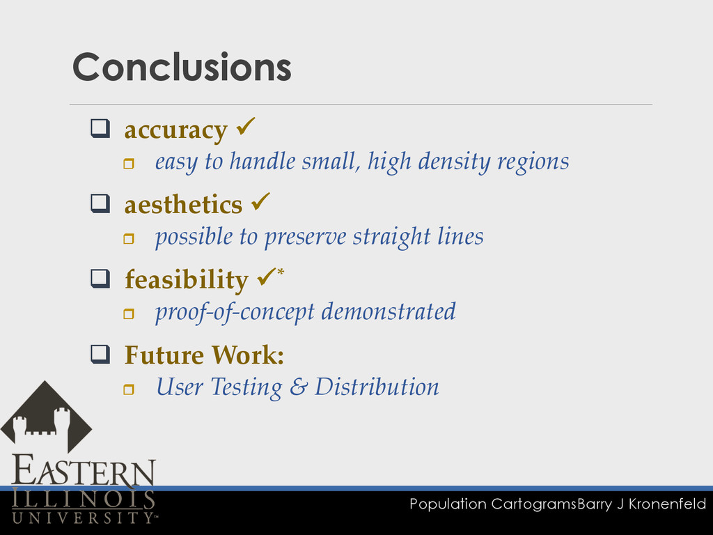
Population Cartograms Barry J Kronenfeld Conclusions q accuracy ! r
easy to handle small, high density regions q aesthetics ! r possible to preserve straight lines q feasibility !* r proof-‐‑of-‐‑concept demonstrated q Future Work: r User Testing & Distribution
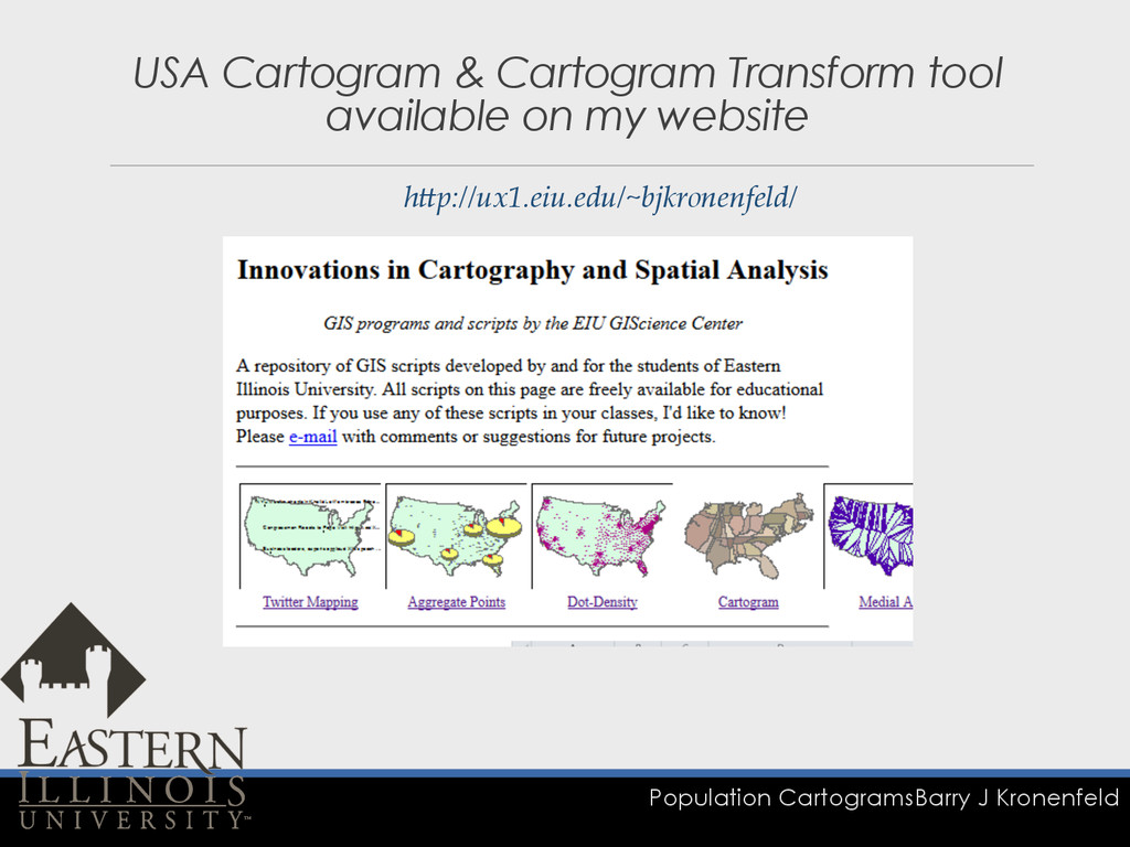
Population Cartograms Barry J Kronenfeld USA Cartogram & Cartogram Transform
tool available on my website hQp://ux1.eiu.edu/~bjkronenfeld/
Population Cartograms Barry J Kronenfeld Cartogram Transform (ArcGIS Tool) Cartogram
as Projection
Population Cartograms Barry J Kronenfeld Mississippi & Columbia Rivers
Population Cartograms Barry J Kronenfeld Acknowledgements q EIU Council on
Faculty Research (CFR) Grant q Software built on Dot Spatial
Population Cartograms Barry J Kronenfeld Questions?
More Decks by NACIS
See All by NACIS
Elaine Guidero
nacis
1
340
Nat Case Trust the surveyor as far as you can throw him
nacis
0
180
Dennis Street Names
nacis
0
210
Leo Dillon Toponyms
nacis
0
190
Barbara Iran Art Aesthetics Maps
nacis
0
170
Marcy Bidney American Geographic Society Library
nacis
0
220
Jonathan Schroeder NGIS Time Series Tables
nacis
0
230
Paul Hunt Census Mapping Mashups
nacis
0
190
Featured
See All Featured
Practical Orchestrator
shlominoach
192
12k
What's in a price? How to price your products and services
michaelherold
247
13k
From Legacy to Launchpad: Building Startup-Ready Communities
dugsong
0
380
Statistics for Hackers
jakevdp
799
230k
Collaborative Software Design: How to facilitate domain modelling decisions
baasie
1
380
A designer walks into a library…
pauljervisheath
211
25k
GitHub's CSS Performance
jonrohan
1033
470k
Making the Leap to Tech Lead
cromwellryan
135
10k
Abbi's Birthday
coloredviolet
5
11k
Easily Structure & Communicate Ideas using Wireframe
afnizarnur
194
17k
Visualization
eitanlees
153
17k
What does AI have to do with Human Rights?
axbom
PRO
1
2.5k


 nacis
 shlominoach
 michaelherold
 dugsong
 jakevdp
 baasie
 pauljervisheath
 jonrohan
 cromwellryan
 coloredviolet
 afnizarnur
 eitanlees
 axbom