Upgrade to Pro — share decks privately, control downloads, hide ads and more …

MapStore at work, supporting customers in Belgium

MapStore at work, supporting customers in Belgium

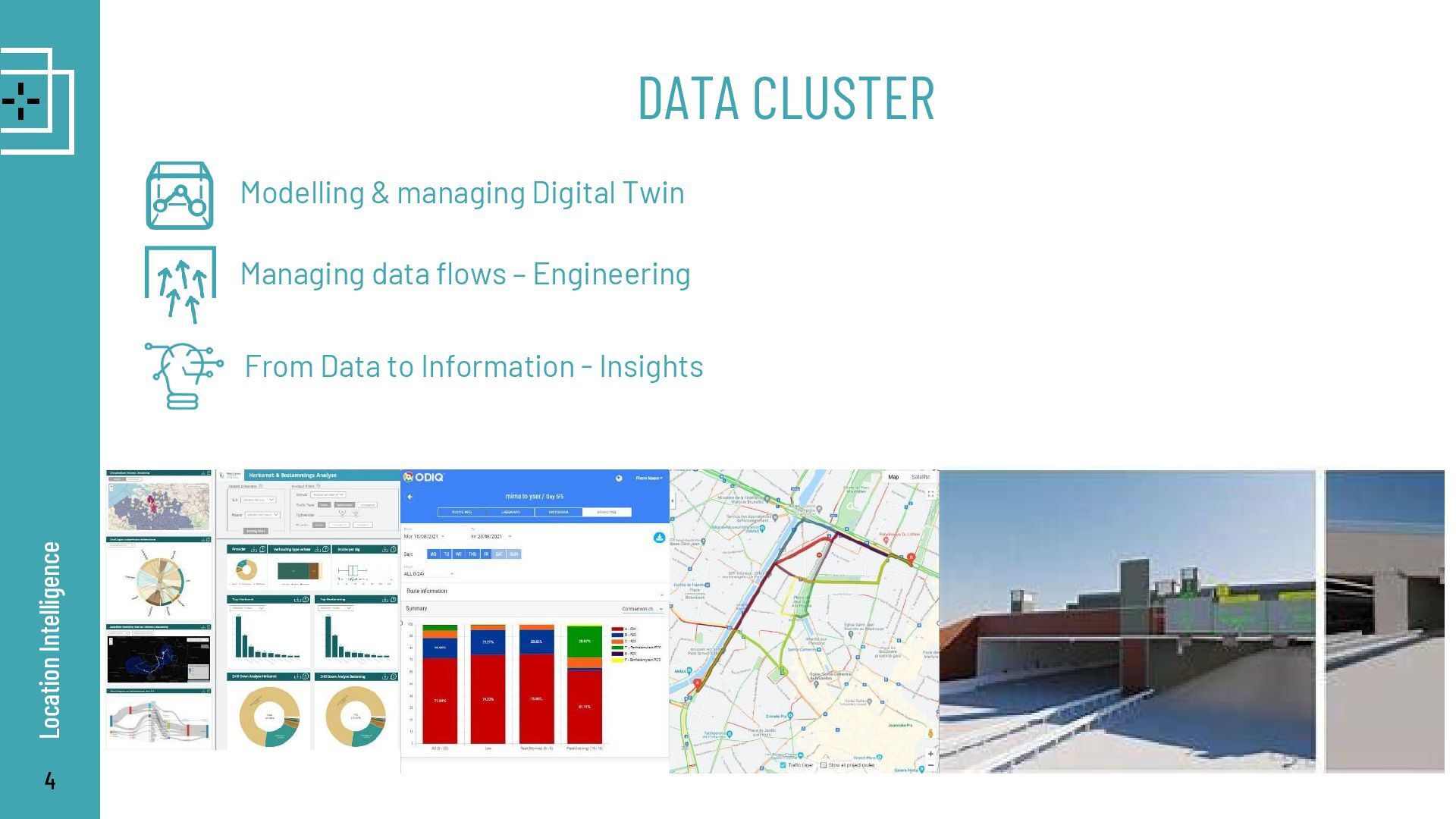
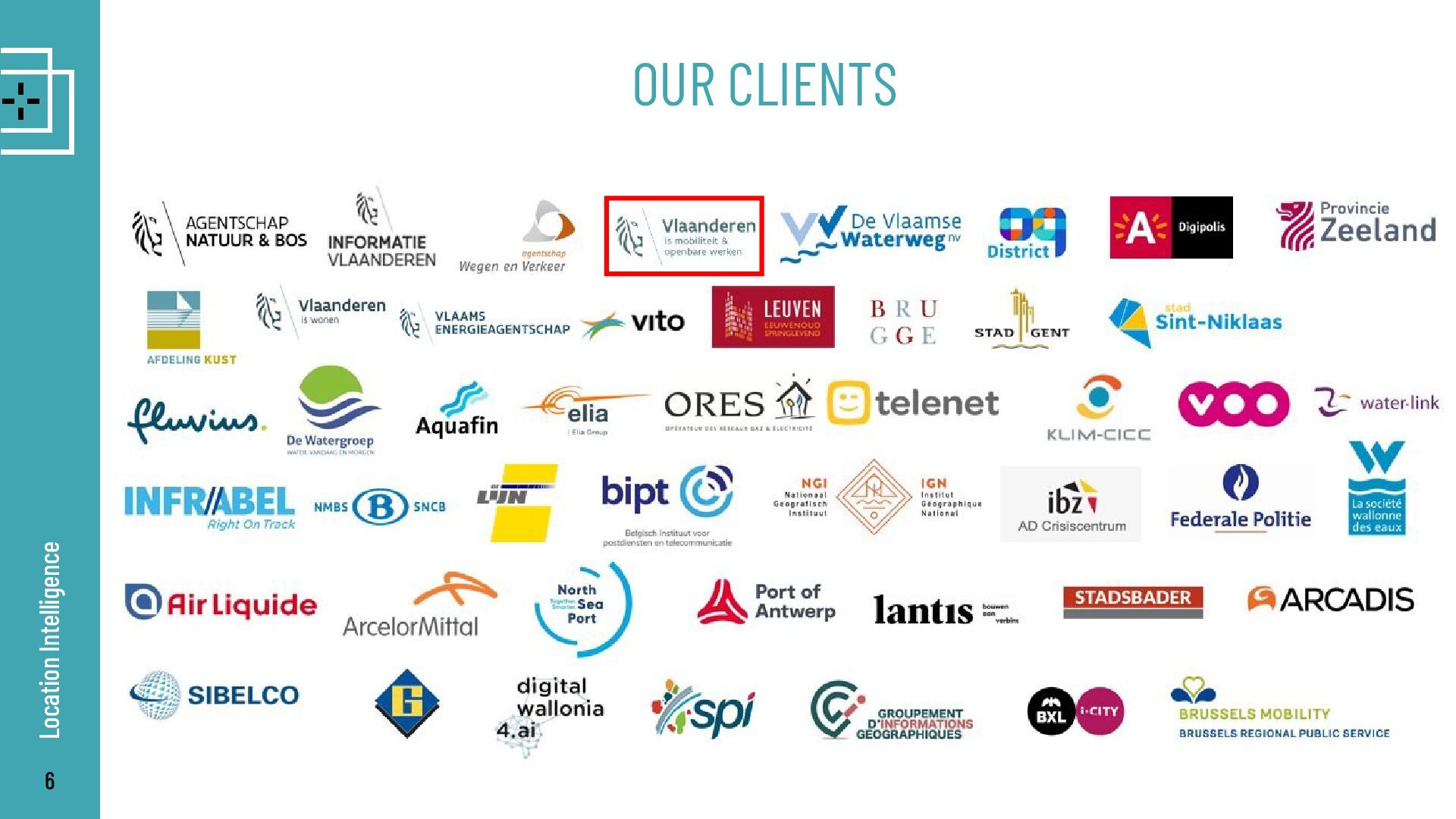
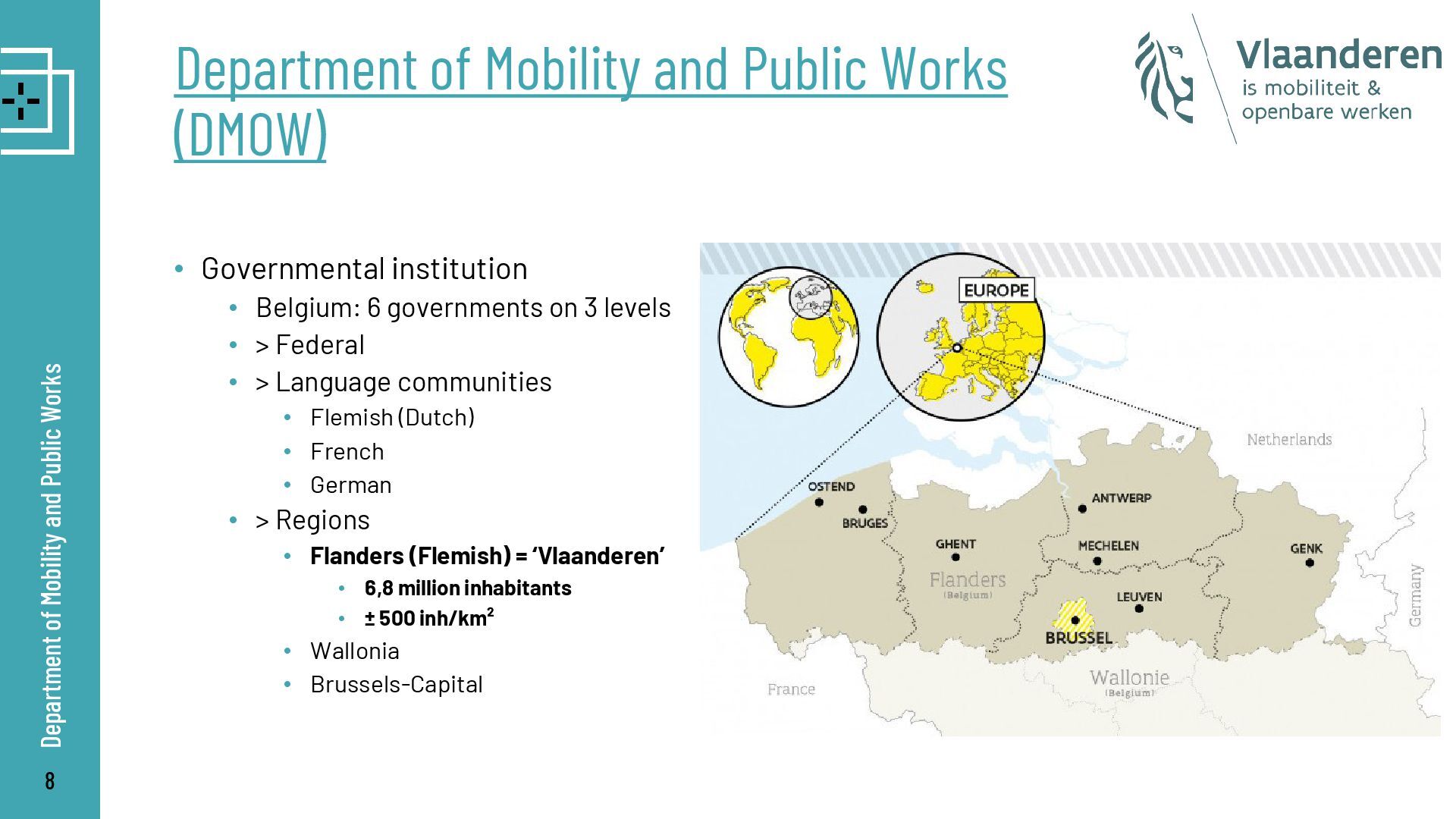
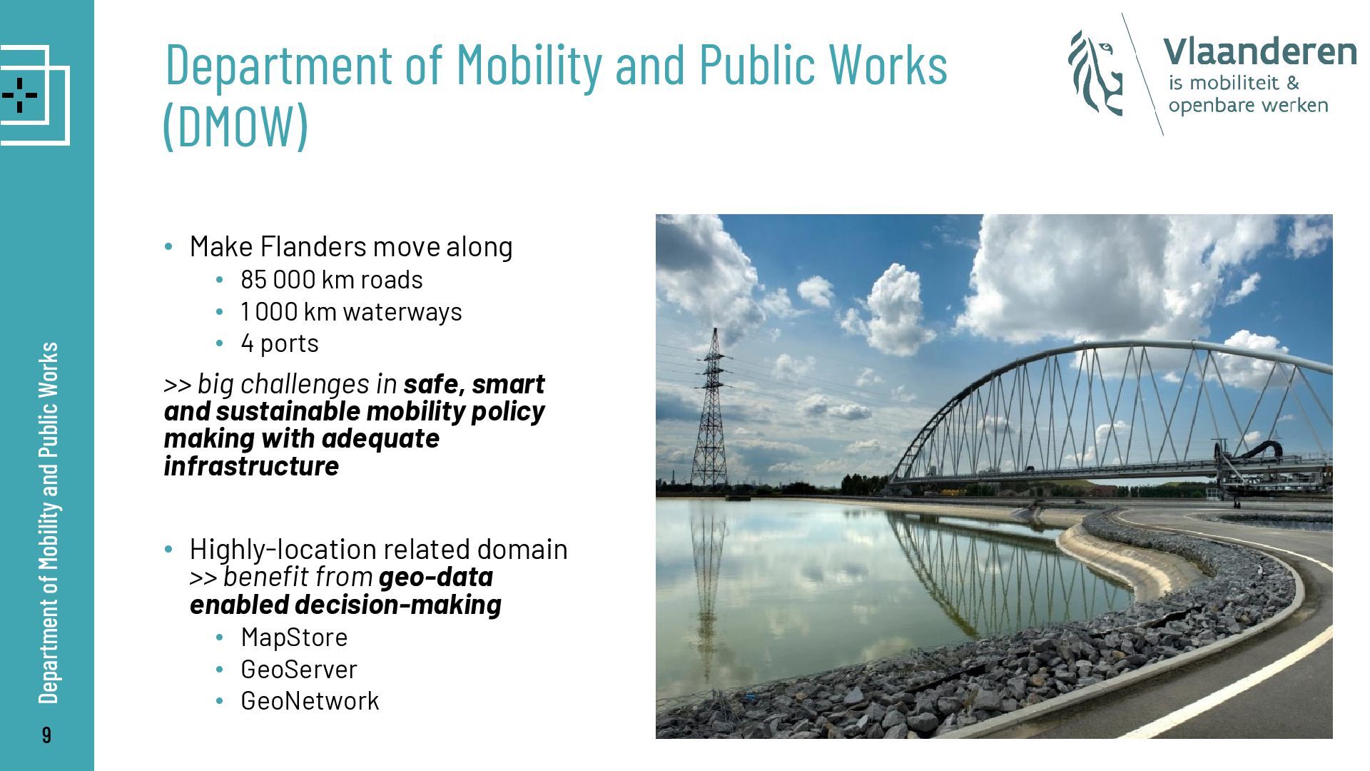
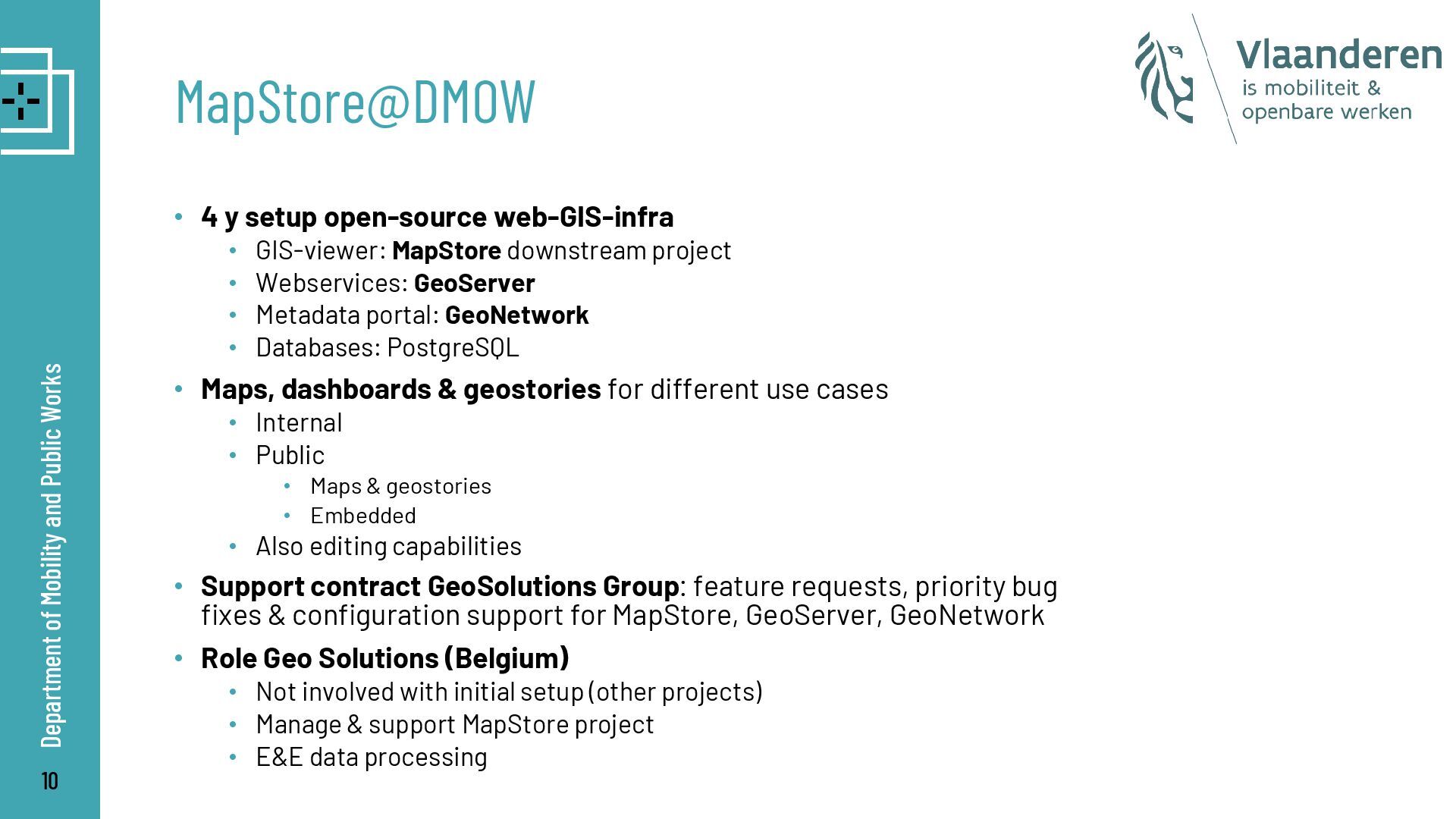
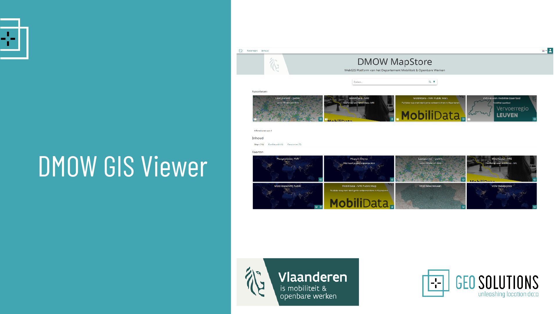
In this slides, we will be featuring an interesting use case for MapStore. Our Belgian Partner NV.GeoSolutions will describe their experience with GeoServer and MapStore since they created a downstream product based on MapStore which is used by a few public organizations in Belgium, including DMOW, Flanders Mobility Department.

Simone Giannecchini

March 25, 2025
Tweet

Video

More Decks by Simone Giannecchini

Other Decks in Technology

Transcript

  1. 1 Part of biggest Location BeNeLux group HQ: Edegem Offices

    in Leuven, Namur, Gent 40M € o 275 Professionals o GIS systems o Mobile WorkForce o Scheduling o Internet of Things & Connectivity o The New Workplace o GEO Strategies Location Intelligence - BE Location Intelligence
  2. 2 How do we help our customers? Location Intelligence Consultancy:

    GIS, DATA ENG, PM,… Teams: Dashboarding Products / Data Experts Solutions One Stop Shop
  3. 3 GOVERNMENT TECHNOLOGY CLUSTER Technology independent Location Intelligence Technology brings

    location to life Geo integrates location into the technology of the client to • Share info • Work together • Smart decisions
  4. 4 DATA CLUSTER Location Intelligence Modelling & managing Digital Twin

    Managing data flows – Engineering From Data to Information - Insights
  5. 5 BUSINESS CLUSTER Location Intelligence Business and functional analysis Enterprise

    and Solution Architecture Project and program management
  6. 8 Department of Mobility and Public Works (DMOW) • Governmental

    institution • Belgium: 6 governments on 3 levels • > Federal • > Language communities • Flemish (Dutch) • French • German • > Regions • Flanders (Flemish) = ‘Vlaanderen’ • 6,8 million inhabitants • ± 500 inh/km² • Wallonia • Brussels-Capital Department of Mobility and Public Works
  7. 9 Department of Mobility and Public Works (DMOW) • Make

    Flanders move along • 85 000 km roads • 1 000 km waterways • 4 ports >> big challenges in safe, smart and sustainable mobility policy making with adequate infrastructure • Highly-location related domain >> benefit from geo-data enabled decision-making • MapStore • GeoServer • GeoNetwork Department of Mobility and Public Works
  8. 10 MapStore@DMOW • 4 y setup open-source web-GIS-infra • GIS-viewer:

    MapStore downstream project • Webservices: GeoServer • Metadata portal: GeoNetwork • Databases: PostgreSQL • Maps, dashboards & geostories for different use cases • Internal • Public • Maps & geostories • Embedded • Also editing capabilities • Support contract GeoSolutions Group: feature requests, priority bug fixes & configuration support for MapStore, GeoServer, GeoNetwork • Role Geo Solutions (Belgium) • Not involved with initial setup (other projects) • Manage & support MapStore project • E&E data processing Department of Mobility and Public Works
  9. 12 Case: Shared soft mobility DMOW GIS Viewer • Transport

    region Antwerp: • Current situation of shared soft mobility (bikes & scooters) ? • Where can we improve? Which areas are underserved? • Processing • harvest all available open GBFS data • aggregate on different levels of administrative boundaries • enrich with number of inhabitants • entire Flanders region • Publish on GeoServer, with multiple styles • Create public MapStore map >> from open data to open data
  10. 14 Case: Intelligent Traffic Lights DMOW GIS Viewer • Equip

    existing traffic lights with new smart technology • React smoothly and adaptively to road users at an intersection • Turning green faster or longer based on the actual traffic ahead • Two-way communication (e.g. emergency services) • Current situation • Active: 167 • Under construction: 171 • Scheduled: 52 • MapStore • Manage data & status >> WFS transaction editing capability • Communication to citizens • Simplified public map view • Embedded on website
  11. 16 Sidenote: Dutch translations DMOW GIS Viewer • MapStore UI

    configured in Dutch • On every MapStore update DMOW • Checks & updates Dutch translations • Push to source code
  12. 17 Sidenote: Authentication DMOW GIS Viewer • Default internal authentication

    service • Username & password • Geostore database • User management >> MapStore admin • External authentication service • OpenID Connect • Default providers • Google • Keycloak • Custom ACM/IDM provider • https://authenticatie.vlaanderen.be • Login VO/Itsme • User management not in MapStore but external in ACM/IDM >> generic (experimental) OpenID Connect provider
  13. 19 Case: PhotoViewer extension DMOW GIS Viewer • Custom MapStore

    extension >> developed from extension framework • Functionalities • View a picture on a map, linked to attributes in a dataset • Implement routes • Navigation • Animation • Generic >> lot of use cases • Custom street view • Graphs of FCD travel times • Historical aerial photographs >> demo POC • Activation in application context
  14. 21 Case: Geostory bicycle infrastructure DMOW GIS Viewer • Transport

    region Antwerp • Geostory to integrate a lot of complex location data in different maps into one thematic overview with extra contextual information in a Geostory • Integrated in reports >> publicly shared with citizen