Upgrade to Pro — share decks privately, control downloads, hide ads and more …

Multisource data for the built environment

Multisource data for the built environment

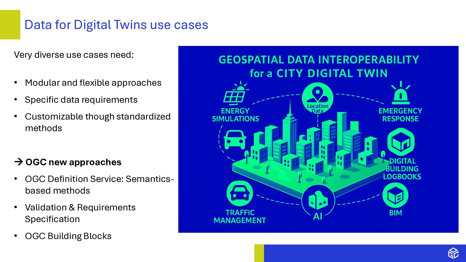
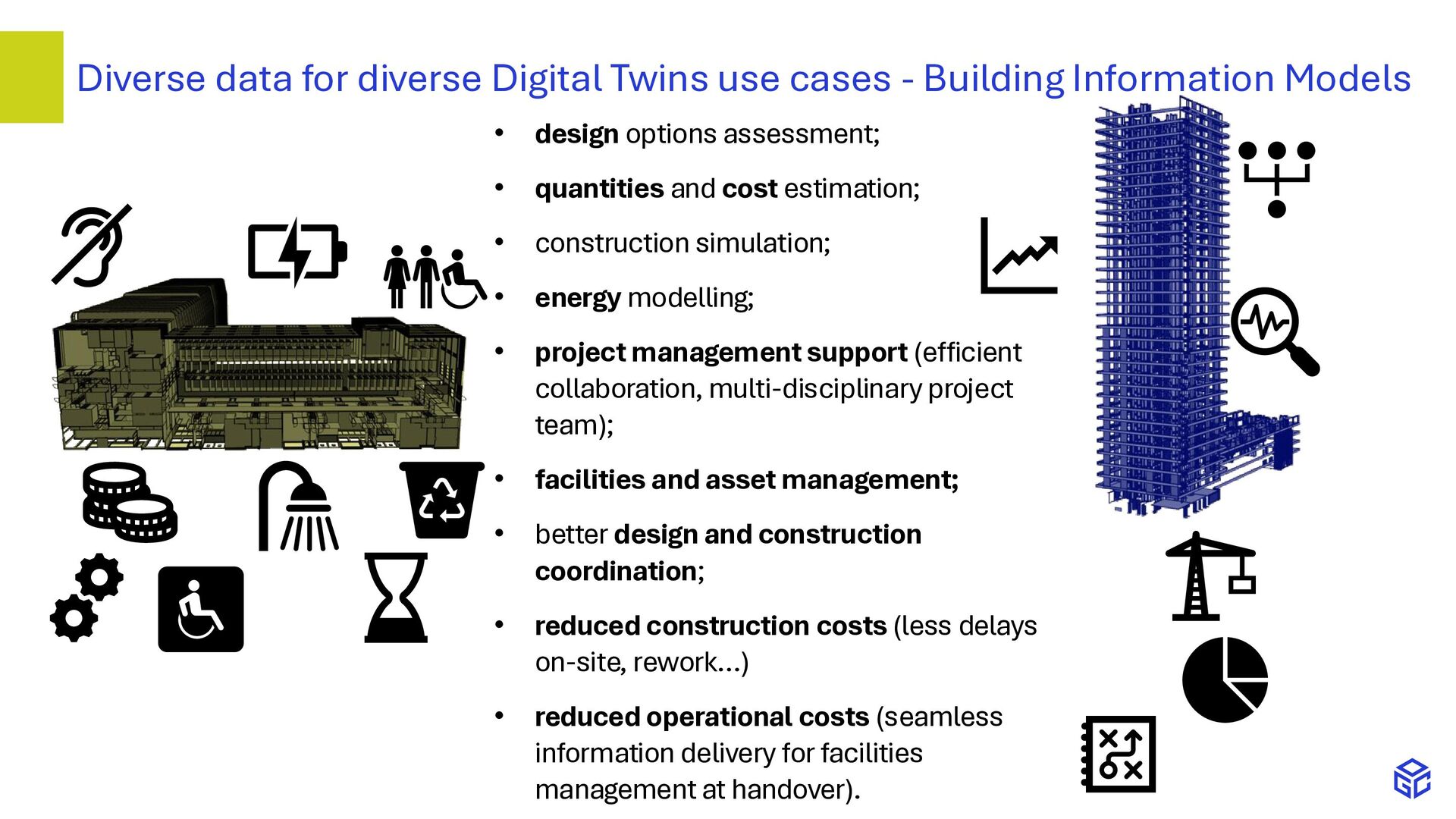
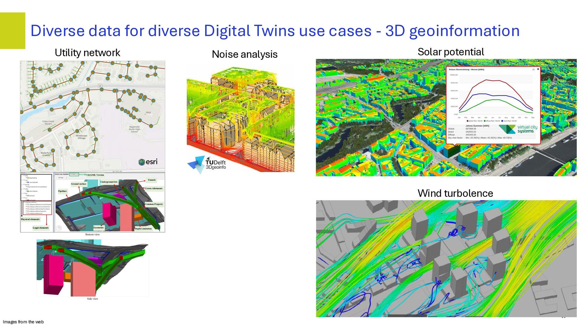
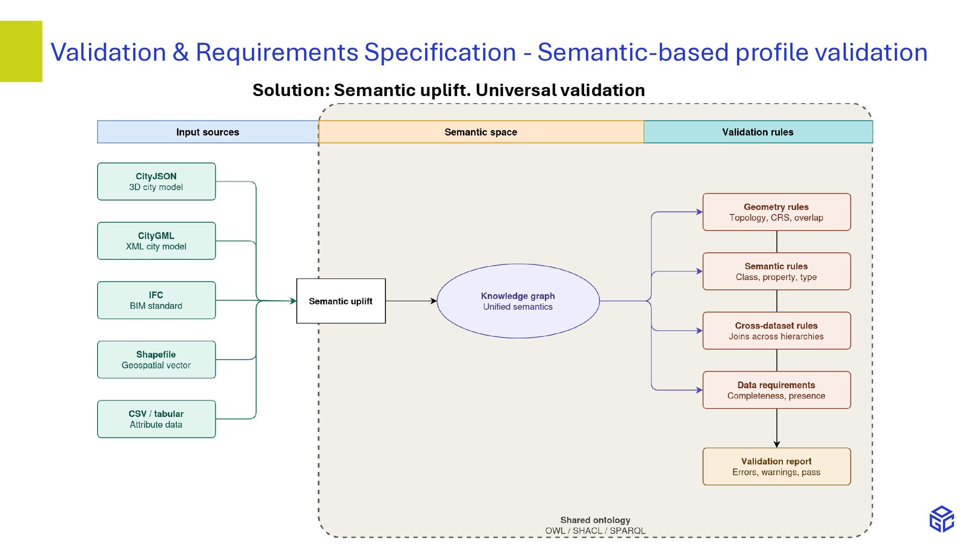
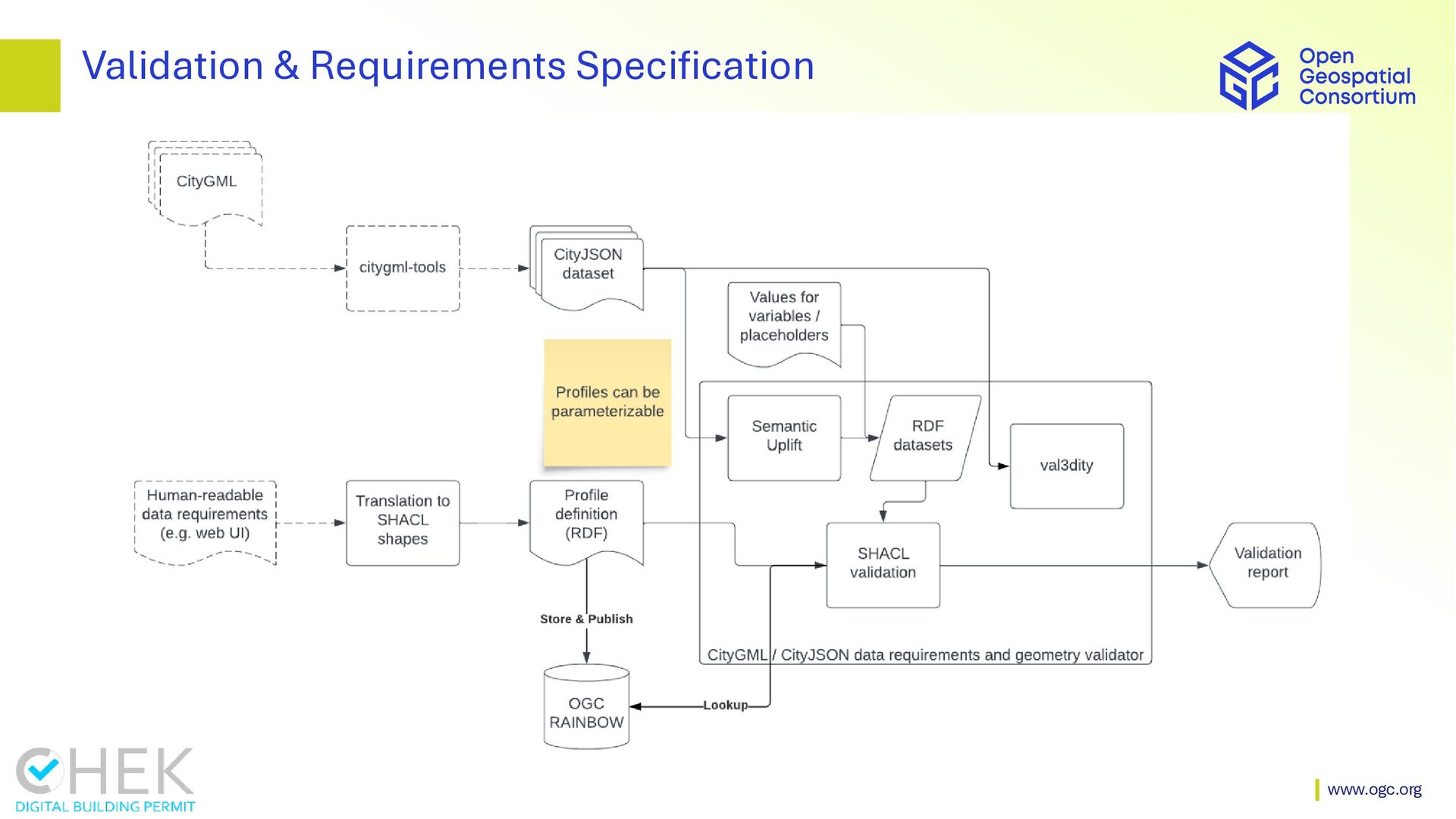
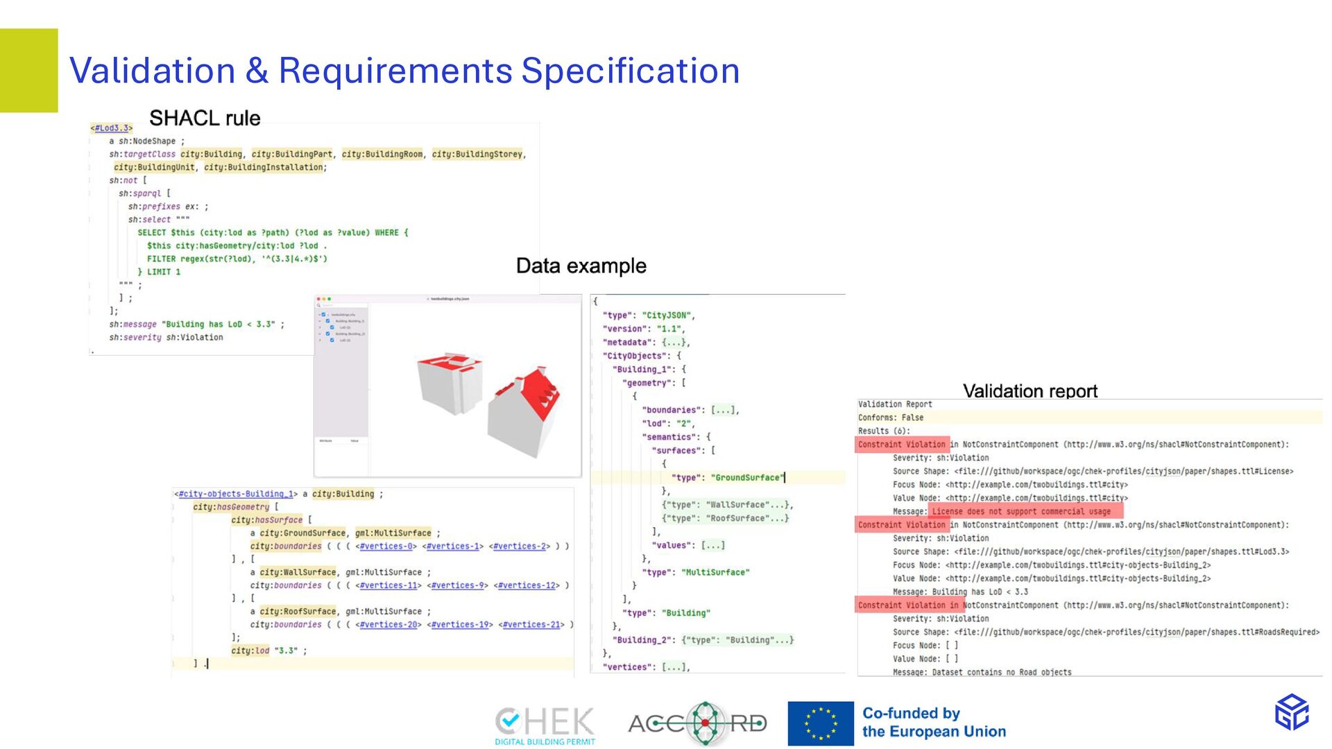
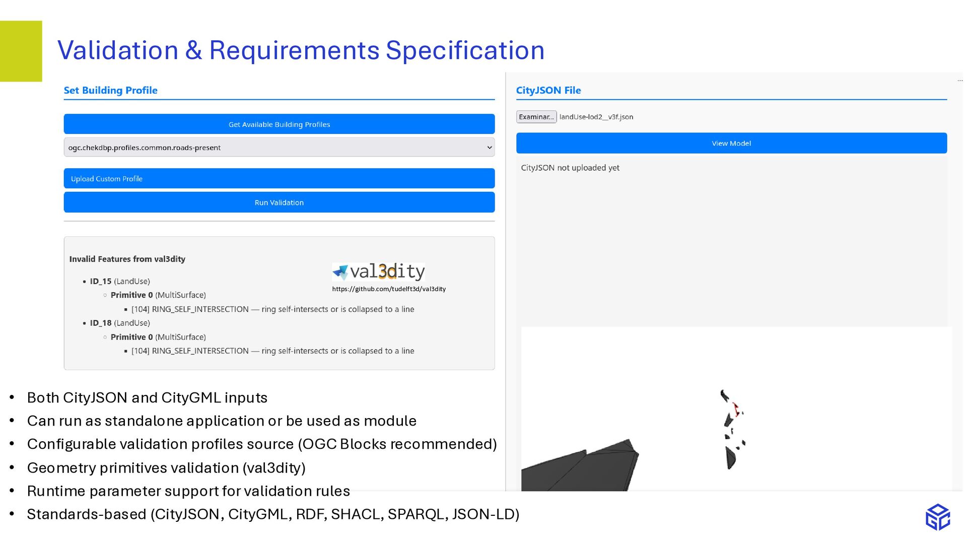
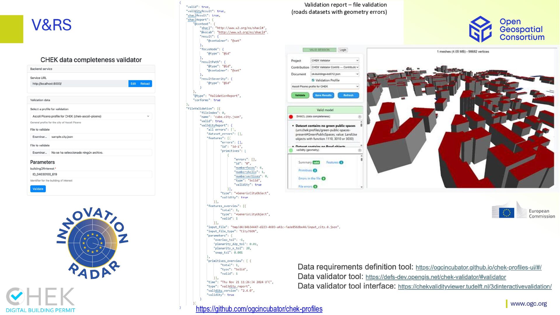
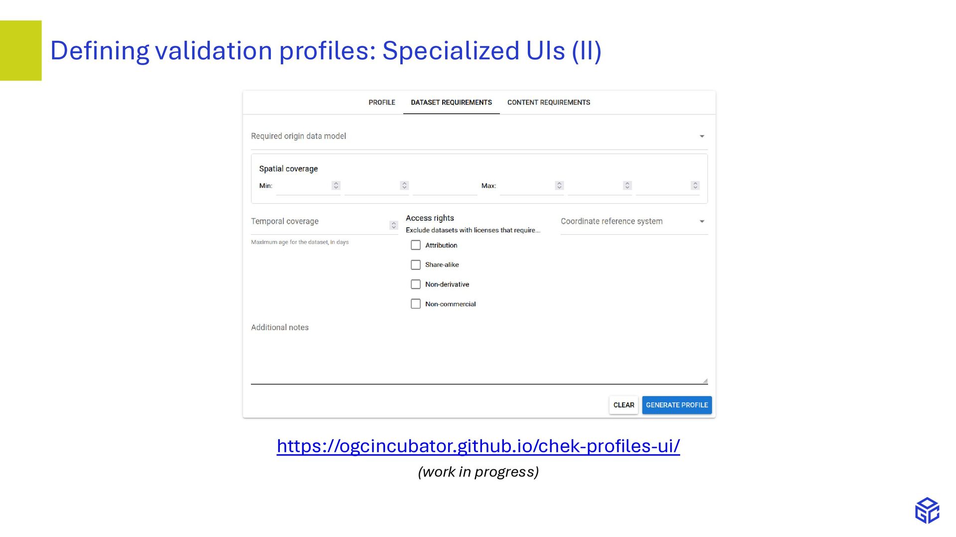
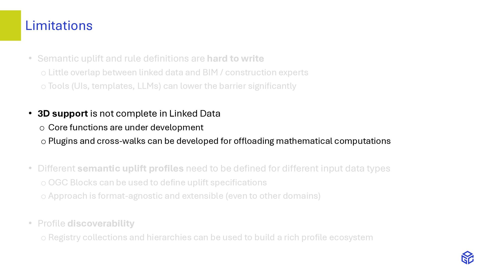
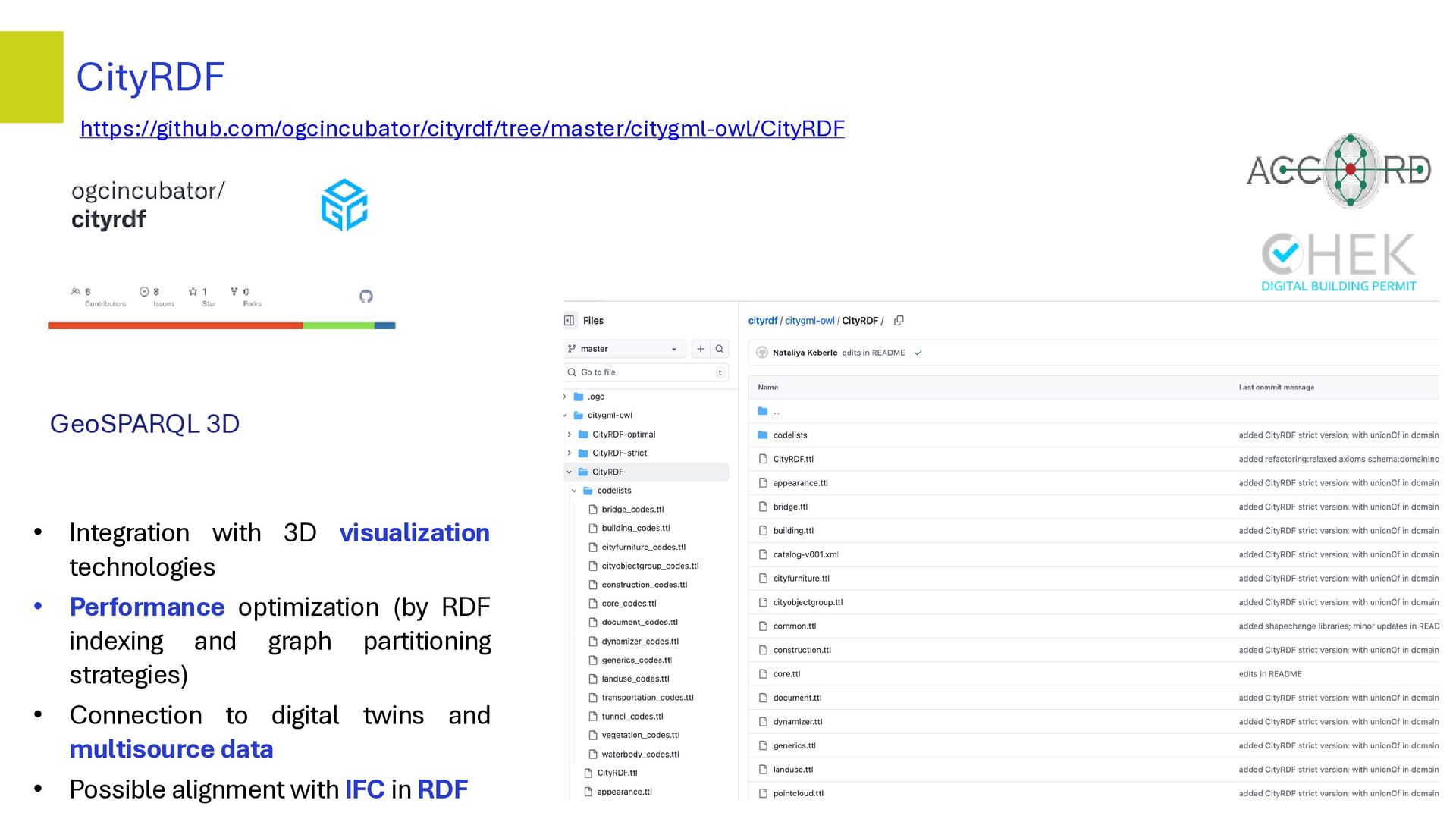
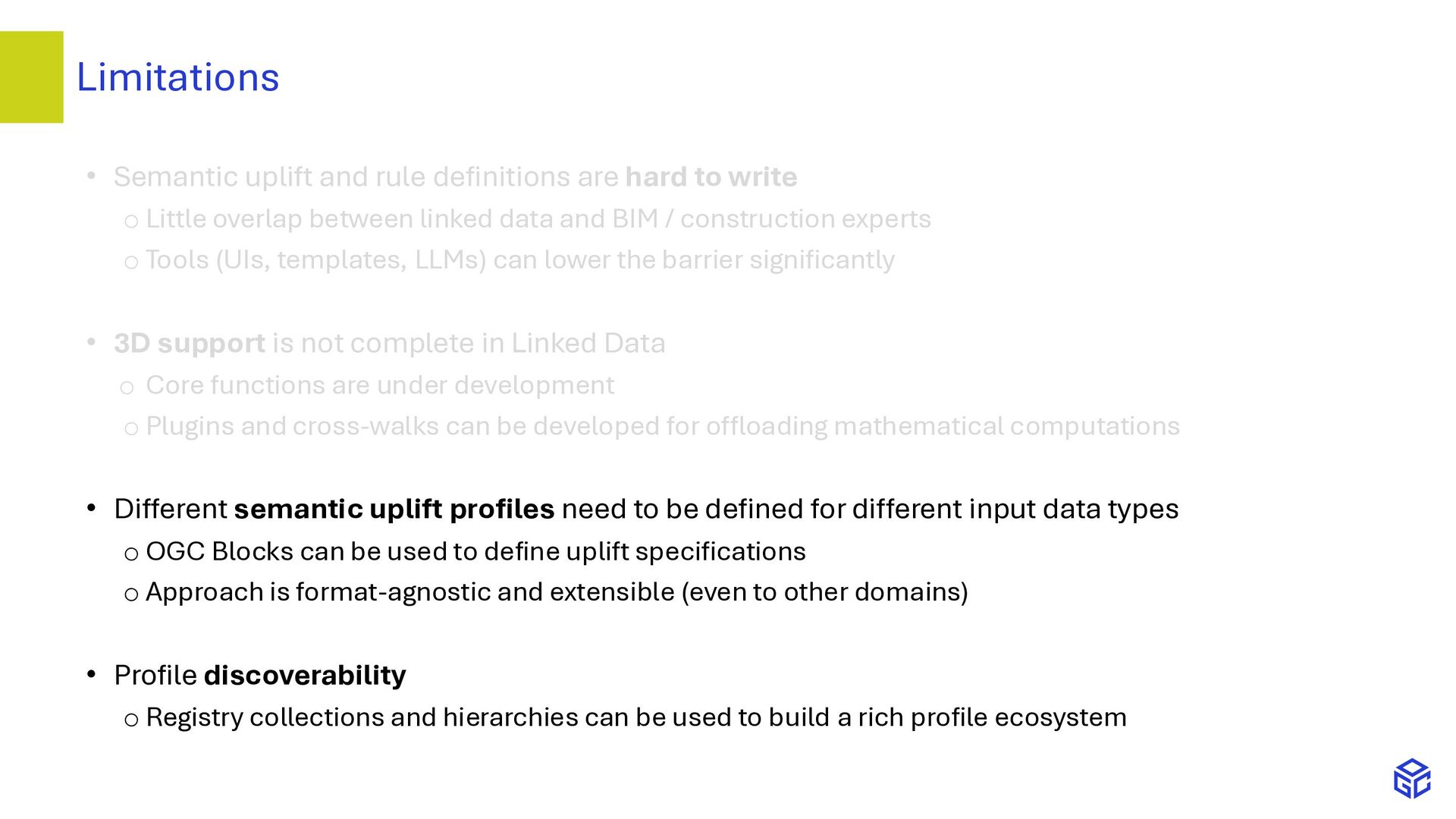
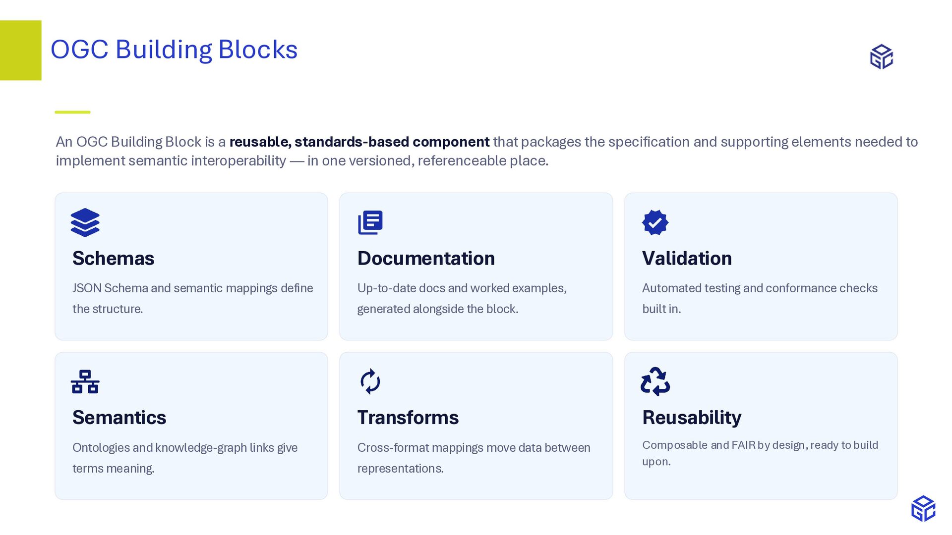
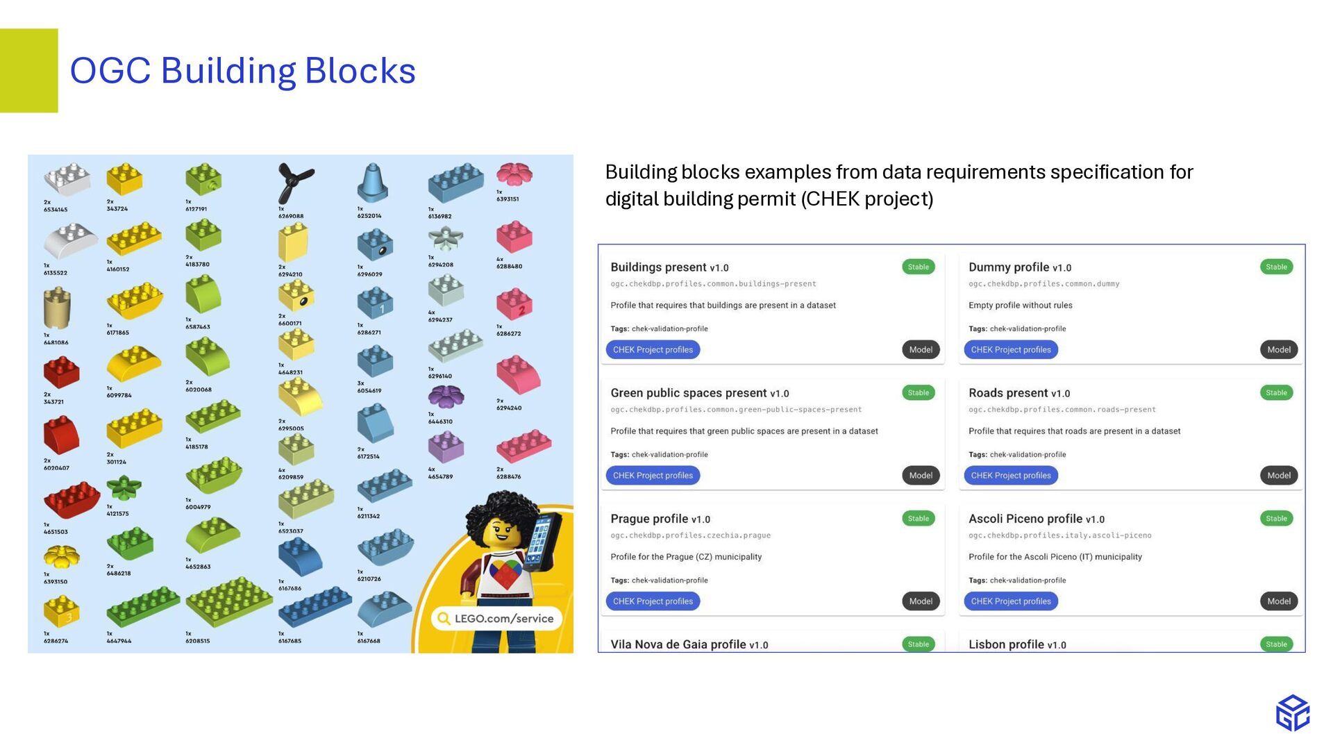
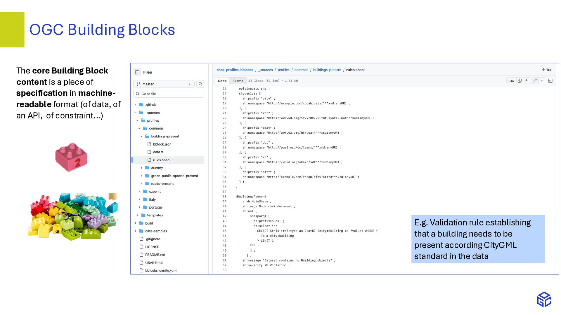
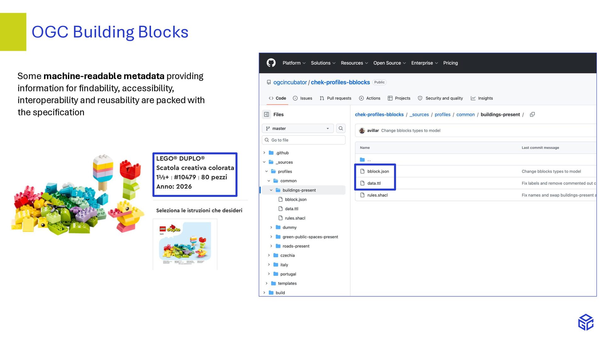
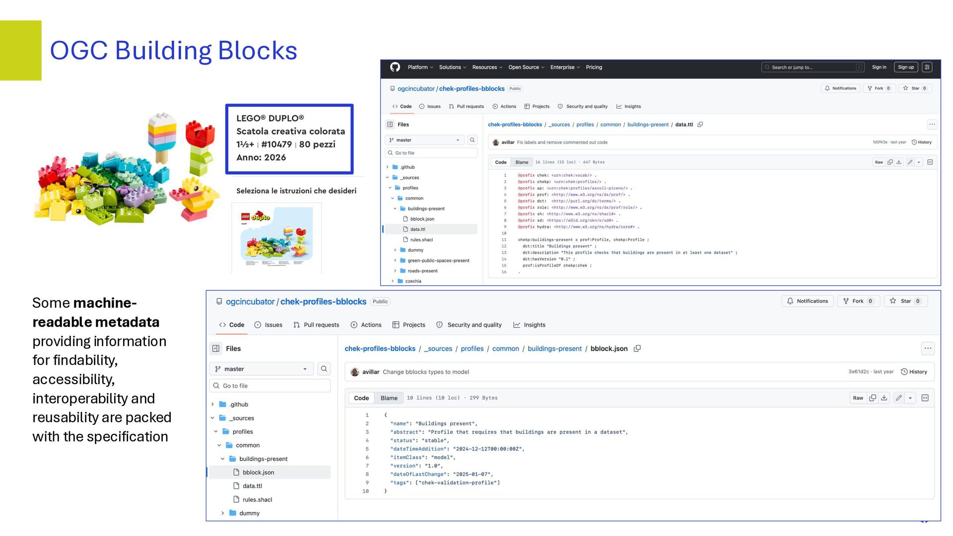
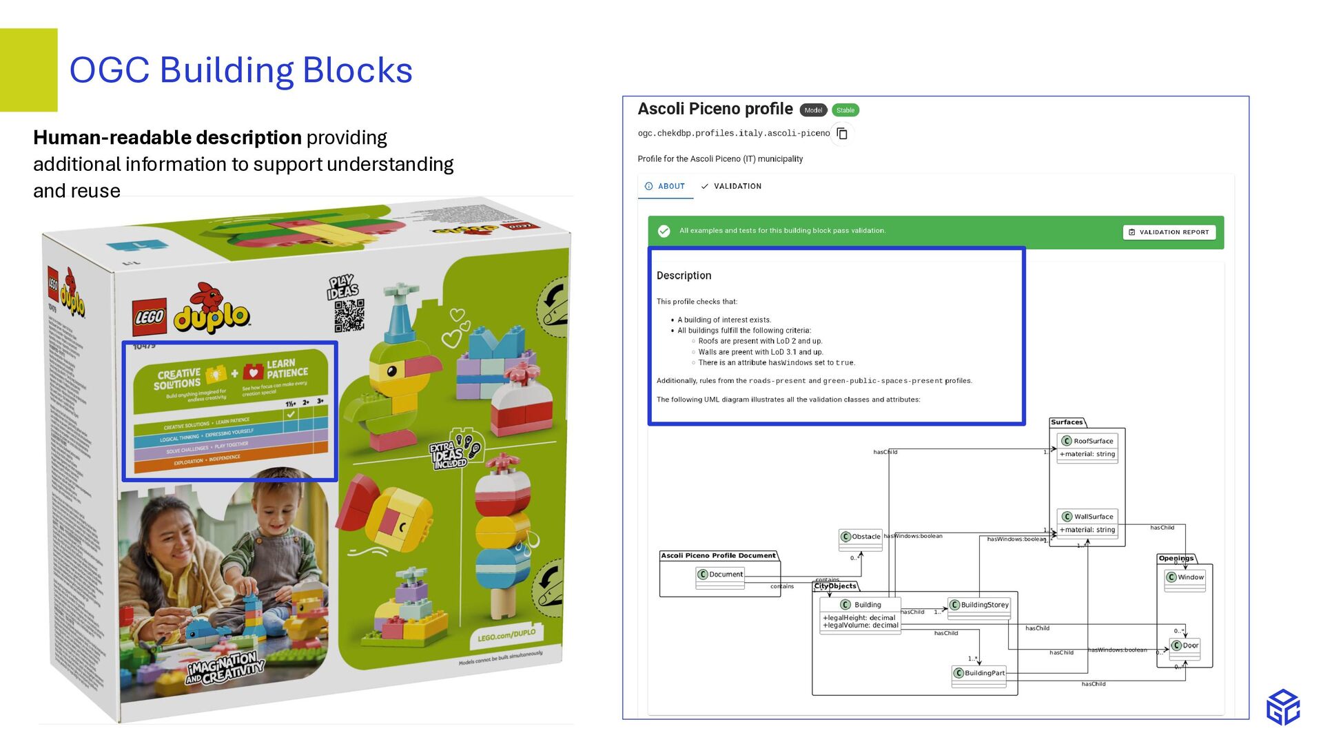
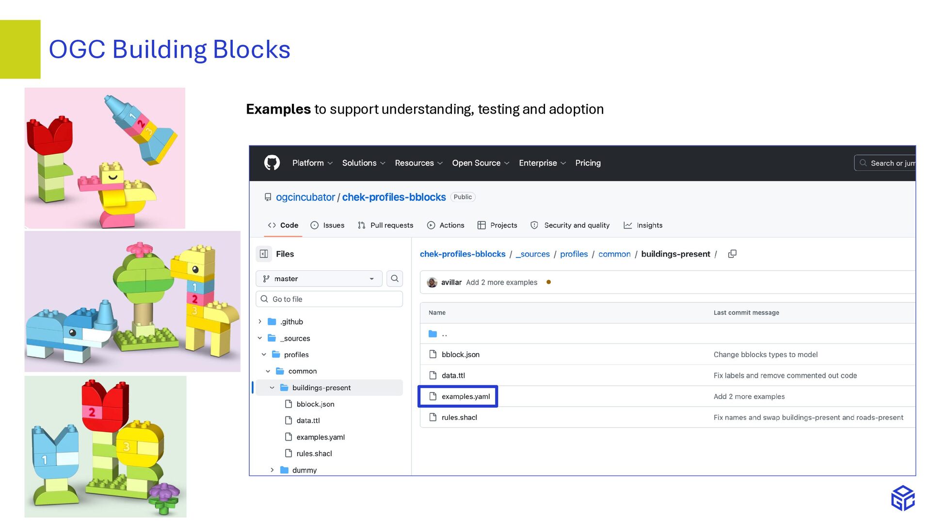
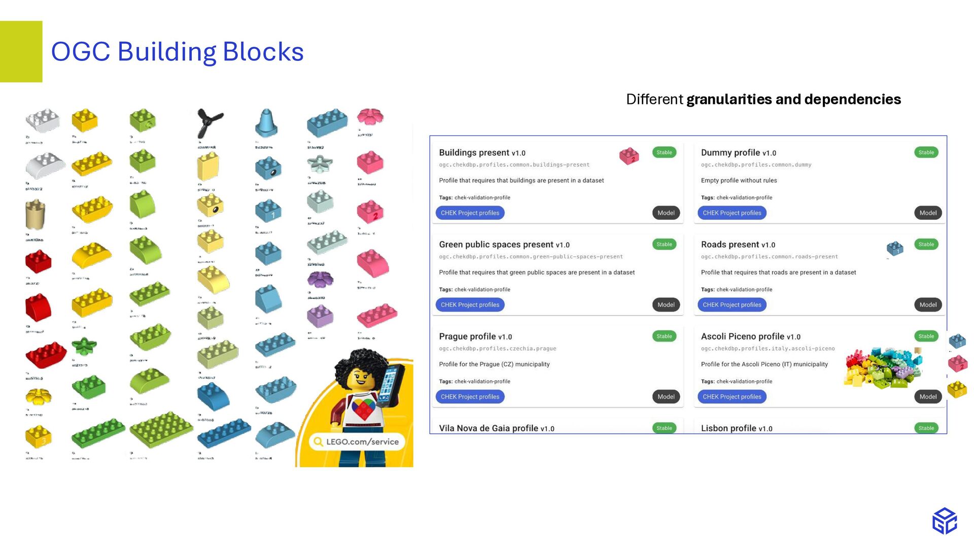
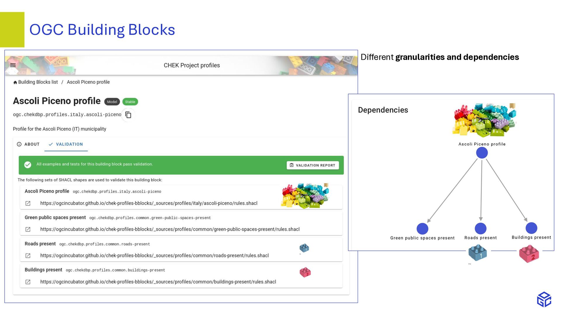
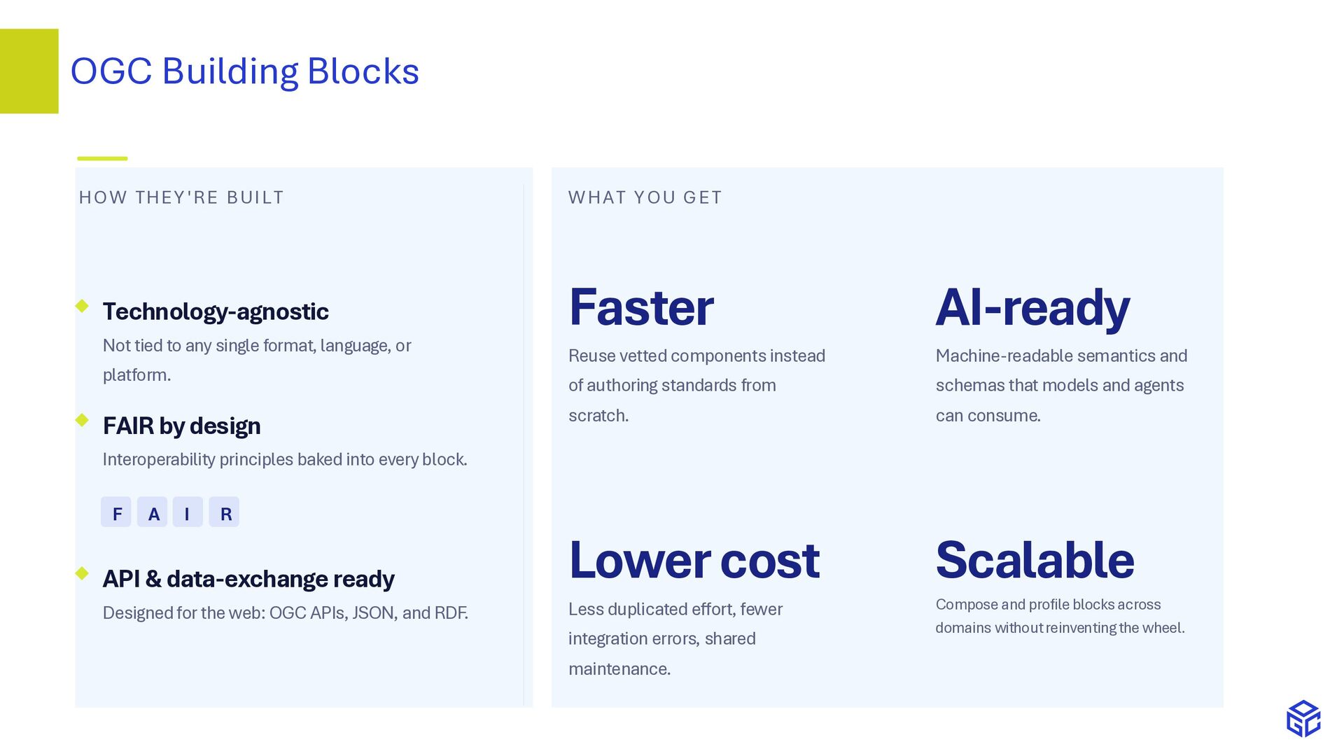
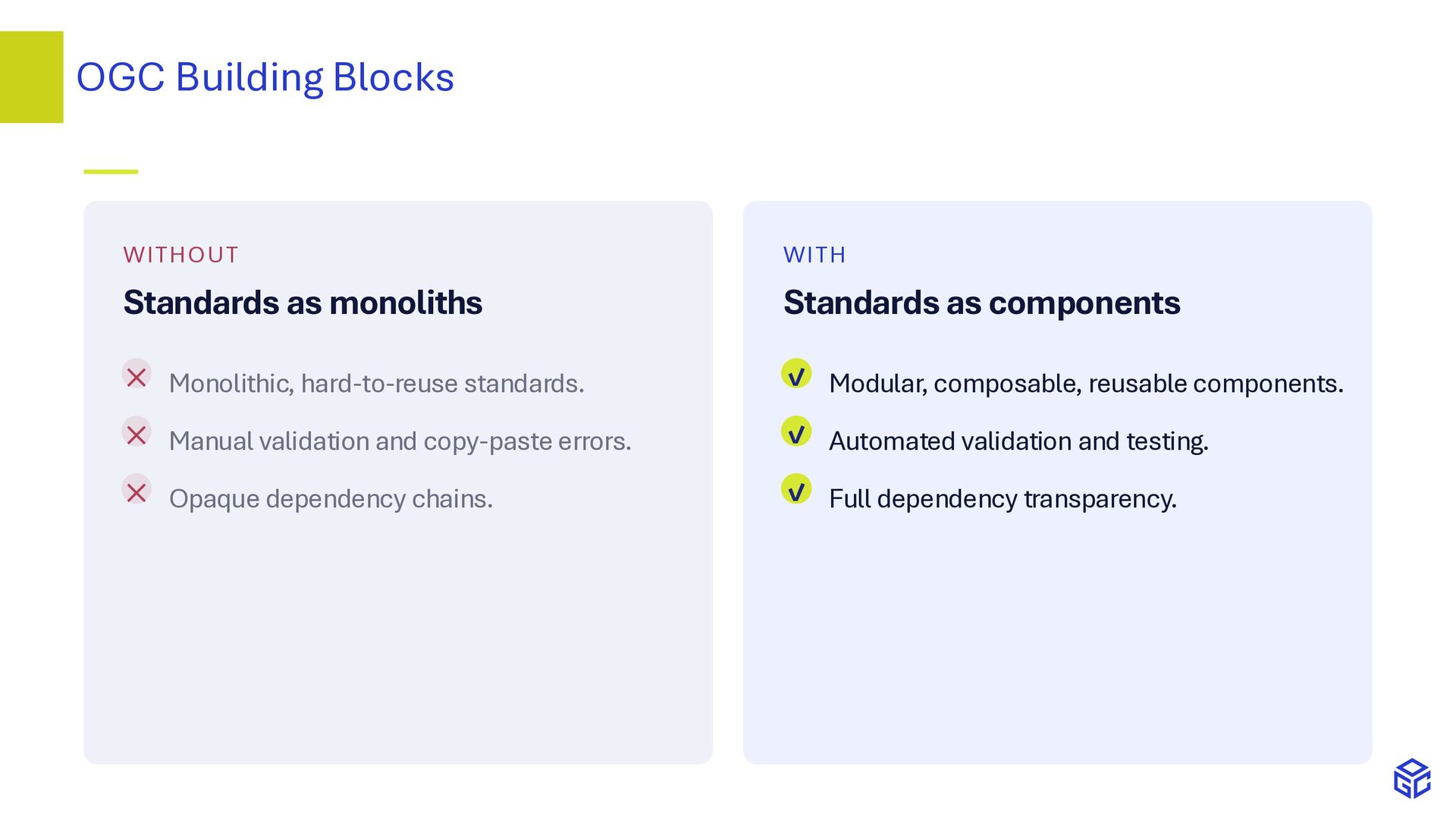
Digital (geo)spatial systems can support a huge set of use cases, for which a huge variety of data is necessary, that can come from very diverse sources (geoinformation, Building Information Modelling, sensor data etc.). It is essential therefore to refer clearly to standards, and specify the requirements and how the standards are used in the very specific cases, flexibly and in a modular way. This enables full transparency, interoperability and reliability of data, such that their use for legally bounded or economical applications becomes possible. OGC approaches based on Linked data and OGC Building Blocks, such as the Validation and Requirements Specification method, support it, as well as FAIR principles in general. The presentation, presented in the InfraBIM Open conference, in Paris, on 9th June 2026, provides an overview of the topic and proposed tools, and links to additional references.

Avatar for Francesca Noardo

Francesca Noardo

June 11, 2026

More Decks by Francesca Noardo

Other Decks in Technology

Transcript

  1. Francesca Noardo [email protected] Rob Atkinson [email protected] Mayte Toscano [email protected] Ingo

    Simonis [email protected] Alejandro Villar [email protected] Multisource data for the built environment - GeoBIM InfraBIM Open Paris, 09th June 2026
  2. • Data for the built environment • Profiles - Validation

    and Requirements Specification • OGC Building Blocks • GeoBIM converters and recommendations from the CHEK project • Conclusions Agenda
  3. Very diverse use cases need: • Modular and flexible approaches

    • Specific data requirements • Customizable though standardized methods → OGC new approaches • OGC Definition Service: Semantics- based methods • Validation & Requirements Specification • OGC Building Blocks Data for Digital Twins use cases
  4. • design options assessment; • quantities and cost estimation; •

    construction simulation; • energy modelling; • project management support (efficient collaboration, multi-disciplinary project team); • facilities and asset management; • better design and construction coordination; • reduced construction costs (less delays on-site, rework…) • reduced operational costs (seamless information delivery for facilities management at handover). Diverse data for diverse Digital Twins use cases - Building Information Models
  5. Diverse data for diverse Digital Twins use cases - 3D

    geoinformation Utility network Solar potential Wind turbolence Noise analysis Images from the web
  6. Noardo, F. Multisource Spatial Data Integration for Use Cases Applications.

    Transactions in GIS 2022, 26,7, 2874-2913 (doi: https://doi.org/10.1111/tgis.12987). EU MSC cofund ‘Leading Fellows’ Postdocs Programme, grant agreement No. 707404. Multisource Spatial data integration for smart city applications. Multisource data integration methodology
  7. Noardo, F. Multisource Spatial Data Integration for Use Cases Applications.

    Transactions in GIS 2022, 26,7, 2874-2913 (doi: https://doi.org/10.1111/tgis.12987). EU MSC cofund ‘Leading Fellows’ Postdocs Programme, grant agreement No. 707404. Multisource Spatial data integration for smart city applications. Parameters for data requirements
  8. Dataset requirements Objects requirements Standard data model profiling tool ↑↓

    Data requirements specification template - Explain data requirements - Validate data against standard-based data requirements Std Data model Possible extensions Validation & Requirements Specification Example human-readable data requirements specification, from the CHEK project
  9. • Problems: • Different formats and file types • Different

    semantics between representations • Difficulty for reusing common validation patterns • Validation rules can involve objects from different data models, hierarchies… Validation & Requirements Specification - Semantic-based profile validation Comprehensive domain data models (goal: accommodate diverse use cases) Profiling I – select only the part of the model needed (goal: overcome overspecification) Profiling II – constrain how to use the standard for a specific use case (goal: overcome under specification) and possibly use different standards together
  10. https://github.com/tudelft3d/val3dity • Both CityJSON and CityGML inputs • Can run

    as standalone application or be used as module • Configurable validation profiles source (OGC Blocks recommended) • Geometry primitives validation (val3dity) • Runtime parameter support for validation rules • Standards-based (CityJSON, CityGML, RDF, SHACL, SPARQL, JSON-LD) Validation & Requirements Specification
  11. • Semantic uplift and rule definitions are hard to write

    o Little overlap between linked data and BIM / construction experts o Tools (UIs, templates, LLMs) can lower the barrier significantly • 3D support is not complete in Linked Data o Core functions are under development o Plugins and cross-walks can be developed for offloading mathematical computations • Different semantic uplift profiles need to be defined for different input data types o OGC Blocks can be used to define uplift specifications o Approach is format-agnostic and extensible (even to other domains) • Profile discoverability o Registry collections and hierarchies can be used to build a rich profile ecosystem Limitations
  12. • Semantic uplift and rule definitions are hard to write

    o Little overlap between linked data and BIM / construction experts o Tools (UIs, templates, LLMs) can lower the barrier significantly • 3D support is not complete in Linked Data o Core functions are under development o Plugins and cross-walks can be developed for offloading mathematical computations • Different semantic uplift profiles need to be defined for different input data types o OGC Blocks can be used to define uplift specifications o Approach is format-agnostic and extensible (even to other domains) • Profile discoverability o Registry collections and hierarchies can be used to build a rich profile ecosystem Limitations
  13. CityRDF https://github.com/ogcincubator/cityrdf/tree/master/citygml-owl/CityRDF GeoSPARQL 3D • Integration with 3D visualization technologies

    • Performance optimization (by RDF indexing and graph partitioning strategies) • Connection to digital twins and multisource data • Possible alignment with IFC in RDF
  14. • Semantic uplift and rule definitions are hard to write

    o Little overlap between linked data and BIM / construction experts o Tools (UIs, templates, LLMs) can lower the barrier significantly • 3D support is not complete in Linked Data o Core functions are under development o Plugins and cross-walks can be developed for offloading mathematical computations • Different semantic uplift profiles need to be defined for different input data types o OGC Blocks can be used to define uplift specifications o Approach is format-agnostic and extensible (even to other domains) • Profile discoverability o Registry collections and hierarchies can be used to build a rich profile ecosystem Limitations
  15. An OGC Building Block is a reusable, standards-based component that

    packages the specification and supporting elements needed to implement semantic interoperability — in one versioned, referenceable place. Schemas JSON Schema and semantic mappings define the structure. Documentation Up-to-date docs and worked examples, generated alongside the block. Validation Automated testing and conformance checks built in. Semantics Ontologies and knowledge-graph links give terms meaning. Transforms Cross-format mappings move data between representations. Reusability Composable and FAIR by design, ready to build upon. OGC Building Blocks
  16. The core Building Block content is a piece of specification

    in machine- readable format (of data, of an API, of constraint…) E.g. Validation rule establishing that a building needs to be present according CityGML standard in the data OGC Building Blocks
  17. OGC Building Blocks Some machine-readable metadata providing information for findability,

    accessibility, interoperability and reusability are packed with the specification
  18. OGC Building Blocks Some machine- readable metadata providing information for

    findability, accessibility, interoperability and reusability are packed with the specification
  19. HO W THEY'RE BUI LT Technology-agnostic Not tied to any

    single format, language, or platform. FAIR by design Interoperability principles baked into every block. F A I R API & data-exchange ready Designed for the web: OGC APIs, JSON, and RDF. WHAT YOU GET Faster Reuse vetted components instead of authoring standards from scratch. AI-ready Machine-readable semantics and schemas that models and agents can consume. Lower cost Less duplicated effort, fewer integration errors, shared maintenance. Scalable Compose and profile blocks across domains without reinventing the wheel. OGC Building Blocks
  20. WITHOUT Standards as monoliths ✕ Monolithic, hard-to-reuse standards. ✕ Manual

    validation and copy-paste errors. ✕ Opaque dependency chains. WITH Standards as components ✓ Modular, composable, reusable components. ✓ Automated validation and testing. ✓ Full dependency transparency. OGC Building Blocks
  21. www.ogc.org CHEK GeoBIM Best Practices Strengthen semantic compatibility and the

    classification of objects Clarify the mapping between CityGML and IFC Support for more detailed profiles Standardising georeferencing in CityGML and its relationship with IFC CRS information and transformation Integrated validation tools Include strategies for correction and generalisation of geometries Management of incomplete or degenerate geometries Simplification and generalisation Strengthen integration with third-party software and validators Plugins or (OGC) APIs for CityGML Encourage alignment between CityGML and IFC in standardisation bodies Ongoing OGC–buildingSMART collaboration CHEK Deliverable 3.4 CHEK GeoBIM specs https://chekdbp.eu/wp-content/uploads/2025/10/D3.4_OGC-bSI-GeoBIM-documents-with-final-CHEK-specs_v.1.0.pdf
  22. www.ogc.org Conclusions Start from use case needs and data contents

    Define requirements as standard-based machine-readable profiles RDF and semantics technologies help OGC Building blocks to provide reusable, interoperable, transparent components Work together to align knowledge, approaches, technology
  23. www.ogc.org Thanks [email protected] https://www.ogc.org Next OGC EVENTS: OGC iDays -

    OGC Innovation days, Munich, November 23-24th 2026 https://events.ogc.org/iDays2026 Digital Building Permit conference 2026, Munich, November 25-27th 2026 https://eu4dbp.net/dbpc26/
  24. Resources Simonis, I., Atkinson, R., Villar, A., Noardo, F., &

    Toscano, M. (2026). The machine-interpretable standards ecosystem: Standards, Profiles, Building Blocks, and Registers. An architectural framework for a composable, discoverable, and AI-ready standards infrastructure (OGC Document No. 26-021). Open Geospatial Consortium. https://doi.org/10.62973/26-021 OGC Building Blocks webpage https://blocks.ogc.org Noardo, F., Atkinson, R., Simonis, I., Villar, A., & Zaborowski, P. OGC Data Exchange Toolkit: Interoperable and Reusable 3D Data at the End of the OGC Rainbow. Recent Advances in 3D Geoinformation Science, 761. Noardo, F., Atkinson, R. A., Villar, A., Zaborowski, P., & Simonis, I. (2024). Profiling Standards to Improve Practical Interoperability. The International Archives of the Photogrammetry, Remote Sensing and Spatial Information Sciences, 48, 359-366. CHEK Data completeness checking service code https://github.com/ogcincubator/chek-data- completeness/ CHEK Data Completeness validator user interface https://defs-dev.opengis.net/chek- validator/#validator 3Dinteractivevalidation, A lightweight Flask-based web application for uploading, validating, and visualizing CityJSON files. It leverages the CHEK Validator to validate CityJSON data against SHACL profiles and converts the data to a GLB format for 3D visualization. https://github.com/tudelft3d/3dinteractivevalidation CHEK Validation Results Viewer , demo website: https://chekvalidityviewer.tudelft.nl/3dinteractivevalidation/ CHEK GIS Validator – BIMserver Connector, his web interface connects a user's BIMserver.center account to the CHEK model validator to check CityJSON files for completeness and geometric validity https://github.com/tudelft3d/chek-bimserver-gis- validator https://www.linkedin.com/pulse/standardized-data-still-doesnt-always-talk-each-other- jantien-stoter-fnbbe/?trackingId=y%2Fx2DXOvRIWfz%2F4rptj96Q%3D%3D www.ogc.org