Upgrade to Pro — share decks privately, control downloads, hide ads and more …

Vector tiles and GeoServer: dynamic vector tile...

Vector tiles and GeoServer: dynamic vector tiles server, XYZ services, and base maps

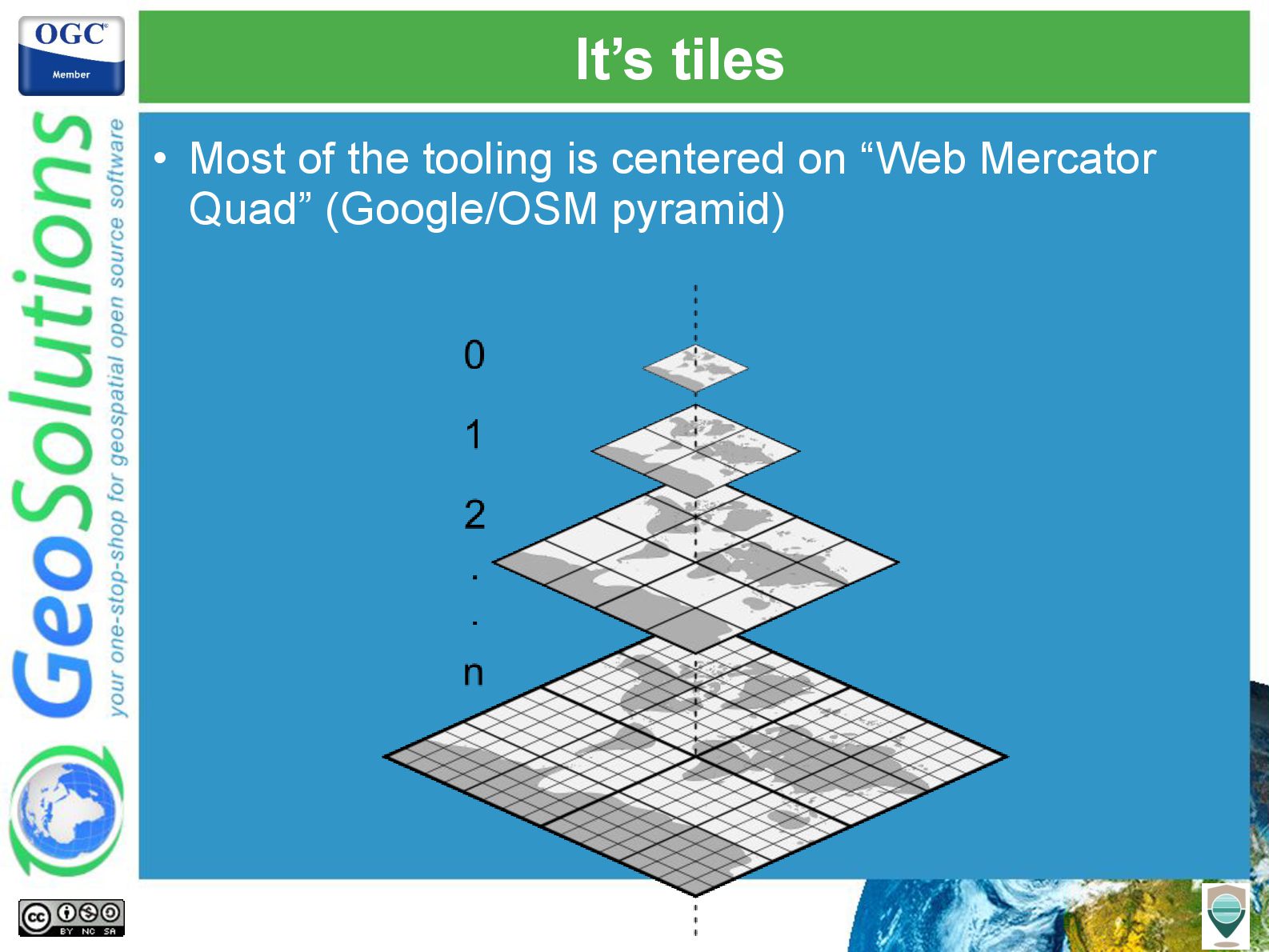
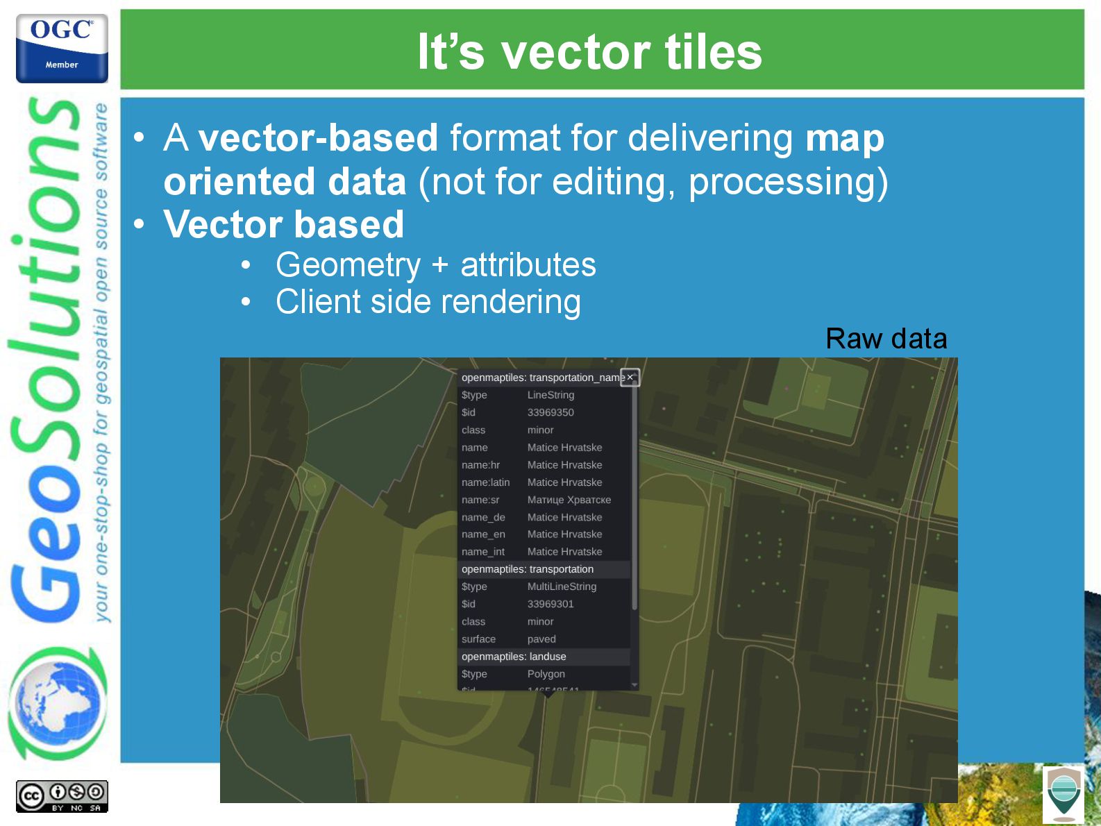
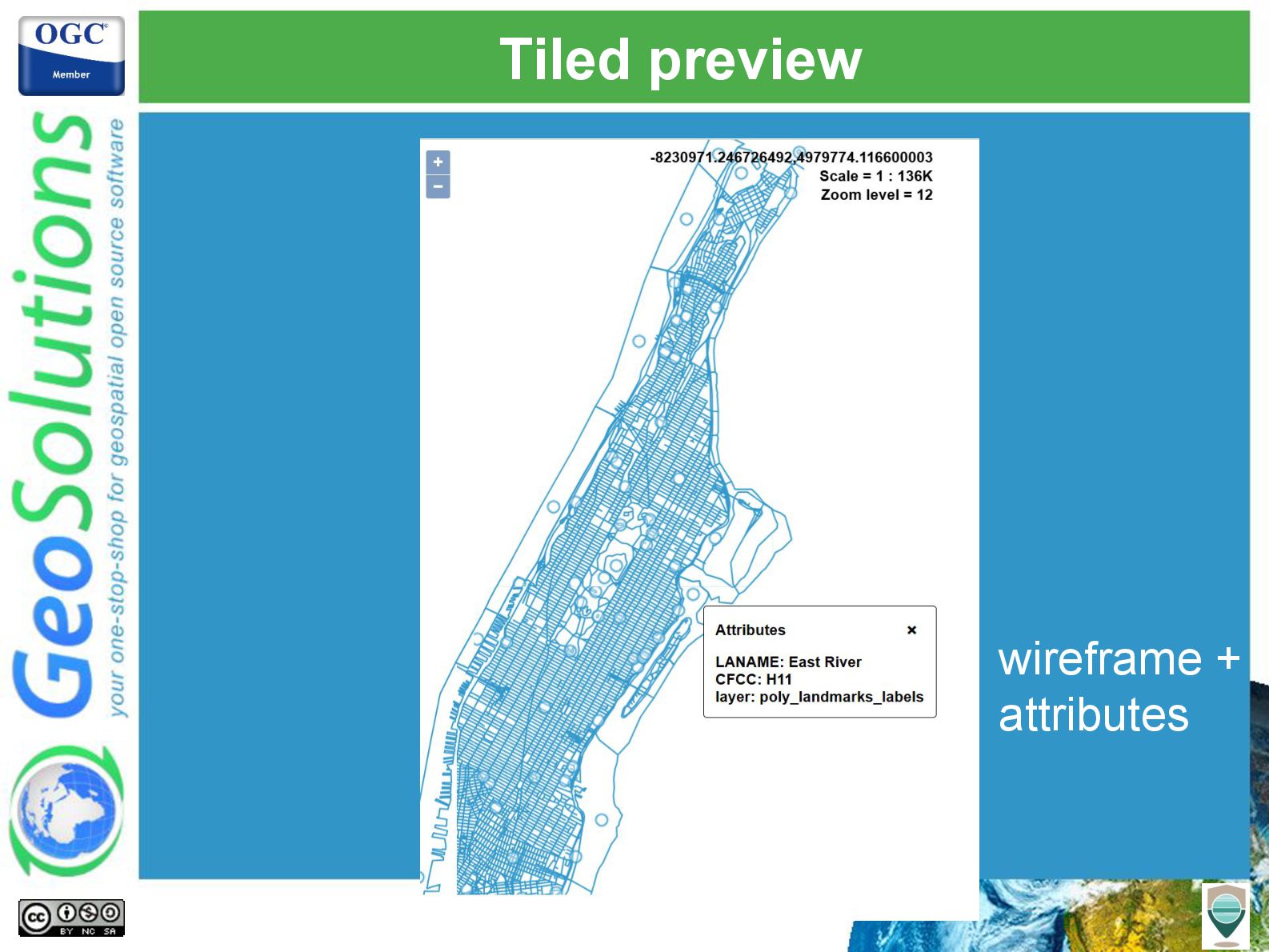
Mapbox vector tiles have emerged as a popular format for delivering geospatial data, offering dynamic rendering and interactivity for modern web maps. While not an official OGC standard, this open specification has been widely adopted, making it a staple of web cartography. This presentation delves into GeoServer's evolving capabilities to serve Mapbox vector tiles, emphasizing recent enhancements and best practices.

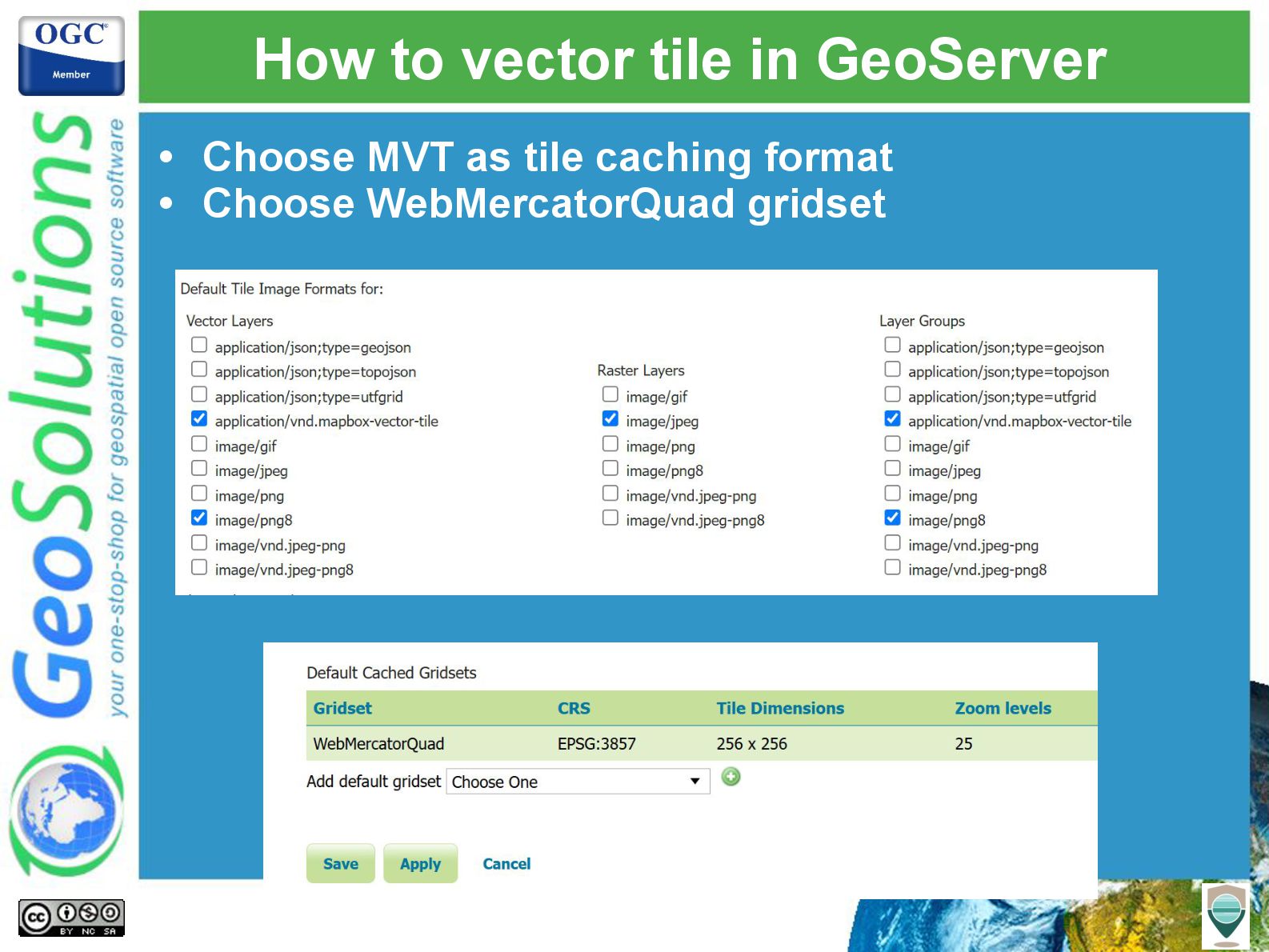
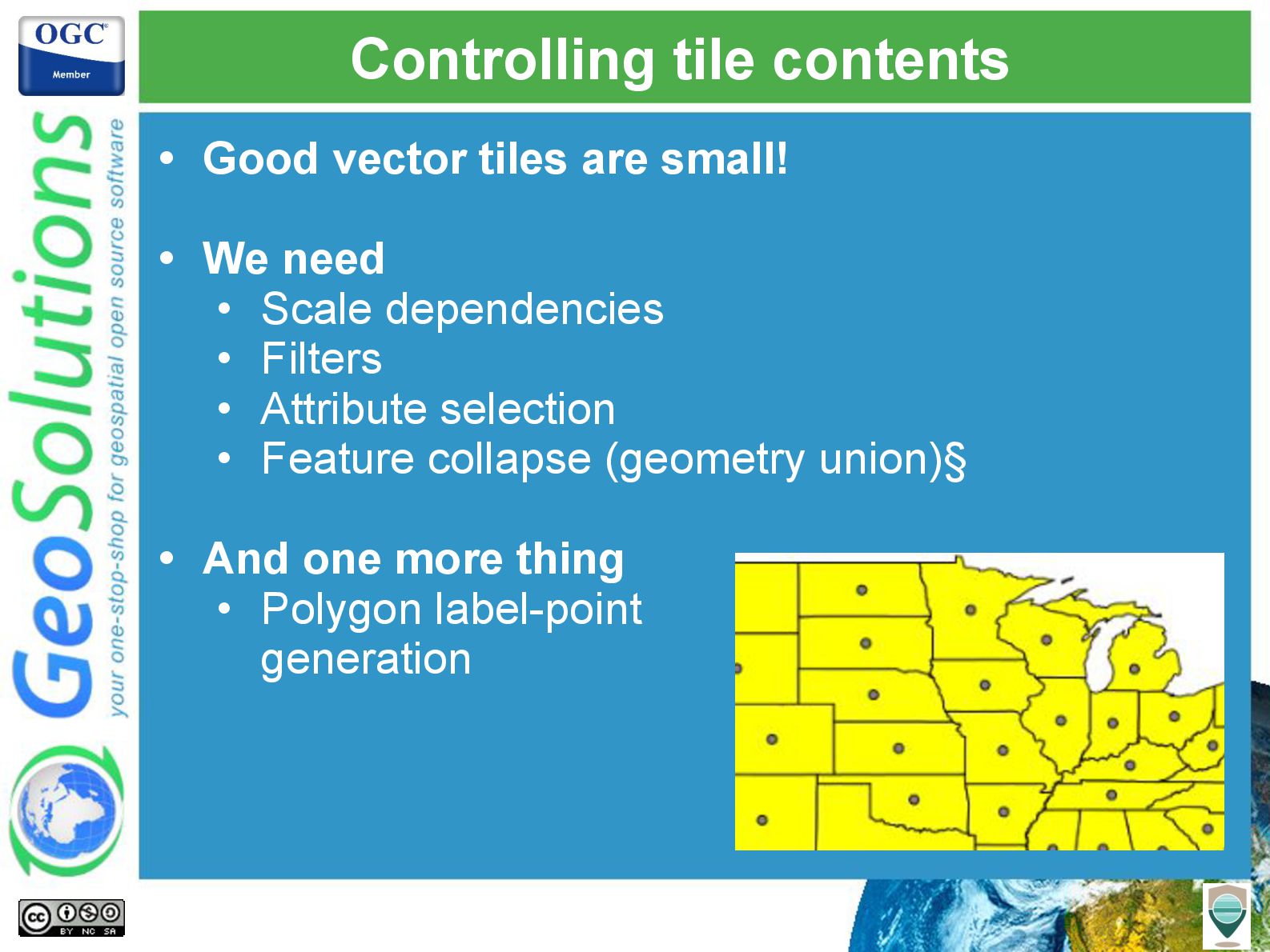
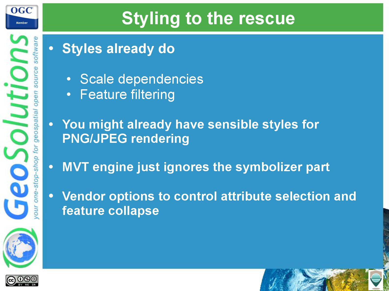
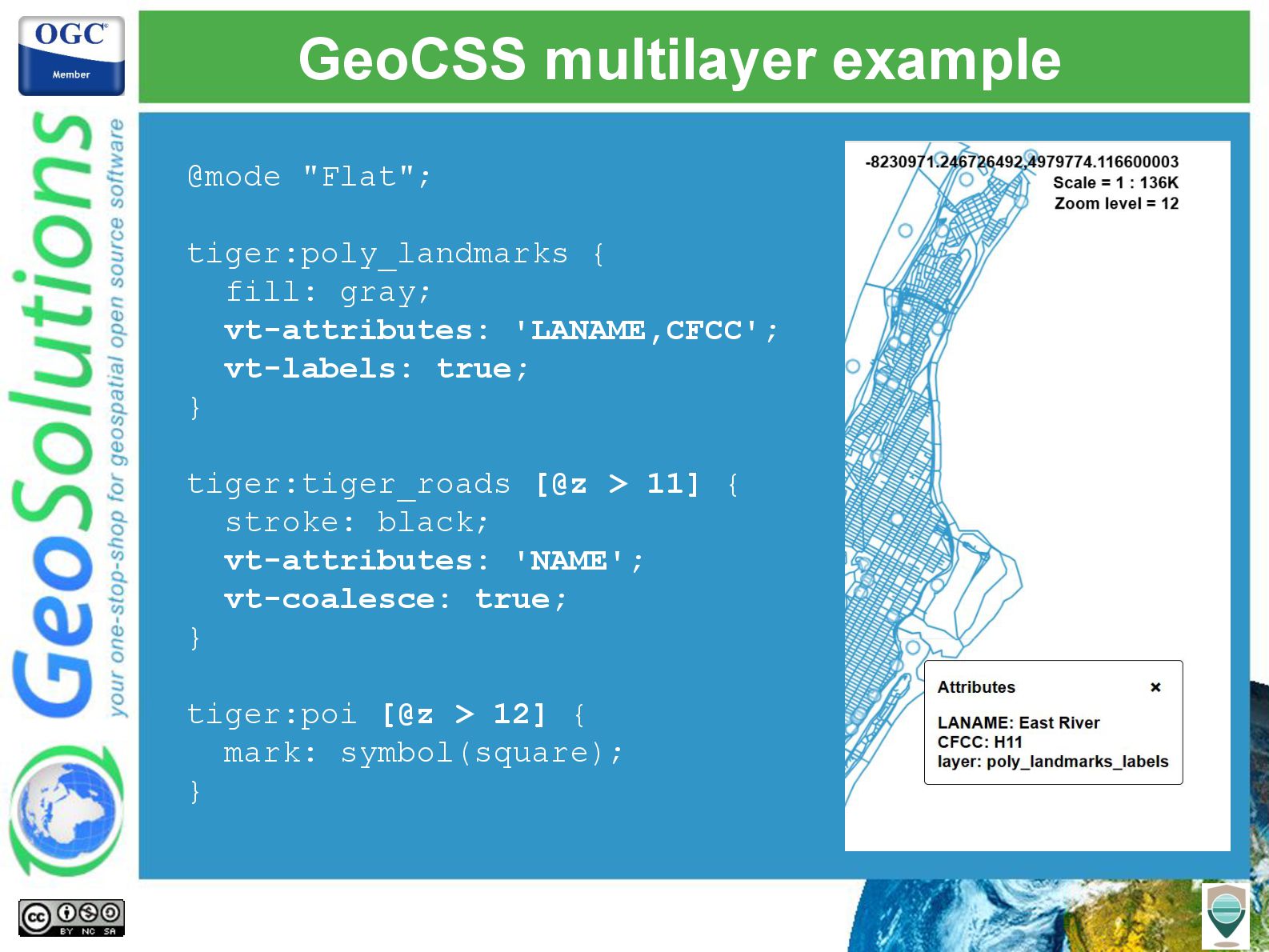
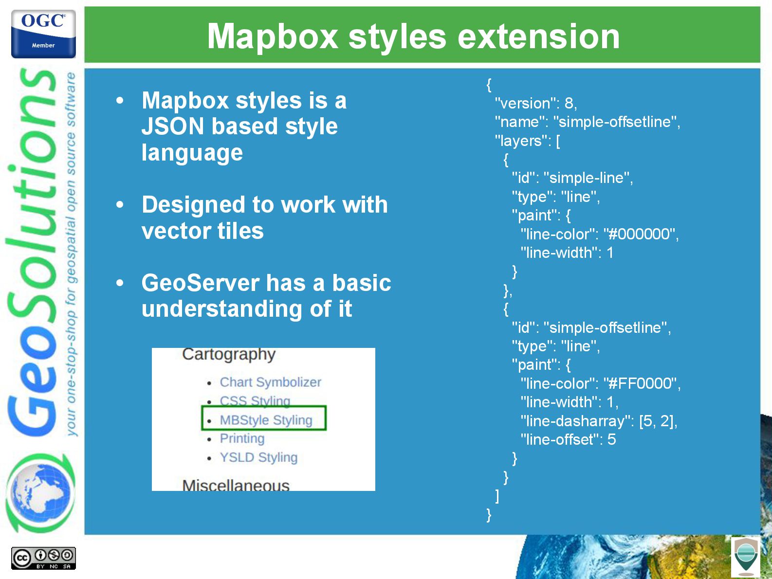
We will explore how GeoServer leverages SLD and CSS to define the contents of vector tiles, ensuring tailored and efficient data delivery. New configuration options, such as label point generation, attribute selection and geometry coalescing, will be highlighted as tools to control and optimize tile outputs. Practical advice will also be provided for streamlining vector tile generation, helping users create seamless and scalable workflows.

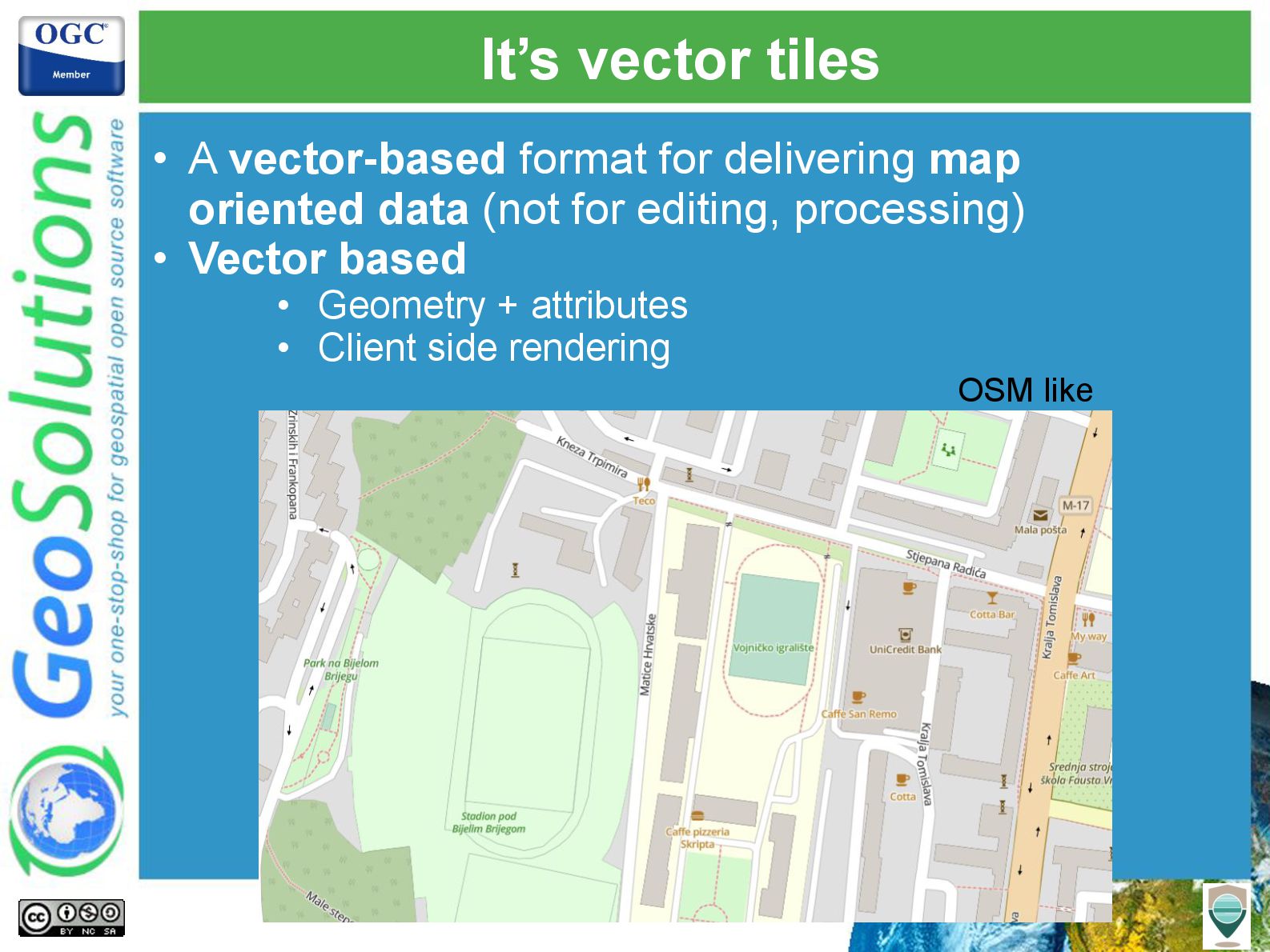
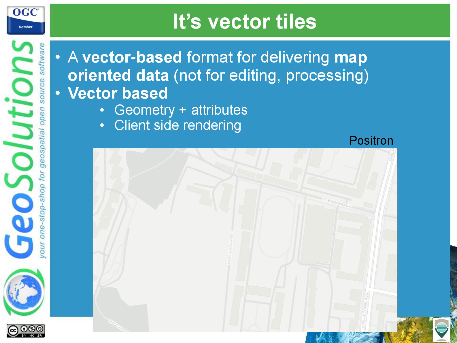
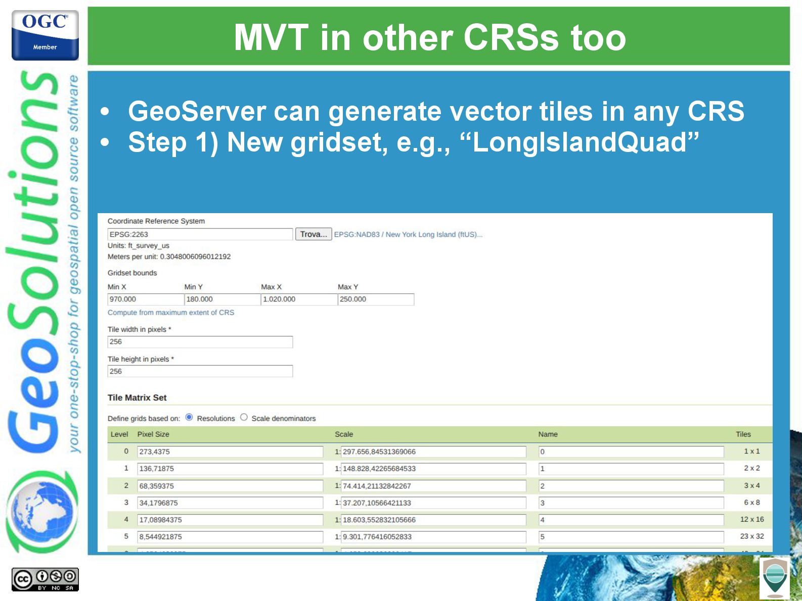
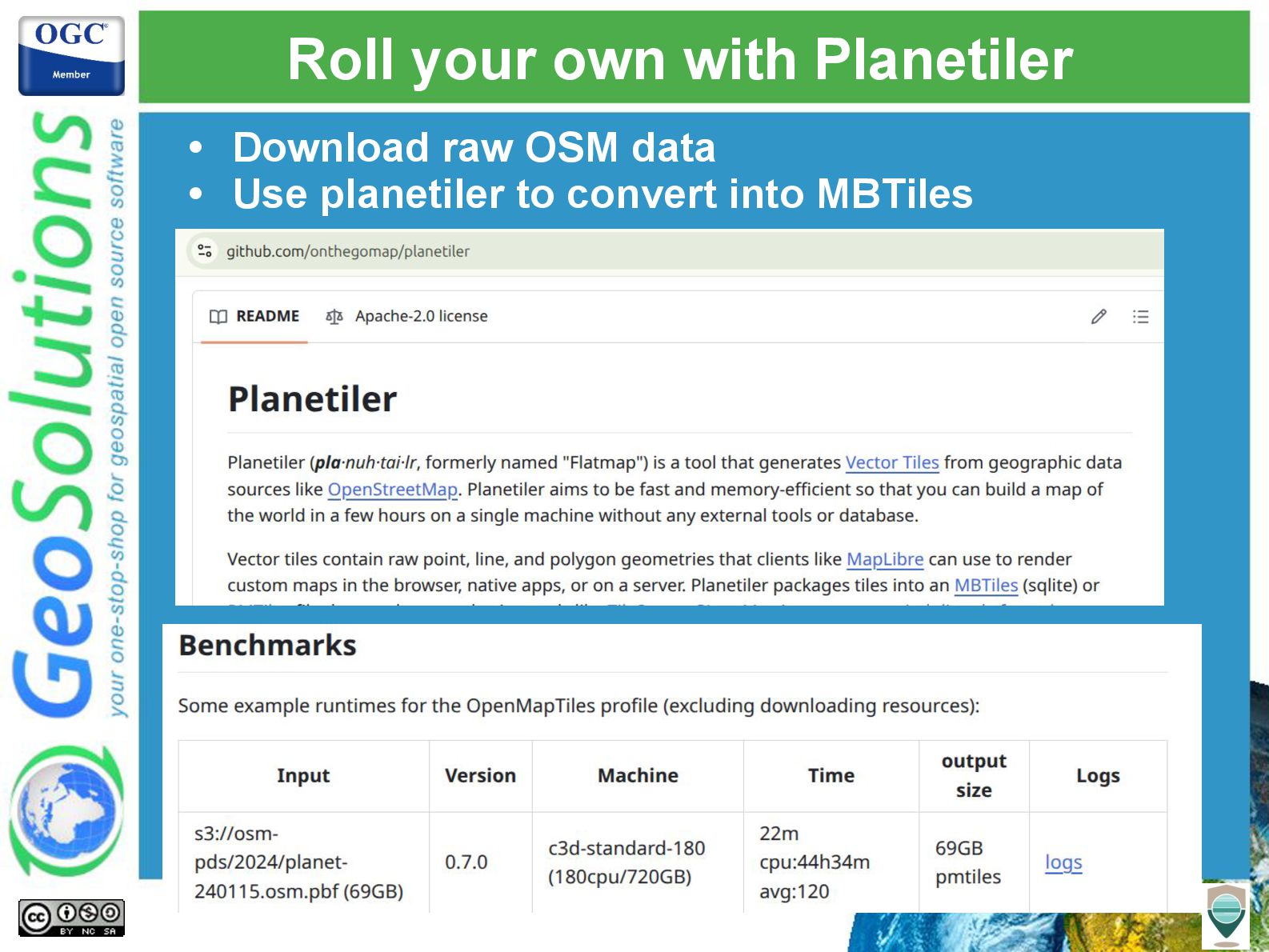
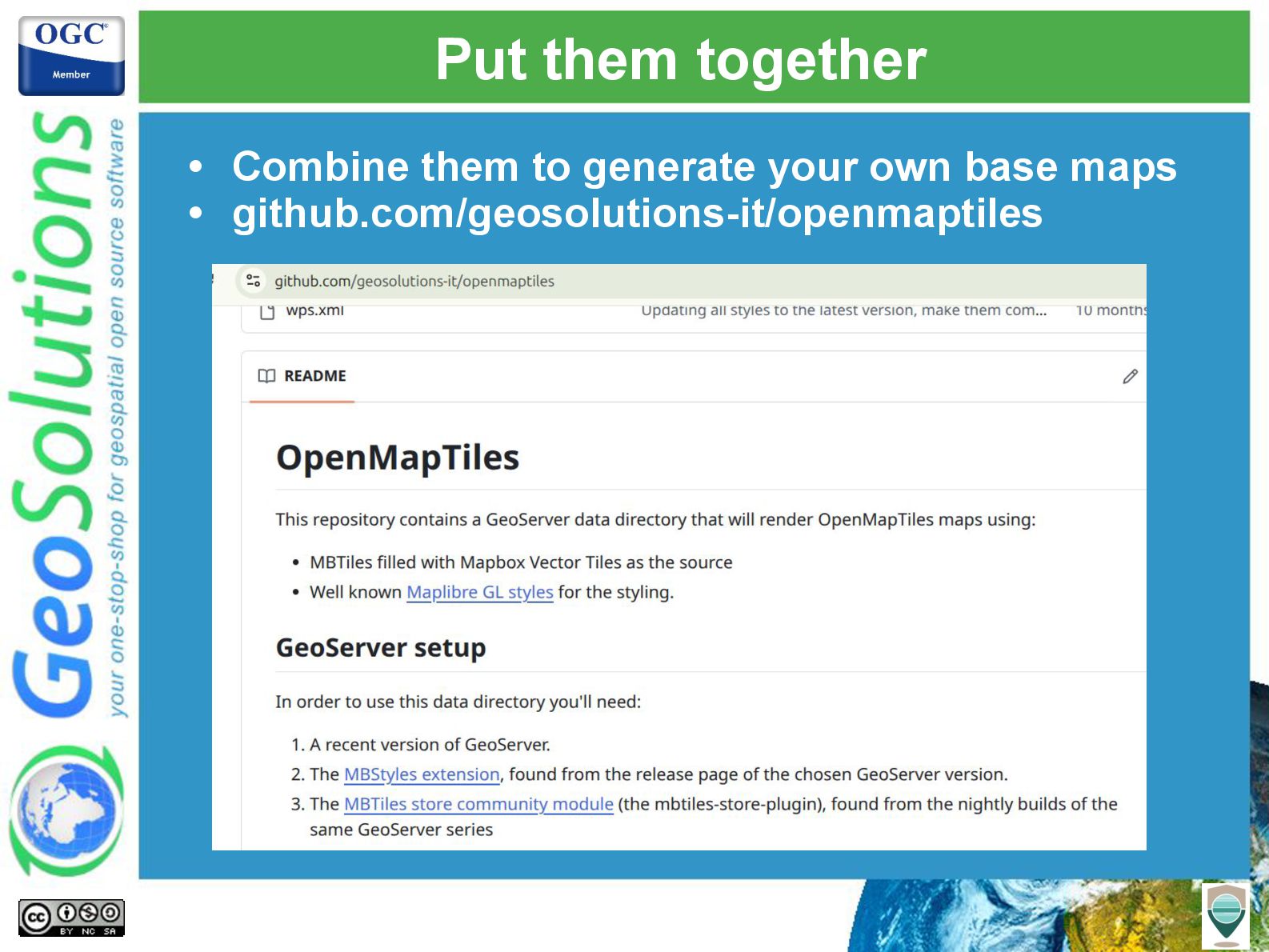
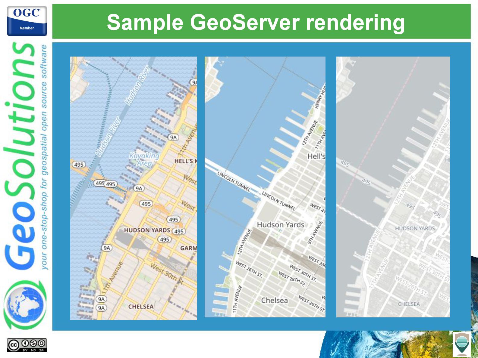
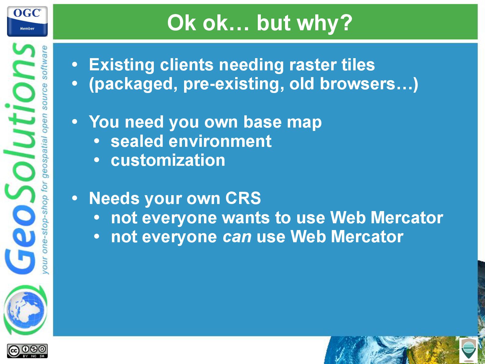
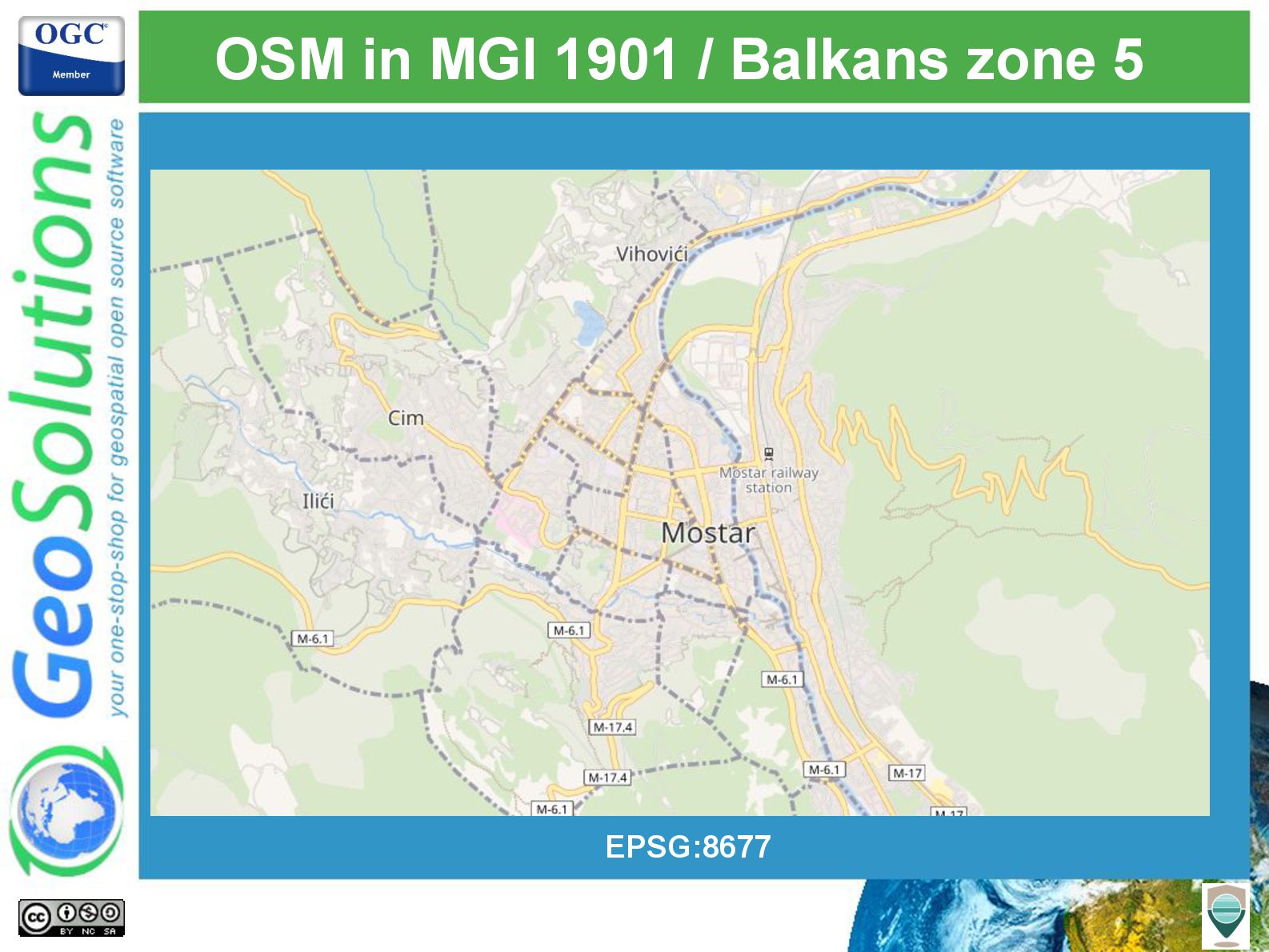
The session will conclude with a look at how vector tiles can serve as an input for generating high-quality base maps in various coordinate reference systems. Using OpenMapTiles styles and Planetiler, we will demonstrate how to produce visually appealing, multi-projection base maps, unlocking the full potential of vector tiles for diverse applications.

Whether you're building interactive maps or generating custom base maps, this talk will equip you with the knowledge and tools to make the most of GeoServer's vector tile capabilities.

Avatar for Simone Giannecchini

Simone Giannecchini PRO

July 22, 2025
Tweet

More Decks by Simone Giannecchini

Other Decks in Technology

Transcript

  1. GeoSolutions Enterprise Support Services Deployment Subscription Professional Training Customized Solutions

    GeoNode • Offices in Italy & US, Global Clients/Team • 30+ collaborators, 25+ Engineers • Our products • Our Offer
  2. Affiliations We strongly support Open Source, it is in our

    core We participate in OGC testbeds and get funded to advance new open standards We support standards critical to GEOINT
  3. It’s tiles • Most of the tooling is centered on

    “Web Mercator Quad” (Google/OSM pyramid)
  4. It’s vector tiles • A vector-based format for delivering map

    oriented data (not for editing, processing) • Vector based • Geometry + attributes • Client side rendering Raw data
  5. It’s vector tiles • A vector-based format for delivering map

    oriented data (not for editing, processing) • Vector based • Geometry + attributes • Client side rendering OSM like
  6. It’s vector tiles • A vector-based format for delivering map

    oriented data (not for editing, processing) • Vector based • Geometry + attributes • Client side rendering Positron
  7. What do we do to geometries…. • Geometries are clipped

    on the tile (on a buffer around it) • Vertices snapped on a integer grid (fine enough for display at that zoom level)
  8. What about features and attributes? • A good vector tile

    is a small one • As few features as possible in the tile • Minimal attributes • Coalesce geometries with the same attributes In yellow, one feature!
  9. Proudly doing MVT since 2015 • Vector tiles community module,

    GS 2.8.0, 2015 • Official extension in 2.14.0, 2018 • Last significant improvements, 09/2024
  10. How to vector tile in GeoServer • Choose MVT as

    tile caching format • Choose WebMercatorQuad gridset
  11. Controlling tile contents • Good vector tiles are small! •

    We need • Scale dependencies • Filters • Attribute selection • Feature collapse (geometry union)§ • And one more thing • Polygon label-point generation
  12. Styling to the rescue • Styles already do • Scale

    dependencies • Feature filtering • You might already have sensible styles for PNG/JPEG rendering • MVT engine just ignores the symbolizer part • Vendor options to control attribute selection and feature collapse
  13. GeoCSS single layer example gs:roads [@z > 11] [type=highway] {

    stroke: black; vt-attributes: 'name'; vt-coalesce: true; } Layer Scale dep. Attribute filter Small oddity, activate output
  14. GeoCSS multilayer example @mode "Flat"; tiger:poly_landmarks { fill: gray; vt-attributes:

    'LANAME,CFCC'; vt-labels: true; } tiger:tiger_roads [@z > 11] { stroke: black; vt-attributes: 'NAME'; vt-coalesce: true; } tiger:poi [@z > 12] { mark: symbol(square); }
  15. Getting in touch with XYZ apps • Grab the ResourceURL

    from WMTS capabilities, replace placeholders http://host:port/geoserver/gwc/service/wmts/rest/nyc-vt/{st yle}/{TileMatrixSet}/{TileMatrix}/{TileRow}/{TileCol}?forma t=application/vnd.mapbox-vector-tile http://localhost:8083/geoserver/gwc/service/wmts/rest/nyc-v t/WebMercatorQuad/{z}/{y}/{x}?format=application/vnd.mapbox -vector-tile
  16. MVT in other CRSs too • GeoServer can generate vector

    tiles in any CRS • Step 1) New gridset, e.g., “LongIslandQuad”
  17. MVT in other CRSs too • Step 2) Bind gridset

    with layer • Step 3) Grab and customize tiles URL from WMTS capabilities http://localhost:8083/geoserver/gwc/service/wmts/rest/tiger-ny/ LongIslandQuad/{z}/{y}/{x}?format=application/vnd.mapbox-ve ctor-tile
  18. MVT in other CRSs too • Step 4) Customized JS

    client (e.g., OpenLayers) const extent = [970000, 180000, 1020000, 250000]; const resolutions = [ 273.4375, 136.71875, 68.359375, 34.1796875, 17.08984375, 8.544921875, 4.2724609375, 2.13623046875, 1.068115234375, 0.5340576171875 ]; const tileGrid = new ol.tilegrid.TileGrid({ extent: extent, tileSize: 256, resolutions: resolutions }); Grid structure
  19. MVT in other CRSs too proj4.defs("EPSG:2263", "+proj=lcc +lat_1=41.03333333333333 +lat_2=40.66666666666666 +lat_0=40.16666666666666

    +lon_0=-74 +x_0=984250 +y_0=0 +datum=NAD83 +units=ft +no_defs"); ol.proj.proj4.register(proj4); const projection = ol.proj.get('EPSG:2263'); const vectorTileLayer = new ol.layer.VectorTile({ source: new ol.source.VectorTile({ format: new ol.format.MVT(), url: 'http://localhost:8083/geoserver/gwc/service/wmts/rest /tiger-ny/LongIslandQuad/{z}/{y}/{x} ?format=application/vnd.mapbox-vector-tile', projection: projection, tileGrid: tileGrid, }), … }); CRS Putting it all toghether
  20. MBTiles store • MBTiles are Sqlite files chock full of

    tiles • They can be vector tiles • MBTiles store community module • Exposes vector tiles as “vector layers”
  21. MBTiles available in the wild • Whole world, or just

    one area • You’ll have to “log in” eventually
  22. Roll your own with Planetiler • Download raw OSM data

    • Use planetiler to convert into MBTiles
  23. Mapbox styles extension • Mapbox styles is a JSON based

    style language • Designed to work with vector tiles • GeoServer has a basic understanding of it { "version": 8, "name": "simple-offsetline", "layers": [ { "id": "simple-line", "type": "line", "paint": { "line-color": "#000000", "line-width": 1 } }, { "id": "simple-offsetline", "type": "line", "paint": { "line-color": "#FF0000", "line-width": 1, "line-dasharray": [5, 2], "line-offset": 5 } } ] }
  24. Put them together • Combine them to generate your own

    base maps • github.com/geosolutions-it/openmaptiles
  25. Ok ok… but why? • Existing clients needing raster tiles

    • (packaged, pre-existing, old browsers…) • You need you own base map • sealed environment • customization • Needs your own CRS • not everyone wants to use Web Mercator • not everyone can use Web Mercator
  26. OSM in MGI 1901 / Balkans zone 5 • Produce

    vector tiles • Use case, target projection • Consume vector tiles • Use case, basemap EPSG:8677