Share
Embed
A Standards-Based Portal for Oceanographic Models and Data
Presentation to USGS Pacific Coastal and Marine Science Center
Rich Signell
June 22, 2016
Transcript
20 slides
-
A Standards-Based Portal for Oceanographic Models and Data Rich Signell
(USGS-CMG) Kyle Wilcox (Axiom Data Science) Filipe Fernandes (SECOORA) PCMSC Webinar, June 22, 2016 -
US Integrated Ocean Observing System (IOOS® ) 17 Federal
Agencies 11 Regional Associations -
IOOS Core Principles • Adopt open standards & practices •
Avoid customer-specific stovepipes • Standardized access services implemented at data providers 3 Customer Web access service Data Provider Observations Models -
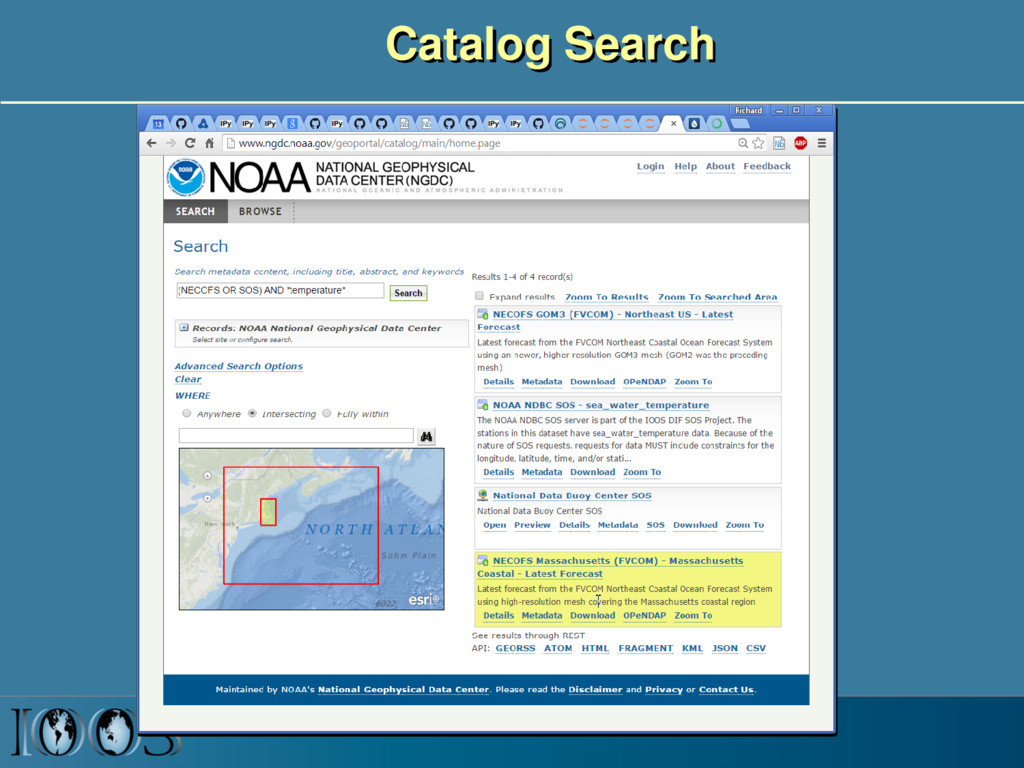
From pile of files to interoperability Standardized Search and Browse
Standardized Data Access Raw Dataset files -
Ocean grids are often not regularly spaced! Stretched surface and
terrain following vertical coordinates Curvilinear orthogonal horizontal coordinates -
CF Conventions for met/ocean models Some of the groups using
CF: OGC: Open Geospatial Consortium ODIP: Ocean Data Interoperability Platform IOOS: Integrated Ocean Observing System CMIP: Coupled Model Intercomparison Project (supporting IPPC) float temp(ocean_time, s_rho, eta_rho, xi_rho) ; temp: standard_name = “sea_water_potential_temperature" ; temp: units = "Celsius" ; temp: coordinates = "lon_rho lat_rho s_rho ocean_time" ; double s_rho(s_rho) ; s_rho: long_name = "S-coordinate at RHO-points" ; s_rho: positive = "up" ; s_rho: standard_name = "ocean_s_coordinate_g1" ; s_rho: formula_terms = "s: s_rho C: Cs_r eta: zeta depth: h depth_c: hc " -
IOOS Model Data Interoperability Design ROMS ADCIRC SWAN DelftFM Delft3D
NcML NcML NcML NcML NcML Common Data Model OPeNDAP+CF WCS NetCDF Subset THREDDS Data Server Standardized (CF-1.6, UGRID-1.0) Virtual Datasets Nonstandard Model Output Data Files Web Services Matlab Panoply IDV Clients NetCDF -Java Library or Broker WMS ncISO ArcGIS NetCDF4 -Python FVCOM Python ERDDAP NetCDF-Java SOS Geoportal Server GeoNetwork GI-CAT Observed data (buoy, gauge, ADCP, glider) Portals WMS clients CKAN-pycsw NcML Grid Ugrid TimeSeries Profile Trajectory TimeSeriesProfile Nonstandard Data Files Catalog Services sudo apt-get docker docker run –d axiom/docker-thredds -
Matlab NCTOOLBOX https://github.com/nctoolbox • Objective: Make it simple to access
CF data • Example function: • [t, geo]=nj_tslice(URL,’temp’,1); • t = 7x800x160 single • geo = – lat: [800x160 single] – lon: [800x160 single] – z: [7x800x160 double] – time: 735169.0208 (matlab datenum) • nj_tslice works identically for ROMS, POM, ECOM, WRF, Wavewatch3 • URL can be: local NetCDF, remote NetCDF, NcML, OpenDAP Data URL -
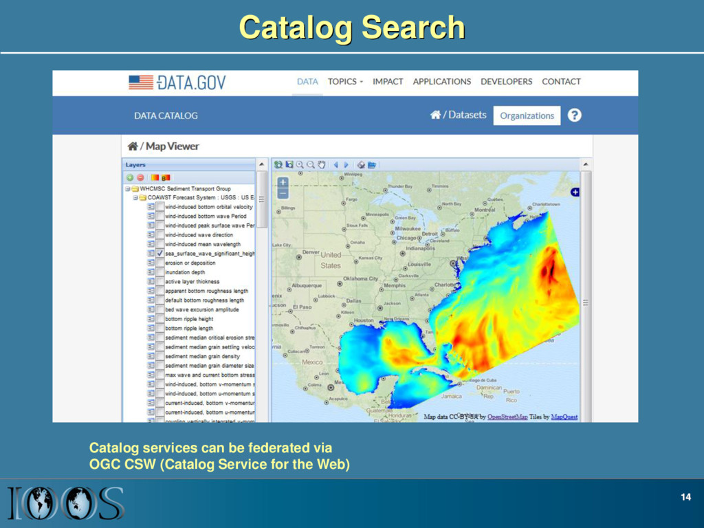
Catalog Search 14 Catalog services can be federated via OGC
CSW (Catalog Service for the Web) -
Service-based Framework Components • Common data models for “feature types”
(structured and unstructured grids, time series, profiles, swaths) (Unidata CDM) • Standard web data services for delivering these common data model “feature types” (OPeNDAP, SOS) • Standard catalog services for the metadata • Tools to search, access and process these services in common analysis environments: R, Matlab, Python, ArcGIS, JavaScript -
Getting model data connected • Find someone with a THREDDS
Data Server or install your own • Drop your files in a directory, and add an NcML file that starts with “00_dir” (e.g. “00_dir_roms.ncml”) to aggregate, standardize and describe the dataset: Sample ROMS NcML file • If you want your data to end up in the portal, add “CMG_Portal” to the “project” attribute: <attribute name=“project”value=“CMG_Portal”/> • If you want your datasets to be discoverable, edit the list of thredds catalogs on CMG github repo, submit PR • Full instructions on the USGS-CMG Portal Github Wiki -
Framework benefits • Lots of choices for data access (Browser,
Matlab, Python, Excel, IDV, R, IDL • Less time wasted messing with data, more time spent on science • Easy development of portals • More usage of products • Faster feedback to modelers, improved models • Let’s get some PCMSC data plugged in!