Upgrade to Pro — share decks privately, control downloads, hide ads and more …

Exploring MapStore Release 2022.02: improved 3DTiles support and more

Exploring MapStore Release 2022.02: improved 3DTiles support and more

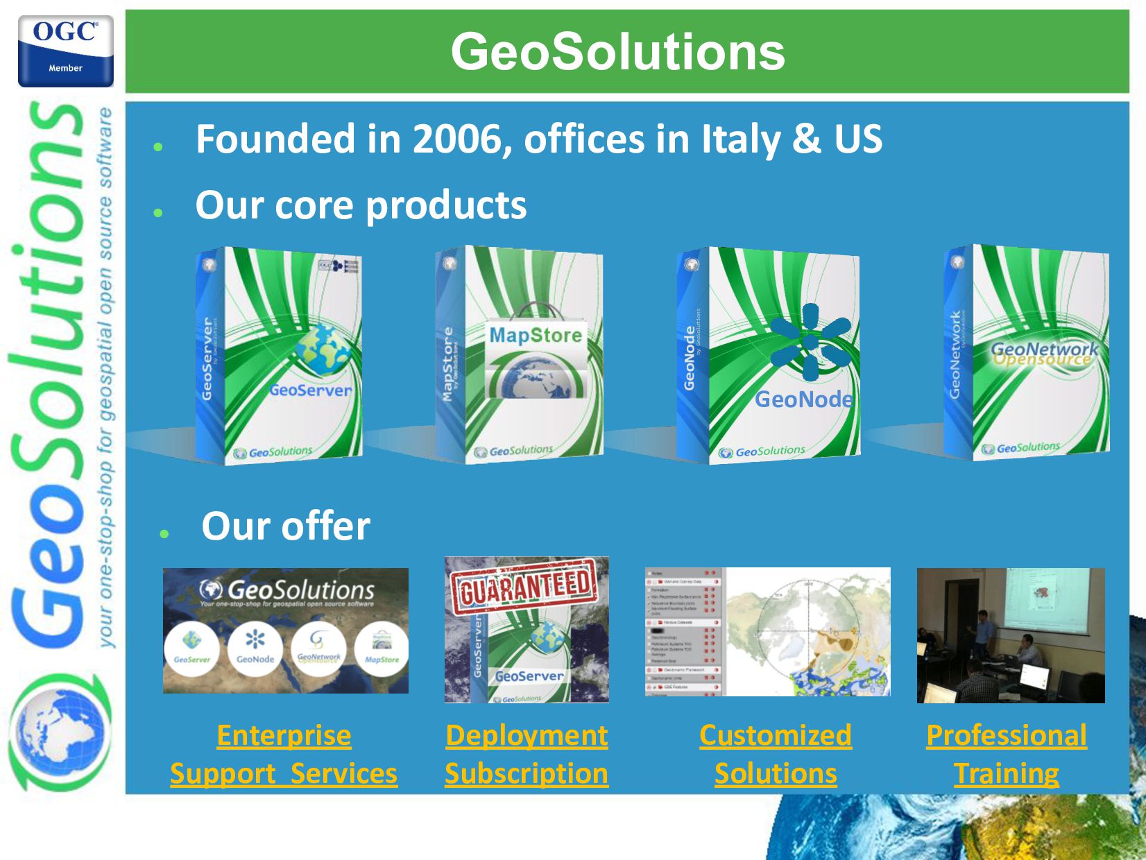
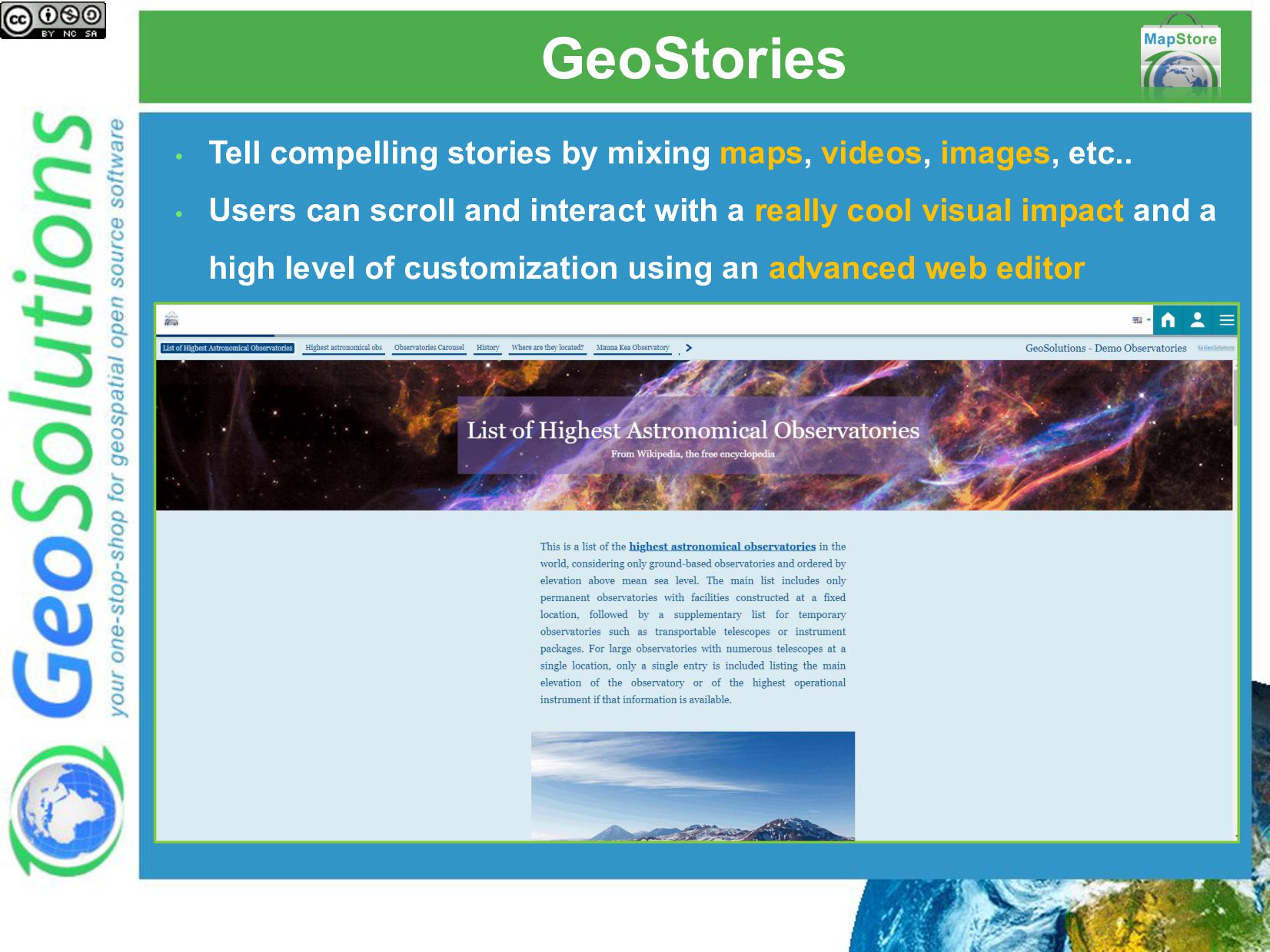
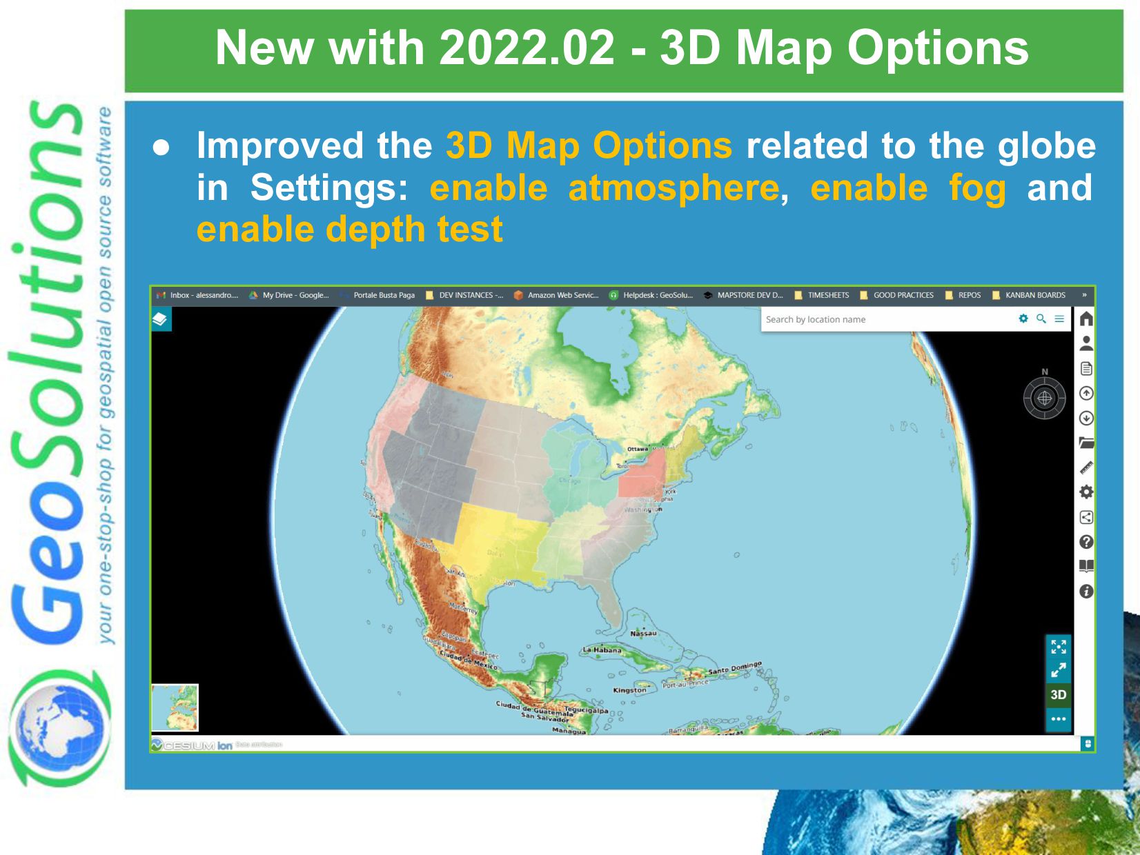
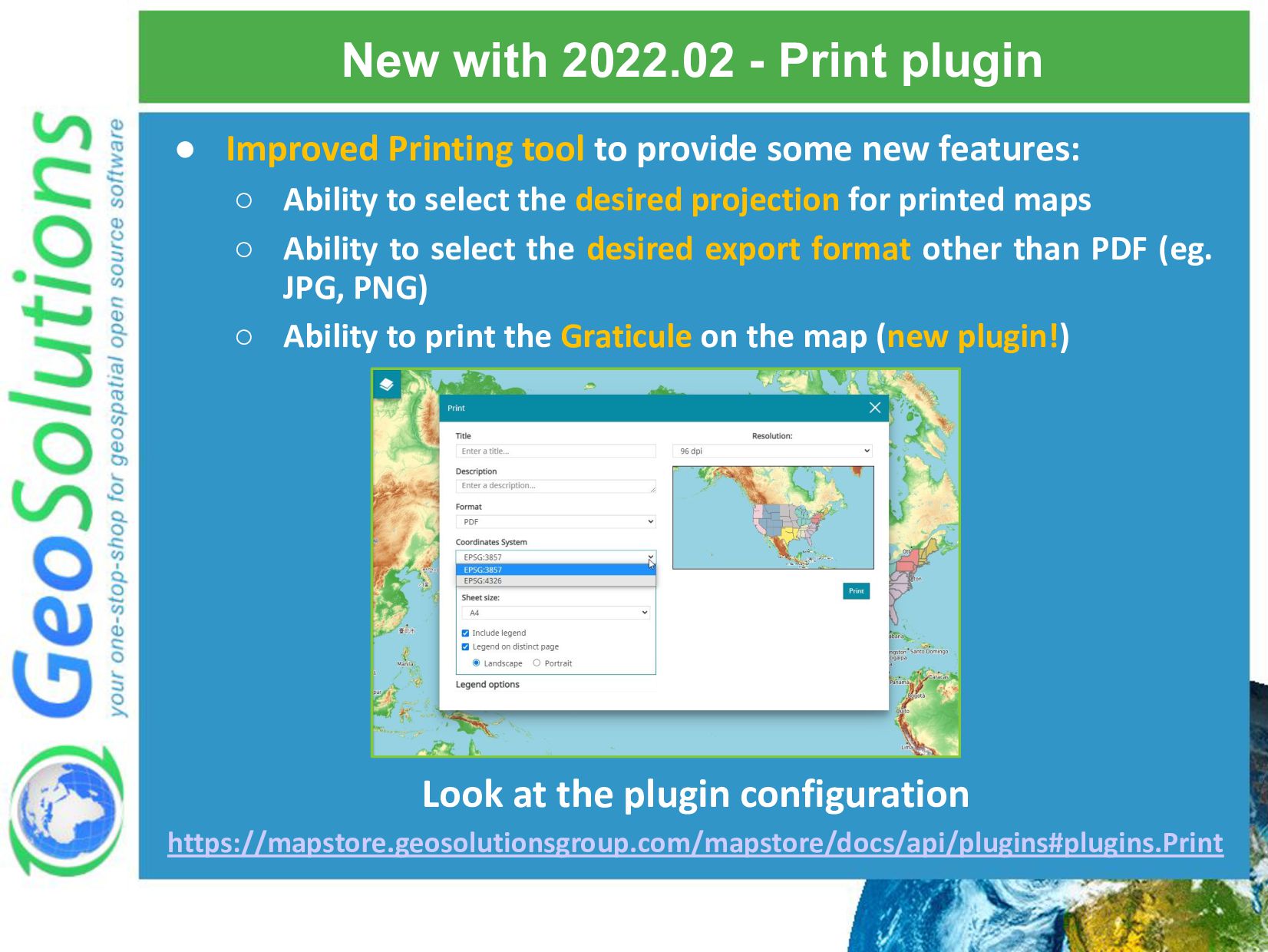
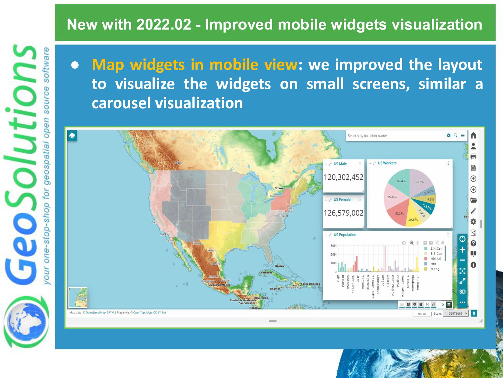
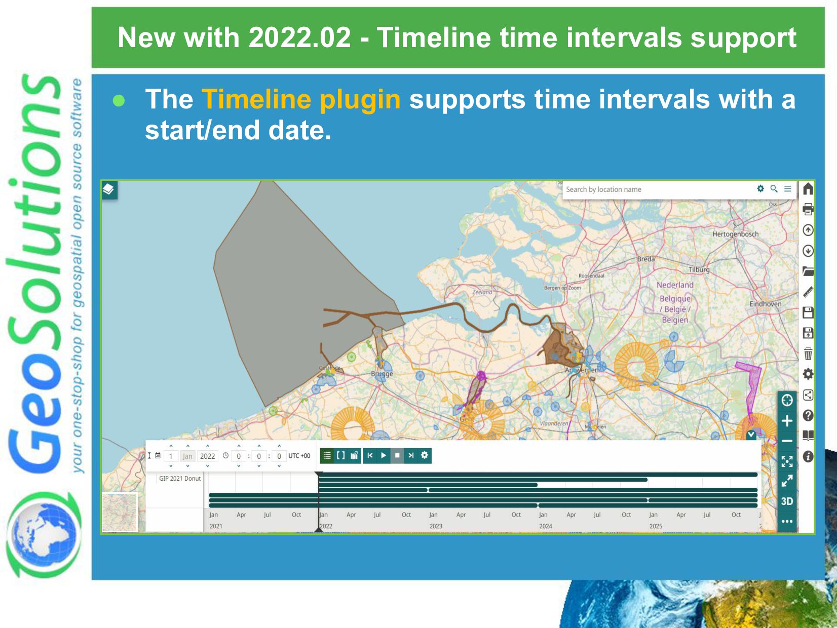
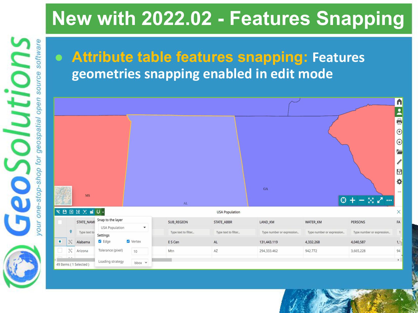
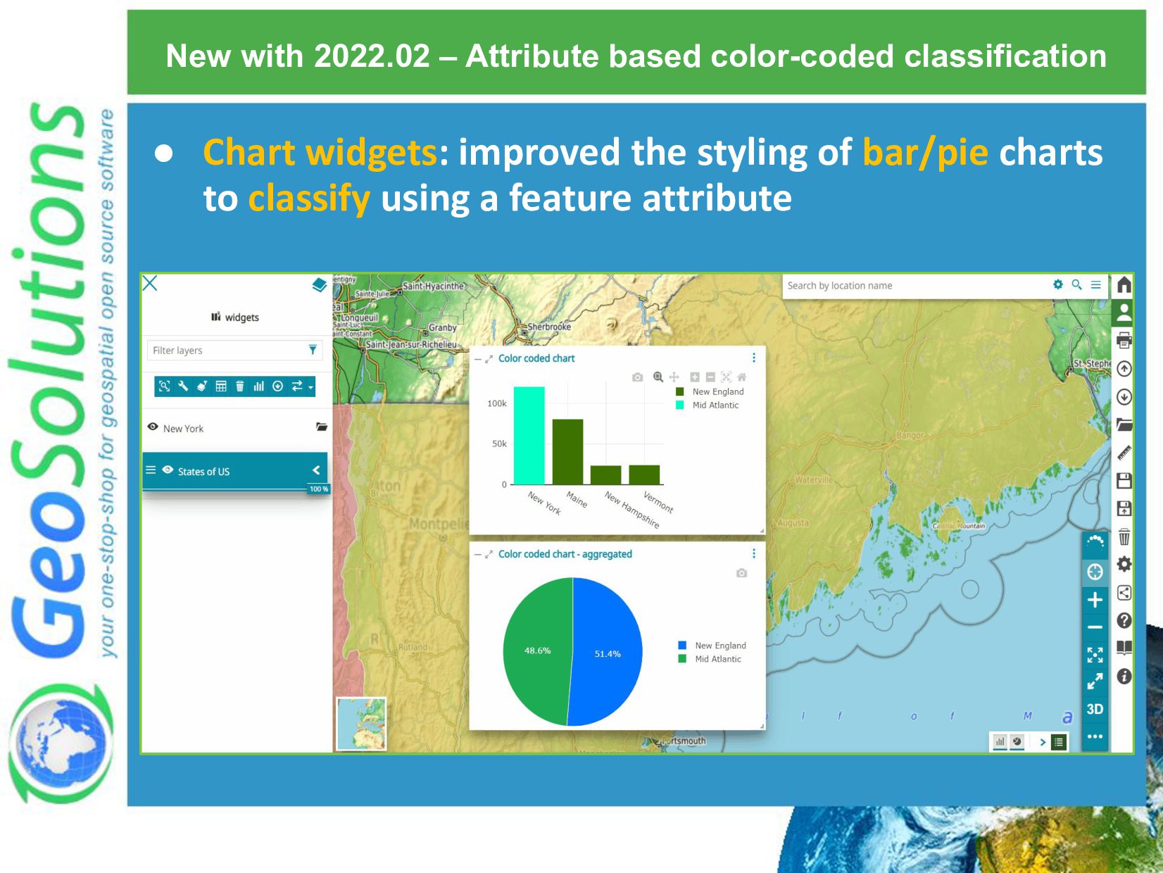
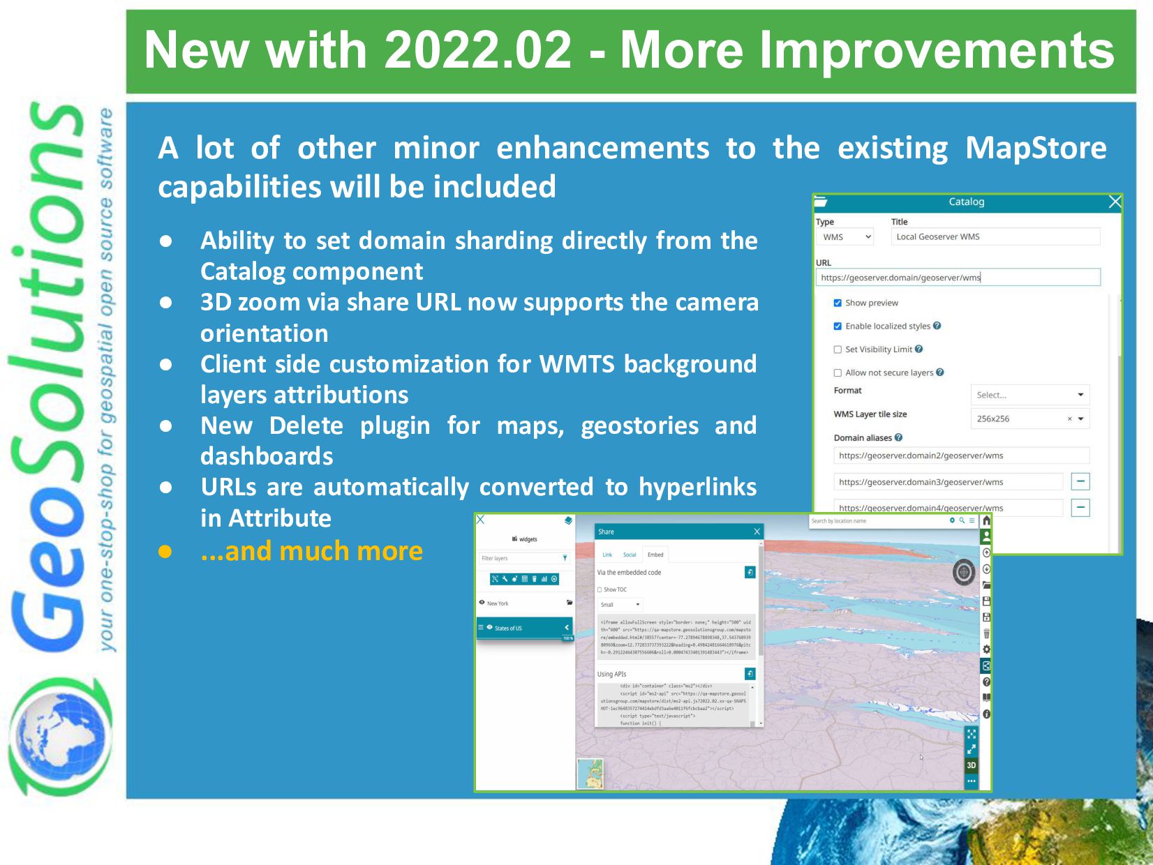
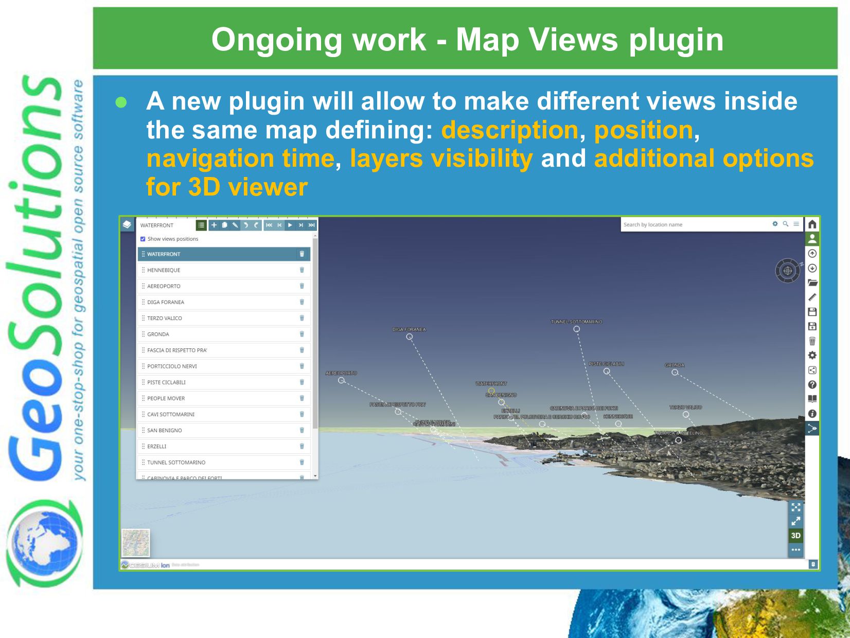
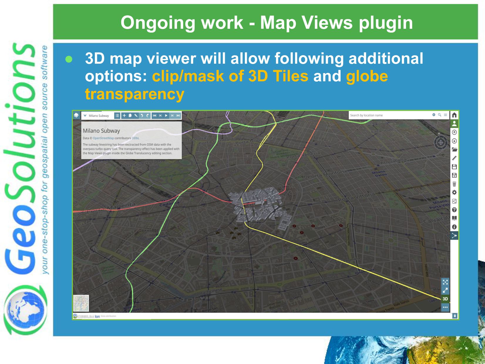
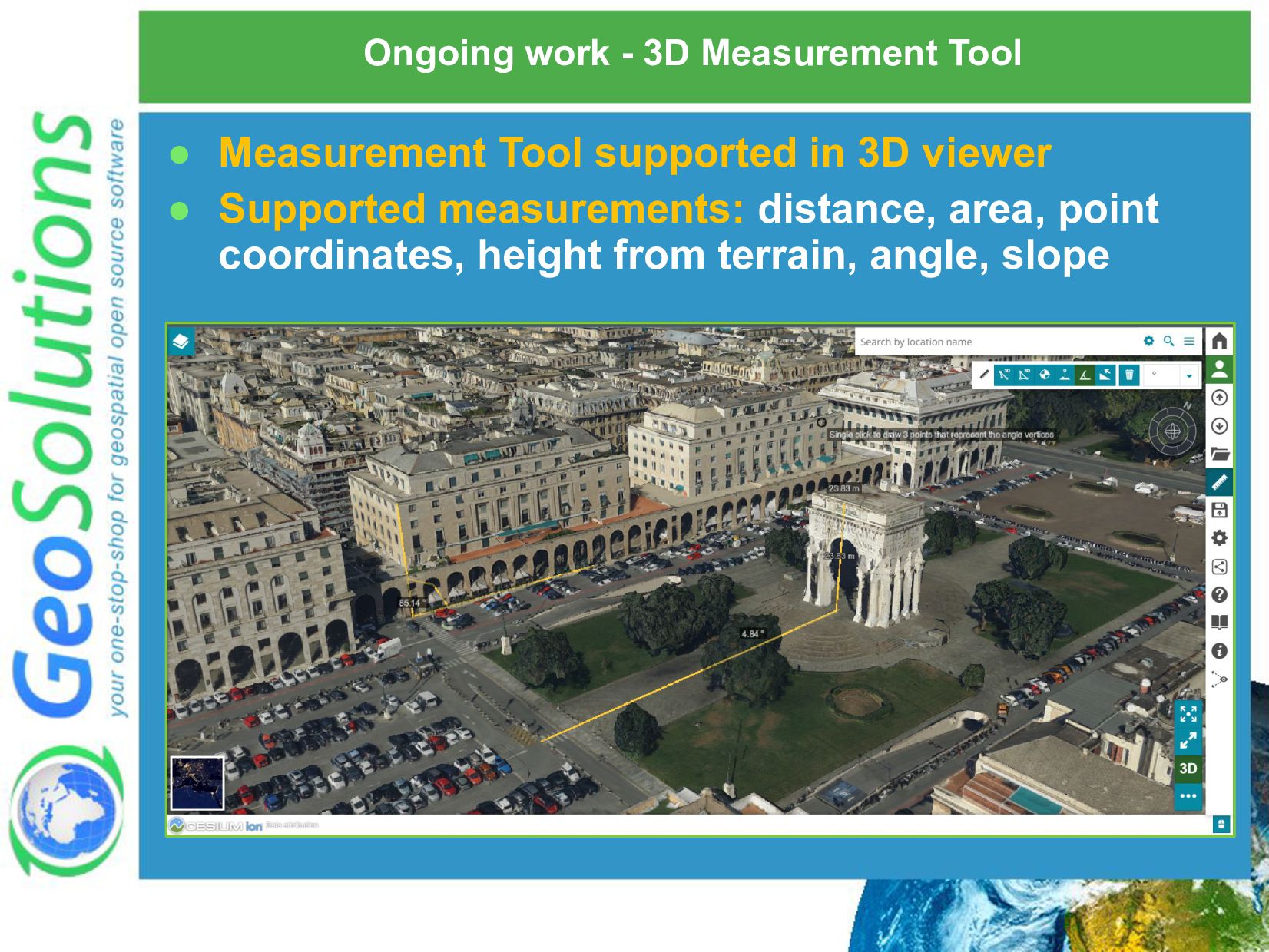
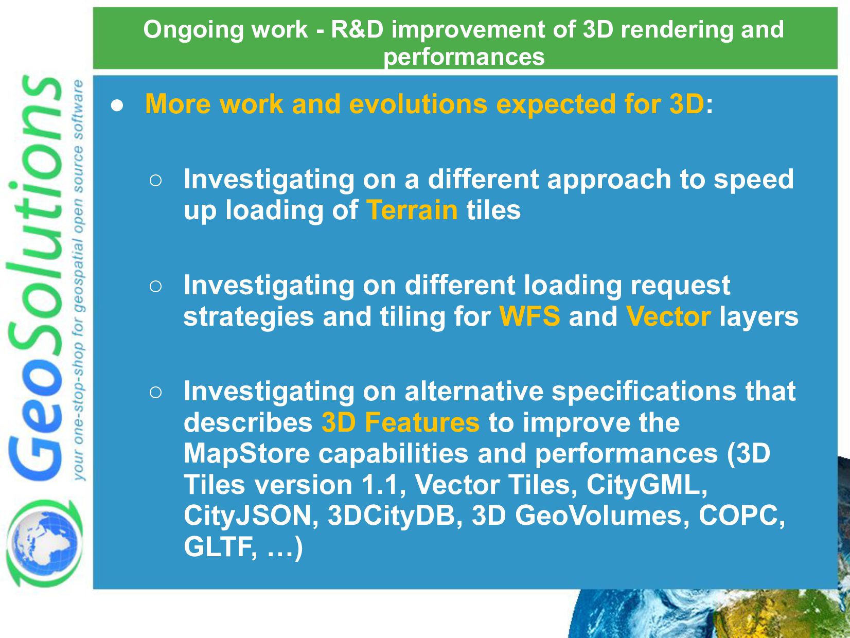
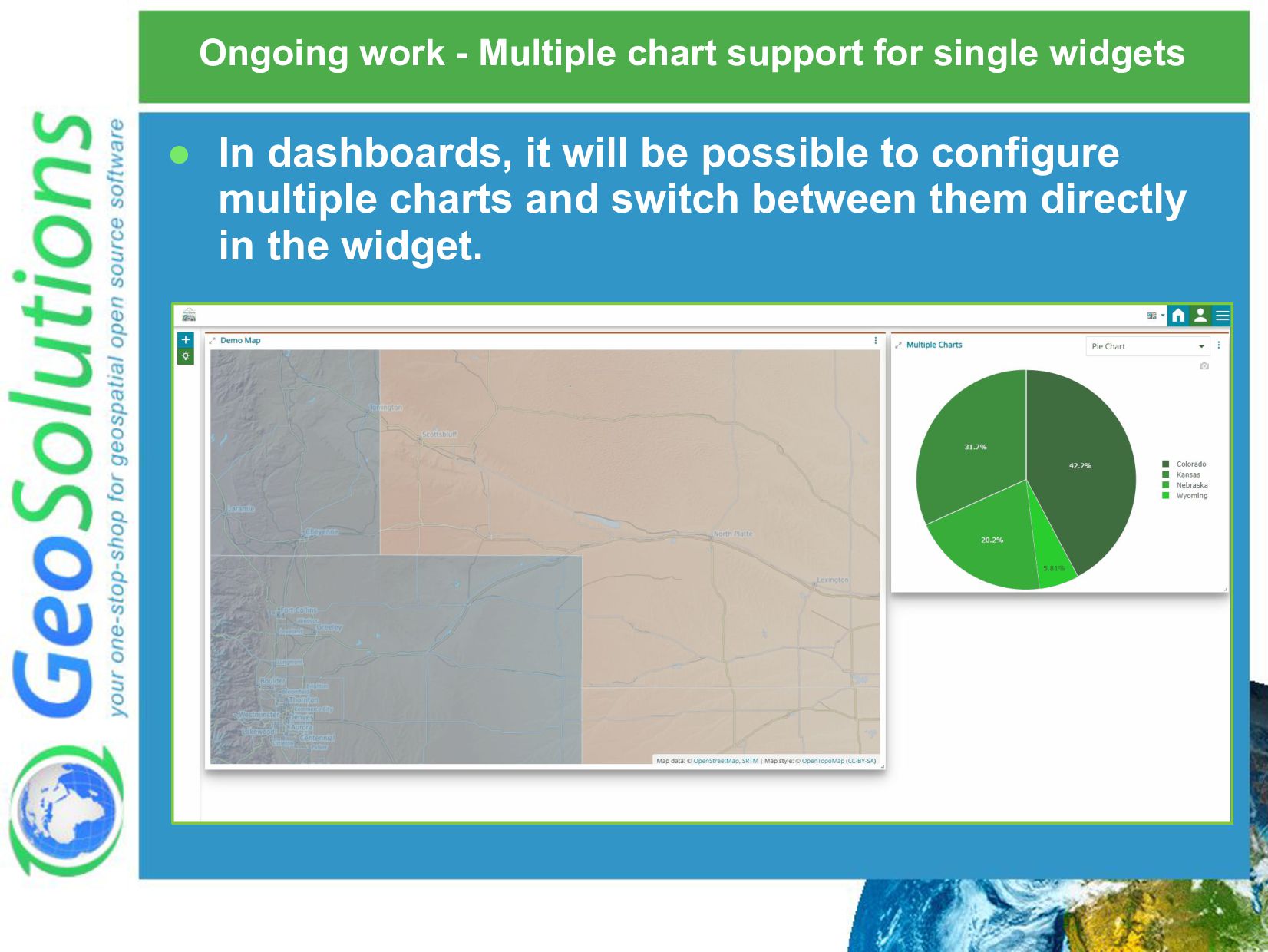
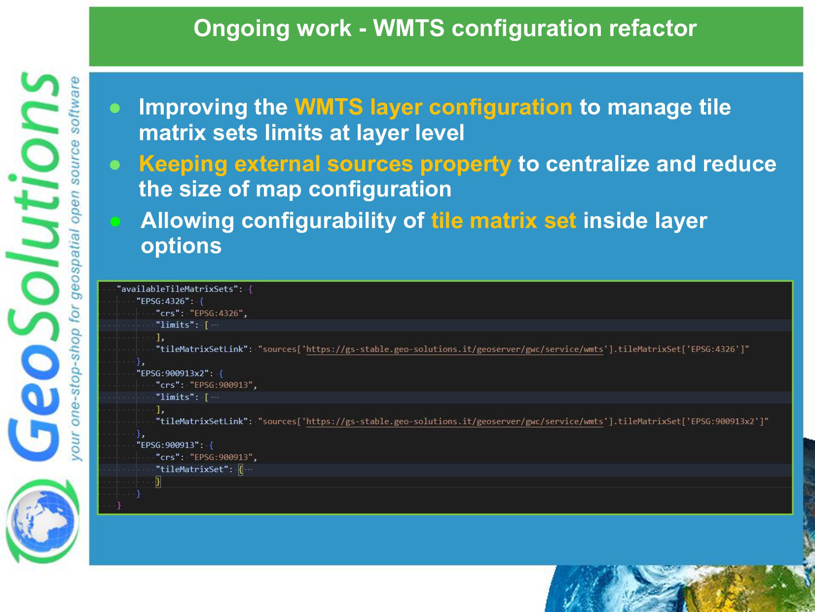
Webinar from GeoSolutions on the recent MapStore 2022.02.00 release. Learn about enhancements related to 3D WFS support and improved styling support for 3D data, MapStore side toolbar, enhanced Dashboards and GeoStories, authentication support for OpenID and Keycloak and more. We will have 1 hour presentation and 30 minutes of Q&A.

Simone Giannecchini

January 25, 2023
Tweet

More Decks by Simone Giannecchini

Other Decks in Technology

Transcript

  1. GeoSolutions • Founded in 2006, offices in Italy & US

    • Our core products • Our offer Enterprise Support Services Deployment Subscription Professional Training Customized Solutions GeoNode
  2. Trusted by more than 200 clients • UN FAO (CIOK,

    FIGIS, NRL, FORESTRY, ESTG), UN WFP, World Bank, DLR, EUMETSAT, JRC, ARPAT, NATO CMRE, UNESCO, IGAD, UNEP, etc.. • BAYER, BASF, DigitalGlobe, MDA, TOPCON, SwissRE, e-GEOS, Halliburton, etc..
  3. Associations We strongly support Open Source, it Is in our

    core We actively participate in OGC working groups and get funded to advance new open standards We support standards critical to GEOINT
  4. What is MapStore? It is a Framework Build applications leveraging

    MapStore framework (and by developing your own plugins) denver.crime-map.info covidtrackingmap
  5. MapStore Facts • Create and share maps, charts, dashboards and

    geostories online • Mobile first | Responsive • Mapping engine agnostic • OpenLayers|Leaflet|Cesium • Leveraging React ecosystem • Pluggable Look & Feel • Consume data from many sources • OSM, Bing, WFS, CSW, WMS, WMTS • License is Simplified BSD • Commercial friendly!
  6. Who uses MapStore? • Halliburton • Austrocontrol • MapStand •

    UN FAO • EMSA • World Bank (via GeoNode) • Unesco (via GeoNode) • EARTH-I • Arno river basin authority • Region of Tuscany (Hydrologic Service) • Region of Tuscany (Urbanistic Department) • LaMMa • City of Munich • City of Florence • City of Genova • City of Bozen • City of Brussels • IGB (via GeoNode) • Rennes Metropole (via Georchestra) • GeoNode • geOrchestra
  7. MapStore Home Page Users can create and share contents with

    other users. They can browse their own contents and contents shared by other users using the Home page Optionally the creation of contents can be reserved only to administrators
  8. MapStore Basic Flow Add data Create a Resource Share Save

    and set permissions Thanks to resources like Maps, Dashboards, GeoStories and Contexts
  9. Maps The usual mapping interface and many tools available out-of-the-box:

    • Timeline / Elevation tools • Widgets (charts and tables) • Compare tool • Measure tool • Annotations • Visual Styler • ... Compare Measure Widgets Timeline Annotations Visual Styler
  10. Dashboards • Charts, Maps, Tables and more that interact each

    other • Give life to more sophisticated visualizations!
  11. GeoStories • Tell compelling stories by mixing maps, videos, images,

    etc.. • Users can scroll and interact with a really cool visual impact and a high level of customization using an advanced web editor
  12. Application Contexts • MapStore allows to customize the viewer with

    tools (plugins) you need • Select standard MapStore plugin or develop and install your own • Maps inside MapStore can have specific tools reserved to particular use cases through App Contexts
  13. Users and groups management MapStore has an user/group management system

    and the possibility to integrate it with LDAP, GeoServer and GeoFence to provide advanced security and resource/data access privileges with high level of granularity set
  14. Downstream Project System Start from the standard MapStore and create

    your own project, replacing whatever you want, and keeping track only of your customizations (simplifying future updates). You can: • Customize Look and Feel • Create/replace pages • Configure and create your own plugins • Extend or replace the back-end with your own Well known projects like GeoNode and geOrchestra use this concept 🡪 More details here
  15. More Information • Official Demo http://mapstore.geo-solutions.it/ • User Docs https://mapstore.readthedocs.io/en/latest/user-guide/home-page/

    • GitHub Repo https://github.com/geosolutions-it/MapStore2 • Dev Docs https://mapstore.readthedocs.io/en/latest/developer-guide/requirements/ • Youtube Videos https://www.youtube.com/playlist?list=PLe2yzutVrnZ5tjYGYYcKmZzo_M9ku5I9X • Mailing Lists https://groups.google.com/g/mapstore-users https://groups.google.com/g/mapstore-developers • MapStore Online training https://training.mapstore.geosolutionsgroup.com/index.html
  16. MapStore v2022.02 releases timeline • 2022.02.02 Released December 13th 2022

    • 2022.02.01 Released November 17th 2022 • 2022.02.00 (Major) Released September 28th 2022 • 2022.01.02 Released June 9th 2022 • 2022.01.01 Released May 4th 2022 • 2022.01.00 (Major) Released March 16h 2022
  17. New with 2022.02 - Improved 3D data handling 3D Tiles

    support: to manage 3D Tiles layers and styling leveraging on the Cesium JS update You can add 3D Tiles from Catalog tool!
  18. New with 2022.02 - Improved 3D data handling Improved the

    support for Terrain layers including a new dedicated layer type to support terrain provider layer for the 3D viewer Look at https://docs.mapstore.geosolutionsgroup.com/en/v2022.02.02/developer-guide/ maps-configuration/#terrain Now you can configure the preferred Terrain provider for each 3D map!
  19. New with 2022.02 - Improved 3D data handling • Support

    to WFS layers and imported vector layers (GeoJSON, Shapefile…) in 3D mode ◦ Visualization of 2D and 3D Geometries in 3D mode ◦ Support to Identify Look at https://docs.mapstore.geosolutionsgroup.com/en/v2022.02.02/user-guide/layer-s ettings/#styling-of-vector-layer ◦ Support to Styling
  20. New with 2022.02 - Improved 3D data handling Points Lines

    Polygons • Styling properties specific for 3D mode with the inclusion of dedicated symbolizers! Aligned the UI of the Styler for vector layers to the one used for WMS layer
  21. New with 2022.02 - Improved 3D data handling Identify for

    3D Tiles and 3D vector layers! • Enhanced the support for the Identify (click on map) in 3D mode according to the camera orientation
  22. New with 2022.02 - Improved 3D data handling • Improved

    3D mode performances: applied Explicit Rendering strategy to avoid frames loading when the map is idle
  23. New with 2022.02 - 3D Map Options • Improved the

    3D Map Options related to the globe in Settings: enable atmosphere, enable fog and enable depth test
  24. MapStore Dependencies • A lot of dependencies updates across 2022.01

    and 2022.02 series ◦ Upgrade of Cesium to v1.90.0 ◦ Upgrade of Postgres JDBC driver to 42.2.23 ◦ Upgrade of Bootstrap to v3.4.1 ◦ Support for build to npm 7 ◦ Upgrade of Spring dependency to v5.3.18 and Spring Security to v5.3.10 ◦ Minimum Tomcat version required is v8.5.69
  25. New with 2022.02 - Query params handling • First implementation

    in v2022.01.01 series ◦ Provided the ability to send query params using POST • Enhanced in v2022.02.00 ◦ Support to multiple embedded maps on the same web page via POST • Enhanced in v2022.02.01 ◦ Provided support for a simplified handling of query parameters ◦ Support of query params for 3D mode More documentation available online at: https://docs.mapstore.geosolutionsgroup.com/en/v2022.02.02/developer-guide/map-query-parameters Example https://mapstore.geosolutionsgroup.com/mapstore/#/viewer/openlayers/new?addLayers=gs:us_states &center=-106.458,45.699&zoom=5&mapInfo=gs:us_states&mapInfoFilter=STATE_FIPS=30
  26. New with 2022.02 - Loading Time • Further performance improvements

    from v2021.02 concerning the loading time of MapStore pages ◦ Reduced the initial MapStore JS bundle size by lazy-loading needed lib dependencies ◦ Modular Plugin: for a dynamic import of plugins and extensions only when needed 2022.01.02 2022.02.02 mapstore2.js 1.4 Mb mapstore2.js 2.6 Mb
  27. New with 2022.02 - Print plugin • Improved Printing tool

    to provide some new features: ◦ Ability to select the desired projection for printed maps ◦ Ability to select the desired export format other than PDF (eg. JPG, PNG) ◦ Ability to print the Graticule on the map (new plugin!) Look at the plugin configuration https://mapstore.geosolutionsgroup.com/mapstore/docs/api/plugins#plugins.Print
  28. New with 2022.02 - Side Toolbar • Side Toolbar new

    design: ◦ Faster access to MapStore tools ◦ Allows concurrent use of multiple tools on the same map
  29. New with 2022.02 - Improved mobile widgets visualization • Map

    widgets in mobile view: we improved the layout to visualize the widgets on small screens, similar a carousel visualization
  30. New with 2022.02 - Geostories and Dashboards enhancements • Map

    Widget switcher: ability to switch map widgets, keeping focus with connected widgets. • Dashboards and GeoStories export/import.
  31. New with 2022.02 - Timeline time intervals support • The

    Timeline plugin supports time intervals with a start/end date.
  32. New with 2022.02 - Features Snapping • Attribute table features

    snapping: Features geometries snapping enabled in edit mode
  33. New with 2022.02 - Google and Keycloak authentication with OpenID

    Connect • OpenID integration: authentication providers supporting the protocol plug-in (Google, Keycloak, etc) Look at https://docs.mapstore.geosolutionsgroup.com/en/v2022.02.02/developer-guide/i ntegrations/users/openId/
  34. New with 2022.02 – Attribute based color-coded classification • Chart

    widgets: improved the styling of bar/pie charts to classify using a feature attribute
  35. New with 2022.02 - More Improvements A lot of other

    minor enhancements to the existing MapStore capabilities will be included • Ability to set domain sharding directly from the Catalog component • 3D zoom via share URL now supports the camera orientation • Client side customization for WMTS background layers attributions • New Delete plugin for maps, geostories and dashboards • URLs are automatically converted to hyperlinks in Attribute • ...and much more
  36. Ongoing work - Map Views plugin • A new plugin

    will allow to make different views inside the same map defining: description, position, navigation time, layers visibility and additional options for 3D viewer
  37. • 3D map viewer will allow following additional options: clip/mask

    of 3D Tiles and globe transparency Ongoing work - Map Views plugin
  38. Ongoing work - Vector/WFS Style editor symbolizer enhancements for 3D

    viewer • Leader line property to connect a marker, 3D model, icon or text to the terrain • 3D Model as point symbolizer
  39. Ongoing work - Legend for vector layers • Layer items

    in TOC will show the legend for WFS and vector layers is a style has been defined
  40. Ongoing work - 3D Measurement Tool • Measurement Tool supported

    in 3D viewer • Supported measurements: distance, area, point coordinates, height from terrain, angle, slope
  41. Ongoing work - R&D improvement of 3D rendering and performances

    • More work and evolutions expected for 3D: ◦ Investigating on a different approach to speed up loading of Terrain tiles ◦ Investigating on different loading request strategies and tiling for WFS and Vector layers ◦ Investigating on alternative specifications that describes 3D Features to improve the MapStore capabilities and performances (3D Tiles version 1.1, Vector Tiles, CityGML, CityJSON, 3DCityDB, 3D GeoVolumes, COPC, GLTF, …)
  42. Ongoing work - Multiple chart support for single widgets •

    In dashboards, it will be possible to configure multiple charts and switch between them directly in the widget.
  43. Ongoing work - WMTS configuration refactor • Improving the WMTS

    layer configuration to manage tile matrix sets limits at layer level • Keeping external sources property to centralize and reduce the size of map configuration • Allowing configurability of tile matrix set inside layer options
  44. MapStore Online Documentation Check out the updated User and Developer

    guides of the release v2022.02.02 https://docs.mapstore.geosolutionsgroup.com/en/v2022.02. 02/user-guide/home-page/ https://docs.mapstore.geosolutionsgroup.com/en/v2022.02. 02/developer-guide/requirements/