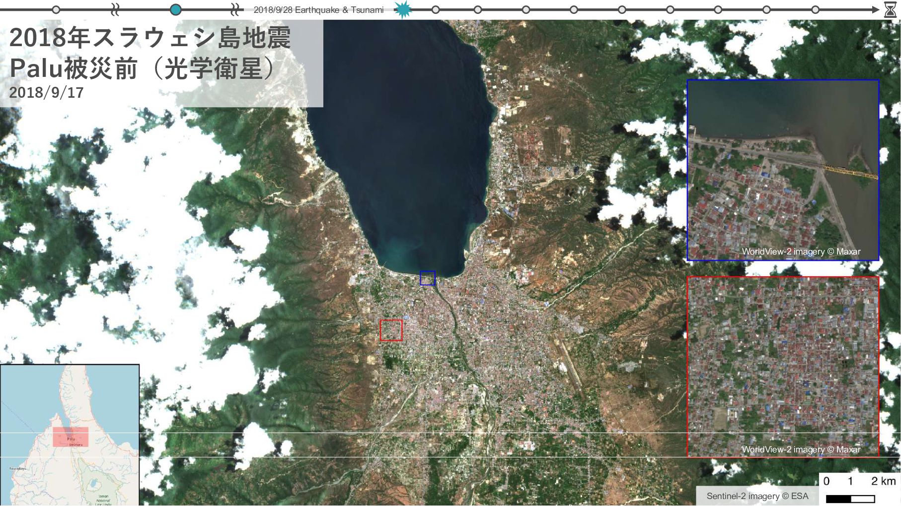
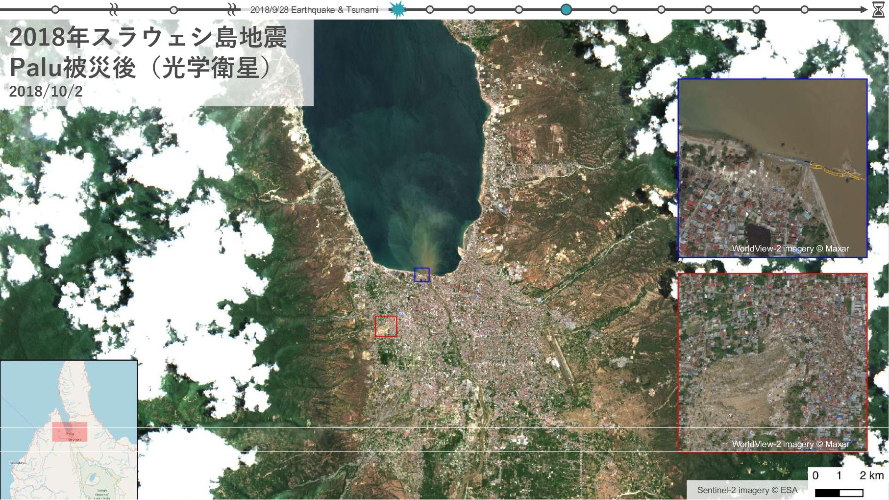
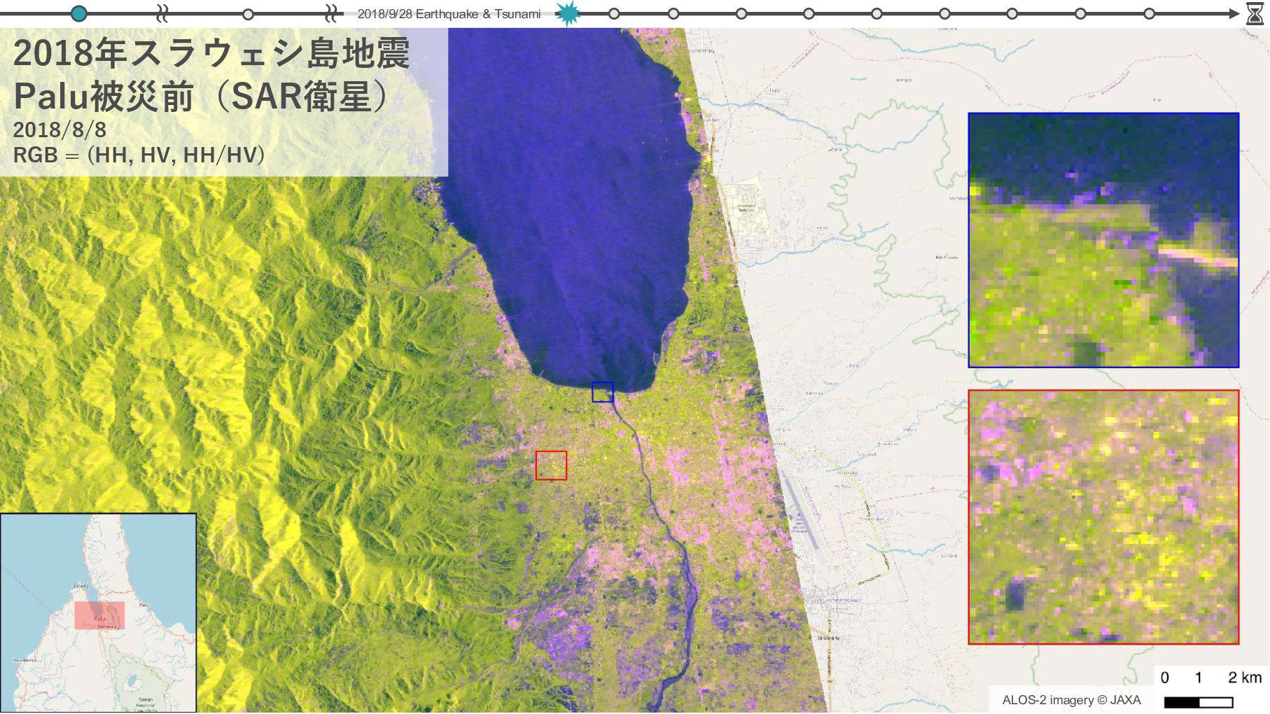
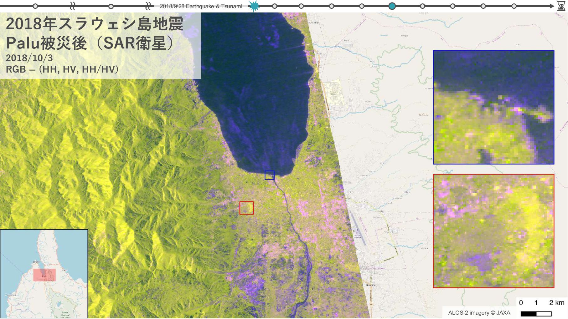
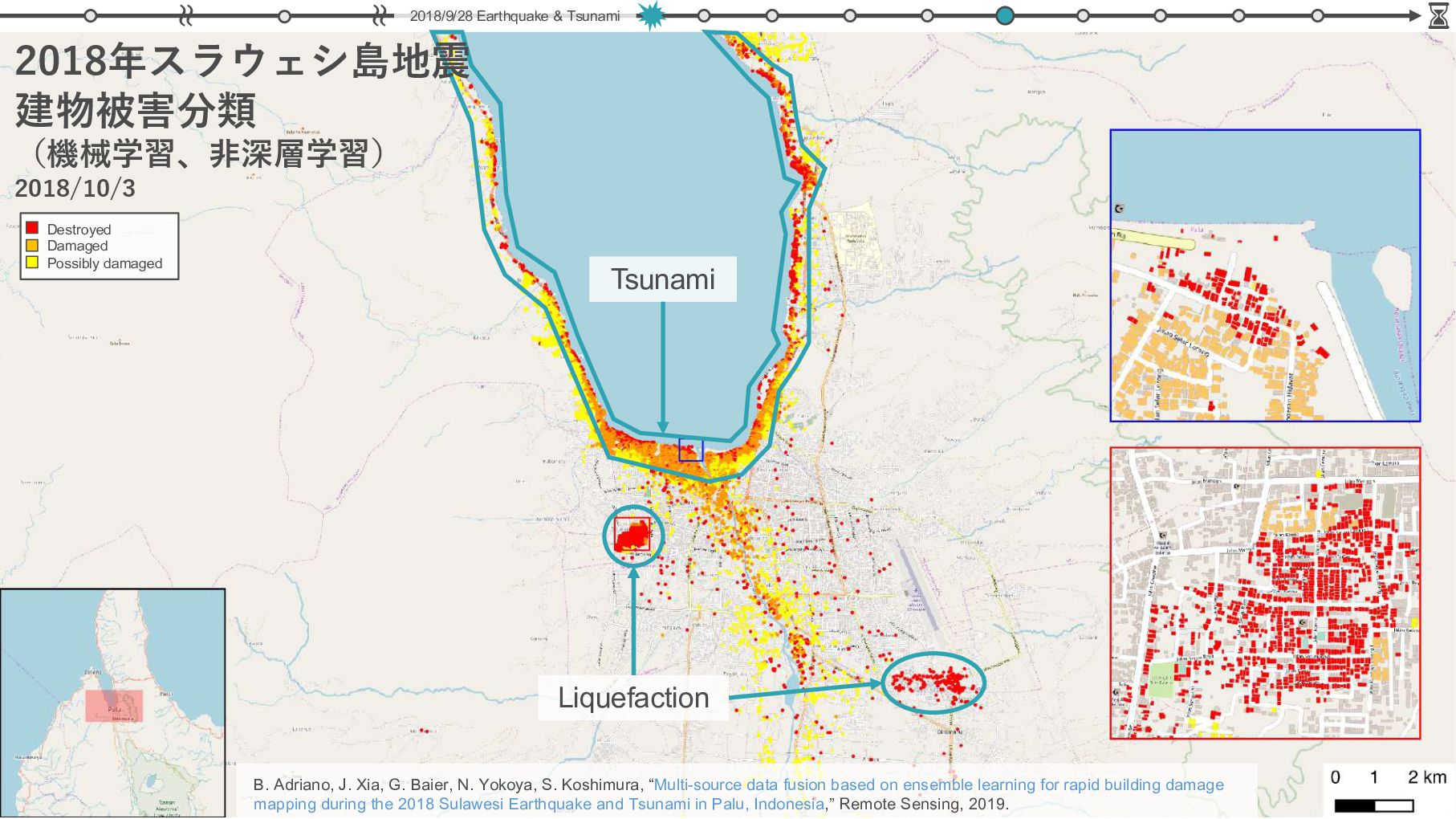
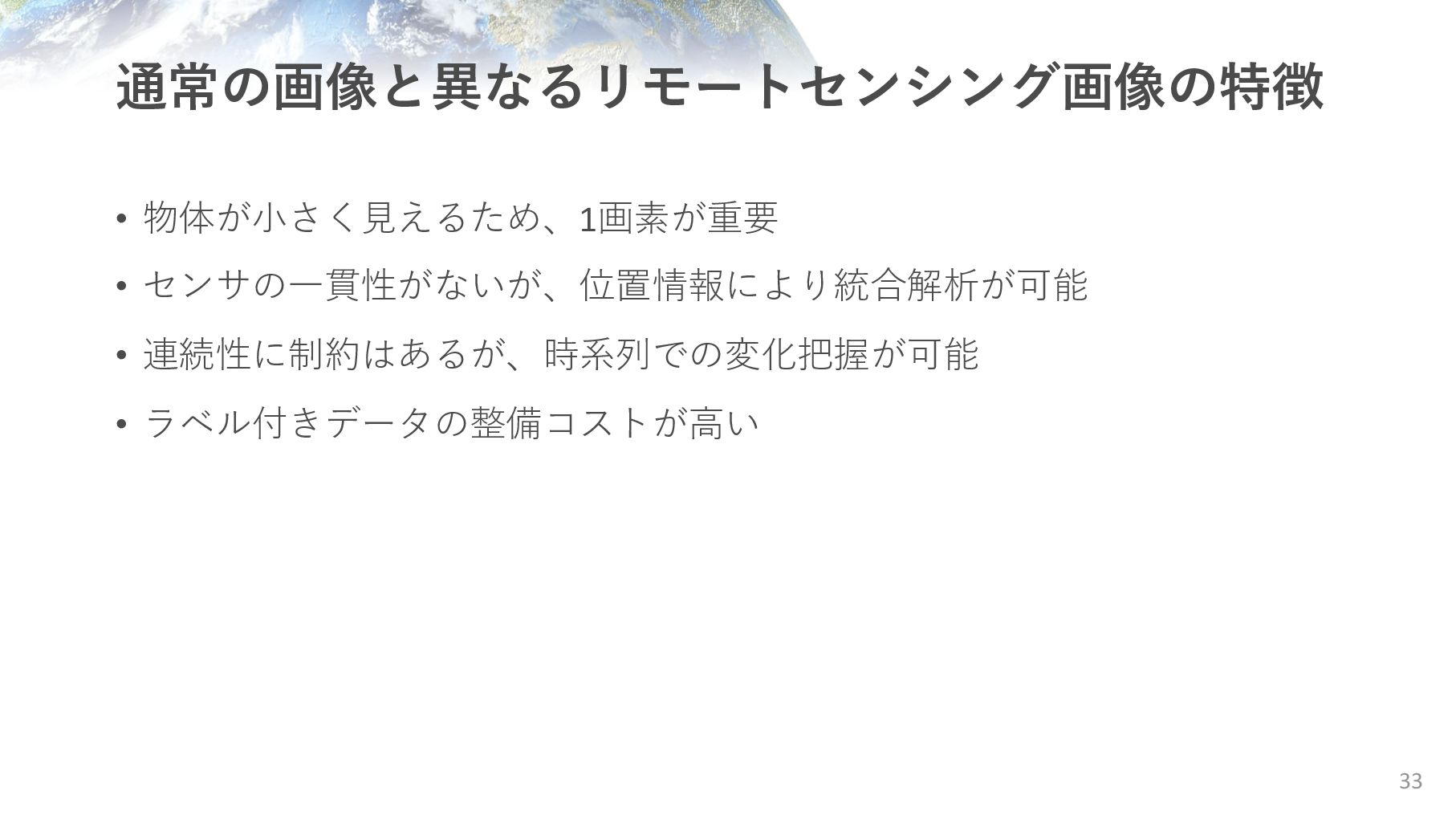
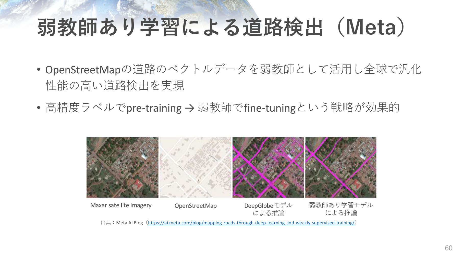
Earthquake & Tsunami Tsunami Liquefaction B. Adriano, J. Xia, G. Baier, N. Yokoya, S. Koshimura, “Multi-source data fusion based on ensemble learning for rapid building damage mapping during the 2018 Sulawesi Earthquake and Tsunami in Palu, Indonesia,” Remote Sensing, 2019. 2018年スラウェシ島地震 建物被害分類 (機械学習、⾮深層学習) 2018/10/3
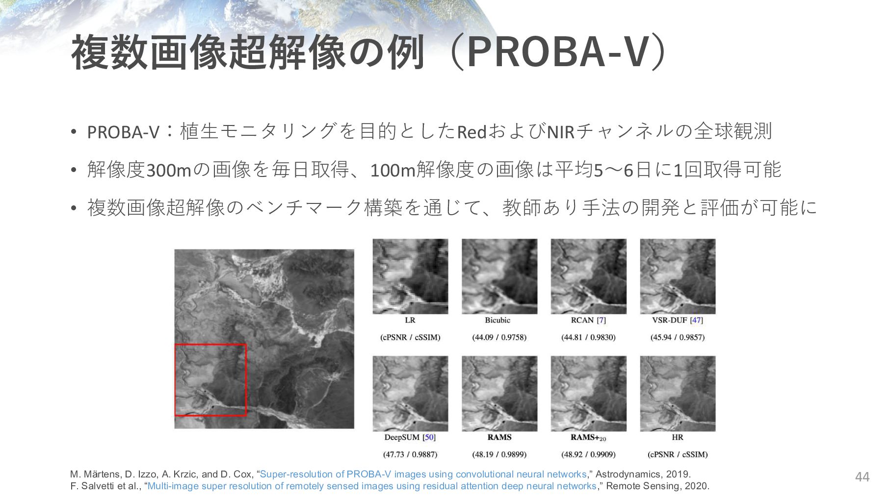
Cox, “Super-resolution of PROBA-V images using convolutional neural networks,” Astrodynamics, 2019. F. Salvetti et al., “Multi-image super resolution of remotely sensed images using residual attention deep neural networks,” Remote Sensing, 2020. • PROBA-V:植⽣モニタリングを⽬的としたRedおよびNIRチャンネルの全球観測 • 解像度300mの画像を毎⽇取得、100m解像度の画像は平均5〜6⽇に1回取得可能 • 複数画像超解像のベンチマーク構築を通じて、教師あり⼿法の開発と評価が可能に
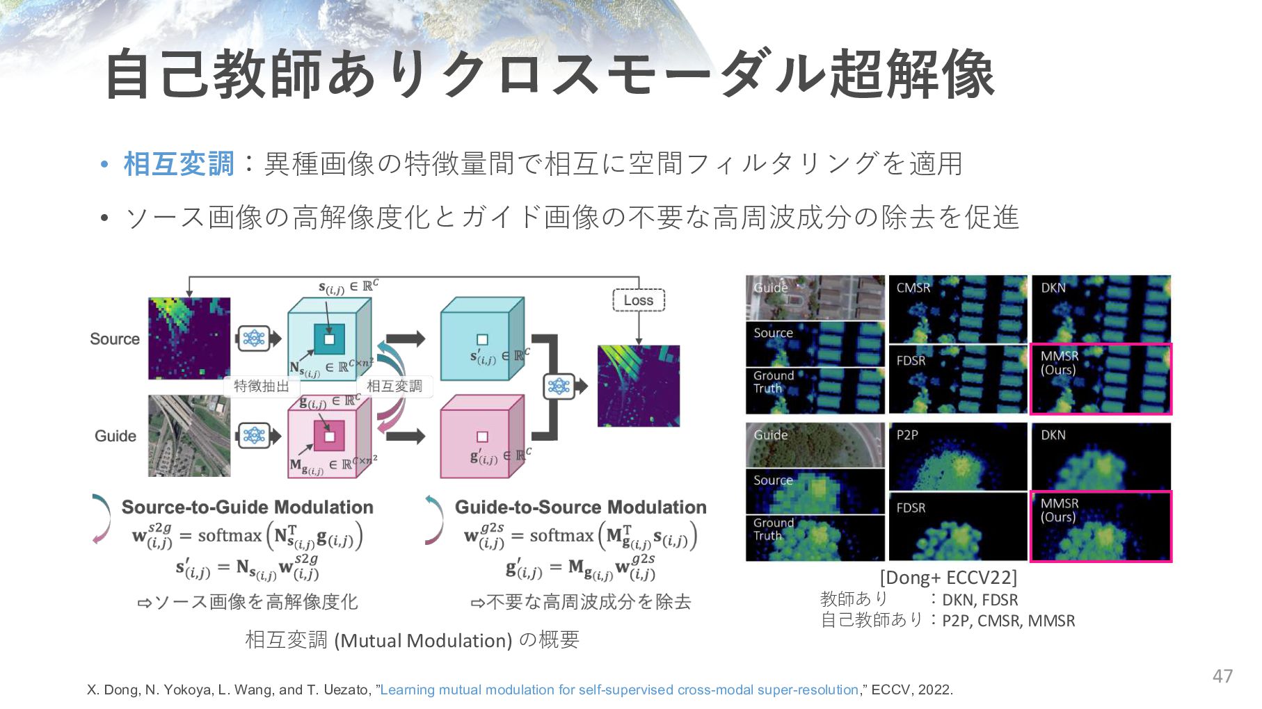
K. Schindler, “Guided super-resolution as pixel-to-pixel transformation,” ICCV, 2019. G. Shacht, D. Danon, S. Fogel, D. Cohen-Or, “Single pair cross-modality super resolution,” CVPR, 2021 X. Dong, N. Yokoya, L. Wang, and T. Uezato, “Learning mutual modulation for self-supervised cross-modal super-resolution,” ECCV, 2022. ① 解像度を落として⼊出⼒のペアを作成 [CMSR; Shacht+ CVPR21] ② 画像変換として定式化 [P2P; Lutio+ ICCV19] ③ ネットワークの帰納バイアスを活⽤ [MMSR; Dong+ ECCV22] 超解像 Down- sampling 教⽰ 画像 変換 Down- sampling 教⽰ 超解像 教⽰
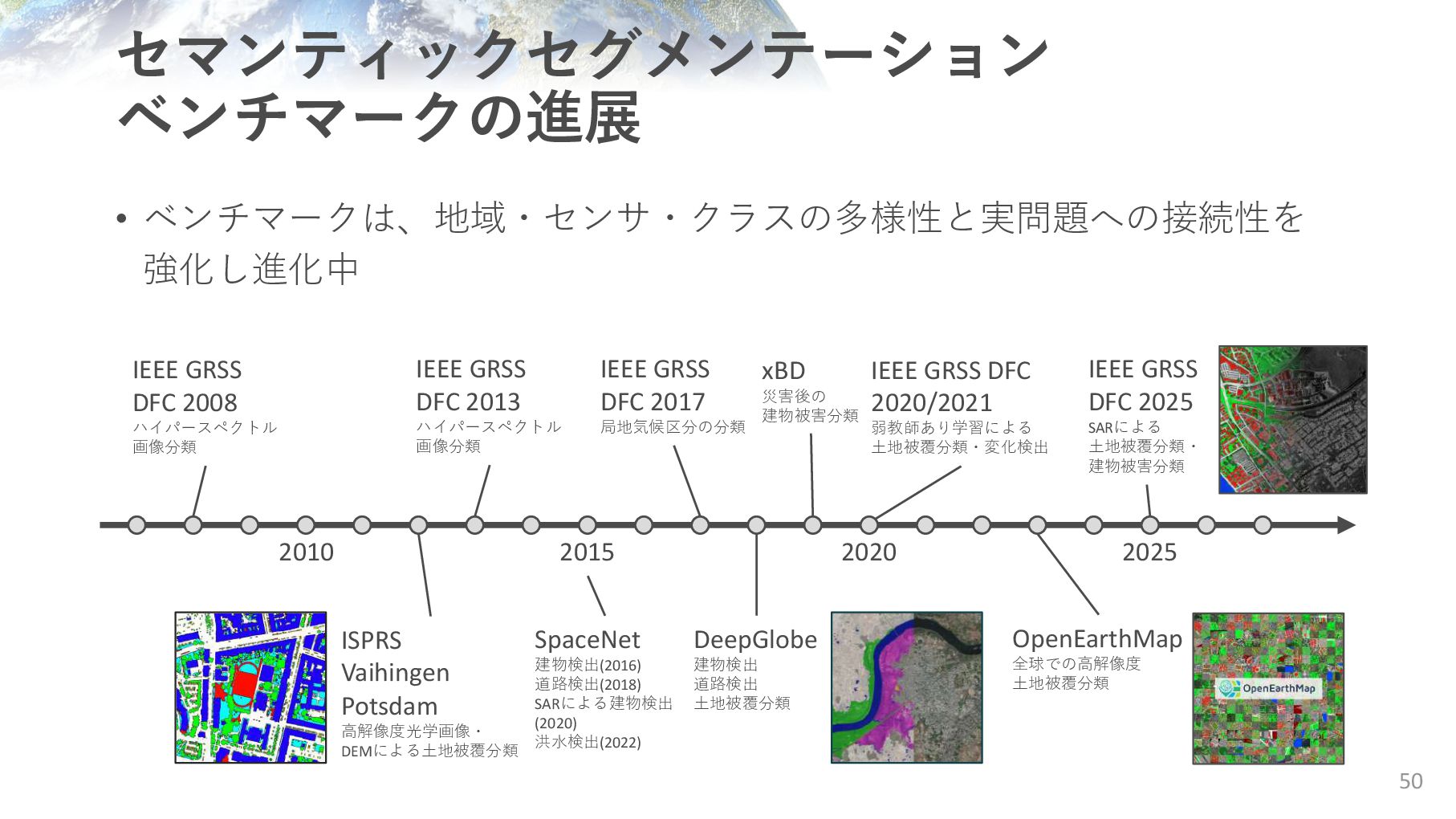
GSD以下の最初の全球⼟地被覆分類地図 • WorldCover (ESA, 2021) ◦ Sentinel-1 & 2×Random Forest ◦ 現地調査データ(LUCAS)や既存地図を使⽤ • Esri Land Cover Map (2021) ◦ Sentinel-2×CNN、⼿動アノテーション ◦ 年次更新型 • Dynamic World (Google x WRI, 2022) ◦ Sentinel-2×CNN、⼿動アノテーション ◦ 観測毎に地図を更新 48 J. Chen et al., “Global land cover mapping at 30 m resolution: A POK-based operational approach,” ISPRS J. Photogram. Remote Sens. 2014. C. Brown et al., “Dynamic World, Near real-time global 10m land use land cover mapping,” Scientific Data, 2022. https://esa-worldcover.org/ http://www.globallandcover.com/
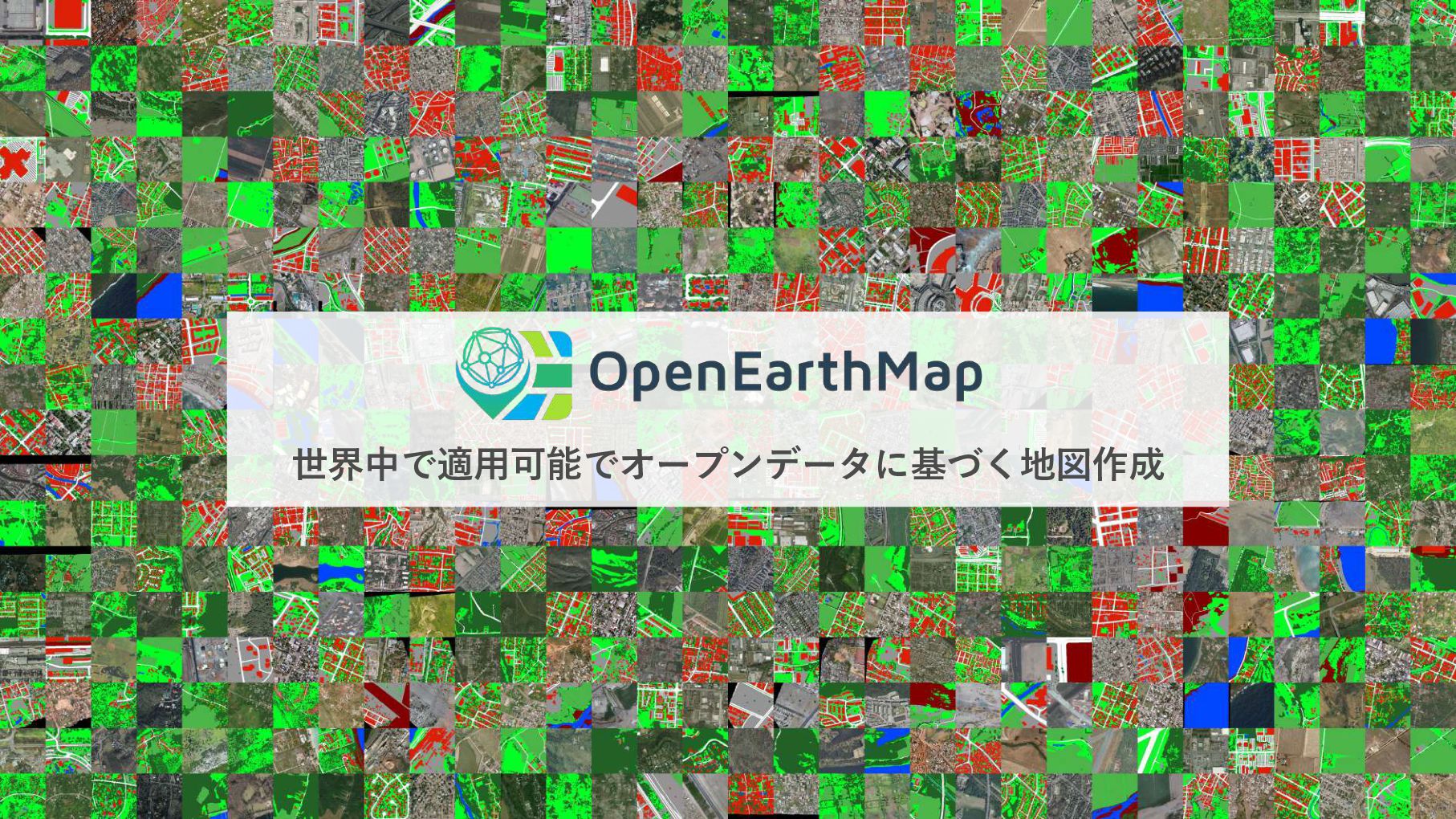
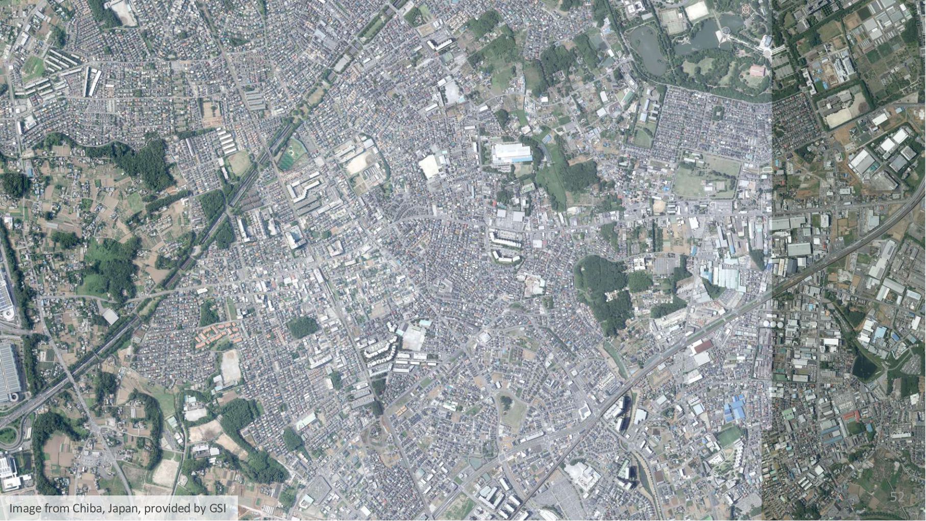
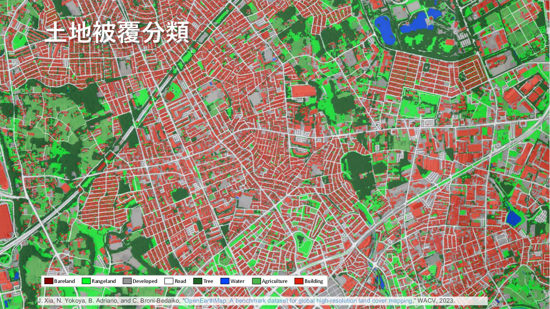
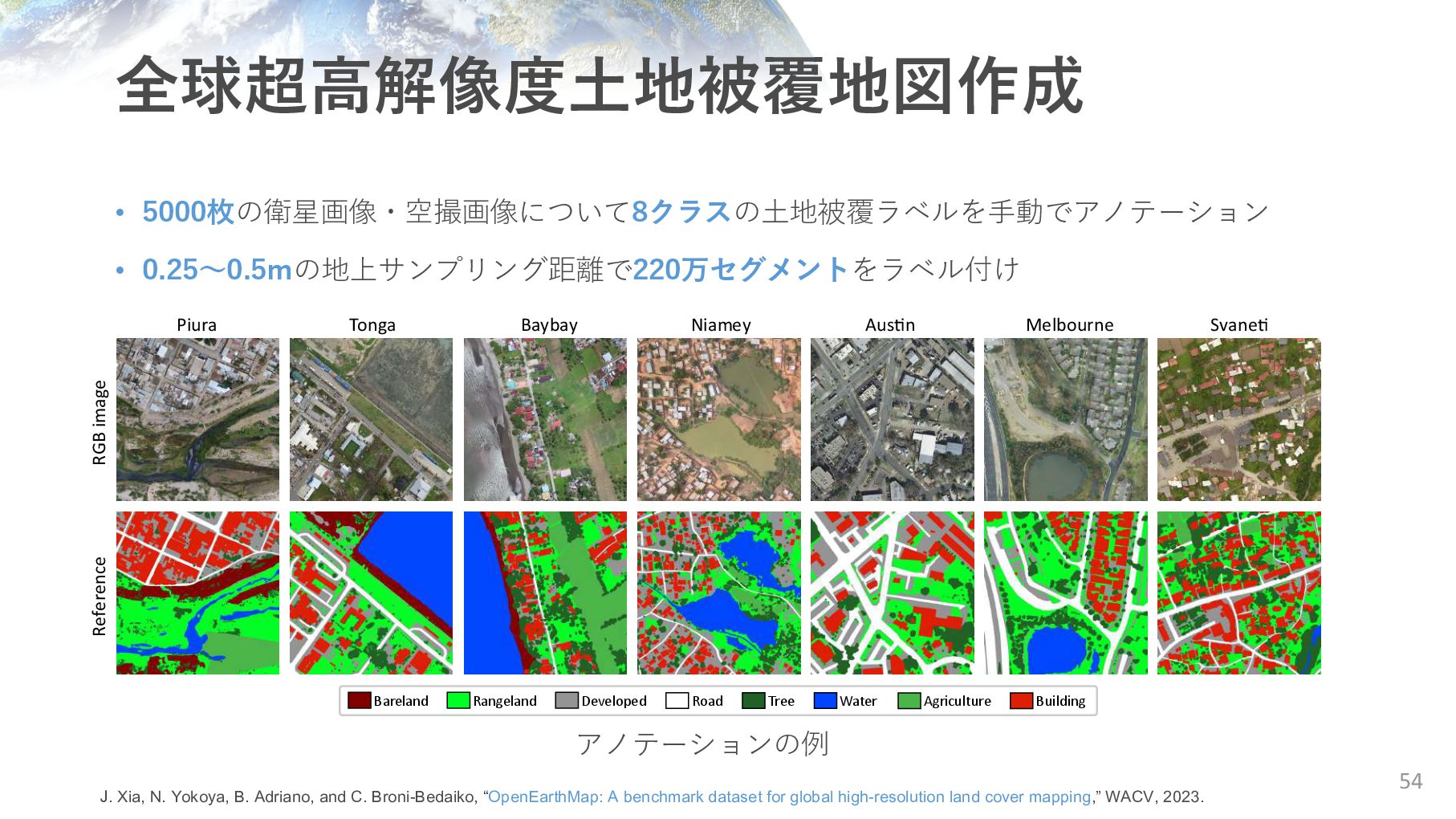
Developed Road Tree Water Agriculture Building J. Xia, N. Yokoya, B. Adriano, and C. Broni-Bedaiko, “OpenEarthMap: A benchmark dataset for global high-resolution land cover mapping,” WACV, 2023.
Tonga Baybay Niamey Austin Melbourne Svaneti Bareland Rangeland Developed Road Tree Water Agriculture Building アノテーションの例 J. Xia, N. Yokoya, B. Adriano, and C. Broni-Bedaiko, “OpenEarthMap: A benchmark dataset for global high-resolution land cover mapping,” WACV, 2023.
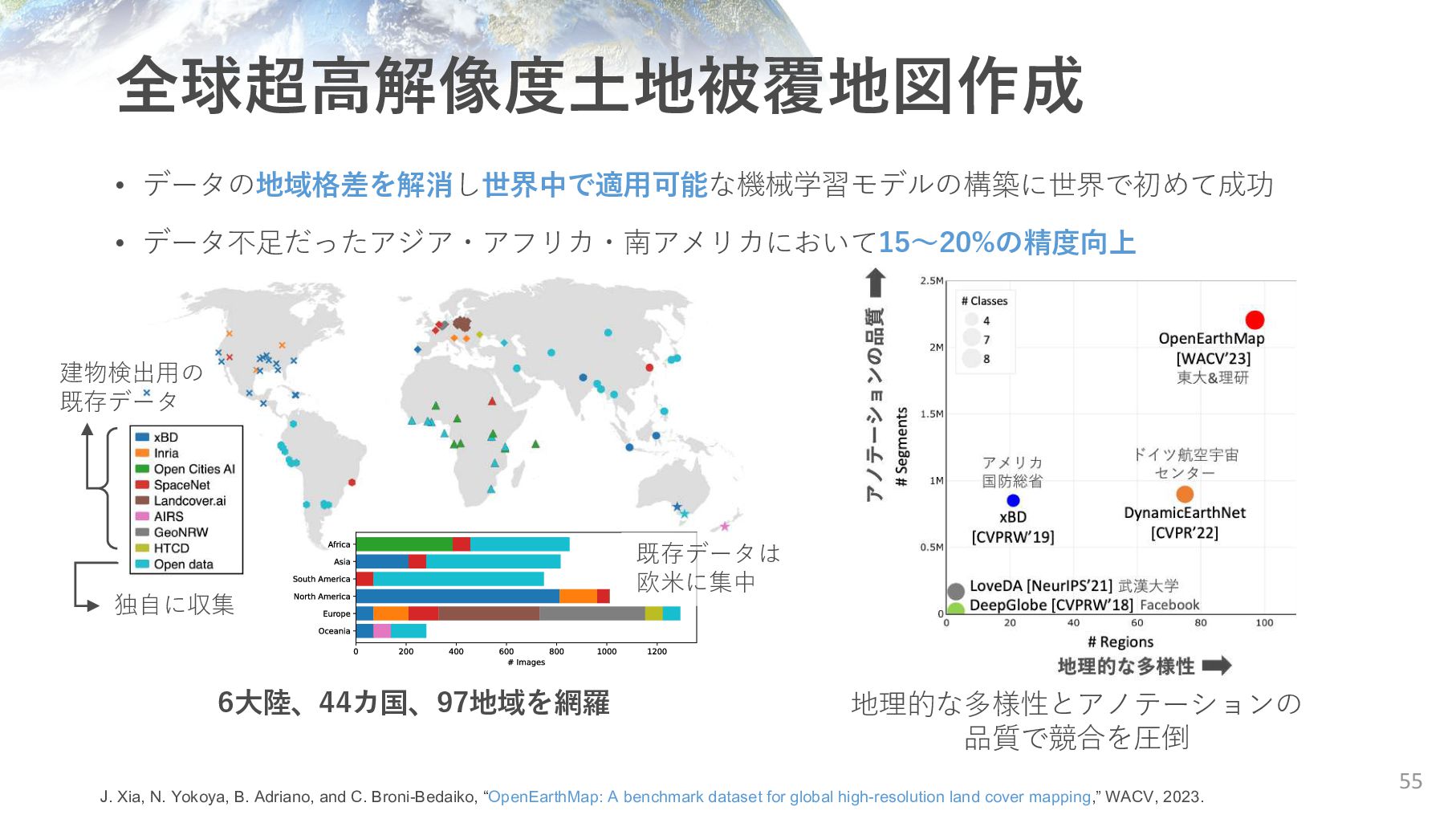
既存データ 独⾃に収集 既存データは 欧⽶に集中 J. Xia, N. Yokoya, B. Adriano, and C. Broni-Bedaiko, “OpenEarthMap: A benchmark dataset for global high-resolution land cover mapping,” WACV, 2023.
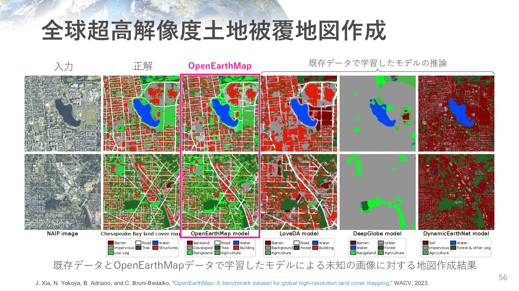
Chesapeake Bay land cover map Bareland Developed Rangeland Road Tree Agriculture Water Building Barren Impervious Low veg Road Tree Water Structures Barren Background Agriculture Road Forest Water Building Barren Water Rangeland Urban Forest Agriculture Soil Impervious Agriculture Water Forest & other veg 全球超⾼解像度⼟地被覆地図作成 56 既存データとOpenEarthMapデータで学習したモデルによる未知の画像に対する地図作成結果 ⼊⼒ 正解 OpenEarthMap 既存データで学習したモデルの推論 J. Xia, N. Yokoya, B. Adriano, and C. Broni-Bedaiko, “OpenEarthMap: A benchmark dataset for global high-resolution land cover mapping,” WACV, 2023.
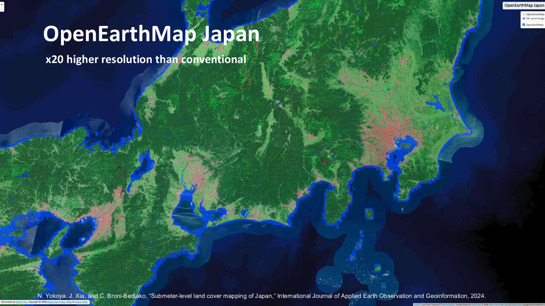
”Submeter-level land cover mapping of Japan,” International Journal of Applied Earth Observation and Geoinformation, 2024. x20 higher resolution than conventional
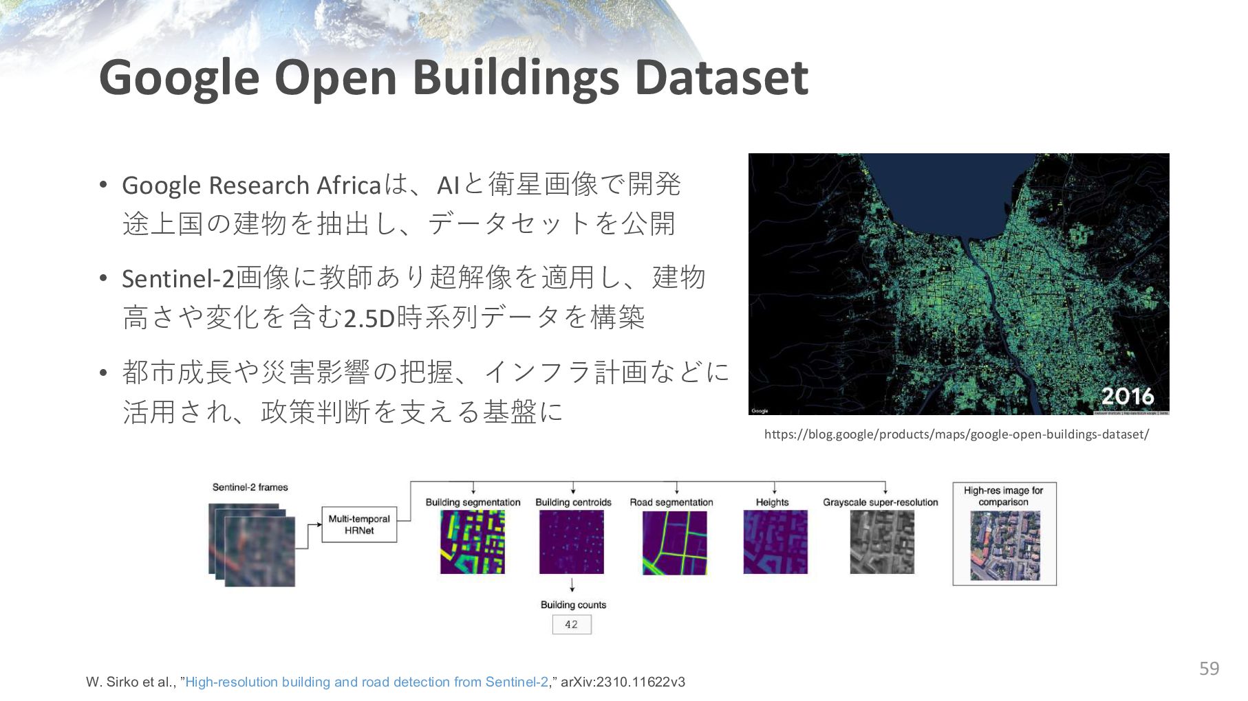
Sentinel-2画像に教師あり超解像を適⽤し、建物 ⾼さや変化を含む2.5D時系列データを構築 • 都市成⻑や災害影響の把握、インフラ計画などに 活⽤され、政策判断を⽀える基盤に 59 https://blog.google/products/maps/google-open-buildings-dataset/ W. Sirko et al., ”High-resolution building and road detection from Sentinel-2,” arXiv:2310.11622v3
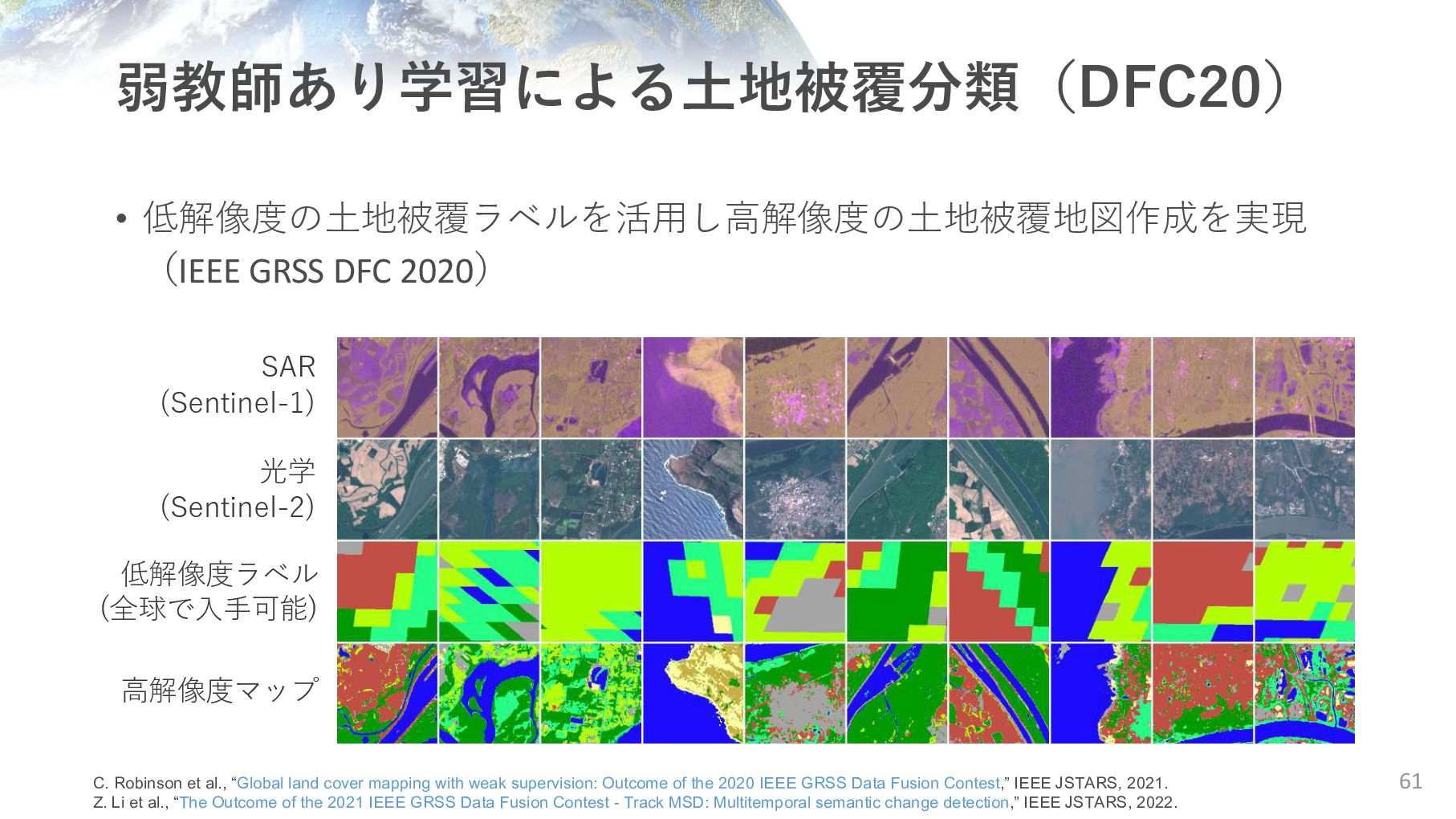
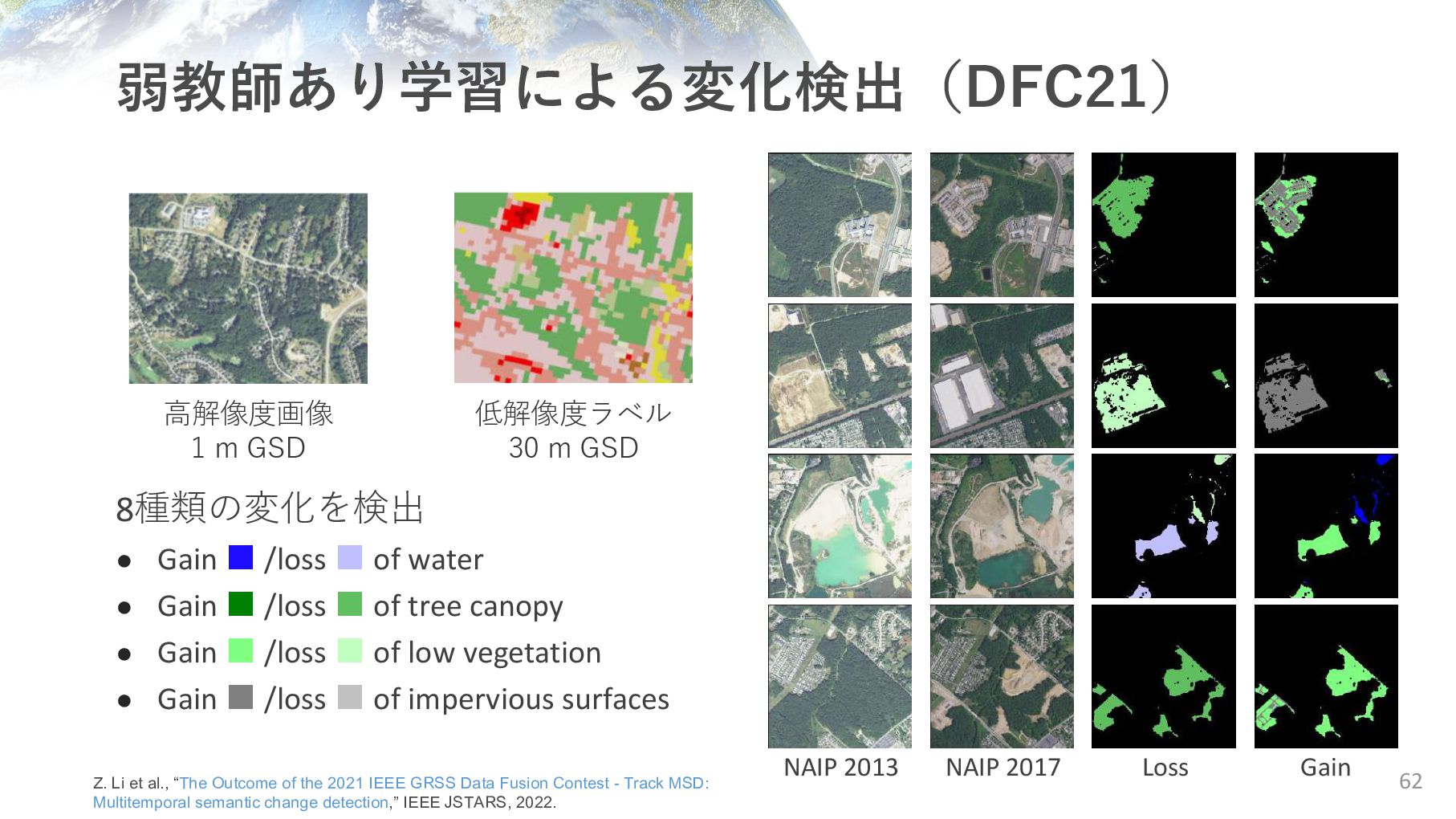
光学 (Sentinel-2) 低解像度ラベル (全球で⼊⼿可能) ⾼解像度マップ C. Robinson et al., “Global land cover mapping with weak supervision: Outcome of the 2020 IEEE GRSS Data Fusion Contest,” IEEE JSTARS, 2021. Z. Li et al., “The Outcome of the 2021 IEEE GRSS Data Fusion Contest - Track MSD: Multitemporal semantic change detection,” IEEE JSTARS, 2022.
2021 IEEE GRSS Data Fusion Contest - Track MSD: Multitemporal semantic change detection,” IEEE JSTARS, 2022. 8種類の変化を検出 • Gain ▪ /loss ▪ of water • Gain ▪ /loss ▪ of tree canopy • Gain ▪ /loss ▪ of low vegetation • Gain ▪ /loss ▪ of impervious surfaces NAIP 2013 NAIP 2017 Loss Gain ⾼解像度画像 1 m GSD 低解像度ラベル 30 m GSD
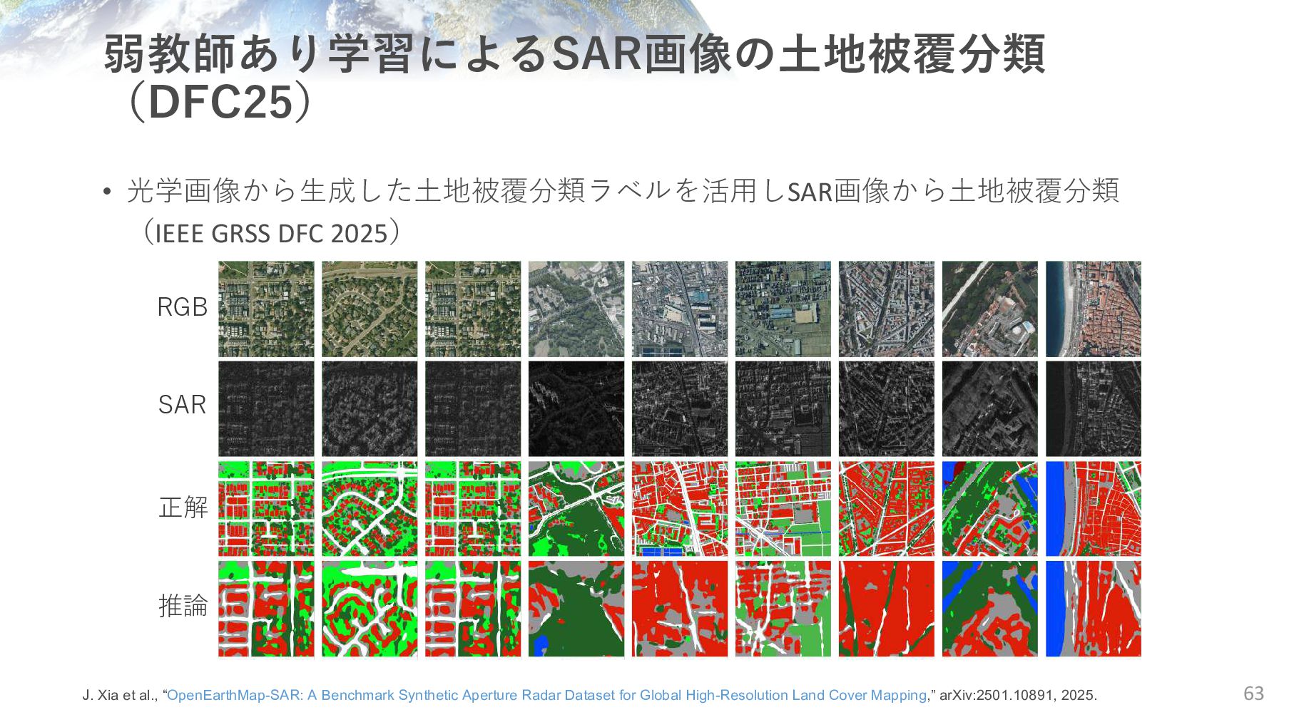
Xia et al., “OpenEarthMap-SAR: A Benchmark Synthetic Aperture Radar Dataset for Global High-Resolution Land Cover Mapping,” arXiv:2501.10891, 2025. RGB SAR 正解 推論
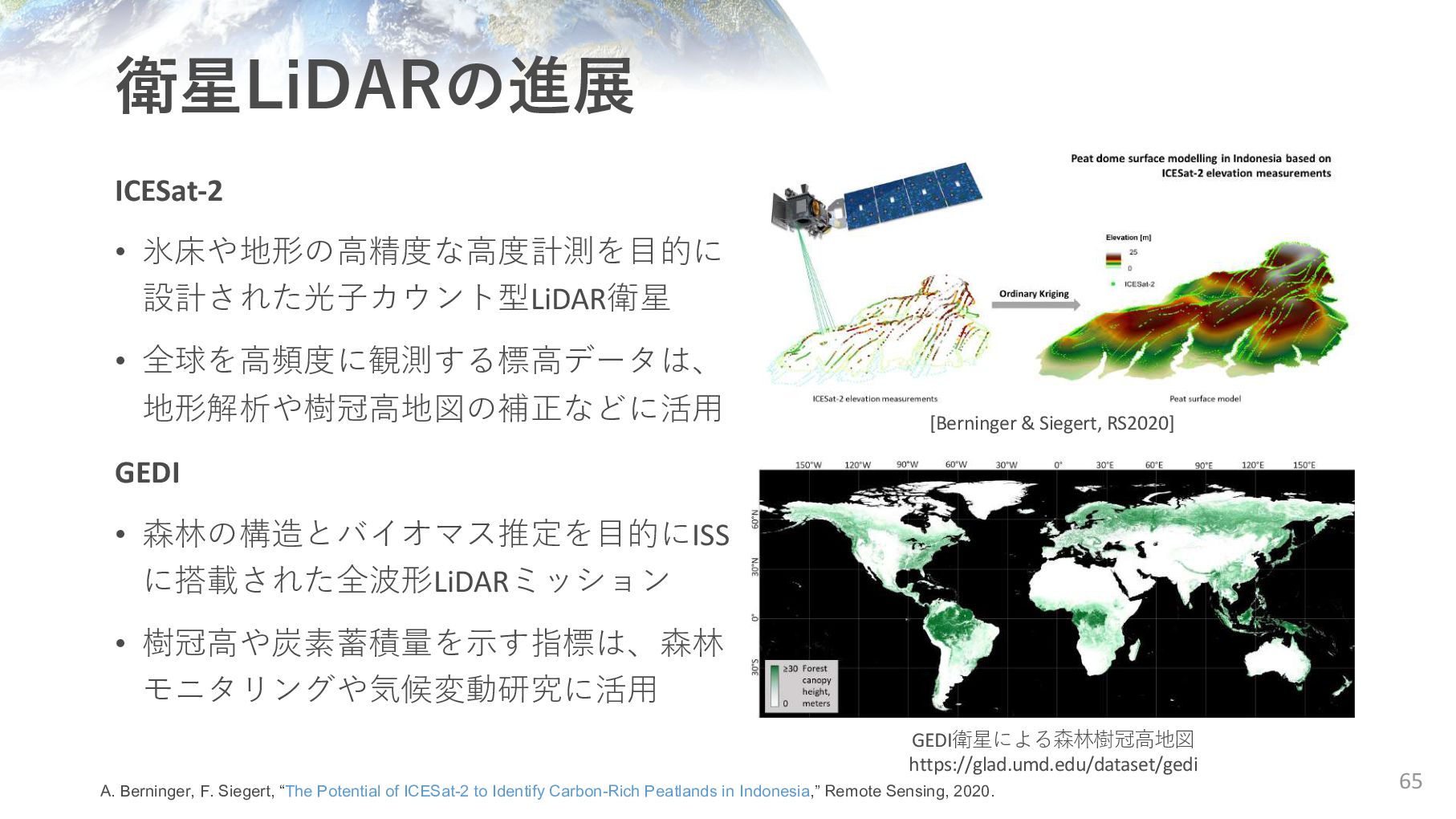
• 森林の構造とバイオマス推定を⽬的にISS に搭載された全波形LiDARミッション • 樹冠⾼や炭素蓄積量を⽰す指標は、森林 モニタリングや気候変動研究に活⽤ GEDI衛星による森林樹冠⾼地図 https://glad.umd.edu/dataset/gedi A. Berninger, F. Siegert, “The Potential of ICESat-2 to Identify Carbon-Rich Peatlands in Indonesia,” Remote Sensing, 2020. [Berninger & Siegert, RS2020]
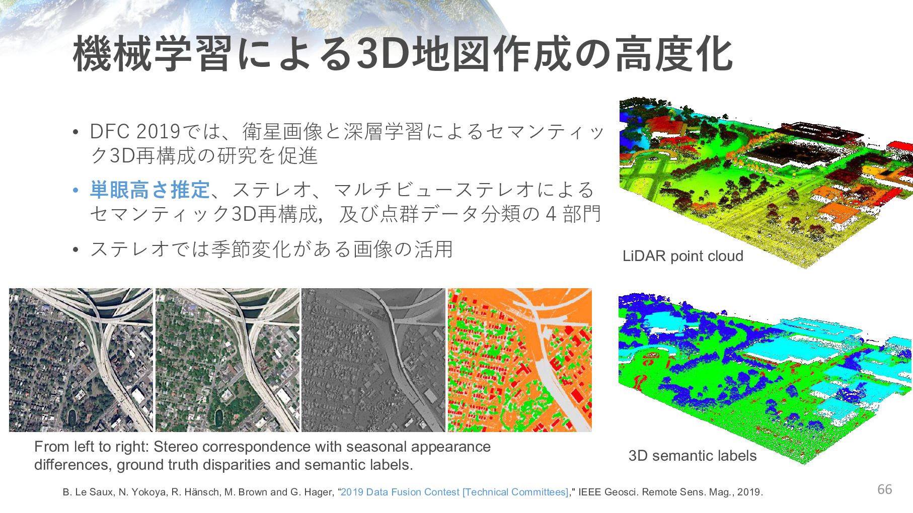
ステレオでは季節変化がある画像の活⽤ From left to right: Stereo correspondence with seasonal appearance differences, ground truth disparities and semantic labels. LiDAR point cloud 3D semantic labels B. Le Saux, N. Yokoya, R. Hänsch, M. Brown and G. Hager, “2019 Data Fusion Contest [Technical Committees]," IEEE Geosci. Remote Sens. Mag., 2019.
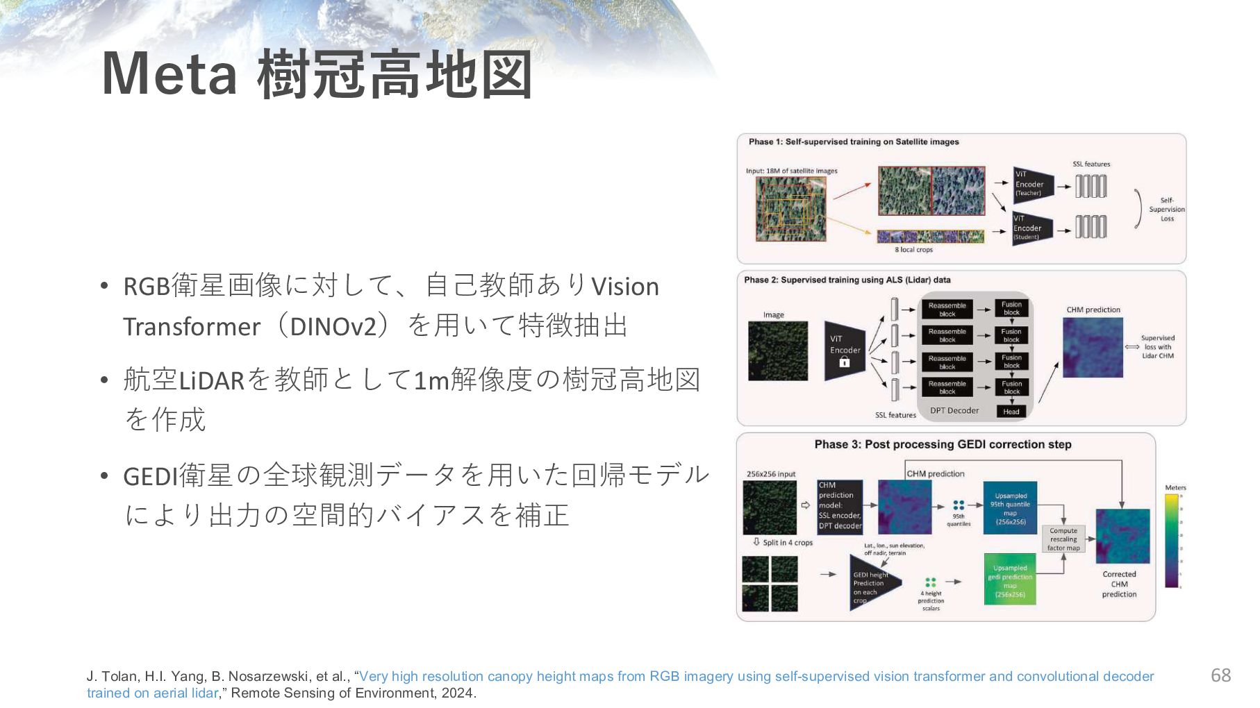
により出⼒の空間的バイアスを補正 68 J. Tolan, H.I. Yang, B. Nosarzewski, et al., “Very high resolution canopy height maps from RGB imagery using self-supervised vision transformer and convolutional decoder trained on aerial lidar,” Remote Sensing of Environment, 2024.
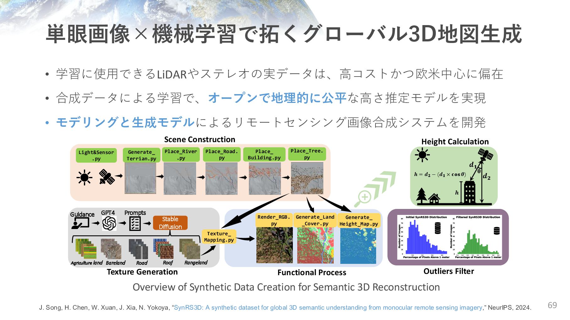
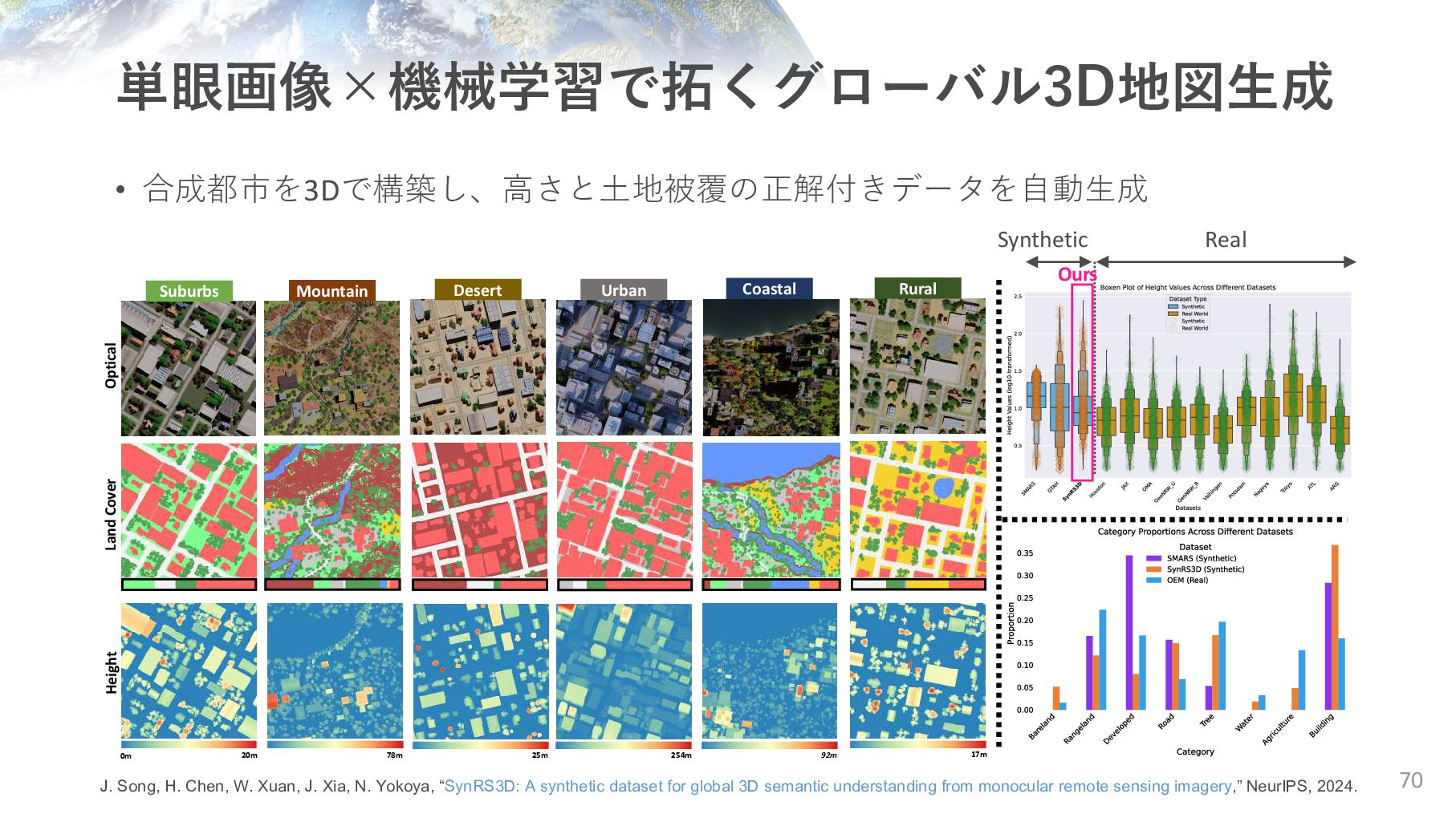
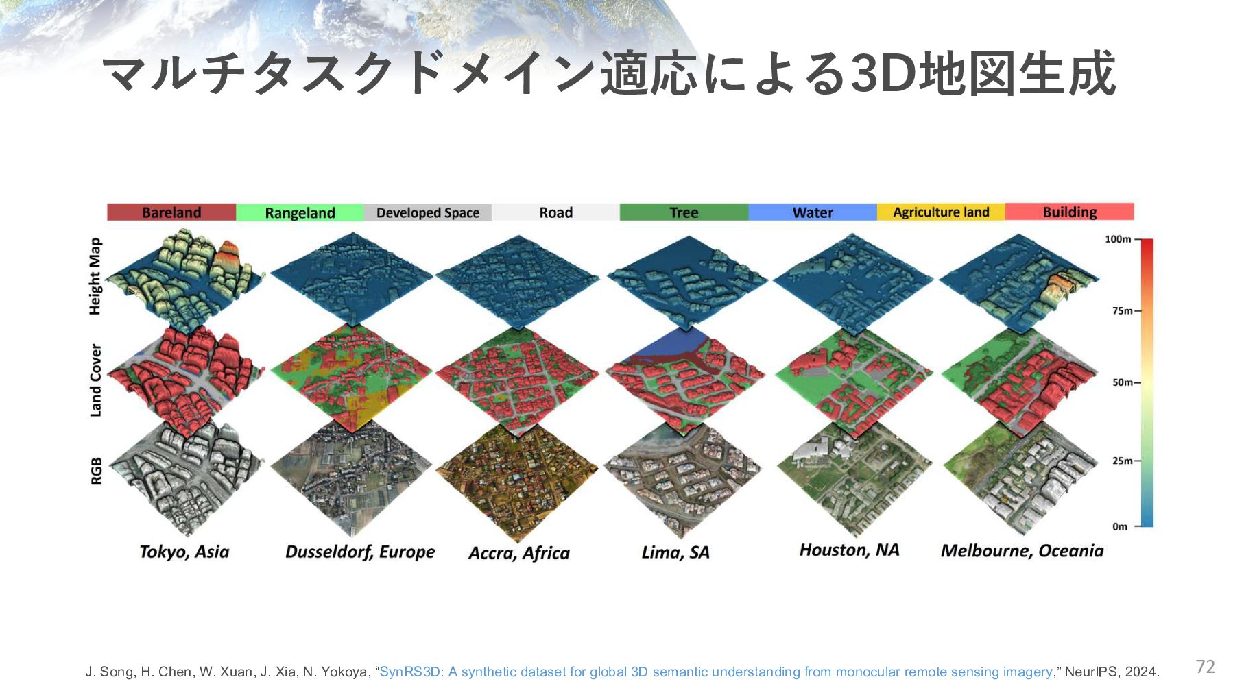
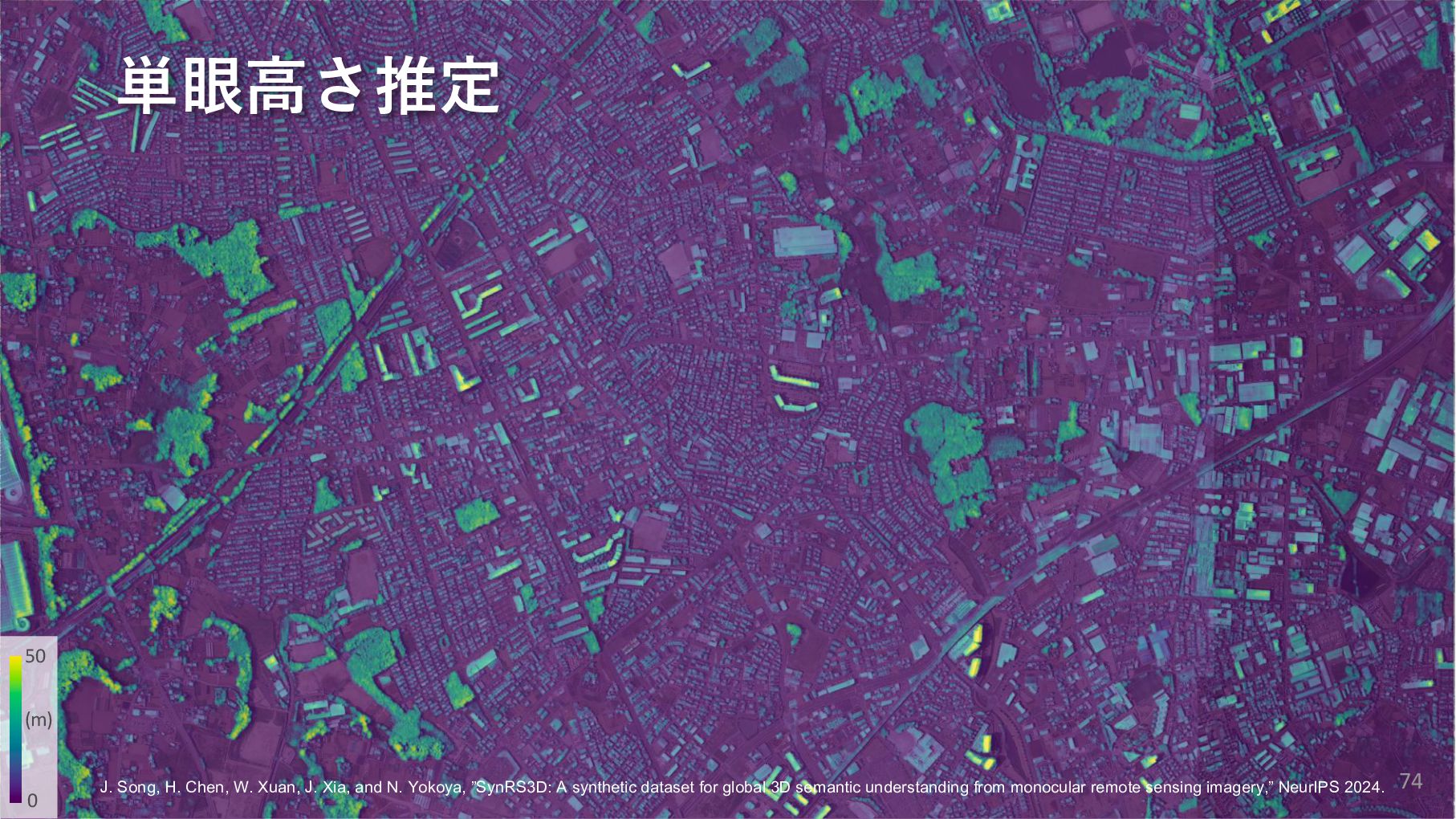
N. Yokoya, “SynRS3D: A synthetic dataset for global 3D semantic understanding from monocular remote sensing imagery,” NeurIPS, 2024. Suburbs Mountain Desert Urban Coastal Rural 0m 20m 78m 25m 254m 92m 17m Optical Land Cover Height Synthetic Real Ours • 合成都市を3Dで構築し、⾼さと⼟地被覆の正解付きデータを⾃動⽣成
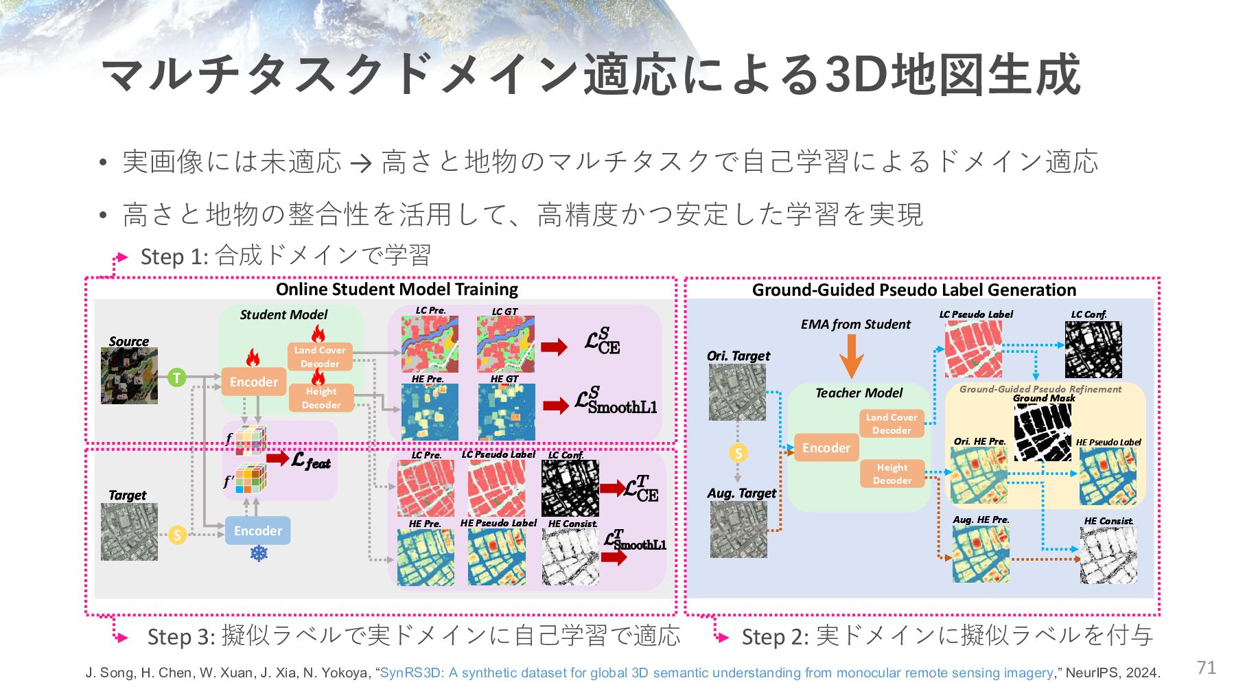
H. Chen, W. Xuan, J. Xia, N. Yokoya, “SynRS3D: A synthetic dataset for global 3D semantic understanding from monocular remote sensing imagery,” NeurIPS, 2024. Land Cover Decoder Height Decoder T S 𝒇 𝒇′ Source Source Source Target Target Target LC GT LC GT LC Pre. LC Pre. HE Pre. HE Pre. HE Pre. HE GT HE GT HE GT LC Pre. LC Pre. LC Pre. HE Pre. HE Pre. HE Pre. LC Pseudo Label LC Pseudo Label LC Pseudo Label HE Pseudo Label HE Pseudo Label HE Pseudo Label HE Consist. HE Consist. HE Consist. LC Conf. LC Conf. LC Conf. Student Model EMA from Student S Encoder Land Cover Decoder Teacher Model Teacher Model Height Decoder Encoder Land Cover Decoder Teacher Model Height Decoder Ori. Target Ori. Target Ori. Target Aug. Target Aug. Target Aug. Target HE Consist. HE Consist. HE Consist. LC Conf. LC Conf. LC Conf. LC Pseudo Label LC Pseudo Label LC Pseudo Label Ground-Guided Pseudo Refinement Ground-Guided Pseudo Refinement Ground-Guided Pseudo Refinement Encoder Encoder Ori. HE Pre. Ori. HE Pre. Ori. HE Pre. Aug. HE Pre. Aug. HE Pre. Aug. HE Pre. HE Pseudo Label HE Pseudo Label Ground Mask Ground Mask Ground Mask Online Student Model Training Ground-Guided Pseudo Label Generation Step 2: 実ドメインに擬似ラベルを付与 Step 3: 擬似ラベルで実ドメインに⾃⼰学習で適応 Step 1: 合成ドメインで学習
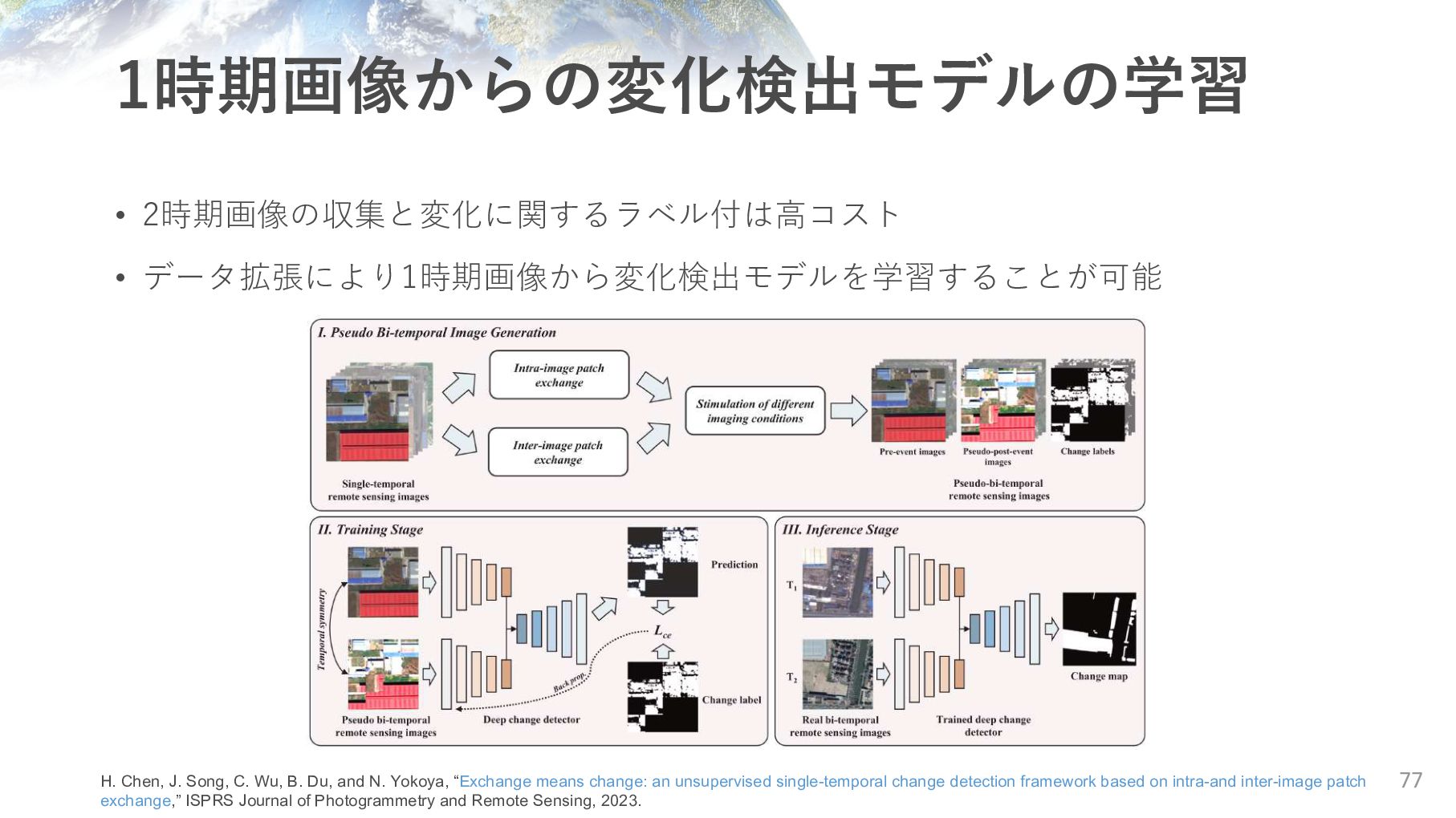
C. Wu, B. Du, and N. Yokoya, “Exchange means change: an unsupervised single-temporal change detection framework based on intra-and inter-image patch exchange,” ISPRS Journal of Photogrammetry and Remote Sensing, 2023.
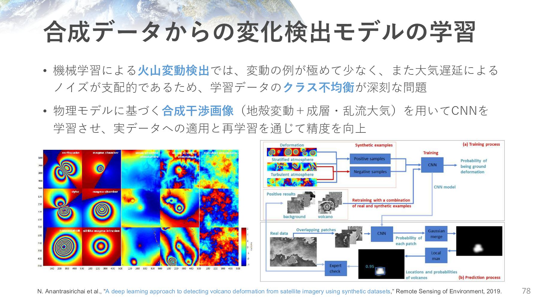
et al., “A deep learning approach to detecting volcano deformation from satellite imagery using synthetic datasets,” Remote Sensing of Environment, 2019.
Mask 79 J. Song, H. Chen, W. Xuan, J. Xia, and N. Yokoya, “SynRS3D: A synthetic dataset for global 3D semantic understanding from monocular remote sensing imagery,” NeurIPS 2024. • 2時期画像の収集と建物の変化に関するラベル付は⾼コスト • 実データに加え、⼿続き型モデリングと⽣成モデルで作成した2時期の合成画像と 変化マスクを併⽤して学習し、建物変化検出モデルの汎化性能を向上 国⼟地理院 空撮画像
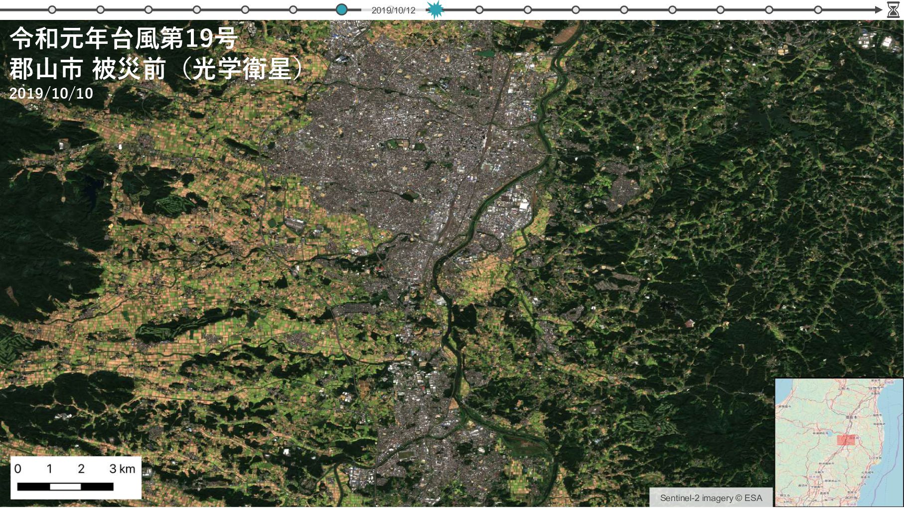
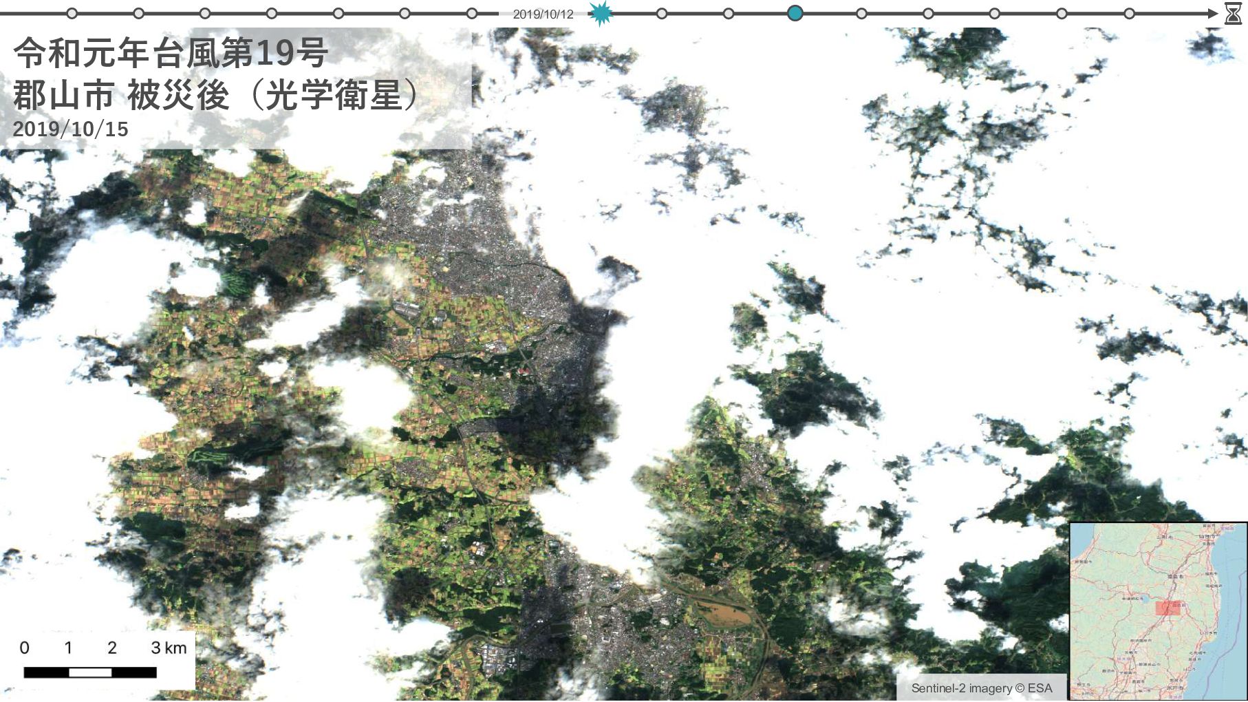
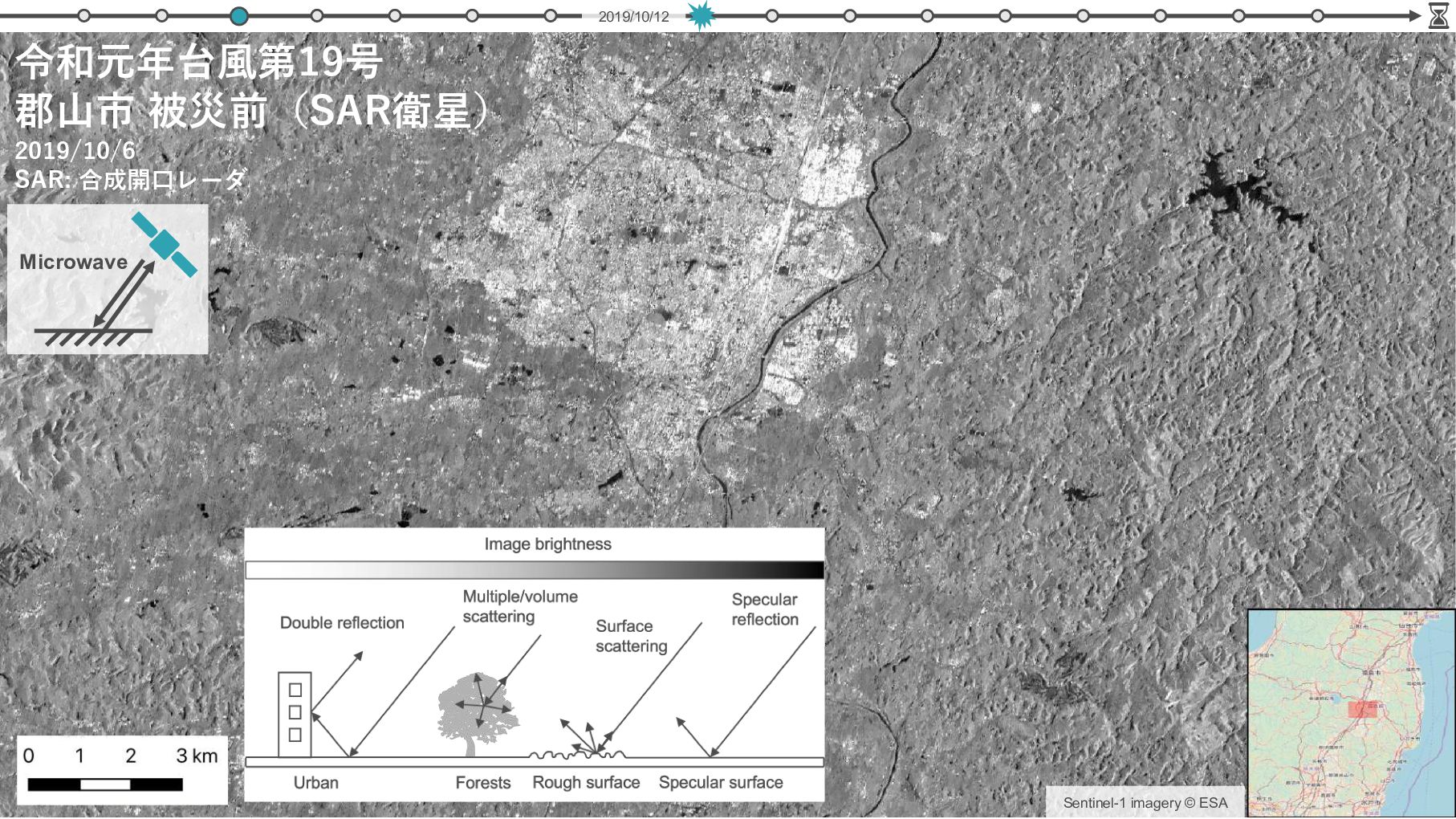
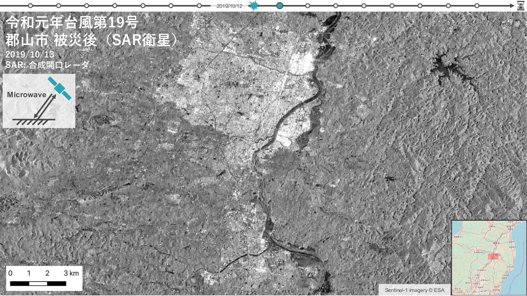
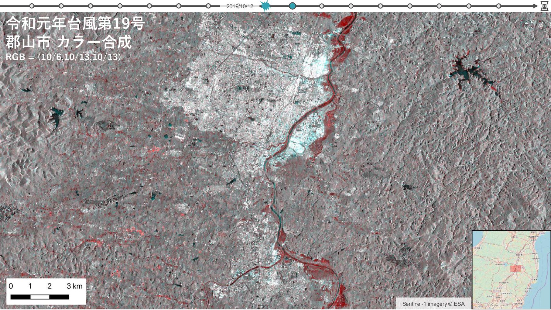
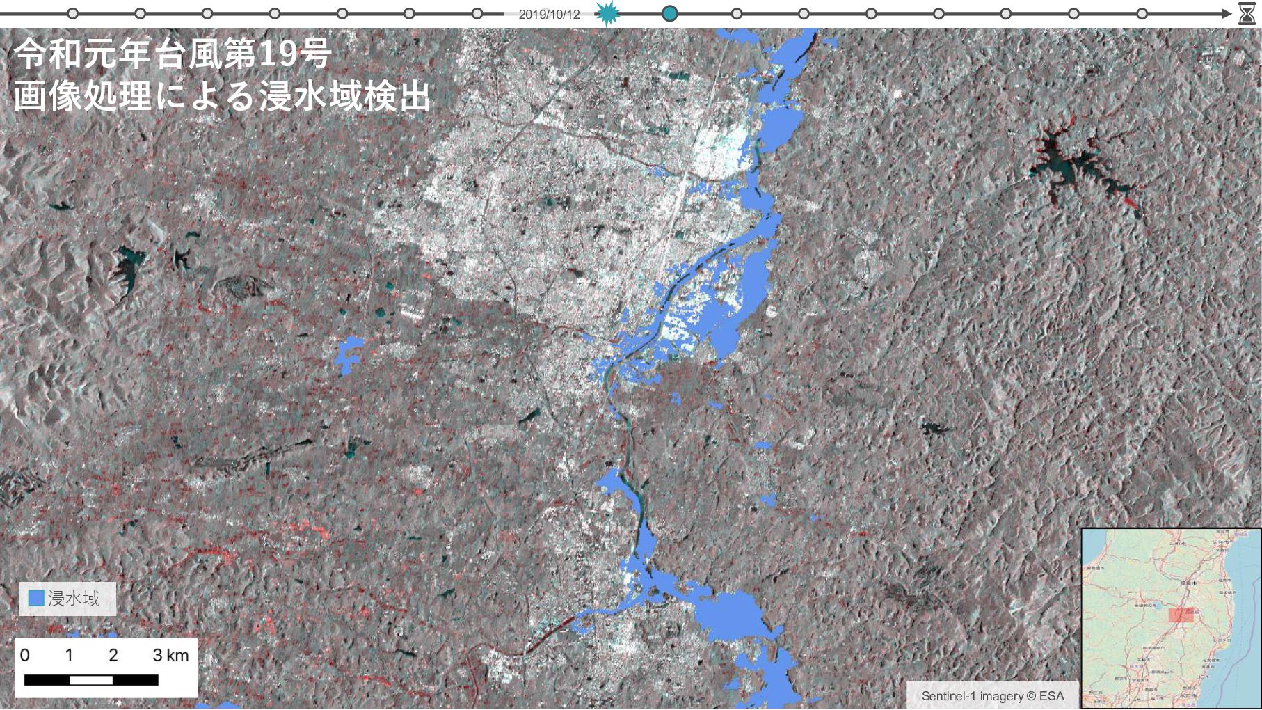
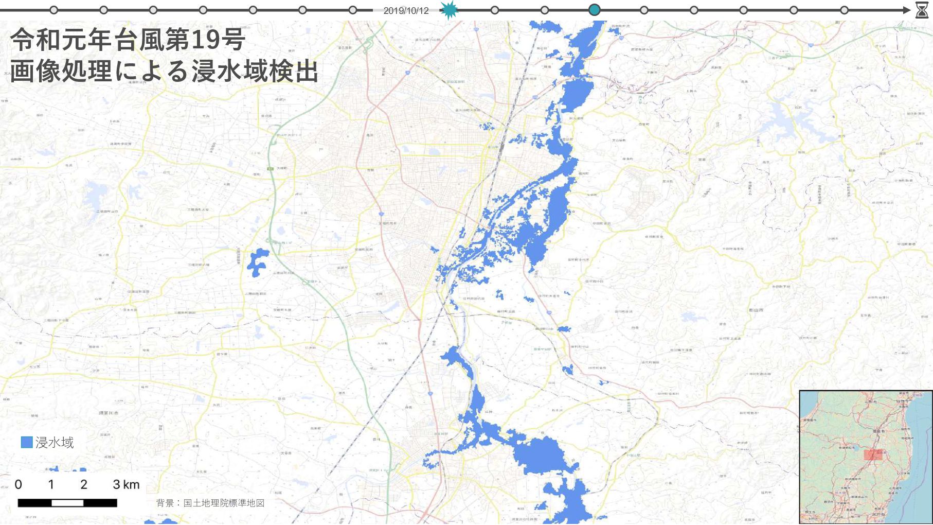
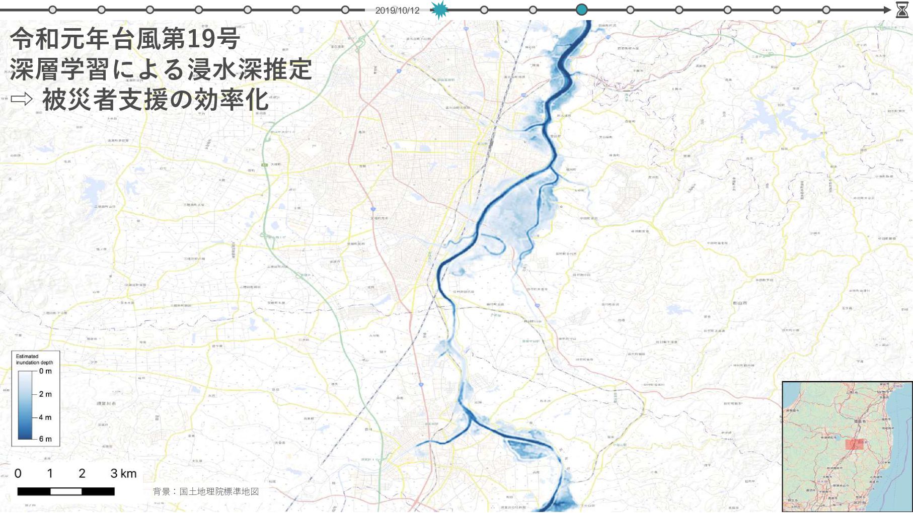
擬似3次元変化データ 実3次元変化推定 衛星画像 変化検出 事前 学習 ⾮常時の 即時推定 ⼟⽯流・洪⽔ シミュレーション 災害直後 災害前 3 m -3 m CNN 地形データ 変換 N. Yokoya et al., ”Breaking limits of remote sensing by deep learning from simulated data for flood and debris flow mapping,” IEEE Trans. Geosci. Remote Sens., 2022.
推論結果 被災前 RGB H. Chen et al., ” BRIGHT: A globally distributed multimodal building damage assessment dataset with very-high-resolution for all-weather disaster response,” arXiv:2501.06019.
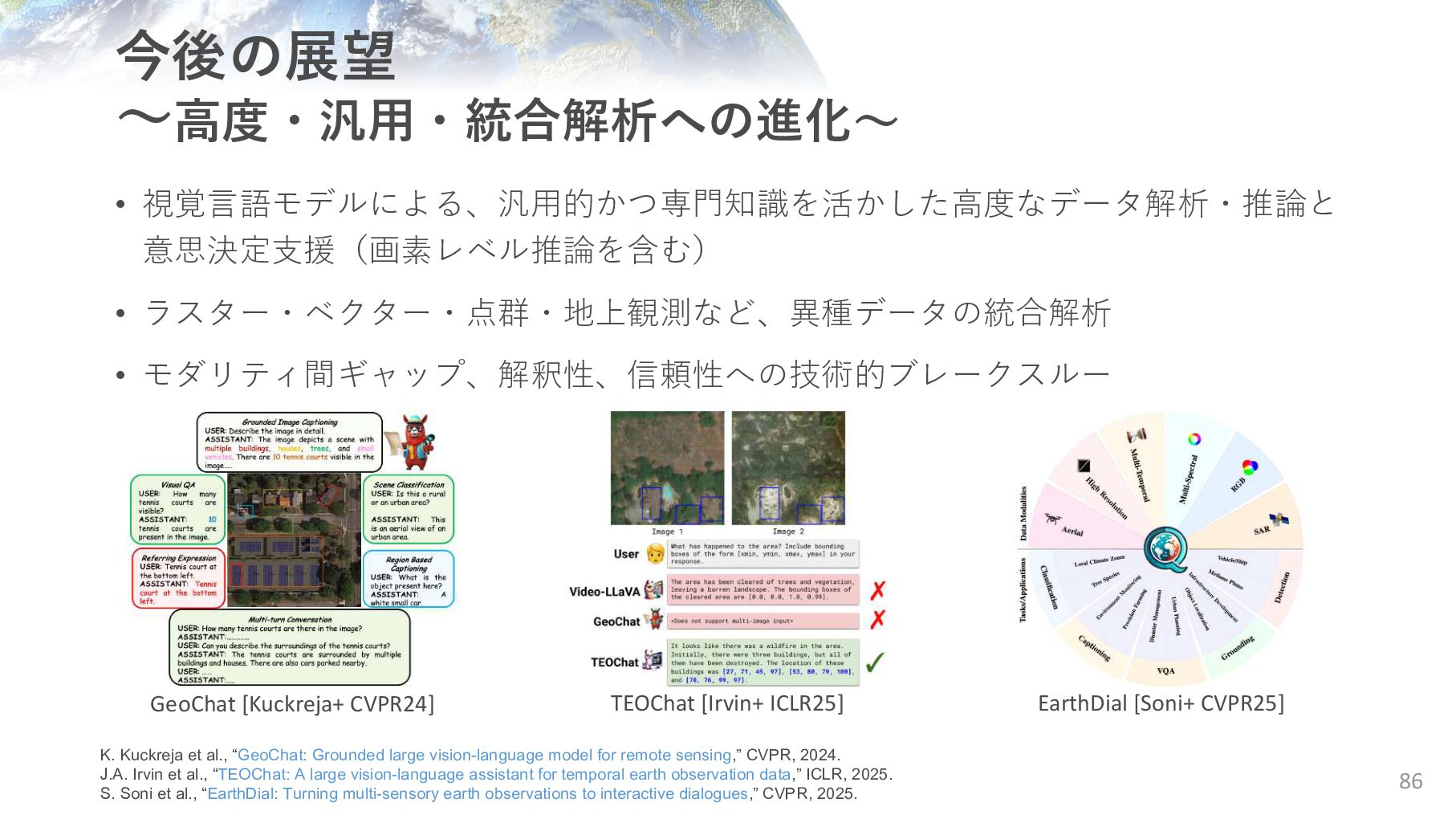
GeoChat [Kuckreja+ CVPR24] TEOChat [Irvin+ ICLR25] EarthDial [Soni+ CVPR25] K. Kuckreja et al., “GeoChat: Grounded large vision-language model for remote sensing,” CVPR, 2024. J.A. Irvin et al., “TEOChat: A large vision-language assistant for temporal earth observation data,” ICLR, 2025. S. Soni et al., “EarthDial: Turning multi-sensory earth observations to interactive dialogues,” CVPR, 2025.
![THANKS FOR LISTENING! 5-1-5 Kashiwanoha, Kashiwa, Chiba-ken 277-8561, Japan [email protected]](https://files.speakerdeck.com/presentations/b1e6d2002df14a388d08628e9919724c/slide_87.jpg)