2025 ReSAKSS - The Untapped Potential of Artificial Intelligence and Geospatial Technology in African Agrifood Systems: Dr. Jean Paul Faye
Dr. Jean Paul L. Faye, Head of AI Innovation and Modeling Unit, Department of Data Intelligence and Governance, AKADEMIYA2063; Physics Department, Faculty of Science and Technology, Cheikh Anta Diop University
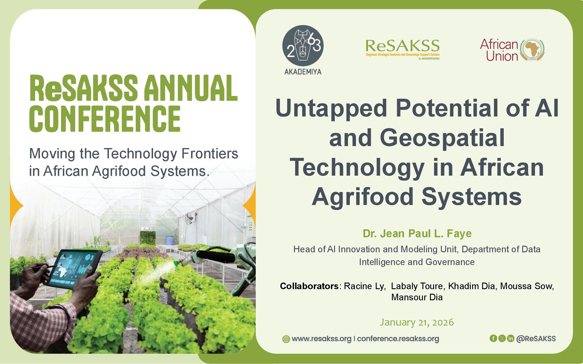
Untapped Potential of AI and Geospatial Technology in African Agrifood Systems Dr. Jean Paul L. Faye Head of AI Innovation and Modeling Unit, Department of Data Intelligence and Governance Collaborators: Racine Ly, Labaly Toure, Khadim Dia, Moussa Sow, Mansour Dia January 21, 2026
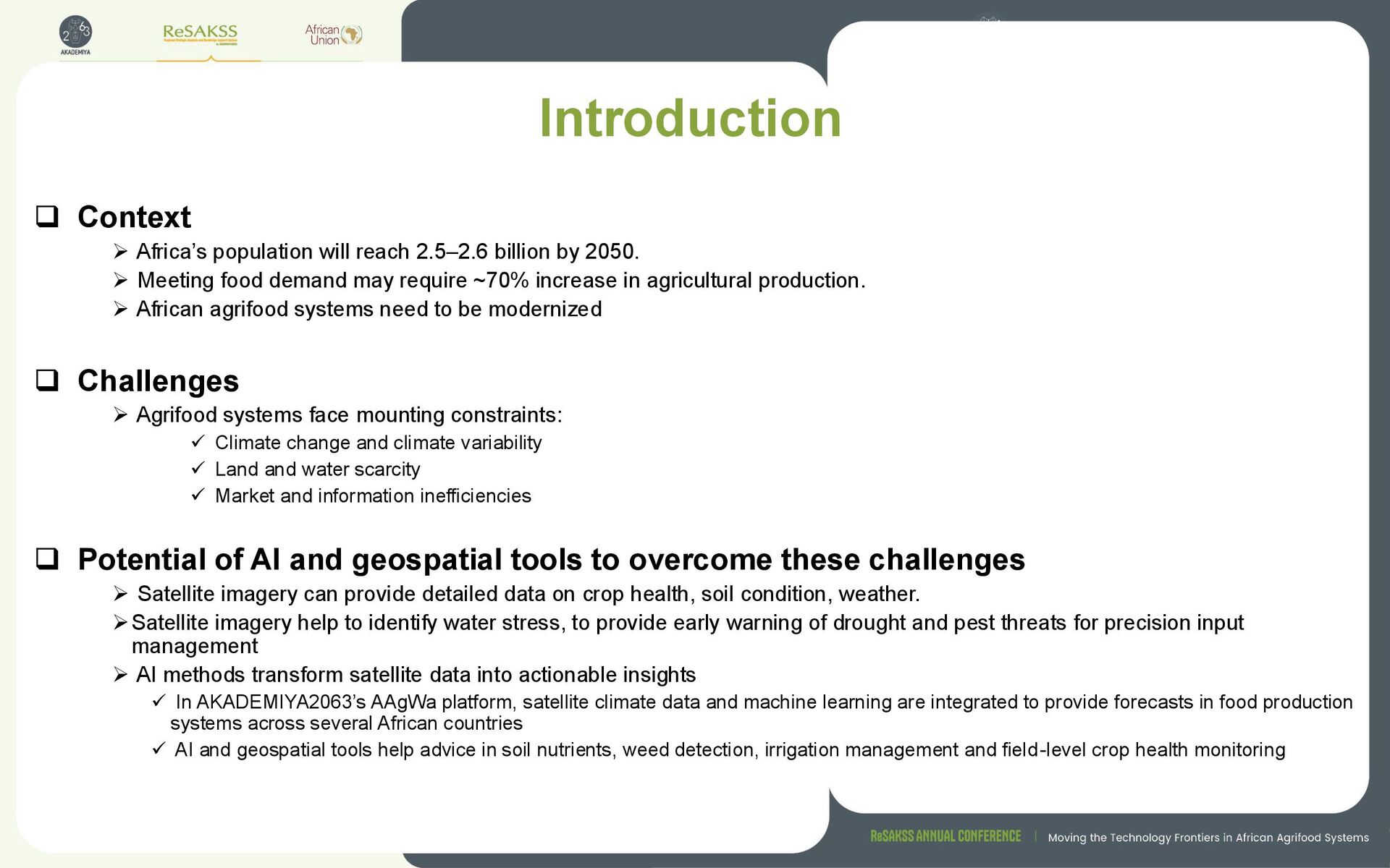
by 2050. ➢ Meeting food demand may require ~70% increase in agricultural production. ➢ African agrifood systems need to be modernized ❑ Challenges ➢ Agrifood systems face mounting constraints: ✓ Climate change and climate variability ✓ Land and water scarcity ✓ Market and information inefficiencies ❑ Potential of AI and geospatial tools to overcome these challenges ➢ Satellite imagery can provide detailed data on crop health, soil condition, weather. ➢Satellite imagery help to identify water stress, to provide early warning of drought and pest threats for precision input management ➢ AI methods transform satellite data into actionable insights ✓ In AKADEMIYA2063’s AAgWa platform, satellite climate data and machine learning are integrated to provide forecasts in food production systems across several African countries ✓ AI and geospatial tools help advice in soil nutrients, weed detection, irrigation management and field-level crop health monitoring
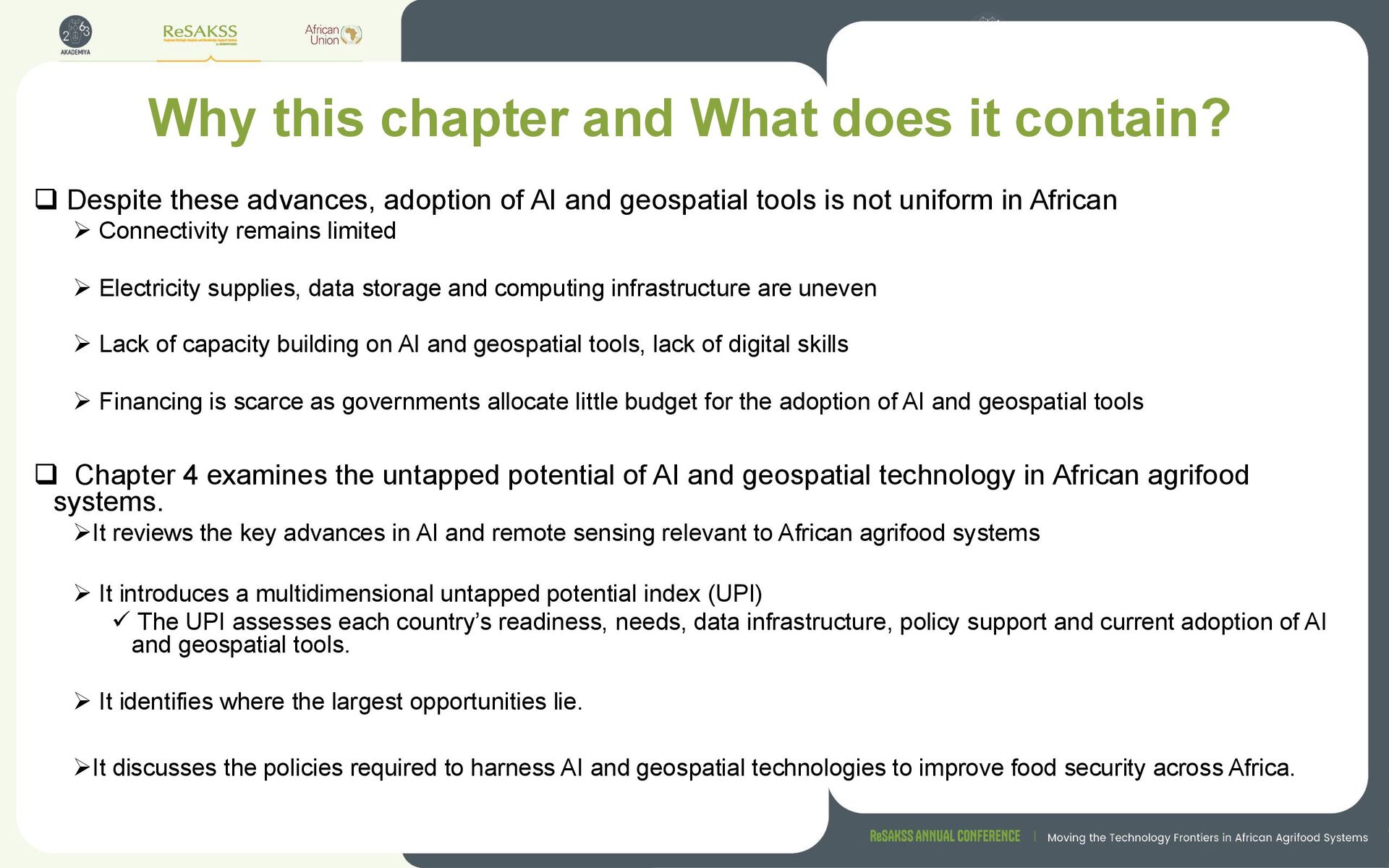
these advances, adoption of AI and geospatial tools is not uniform in African ➢ Connectivity remains limited ➢ Electricity supplies, data storage and computing infrastructure are uneven ➢ Lack of capacity building on AI and geospatial tools, lack of digital skills ➢ Financing is scarce as governments allocate little budget for the adoption of AI and geospatial tools ❑ Chapter 4 examines the untapped potential of AI and geospatial technology in African agrifood systems. ➢It reviews the key advances in AI and remote sensing relevant to African agrifood systems ➢ It introduces a multidimensional untapped potential index (UPI) ✓ The UPI assesses each country’s readiness, needs, data infrastructure, policy support and current adoption of AI and geospatial tools. ➢ It identifies where the largest opportunities lie. ➢It discusses the policies required to harness AI and geospatial technologies to improve food security across Africa.
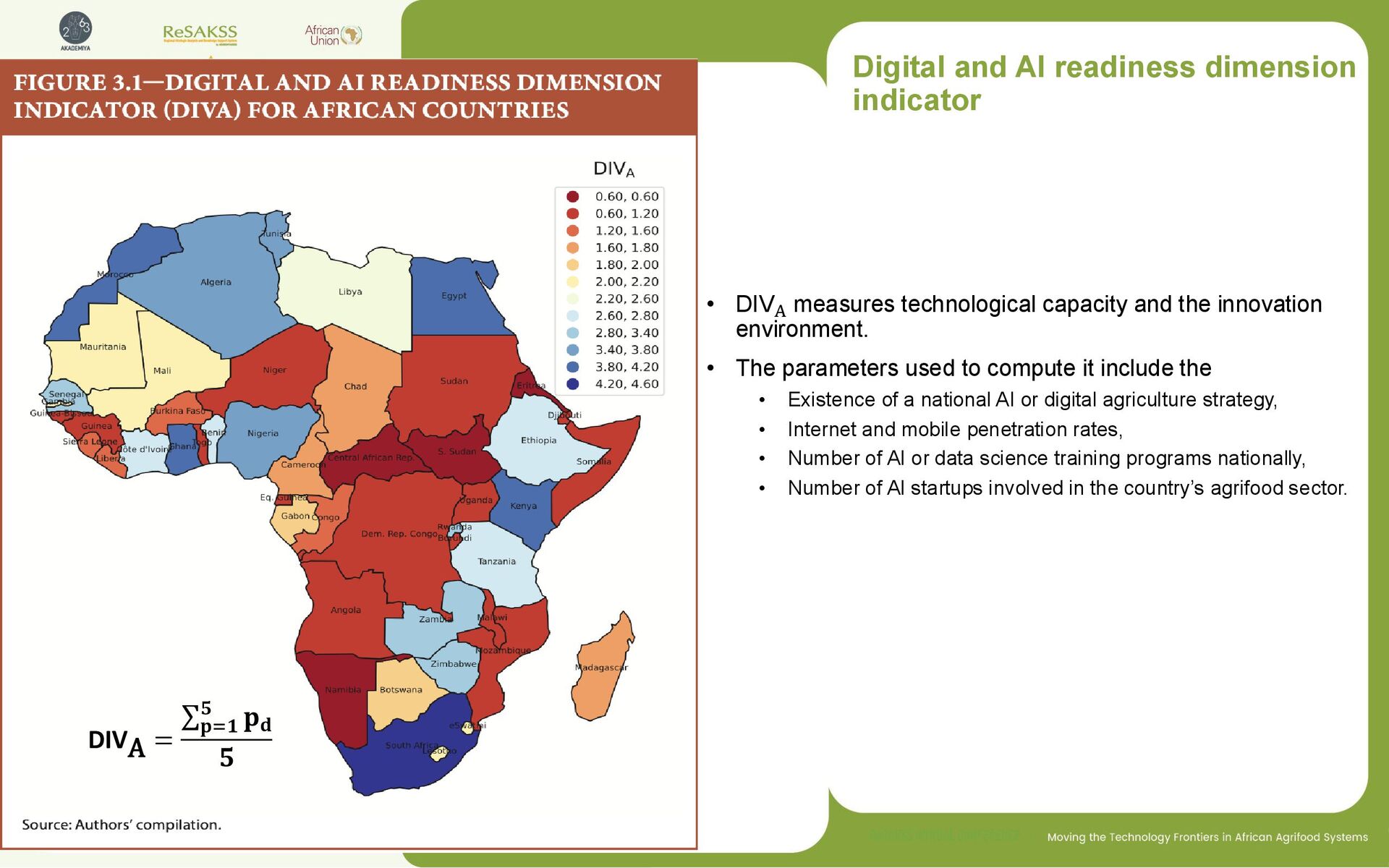
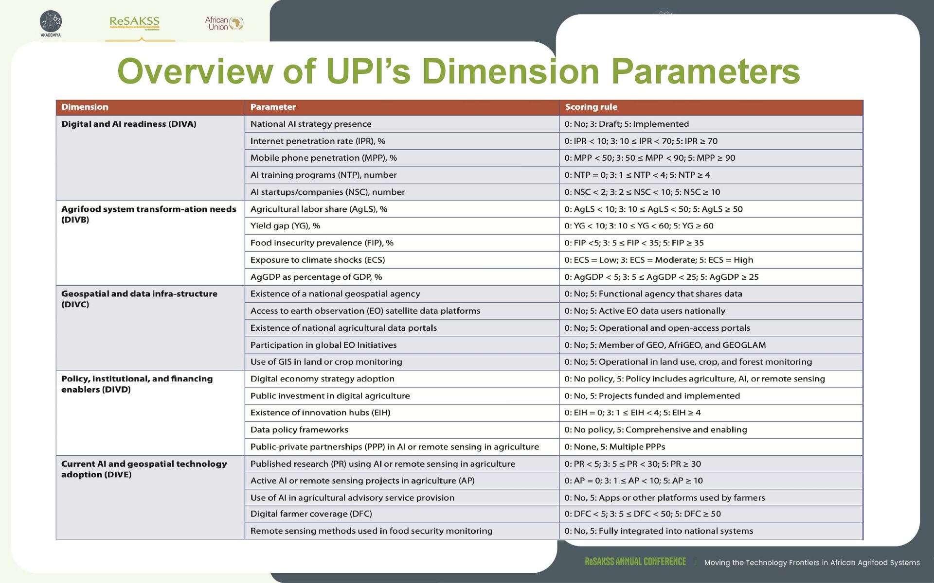
capacity and the innovation environment. • The parameters used to compute it include the • Existence of a national AI or digital agriculture strategy, • Internet and mobile penetration rates, • Number of AI or data science training programs nationally, • Number of AI startups involved in the country’s agrifood sector. DIVA = σ 𝐩=𝟏 𝟓 𝐩𝐝 𝟓
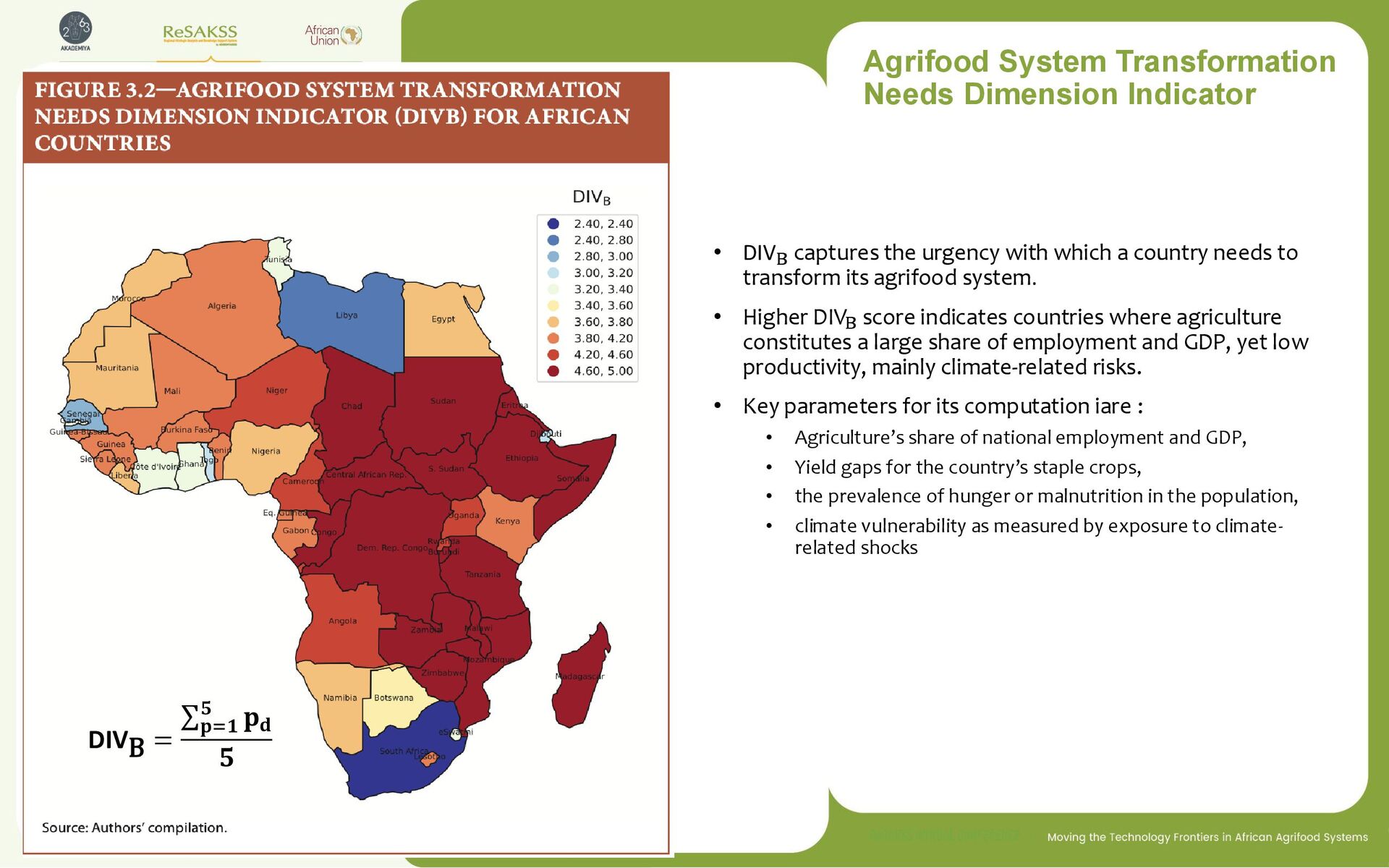
urgency with which a country needs to transform its agrifood system. • Higher DIVB score indicates countries where agriculture constitutes a large share of employment and GDP, yet low productivity, mainly climate-related risks. • Key parameters for its computation iare : • Agriculture’s share of national employment and GDP, • Yield gaps for the country’s staple crops, • the prevalence of hunger or malnutrition in the population, • climate vulnerability as measured by exposure to climate- related shocks DIVB = σ 𝐩=𝟏 𝟓 𝐩𝐝 𝟓
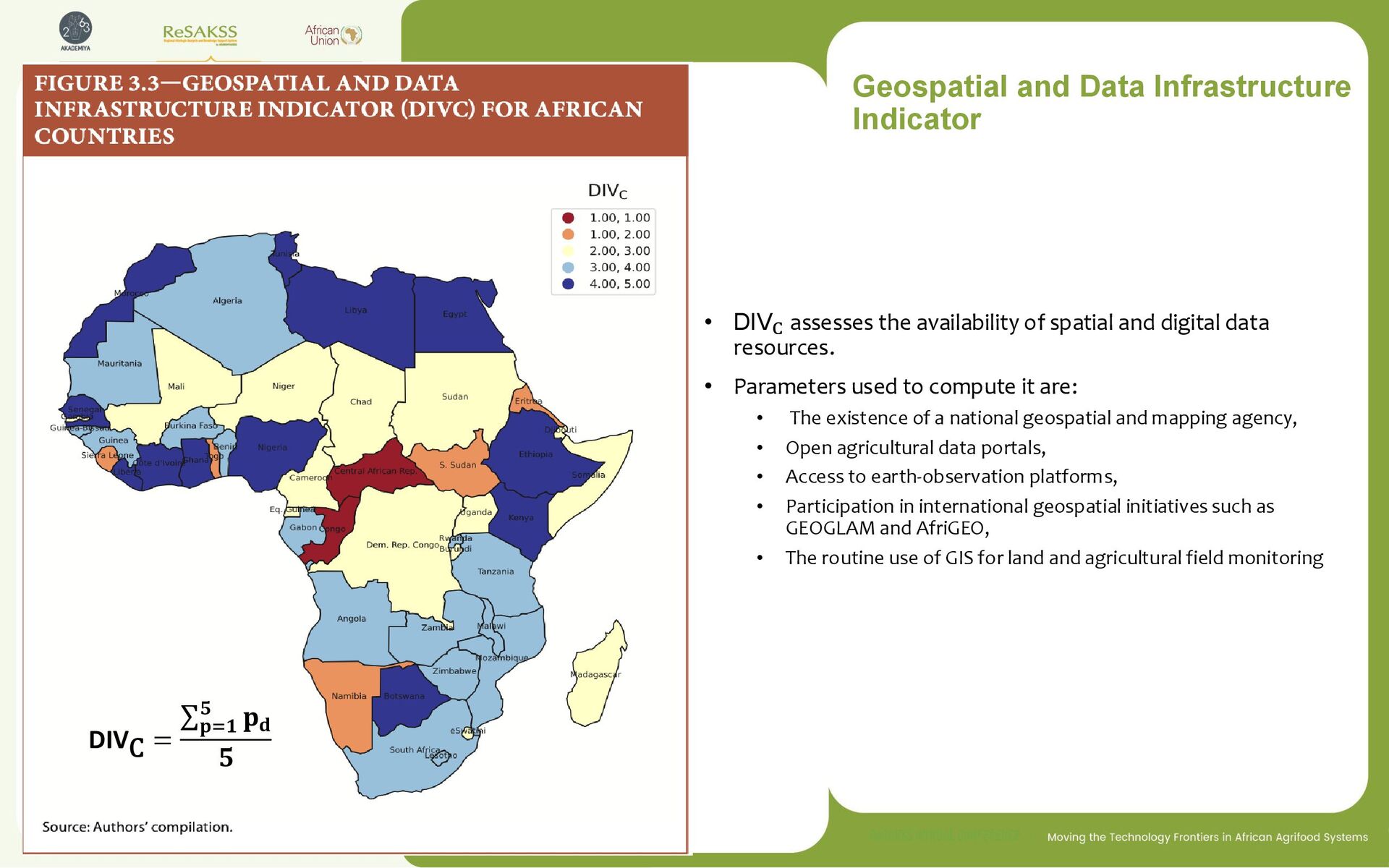
of spatial and digital data resources. • Parameters used to compute it are: • The existence of a national geospatial and mapping agency, • Open agricultural data portals, • Access to earth-observation platforms, • Participation in international geospatial initiatives such as GEOGLAM and AfriGEO, • The routine use of GIS for land and agricultural field monitoring DIVC = σ 𝐩=𝟏 𝟓 𝐩𝐝 𝟓
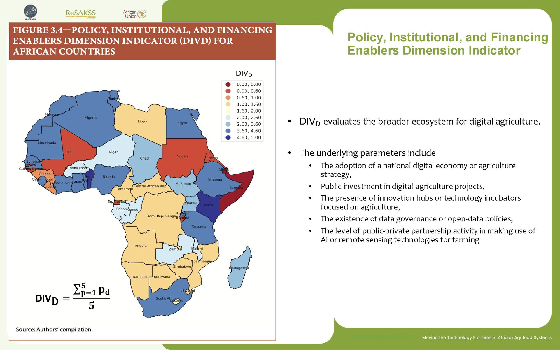
the broader ecosystem for digital agriculture. • The underlying parameters include • The adoption of a national digital economy or agriculture strategy, • Public investment in digital-agriculture projects, • The presence of innovation hubs or technology incubators focused on agriculture, • The existence of data governance or open-data policies, • The level of public-private partnership activity in making use of AI or remote sensing technologies for farming DIVD = σ 𝐩=𝟏 𝟓 𝐩𝐝 𝟓
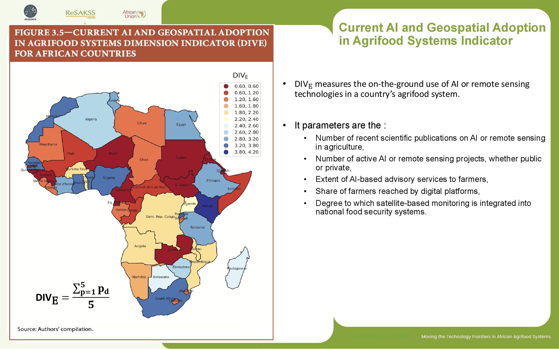
DIVE measures the on-the-ground use of AI or remote sensing technologies in a country’s agrifood system. • It parameters are the : • Number of recent scientific publications on AI or remote sensing in agriculture, • Number of active AI or remote sensing projects, whether public or private, • Extent of AI-based advisory services to farmers, • Share of farmers reached by digital platforms, • Degree to which satellite-based monitoring is integrated into national food security systems. DIVE = σ 𝐩=𝟏 𝟓 𝐩𝐝 𝟓
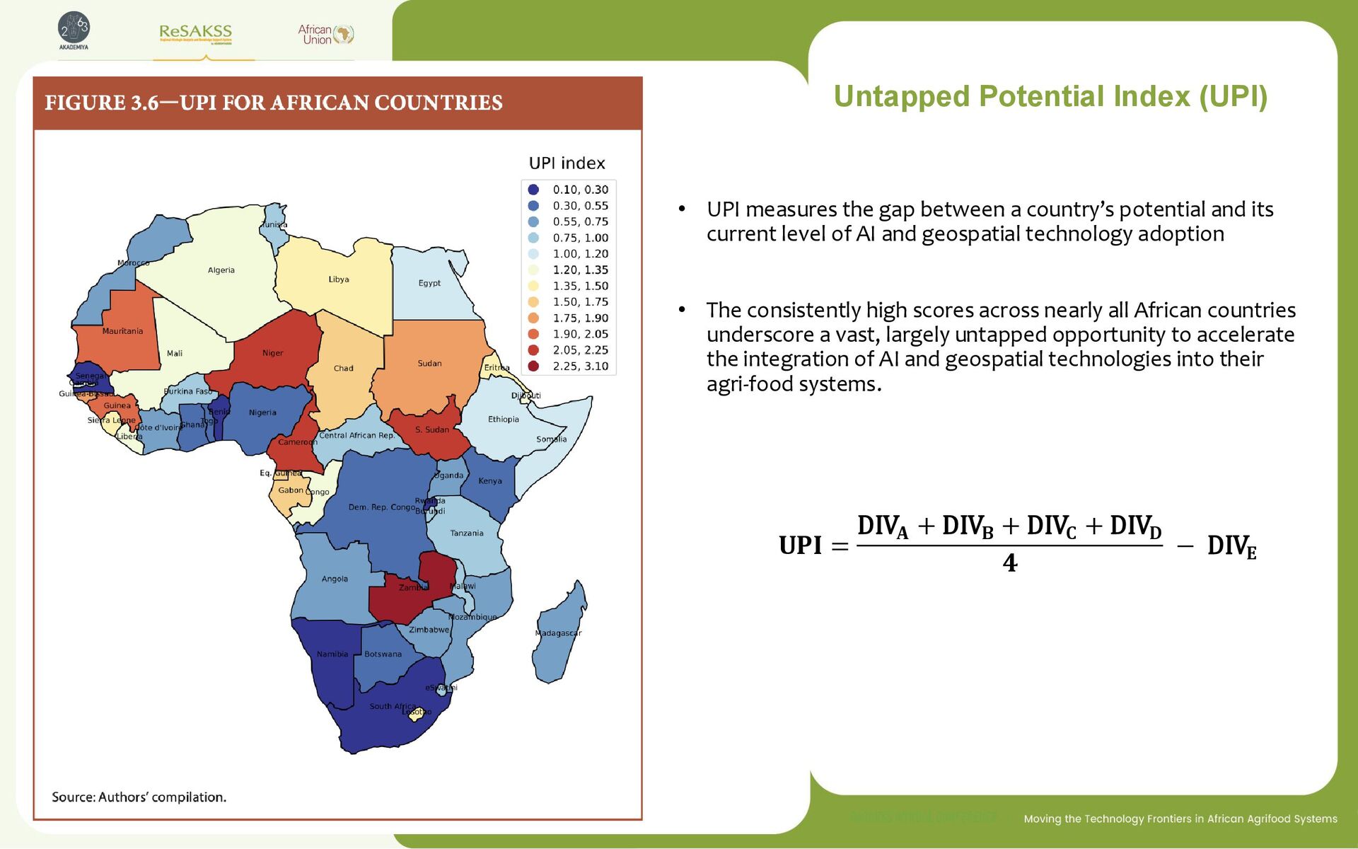
a country’s potential and its current level of AI and geospatial technology adoption • The consistently high scores across nearly all African countries underscore a vast, largely untapped opportunity to accelerate the integration of AI and geospatial technologies into their agri-food systems. 𝐔𝐏𝐈 = DIV𝐀 + DIV𝐁 + DIV𝐂 + DIV𝐃 𝟒 − DIV𝐄
UPI scores, indicating significant untapped potential to increase the use of AI and geospatial technologies in their agrifood systems. ❑ This latent potential reflects both a pressing need, driven by challenges like yield gaps, climate risks, and market inefficiencies, and a growing readiness in terms of infrastructure, policy frameworks, and human capital. ❑ By channeling investments, fostering public-private partnerships, and scaling proven pilot projects, African countries can harness data-driven insights to drive the growth of their agrifood sectors